Museums · East Midlands
Ashfield District
In or near Brinsley.
Ashfield () is a local government district in Nottinghamshire, England. The council is based in Kirkby-in-Ashfield, but the largest town is neighbouring Sutton-in-Ashfield. The district also contains

Alan Murray-Rust — CC BY-SA 2.0 via Wikimedia Commons licence
Plan your visit
- Typical visit
- 1.5 h–3 h
- Best time of year
- Year-round
- Nearest railway station
- Langley Mill · 4.1 km
- Family-friendly
- Limited wheelchair access
Getting there & planning your visit
To visit Ashfield District in Nottinghamshire, the nearest railway station is Langley Mill, which is 4.1 km away. The postcode for sat-nav is NG16 5GS. Accessibility is limited for wheelchair users.
About
Ashfield () is a local government district in Nottinghamshire, England. The council is based in Kirkby-in-Ashfield, but the largest town is neighbouring Sutton-in-Ashfield. The district also contains the town of Hucknall and a few villages. The district is mostly urban, with some of its settlements forming parts of both the Nottingham and Mansfield Urban Areas. The neighbouring districts are Mansfield, Newark and Sherwood, Gedling, Nottingham, Broxtowe, Amber Valley and Bolsover.
Photo gallery
From the Wikipedia article
Ashfield () is a local government district in Nottinghamshire, England. The council is based in Kirkby-in-Ashfield, but the largest town is neighbouring Sutton-in-Ashfield. The district also contains the town of Hucknall and a few villages. The district is mostly urban, with some of its settlements forming parts of both the Nottingham and Mansfield Urban Areas. The neighbouring districts are Mansfield, Newark and Sherwood, Gedling, Nottingham, Broxtowe, Amber Valley and Bolsover.
Excerpt from Wikipedia under CC BY-SA 4.0. See the source article linked in Sources below.
Background
History
The district was created on 1 April 1974 under the Local Government Act 1972, covering the whole of two former districts, most of Hucknall Urban District and of parts of a fourth, which were all abolished at the same time: The new district was named Ashfield, being the shared suffix of two of the towns' names.
Sourced from Wikipedia under CC BY-SA 4.0.
- Coordinates
- 53.0500, -1.3000
- County
- Nottinghamshire
- District
- Ashfield
- Parish
- Selston
- Postcode
- NG16 5GS
- Parliamentary constituency
- Ashfield
- Nearest railway station
- Langley Mill — 4.1 km
- Official site
- www.ashfield.gov.uk
Sources
- wikipedia: Ashfield District (CC BY-SA 4.0)
Other places nearby
Church of St. Michael and All Angels, Underwood
Historic churches · 0.4 km

Brinsley Village Sign
Public art & sculpture · 0.9 km

Brinsley
Towns & cities · 1.7 km
St. Mary's Church, Westwood
Historic churches · 2.3 km

Selston
Villages · 2.4 km

Beauvale Priory
Abbeys & priories · 2.6 km

Beauvale Priory
Archaeological sites · 2.6 km

Jacksdale War Memorial
Memorials & monuments · 2.7 km

Lock On Cromford Canal At Sk442 515
Canal locks · 3.0 km
St. Helen's Church, Selston
Historic churches · 3.0 km

Canal Bridge At Sk 4380 5170
Historic bridges · 3.4 km

Eastwood Theatre
Theatres · 3.5 km
Nearby
📷 3Historic churches · East Midlands
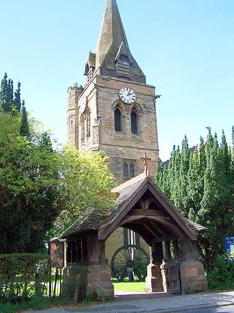
Church of St. Michael and All Angels, Underwood
Church of St. Michael and All Angels, Underwood — grade II listed church in Selston, Ashfield, Nottinghamshire, England, UK.
📷 3Public art & sculpture · East Midlands
Brinsley Village Sign
Brinsley Village Sign — a public art in england-east-midlands, United Kingdom.
📷 5Towns & cities · East Midlands
Brinsley
Brinsley — village in Nottinghamshire, England, UK.
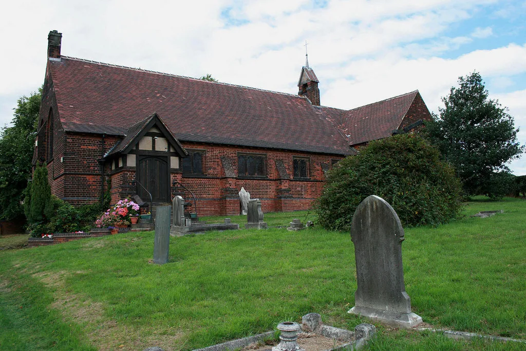
📷 3Historic churches · East Midlands
St. Mary's Church, Westwood
St. Mary's Church, Westwood — church in United Kingdom.
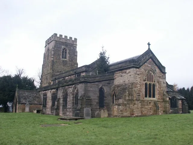
📷 5📷 3Abbeys & priories · East Midlands
Beauvale Priory
Beauvale Priory — a abbey in england-east-midlands, United Kingdom.
Where to eat & stay near Ashfield District
Places to stay
 📷 5
📷 5 📷 5
📷 5Campsites · East Midlands
Golden Valley Caravan Park
Golden Valley Caravan Park — a campsite in england east midlands.
 📷 5
📷 5Campsites · East Midlands
Notts Sun Club
Notts Sun Club — a campsite in england east midlands.
 📷 5
📷 5Hotels · East Midlands
Delta Hotels by Marriott Nottingham Belfry
Delta Hotels by Marriott Nottingham Belfry — a hotel in england east midlands. 4-star. Brand: Delta Hotels.
 📷 7
📷 7Hotels · East Midlands
DoubleTree by Hilton Hotel Nottingham - Gateway
DoubleTree by Hilton Hotel Nottingham - Gateway — a hotel in england east midlands. 4-star. Brand: DoubleTree.
 📷 5
📷 5Hotels · East Midlands
Horsley Lodge Hotel
Horsley Lodge Hotel — a hotel in england east midlands.
Places to eat & drink
 📷 5
📷 5 📷 7
📷 7Cafés · East Midlands
Mortons Farm Tea Rooms
Mortons Farm Tea Rooms — a café in england east midlands.
 📷 7
📷 7 📷 7
📷 7Historic pubs · East Midlands
The Excavator Public House
The Excavator Public House in England East Midlands, United Kingdom.
 📷 5
📷 5Historic pubs · East Midlands
Old Pear Tree Public House And Attached Garden Wall
Old Pear Tree Public House And Attached Garden Wall in England East Midlands, United Kingdom.
 📷 5
📷 5Historic pubs · East Midlands
White Hart Public House
White Hart Public House in England East Midlands, United Kingdom.
More museums in this region
 📷 5
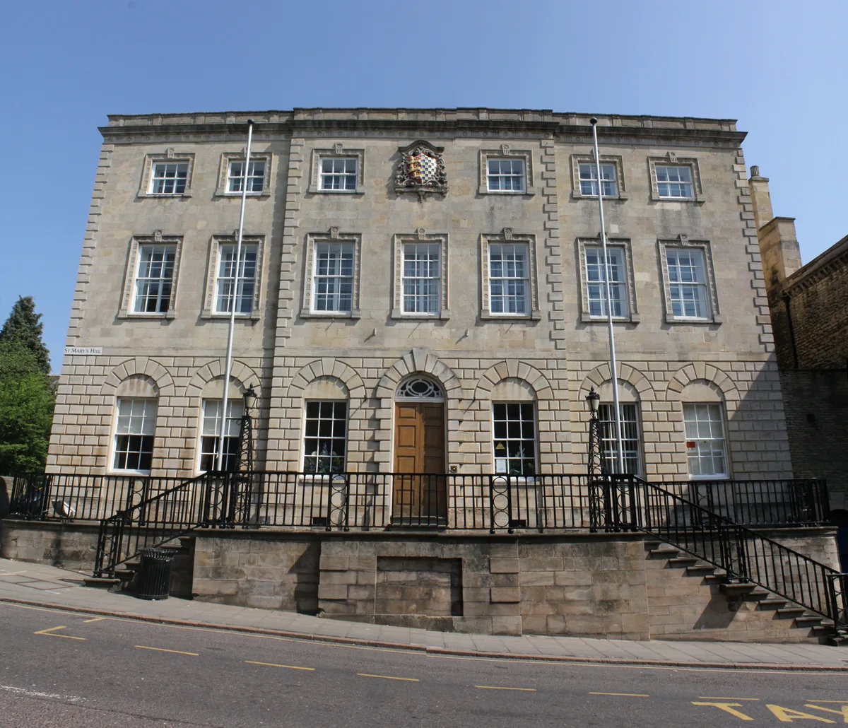
📷 5Museums · East Midlands
Stamford Town Hall
Stamford Town Hall — building in Stamford, Lincolnshire, England, UK.
 📷 5
📷 5Museums · East Midlands
Thorney Museum
Thorney Museum — a museum in england-london, United Kingdom.
 📷 5
📷 5Museums · East Midlands
Octavia Hill Birthplace Museum
Octavia Hill Birthplace Museum — a museum in england-london, United Kingdom.
 📷 5
📷 5Museums · East Midlands
Museum of Technology
Museum of Technology — a museum in england-london, United Kingdom.
Frequently asked questions
- Where is Ashfield District?
- Ashfield District is in Nottinghamshire, the East Midlands, United Kingdom (postcode NG16 5GS), in the parish of Selston.
- What is Ashfield District?
- Ashfield () is a local government district in Nottinghamshire, England. The council is based in Kirkby-in-Ashfield, but the largest town is neighbouring Sutton-in-Ashfield. The district also contains
- How do I get to Ashfield District?
- The nearest railway station is Langley Mill, about 4.1 km away. Drivers can use postcode NG16 5GS.
- How do I get to Ashfield District?
- The nearest railway station is Langley Mill, about 4.1 km away. Drivers can navigate to postcode NG16 5GS.