
Archaeological sites · East of England
Kingston Wood and Outliers
In or near Wimpole.
Kingston Wood and Outliers is a archaeological site in the United Kingdom.

Wikimedia Commons contributors — see linked file page for photographer and licence licence

Plan your visit
- Typical visit
- 45 min–1.5 h
- Nearest railway station
- Shepreth · 8.7 km
- Free entry
- Dog-friendly
Getting there & planning your visit
To visit Kingston Wood and Outliers, the nearest railway station is Shepreth, located 8.7 km away. The postcode for sat-nav is SG8 0AP, and entry is free.
About
Kingston Wood and Outliers is an archaeological site in the United Kingdom. Heritage designation: Site of Special Scientific Interest. Coordinates: 52.1670°, -0.0630°.
Photo gallery
Protected designations
- Site of Special Scientific Interest: Kingston Wood and Outliers SSSI
Designations sourced from Natural England open data under OGL v3.
From the Wikipedia article
Kingston Wood and Outliers is a 47.4-hectare (117-acre) biological Site of Special Scientific Interest south-west of Kingston in Cambridgeshire. The site comprises Kingston Wood itself, Pincote Wood, Hawk's Wood and Lady Pastures Spinney. This ancient woodland is ash and field maple on chalky clay, and it is described by Natural England as one of the oldest and most intact coppiced woodlands in the county. Ground flora include dog's mercury and the nationally restricted oxlip. The site is private with no public access.
Excerpt from Wikipedia under CC BY-SA 4.0. See the source article linked in Sources below.
- Coordinates
- 52.1670, -0.0630
- County
- Cambridgeshire
- District
- South Cambridgeshire
- Parish
- Kingston
- Postcode
- SG8 0AP
- Parliamentary constituency
- St Neots and Mid Cambridgeshire
- Nearest railway station
- Shepreth — 8.7 km
Sources
- wikidata: Q28406560 (CC0)
- wikipedia: Kingston Wood and Outliers (CC BY-SA 4.0)
- commons: Kingston Wood - geograph.org.uk - 896060.jpg (CC BY-SA 4.0)
Other places nearby

Bridge Across Moat South Of Kingston Wood Farmhouse
Historic bridges · 0.2 km

The Red House
Restaurants · 0.9 km

Long Stowe
Villages · 1.4 km
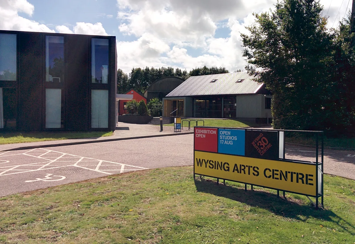
Wysing Arts Centre
Galleries · 1.7 km

Wimpole's Folly
Follies · 2.0 km

PAUS
Lidos & outdoor pools · 2.1 km

Chinese Bridge 300 Yards North Of Wimpole Hall
Historic bridges · 2.3 km

Bourn Hall Ringwork
Castles · 2.4 km
Bourn Castle
Literary houses · 2.4 km

Bourn Castle
Castles · 2.4 km

Kingston
Villages · 2.4 km

Parish Church of St Helen and St Mary
Historic churches · 2.5 km
Nearby
📷 5Historic bridges · East of England
Bridge Across Moat South Of Kingston Wood Farmhouse
Bridge Across Moat South Of Kingston Wood Farmhouse — Grade II listed building-listed bridge in england-london, United Kingdom.
📷 5Restaurants · East of England
The Red House
The Red House — a restaurant in england london.
📷 5📷 5Galleries · East of England
Wysing Arts Centre
Wysing Arts Centre — Visual arts centre, gallery and artists studios.
📷 5Follies · East of England
Wimpole's Folly
Wimpole's Folly — a folly in england-london, United Kingdom.
📷 5Where to eat & stay near Kingston Wood and Outliers
Places to stay
 📷 5
📷 5Hotels · East of England
The Cambridge Belfry
The Cambridge Belfry — a hotel in england london.
 📷 5
📷 5Campsites · East of England
Great Gransden Campsite
Great Gransden Campsite — a campsite in england london.
 📷 5
📷 5Campsites · East of England
Highfield Farm Touring Park
Highfield Farm Touring Park — a campsite in england london.
 📷 5
📷 5 📷 5
📷 5 📷 5
📷 5Places to eat & drink
📷 5Restaurants · East of England
The Red House
The Red House — a restaurant in england london.
 📷 5
📷 5Historic pubs · East of England
The Plough Public House With Attached Stables And Hayloft
The Plough Public House With Attached Stables And Hayloft in England East, United Kingdom.
 📷 5
📷 5 📷 5
📷 5Historic pubs · East of England
Duncombe Arms Public House
Duncombe Arms Public House in England East, United Kingdom.
 📷 5
📷 5Historic pubs · East of England
Pig & Abbot
Pig & Abbot in England East, United Kingdom.
 📷 5
📷 5Historic pubs · East of England
The Hoops Public House
The Hoops Public House in England East, United Kingdom.
More archaeological sites in this region
 Flagship📷 10
Archaeological sites · East of England
Nunn Wood
Nunn Wood — woods in Essex, England, a Site of Special Scientific Interest.
 📷 5
📷 5Archaeological sites · East of England
A Bronze Age post alignment and timber platform at Flag Fen and associated Bronze Age and later field systems and settlement to
A Bronze Age post alignment and timber platform at Flag Fen and associated Bronze Age and later field systems and settlement to — archaeological site in Thorney, City of Peterborough, England, UK.
 📷 5
📷 5Archaeological sites · East of England
Causewayed enclosure 900m west of Great Wilbraham parish church
Causewayed enclosure 900m west of Great Wilbraham parish church — archaeological site in Great Wilbraham, South Cambridgeshire, England, UK.
 📷 5
📷 5Archaeological sites · East of England
Dray's Ditches
Dray's Ditches — archaeological site in Streatley, Central Bedfordshire, England, UK.
Frequently asked questions
- Where is Kingston Wood and Outliers?
- Kingston Wood and Outliers is in Cambridgeshire, East of England, United Kingdom (postcode SG8 0AP), in the parish of Kingston.
- What is Kingston Wood and Outliers?
- Kingston Wood and Outliers is a archaeological site in the United Kingdom.
- How do I get to Kingston Wood and Outliers?
- The nearest railway station is Shepreth, about 8.7 km away. The nearest town is Wimpole. Drivers can use postcode SG8 0AP.
- Is Kingston Wood and Outliers a listed building?
- Kingston Wood and Outliers is officially recognised as Site of Special Scientific Interest listed.
- Is Kingston Wood and Outliers a protected site?
- Yes — Kingston Wood and Outliers is part of the Kingston Wood and Outliers SSSI Site of Special Scientific Interest.
- Is Kingston Wood and Outliers free to visit?
- Yes, Kingston Wood and Outliers is free to enter.
- How do I get to Kingston Wood and Outliers?
- Drivers can navigate to postcode SG8 0AP. It sits within the St Neots and Mid Cambridgeshire parliamentary constituency.