
Historic bridges · East of England
Bridge Across Moat South Of Kingston Wood Farmhouse
In or near Wimpole.
Bridge Across Moat South Of Kingston Wood Farmhouse — Grade II listed building-listed bridge in england-london, United Kingdom.

Keith Edkins — CC BY-SA 2.0 via Wikimedia Commons licence

Plan your visit
- Typical visit
- 15 min–30 min
- Nearest railway station
- Shepreth · 8.6 km
- Free entry
- Dog-friendly
Getting there & planning your visit
The nearest railway station is Shepreth, located 8.6 km away. Entry to the bridge is free.
About
Bridge Across Moat South Of Kingston Wood Farmhouse is a Grade II listed building-listed bridge in england-london, United Kingdom, registered on the National Heritage List for England (NHLE entry 1331197). Listed status protects buildings and structures of special architectural or historic interest. See the linked Wikipedia article for further details.
Heritage listing
Details TL 35 SW 3/113 KINGSTON ERMINE WAY Bridge, across moat, south of Kingston Wood Farmhouse GV II Bridge. Late C17 or early C18 with modern brick to parapet. Two arches. R.C.H.M.: West Cambs. Mon. (12) Listing NGR: TL3275953966 Legacy The contents of this record have been generated from a legacy data system. Legacy System number: 52165 Legacy System: LBS
From the Historic England List Entry under OGL v3.
Protected designations
- Site of Special Scientific Interest: Kingston Wood and Outliers SSSI
Designations sourced from Natural England open data under OGL v3.
Place summary
The Bridge Across Moat South Of Kingston Wood Farmhouse is a Grade II listed bridge located in Kingston, Cambridgeshire, within the London region. This structure is notable for its historical significance, contributing to the architectural heritage of the area.
AI-generated from the structured facts on this page (operator, designation, listing, era). Not a substitute for visiting.
- Coordinates
- 52.1680, -0.0602
- County
- Cambridgeshire
- District
- South Cambridgeshire
- Parish
- Kingston
- Postcode
- SG8 0AP
- Parliamentary constituency
- St Neots and Mid Cambridgeshire
- Nearest railway station
- Shepreth — 8.6 km
Sources
- wikidata: Q26616126 (CC0)
Other places nearby

Kingston Wood and Outliers
Archaeological sites · 0.2 km

The Red House
Restaurants · 1.1 km

Long Stowe
Villages · 1.6 km
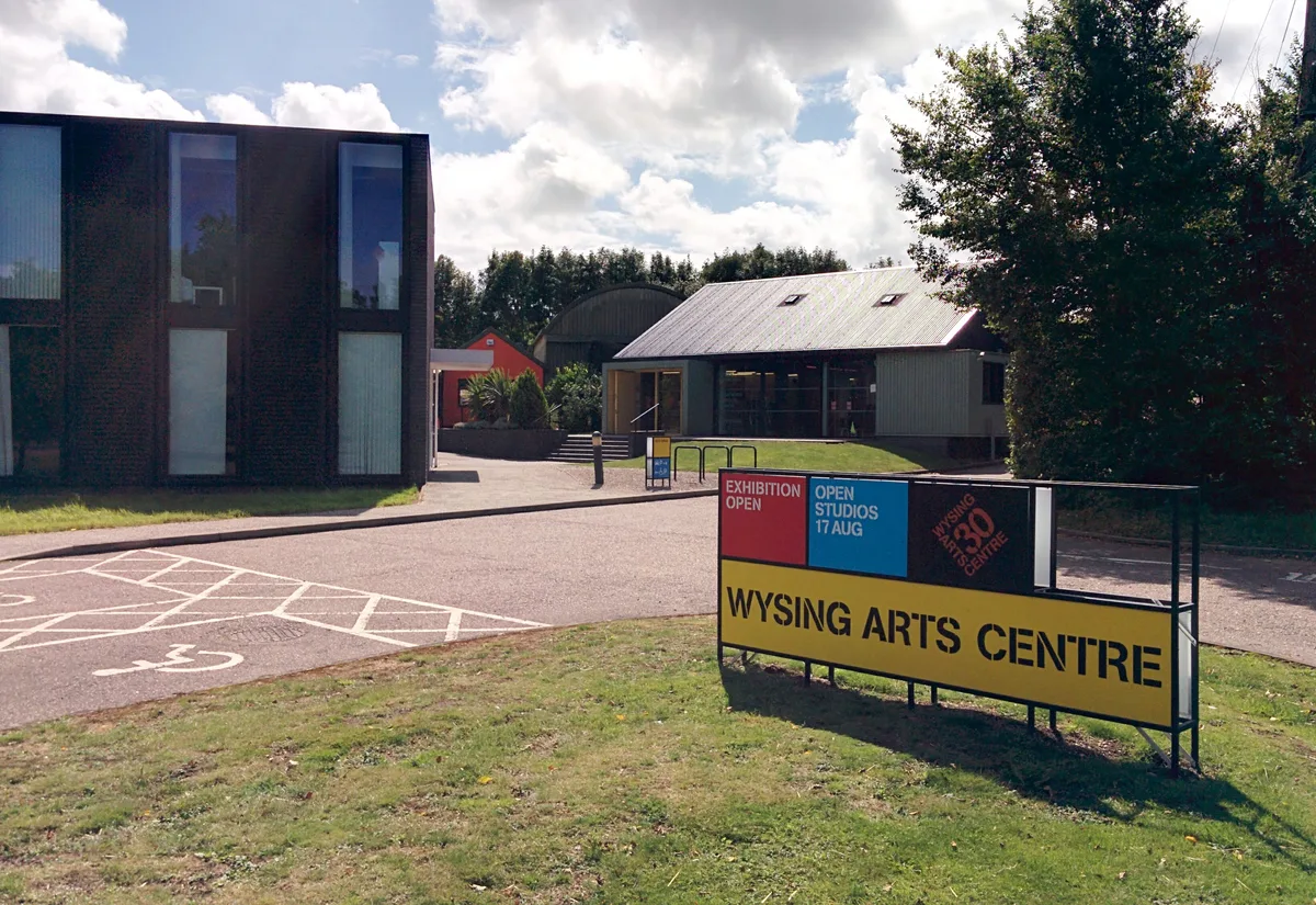
Wysing Arts Centre
Galleries · 1.7 km

PAUS
Lidos & outdoor pools · 2.0 km

Wimpole's Folly
Follies · 2.0 km

Kingston
Villages · 2.2 km

Bourn Hall Ringwork
Castles · 2.3 km
Bourn Castle
Literary houses · 2.3 km

Bourn Castle
Castles · 2.3 km

Chinese Bridge 300 Yards North Of Wimpole Hall
Historic bridges · 2.3 km

Kingston & Bourn Old Railway Local Nature Reserve
Forests & woodlands · 2.3 km
Nearby
📷 2Archaeological sites · East of England
Kingston Wood and Outliers
Kingston Wood and Outliers is a archaeological site in the United Kingdom.
📷 5Restaurants · East of England
The Red House
The Red House — a restaurant in england london.
📷 5📷 5Galleries · East of England
Wysing Arts Centre
Wysing Arts Centre — Visual arts centre, gallery and artists studios.
📷 5📷 5Follies · East of England
Wimpole's Folly
Wimpole's Folly — a folly in england-london, United Kingdom.
Where to eat & stay near Bridge Across Moat South Of Kingston Wood Farmhouse
Places to stay
 📷 5
📷 5Hotels · East of England
The Cambridge Belfry
The Cambridge Belfry — a hotel in england london.
 📷 5
📷 5Campsites · East of England
Great Gransden Campsite
Great Gransden Campsite — a campsite in england london.
 📷 5
📷 5Campsites · East of England
Highfield Farm Touring Park
Highfield Farm Touring Park — a campsite in england london.
 📷 5
📷 5 📷 5
📷 5 📷 5
📷 5Places to eat & drink
📷 5Restaurants · East of England
The Red House
The Red House — a restaurant in england london.
 📷 5
📷 5Historic pubs · East of England
The Plough Public House With Attached Stables And Hayloft
The Plough Public House With Attached Stables And Hayloft in England East, United Kingdom.
 📷 5
📷 5 📷 5
📷 5Historic pubs · East of England
Duncombe Arms Public House
Duncombe Arms Public House in England East, United Kingdom.
 📷 5
📷 5Historic pubs · East of England
Black Horse Public House
Black Horse Public House in England East, United Kingdom.
 📷 5
📷 5More bridges in this region
.JPG?width=1200) 📷 5
📷 5Historic bridges · East of England
Albert Bridge
Albert Bridge is a historic bridge in the United Kingdom.
.jpg?width=1200) 📷 5
📷 5Historic bridges · East of England
Bedford Town Bridge
Bedford Town Bridge is a historic bridge in the United Kingdom.
 📷 5
📷 5Historic bridges · East of England
Bethnal Green and King's Lynn Line
Bethnal Green and King's Lynn Line is a historic bridge in the United Kingdom.
 📷 5
📷 5Historic bridges · East of England
Bethnal Green and King's Lynn Line
Bethnal Green and King's Lynn Line is a historic bridge in the United Kingdom.
Frequently asked questions
- Where is Bridge Across Moat South Of Kingston Wood Farmhouse?
- Bridge Across Moat South Of Kingston Wood Farmhouse is in Cambridgeshire, London, United Kingdom (postcode SG8 0AP), in the parish of Kingston.
- What is Bridge Across Moat South Of Kingston Wood Farmhouse?
- Bridge Across Moat South Of Kingston Wood Farmhouse — Grade II listed building-listed bridge in england-london, United Kingdom.
- How do I get to Bridge Across Moat South Of Kingston Wood Farmhouse?
- The nearest railway station is Shepreth, about 8.6 km away. Drivers can use postcode SG8 0AP.
- Is Bridge Across Moat South Of Kingston Wood Farmhouse a listed building?
- Bridge Across Moat South Of Kingston Wood Farmhouse is officially recognised as Grade II listed building listed.
- Is Bridge Across Moat South Of Kingston Wood Farmhouse a protected site?
- Yes — Bridge Across Moat South Of Kingston Wood Farmhouse is part of the Kingston Wood and Outliers SSSI Site of Special Scientific Interest.
- Is Bridge Across Moat South Of Kingston Wood Farmhouse free to visit?
- Yes, Bridge Across Moat South Of Kingston Wood Farmhouse is free to enter.
- How do I get to Bridge Across Moat South Of Kingston Wood Farmhouse?
- Drivers can navigate to postcode SG8 0AP. It sits within the St Neots and Mid Cambridgeshire parliamentary constituency.