
Forests & woodlands · East of England
Kings Wood
In or near How End.
Kings Wood is a forest or woodland in the United Kingdom.

Wikimedia Commons contributors — see linked file page for photographer and licence licence

Plan your visit
- Typical visit
- 1 h–3 h
- Nearest railway station
- Stewartby · 3.7 km
- Free entry
- Family-friendly
- Dog-friendly
Getting there & planning your visit
To visit Kings Wood, the nearest railway station is Stewartby, which is 3.7 km away. The postcode for sat-nav is MK45 2EZ, and entry to the forest is free.
About
Kings Wood is a named forest, woodland or nature reserve in the United Kingdom. Coordinates: 52.0485°, -0.4774°. This entry is part of The Great Britain Guide, a free, ad-free, open-data tourist directory.
Photo gallery
Protected designations
- Site of Special Scientific Interest: Kings Wood and Glebe Meadows, Houghton Conquest SSSI
Designations sourced from Natural England open data under OGL v3.
From the Wikipedia article
Kings Wood and Glebe Meadows is a 36.1-hectare (89-acre) Site of Special Scientific Interest in Houghton Conquest in Bedfordshire. A local teenage boy, Peter Sollars, discovered many rich communities of plants there, including a number of rare species, e.g. Butcher's Broom, Small Teasel and Green Hellebore in the wood, and combinations of Lady's Bedstraw, Spiny Restharrow, Great Burnet, Adders Tongue Fern and Cowslips in the meadows. The County Botanist at the time, John Dony, was notified of his findings, which were confirmed by a site visit with Peter . The site was notified in 1984 under the Wildlife and Countryside Act 1981, and the planning authority is Central Bedfordshire. It is also a Local Nature Reserve. This site has ash and maple woodland on heavy clay, a habitat which has become rare in lowland England. It is biologically diverse, with a number of rare species. Several plants are indicative of ancient woodland, such as wood melick and wood anemone. Glebe Meadows has a rich variety of species due to its traditional management, and there are also some small ponds and mature hedgerows. There is access by a footpath from Rectory Lane.
Excerpt from Wikipedia under CC BY-SA 4.0. See the source article linked in Sources below.
- Coordinates
- 52.0485, -0.4774
- District
- Central Bedfordshire
- Parish
- Ampthill
- Postcode
- MK45 2EZ
- Parliamentary constituency
- Mid Bedfordshire
- Nearest railway station
- Stewartby — 3.7 km
Sources
- osm: w4954054 (ODbL)
- wikipedia: Kings Wood and Glebe Meadows, Houghton Conquest (CC BY-SA 4.0)
- commons: Round Close - geograph.org.uk - 549512.jpg (CC BY-SA 4.0)
Other places nearby

Houghton House
Historic houses · 0.8 km
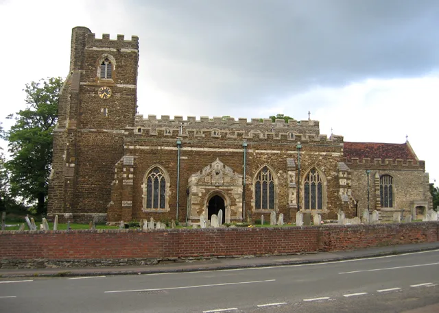
Church of All Saints, Houghton Conquest
Historic churches · 1.4 km

How End
Towns & cities · 1.5 km

Houghton Conquest
Towns & cities · 1.7 km
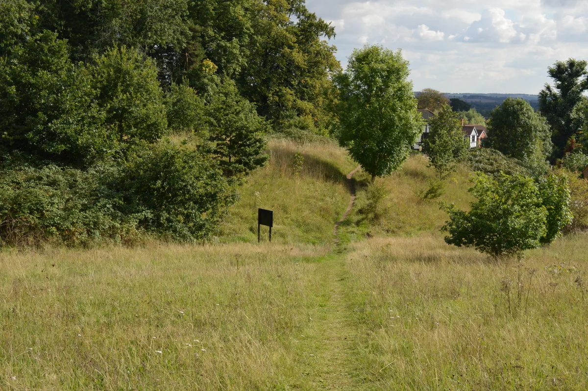
Cut-throat Meadow
Wildlife reserves · 1.9 km

Ampthill Park
Parks · 2.1 km

Zonita Cinema
Theatres · 2.1 km

Maulden
Towns & cities · 2.1 km

The Cupcake Bar
Cafés · 2.1 km

Pump and signpost in Market Place
Historic houses · 2.1 km
The White Hart
Hotels · 2.2 km

Ailesbury Mausoleum
Memorials & monuments · 2.3 km
Nearby
📷 4Historic houses · East of England
Houghton House
Houghton House is a ruined mansion house in the parish of Houghton Conquest, Bedfordshire. It is a Grade I listed building, positioned above the surrounding countryside, and commands excellent views.
📷 5Historic churches · East of England
Church of All Saints, Houghton Conquest
Church of All Saints, Houghton Conquest — church in Houghton Conquest, Bedfordshire, England, UK.
📷 5📷 5Towns & cities · East of England
Houghton Conquest
Houghton Conquest — village and civil parish in Bedfordshire, UK.
📷 5Wildlife reserves · East of England
Cut-throat Meadow
Cut-throat Meadow — nature reserve in the United Kingdom.
📷 3Parks · East of England
Ampthill Park
Ampthill Park — country house and former country estate in Ampthill, Bedfordshire, England, UK.
Where to eat & stay near Kings Wood
Places to stay
📷 5Hotels · East of England
The White Hart
The White Hart — a hotel in england london.
 📷 5
📷 5Campsites · East of England
Belvedere Camping
Belvedere Camping — a campsite in england west midlands.
 📷 5
📷 5Campsites · East of England
Lower Woodend Farm
Lower Woodend Farm — a campsite in england west midlands.
 📷 5
📷 5Campsites · East of England
The Rose and Crown
The Rose and Crown — a campsite in england west midlands.
 📷 5
📷 5 📷 7
📷 7Places to eat & drink
📷 5 📷 5
📷 5Historic pubs · East of England
The Flying Horse Public House
The Flying Horse Public House in England East, United Kingdom.
 📷 5
📷 5 📷 5
📷 5 📷 5
📷 5Historic pubs · East of England
The White Hart Public House
The White Hart Public House in England East, United Kingdom.
 📷 5
📷 5Historic pubs · East of England
The Old Sun Public House
The Old Sun Public House in England East, United Kingdom.
More forests in this region
 📷 5
📷 5Forests & woodlands · East of England
Adams Road Bird Sanctuary
Adams Road Bird Sanctuary is a forest or woodland in the United Kingdom.
 📷 5
📷 5Forests & woodlands · East of England
Arthur's Meadow NR
Arthur's Meadow NR is a forest or woodland in the United Kingdom.
 📷 5
📷 5Forests & woodlands · East of England
Ashwell Quarry & Quarry Springs
Ashwell Quarry & Quarry Springs is a forest or woodland in the United Kingdom.
 📷 5
📷 5Forests & woodlands · East of England
Ashwell Springs
Ashwell Springs is a forest or woodland in the United Kingdom.
Frequently asked questions
- Where is Kings Wood?
- Kings Wood is in London, United Kingdom (postcode MK45 2EZ), in the parish of Ampthill.
- What is Kings Wood?
- Kings Wood is a forest or woodland in the United Kingdom.
- How do I get to Kings Wood?
- The nearest railway station is Stewartby, about 3.7 km away. Drivers can use postcode MK45 2EZ.
- Is Kings Wood a protected site?
- Yes — Kings Wood is part of the Kings Wood and Glebe Meadows, Houghton Conquest SSSI Site of Special Scientific Interest.
- Is Kings Wood free to visit?
- Yes, Kings Wood is free to enter.
- How do I get to Kings Wood?
- The nearest railway station is Stewartby, about 3.7 km away. Drivers can navigate to postcode MK45 2EZ.