Watermills · North East England
Kepier
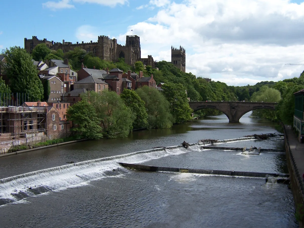
In or near Durham.
Kepier in England North East, United Kingdom.

Adrian Dust — CC BY-SA 2.0 via Wikimedia Commons licence
Plan your visit
- Typical visit
- 30 min–1 h
- Nearest railway station
- Durham · 1.0 km
- Free entry
- Family-friendly
- Dog-friendly
Getting there & planning your visit
Kepier is located in County Durham, with the nearest railway station being Durham, approximately 1 km away. Entry to the watermill is free. The postcode for sat-nav is DH1 1JW.
About
Kepier is a place of interest in England North East, United Kingdom — drawn from open-data sources for visitor reference. See the linked Wikipedia article for the full description.
Photo gallery
From the Wikipedia article
Kepier is a location in the city of Durham, England in the parish of Belmont, close to Gilesgate and beside the River Wear. It is site of the medieval Hospital of St Giles at Kepier. The name derives from 'Kipe weir', meaning a weir with a fish trap, and the convenience of being close to a source of fish (a major part of the monastic diet) may have influenced the location of the hospital. Kepier was also the site of a medieval corn mill, which continued in use until its destruction by fire on September 24, 1870 caused by a spark from the grinding of the stone millwheels. The mill was never rebuilt; only a stone arch over the remnant of the mill race remains. Kepier may also have been the site of a Roman crossing of the River Wear carrying a postulated Roman road, Cade's Road, which led north to Pons Aelius (modern Newcastle upon Tyne). The Kepier estate previously extended over much of Gilesgate, Gilesgate Moor and Carrville. In the 1940s, plans for Kepier power station were drafted, but the project was never undertaken.
Excerpt from Wikipedia under CC BY-SA 4.0. See the source article linked in Sources below.
- Coordinates
- 54.7800, -1.5660
- District
- County Durham
- Parish
- City of Durham
- Postcode
- DH1 1JW
- Parliamentary constituency
- City of Durham
- Nearest railway station
- Durham — 1 km
Sources
Other places nearby

Gilesgate Station
Memorials & monuments · 0.2 km

Durham Gilesgate railway station
Heritage railway stations · 0.2 km

Chapel of St. Mary Magdalene
Chapels · 0.3 km
Chapel of the Hospital of St. Mary Magdalene, Durham
Historic houses · 0.3 km

Chapel of the Hospital of St. Mary Magdalene, Durham
Archaeological sites · 0.3 km

Bede College War Memorial
Memorials & monuments · 0.3 km
College of the Venerable Bede War Memorial
Memorials & monuments · 0.3 km

College of St Hild and St Bede
Other places · 0.3 km

James Finlay Weir Johnston
Memorials & monuments · 0.3 km

The Capital
Restaurants · 0.4 km
Durham
Towns & cities · 0.4 km

Bistro Italiano
Restaurants · 0.4 km
Nearby
📷 3Memorials & monuments · North East England
Gilesgate Station
Gilesgate Station — a memorial in scotland-lowlands, United Kingdom.
📷 4Heritage railway stations · North East England
Durham Gilesgate railway station
Durham Gilesgate railway station in England North East, United Kingdom.
📷 3Chapels · North East England
Chapel of St. Mary Magdalene
Chapel of St. Mary Magdalene — Grade I listed chapel in Durham, England, UK.
📷 3Historic houses · North East England
Chapel of the Hospital of St. Mary Magdalene, Durham
Chapel of the Hospital of St. Mary Magdalene, Durham — a historic house in scotland-lowlands, United Kingdom.
📷 5Archaeological sites · North East England
Chapel of the Hospital of St. Mary Magdalene, Durham
Chapel of the Hospital of St. Mary Magdalene, Durham — archaeological in scotland lowlands.
📷 3Memorials & monuments · North East England
Bede College War Memorial
Bede College War Memorial — a memorial in scotland-lowlands, United Kingdom.
Where to eat & stay near Kepier
Places to stay
 📷 5
📷 5Hotels · North East England
Durham Marriott Hotel Royal County
Durham Marriott Hotel Royal County — a hotel in scotland lowlands.
 📷 5
📷 5Hotels · North East England
Hotel Indigo Durham
Hotel Indigo Durham — a hotel in scotland lowlands.
 📷 5
📷 5Hotels · North East England
Radisson Blu
Radisson Blu — a hotel in scotland lowlands.
 📷 5
📷 5Campsites · North East England
Durham Amateur Rowing Club
Durham Amateur Rowing Club — a campsite in scotland lowlands.
 📷 5
📷 5B&Bs · North East England
Castle View Guest House
Castle View Guest House — a bed-and-breakfast in scotland lowlands.
 📷 5
📷 5B&Bs · North East England
The Georgian Town House
The Georgian Town House — a bed-and-breakfast in scotland lowlands.
Places to eat & drink
📷 5📷 5Restaurants · North East England
Bistro Italiano
Bistro Italiano — a restaurant in scotland lowlands.
 📷 5
📷 5Historic pubs · North East England
The Big Jug Public House
The Big Jug Public House in England North East, United Kingdom.
 📷 5
📷 5Historic pubs · North East England
The Dun Cow Public House
The Dun Cow Public House in England North East, United Kingdom.
 📷 5
📷 5 📷 6
📷 6More watermills in this region
 📷 3
📷 3 📷 4
📷 4Watermills · North East England
Poltross Burn
Poltross Burn in England North East, United Kingdom.
 📷 4
📷 4Watermills · North East England
Rutter Force
Rutter Force in England North East, United Kingdom.
 📷 4
📷 4Frequently asked questions
- Where is Kepier?
- Kepier is in North-East England, United Kingdom (postcode DH1 1JW), in the parish of City of Durham.
- What is Kepier?
- Kepier in England North East, United Kingdom.
- How do I get to Kepier?
- The nearest railway station is Durham, about 1.0 km away. Drivers can use postcode DH1 1JW.
- Is Kepier free to visit?
- Yes, Kepier is free to enter.
- How do I get to Kepier?
- The nearest railway station is Durham, about 1.0 km away. Drivers can navigate to postcode DH1 1JW.