
Cathedrals · North East England
Kepier power station
In or near Durham.
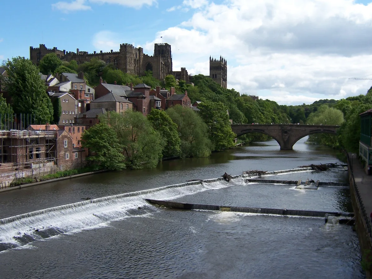
Kepier power station in England North East, United Kingdom.

GRAEME and LESLEY CRANSTON — CC BY-SA 2.0 via Wikimedia Commons licence

Plan your visit
- Typical visit
- 1 h–2 h
- Best time of year
- Year-round
- Nearest railway station
- Durham · 1.4 km
- Paid entry
- Family-friendly
- Limited wheelchair access
Getting there & planning your visit
To visit Kepier power station, the nearest railway station is Durham, located 1.4 km away. Entry is paid, and wheelchair accessibility is limited. The postcode for sat-nav is DH1 1LB.
About
Kepier power station is a place of interest in England North East, United Kingdom — drawn from open-data sources for visitor reference. See the linked Wikipedia article for the full description.
Photo gallery
360° view
Imagery © Mapillary contributors, CC BY-SA 4.0
From the Wikipedia article
The Kepier power station was a cancelled coal-fired power station on the River Wear at Kepier, 0.75 miles (1.21 km) north east of Durham, County Durham, North East England. Planned by the North Eastern Electric Supply Company (NESCo) in 1944, it was never realised as the scheme faced stiff opposition from those who claimed it would obstruct views of the historic Durham Cathedral from the East Coast Main Line. A number of people supported the scheme as it would help meet the increasing demand for electricity and provide much needed jobs in the post-depression, post-war economy of Britain. The station, which had been designed by architect Giles Gilbert Scott, would have been operational by the late 1940s and would have generated 150 megawatts of electricity. However, following a public inquiry the plans were not approved and instead NESCo installed additional capacity at their existing power stations.
Excerpt from Wikipedia under CC BY-SA 4.0. See the source article linked in Sources below.
Background
History
After several years of preliminary planning, surveying sites and drawing up plans, the North Eastern Electric Supply Company (NESCo) bought the site of a large rifle range, over both sides of the River Wear, at Kepier, 0.75 mi north east of the city of Durham, and in early 1944 publicly announced their plans to build a large coal-fired power station on the site. The station was part of a post-war plan by NESCo, and the scheme had a projected cost of £3,500,000. The site was chosen in the mid-Durham area to be close to the coal supplies. It also needed to be a short distance from the River Wear, downstream of Durham, and on solid foundations. Mine workings in County Durham restricted the…
Architecture
The station's site plans and elevations were designed by Giles Gilbert Scott. He had previously designed Battersea Power Station in London, and so the designs of the Kepier station were considered to have been of a very high architectural quality. NESCo claimed that the design of the station would be considered "a credit to the whole district". The main station building was to be 135 ft in height. The station would have burned between 1,500 and 2,000 tonnes of low-grade coal per week, to produce 150 megawatts (MW) of electricity. The coal was to be taken from mines in County Durham, and transported to the station by the Durham goods branch of the Leamside Line railway, which terminated at…
Sourced from Wikipedia under CC BY-SA 4.0.
- Coordinates
- 54.7860, -1.5620
- District
- County Durham
- Parish
- Belmont
- Postcode
- DH1 1LB
- Parliamentary constituency
- City of Durham
- Nearest railway station
- Durham — 1.4 km
- Official site
- grokipedia.com
Sources
- wikidata: Q6393138 (CC0)
- wikipedia: Kepier power station (CC BY-SA 4.0)
Other places nearby
Kepier Haughs
Stadiums · 0.1 km

Loggia of Heath family mansion
Historic houses · 0.3 km

Loggia of Heath family mansion
Archaeological sites · 0.3 km
Kepier Hospital
Historic houses · 0.3 km
Durham
Towns & cities · 0.4 km

Chapel of St. Mary Magdalene
Chapels · 0.6 km

Chapel of the Hospital of St. Mary Magdalene, Durham
Historic houses · 0.6 km

Chapel of the Hospital of St. Mary Magdalene, Durham
Archaeological sites · 0.6 km

Former brick works
Historic houses · 0.6 km

Kepier
Watermills · 0.7 km
Gilesgate Station
Memorials & monuments · 0.7 km

Gilesgate
Other places · 0.8 km
Nearby
📷 3📷 3Historic houses · North East England
Loggia of Heath family mansion
Loggia of Heath family mansion — a historic house in scotland-lowlands, United Kingdom.
📷 5Archaeological sites · North East England
Loggia of Heath family mansion
Loggia of Heath family mansion — archaeological in scotland lowlands.
📷 4Historic houses · North East England
Kepier Hospital
Kepier Hospital in England North East, United Kingdom.
Flagship📷 3Towns & cities · North East England
Durham
Durham — city and the county town of County Durham in North East England.
📷 3Chapels · North East England
Chapel of St. Mary Magdalene
Chapel of St. Mary Magdalene — Grade I listed chapel in Durham, England, UK.
Where to eat & stay near Kepier power station
Places to stay
 📷 5
📷 5Hotels · North East England
Radisson Blu
Radisson Blu — a hotel in scotland lowlands.
 📷 5
📷 5Hotels · North East England
Durham Marriott Hotel Royal County
Durham Marriott Hotel Royal County — a hotel in scotland lowlands.
 📷 5
📷 5Hotels · North East England
Hotel Indigo Durham
Hotel Indigo Durham — a hotel in scotland lowlands.
 📷 5
📷 5Campsites · North East England
Durham Amateur Rowing Club
Durham Amateur Rowing Club — a campsite in scotland lowlands.
 📷 5
📷 5Hostels · North East England
Regatta Place Student Accomodation
Regatta Place Student Accomodation — a hostel in scotland lowlands.
 📷 5
📷 5B&Bs · North East England
Castle View Guest House
Castle View Guest House — a bed-and-breakfast in scotland lowlands.
Places to eat & drink
 📷 5
📷 5 📷 5
📷 5Restaurants · North East England
Bistro Italiano
Bistro Italiano — a restaurant in scotland lowlands.
 📷 5
📷 5Historic pubs · North East England
The Big Jug Public House
The Big Jug Public House in England North East, United Kingdom.
 📷 5
📷 5Cafés · North East England
Old Cinema Launderette
Old Cinema Launderette — a café in scotland lowlands.
 📷 5
📷 5Historic pubs · North East England
The Dun Cow Public House
The Dun Cow Public House in England North East, United Kingdom.
 📷 5
📷 5More cathedrals in this region
 ★ Iconic📷 5
Cathedrals · North East England
Durham Cathedral
The greatest Romanesque building in Britain, shrine of St Cuthbert.
 Flagship📷 5
Cathedrals · North East England
Egglestone Abbey
Egglestone Abbey is a cathedral in the United Kingdom.
 Flagship📷 4
Cathedrals · North East England
Richmond (Yorks)
Richmond (Yorks) in England North East, United Kingdom.
 📷 5
📷 5Frequently asked questions
- Where is Kepier power station?
- Kepier power station is in North-East England, United Kingdom (postcode DH1 1LB), in the parish of Belmont.
- What is Kepier power station?
- Kepier power station in England North East, United Kingdom.
- How do I get to Kepier power station?
- The nearest railway station is Durham, about 1.4 km away. Drivers can use postcode DH1 1LB.
- Who owns Kepier power station?
- Kepier power station is owned by North Eastern Electric Supply Company.
- How do I get to Kepier power station?
- The nearest railway station is Durham, about 1.4 km away. Drivers can navigate to postcode DH1 1LB.