
Stadiums · East of England
Kenilworth Road
In or near Caddington.
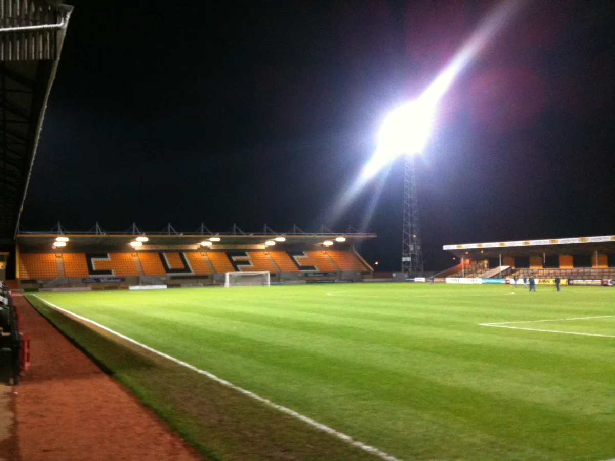
Kenilworth Road — football stadium in Luton, Bedfordshire, England.

Wikimedia Commons contributors — see linked file page for photographer and licence licence

Plan your visit
- Typical visit
- 1.5 h–3 h
- Nearest railway station
- Luton · 1.2 km
Getting there & planning your visit
Kenilworth Road is located in Luton, with the nearest railway station being Luton, approximately 1.2 km away. The postcode for the stadium is LU1 1DH. Please check for accessibility options before your visit.
About
Kenilworth Road is a stadium in the United Kingdom. Records date its origin to 1905. Managed by Luton Town F.C.. Wikidata describes it as: "football stadium in Luton, Bedfordshire, England". Coordinates: 51.8842°, -0.4317°.
Photo gallery
Summary from the official site
Kenilworth Road is the home stadium of Luton Town Football Club, known for its unique entrance for away fans through a residential area. Built in 1905 and recently renovated, it has a seating capacity of 10,356, making it one of the smallest stadiums in the Premier League.
Read more on the official property page.
Protected designations
- Area of Outstanding Natural Beauty: Chilterns
Designations sourced from Natural England open data under OGL v3.
From the Wikipedia article
Kenilworth Road, also known as the Kenny, is a football stadium in the area of Bury Park, Luton, Bedfordshire, England. It has been the home ground of Luton Town Football Club since 1905. The stadium has also hosted women's and youth international matches, including the second leg of the 1984 European Competition for Women's Football final. The 12,000 all-seater stadium is situated in the district of Bury Park, one mile (1.6 km) west of the centre of Luton. It is named after the road which runs along one end of it, though its official address is 1 Maple Road. Kenilworth Road hosted football in the Southern League until 1920, then in the Football League until 2009, when Luton were relegated to the Conference Premier. It has hosted Football League matches once more since 2014. With Luton Town's promotion to the Premier League in 2023, the first Premier League game at Kenilworth Road was against West Ham United in September 2023. Floodlights were fitted in 1953, and the ground became all-seated in 1991. The record attendance of 30,069 was set in 1959, in an FA Cup sixth round replay against Blackpool. The ground is known for the unusual entrance to the Oak Road End, and the five-season ban on away supporters that Luton Town imposed following a riot by visiting fans in 1985.
Excerpt from Wikipedia under CC BY-SA 4.0. See the source article linked in Sources below.
Background
History
Luton Town moved to Kenilworth Road in 1905, leaving their previous home at Dunstable Road after their landlord sold the site for housing at short notice. The club's directors quickly procured a new site, and the club's first match at the new ground came on 4 September 1905, a 0–0 draw against Plymouth Argyle. Watford player C. Barnes scored the first ever goal at the stadium, in a reserve match. Originally known as Ivy Road, The ground has undergone several major changes since its original construction in 1905. The original Main Stand, boasting a press loft and a balcony above the roof, burnt down in 1921, and was replaced by the current stand before the 1922–23 campaign. The new Main…
Architecture
Stand; B–Boxes]] The ground is made up of five stands—opposite the eponymous Kenilworth Stand is the Oak Road End, and to the left is the Main Stand, which is flanked to its right by the David Preece Stand. Opposite them is the Bobbers Stand. The Main Stand covers approximately two-thirds of the length of the pitch, though the attached enclosure is longer, covering the whole distance. The Main Stand, which seats 4,277 fans, To the right of the Main Stand is the 3,229-seater Originally a home section, the Oak Road End was turned into a stand for away fans only at the start of the 1991–92 season. Early in the 2013–14 season, the Oak Road End was re-opened for home supporters for fixtures…
Sourced from Wikipedia under CC BY-SA 4.0.
- Coordinates
- 51.8842, -0.4317
- District
- Luton
- Parish
- Luton, unparished area
- Postcode
- LU1 1DH
- Parliamentary constituency
- Luton South and South Bedfordshire
- Established
- 1905
- Nearest railway station
- Luton — 1.2 km
- Official site
- www.goal.com
Sources
- wikidata: Q1613767 (CC0)
- wikipedia: Kenilworth Road (CC BY-SA 4.0)
- commons: Kenilworth Road, Kenilworth End.jpg (CC BY-SA 4.0)
Other places nearby

Madinah Masjid
Historic churches · 0.1 km

Odeon Luton
Theatres · 0.3 km

Masjid Al-Ghurabaa
Historic churches · 0.4 km
Luton Central Mosque
Historic churches · 0.4 km
Kokni Community Luton
Historic churches · 0.4 km
Jalalabad Jame Masjid
Historic churches · 0.4 km
Bury Park Masjid
Historic churches · 0.4 km
Masjid e Noor
Historic churches · 0.7 km

Rabia Girls' and Boys' School
Natural landmarks · 0.7 km
Masjid Al Huda
Historic churches · 0.7 km

Gaumont Luton
Theatres · 0.9 km

Alma Theatre
Theatres · 0.9 km
Nearby
📷 5Historic churches · East of England
Madinah Masjid
Madinah Masjid — a church in england-london, United Kingdom.
📷 5Theatres · East of England
Odeon Luton
Odeon Luton in England East, United Kingdom.
📷 5Historic churches · East of England
Masjid Al-Ghurabaa
Masjid Al-Ghurabaa — a church in england-london, United Kingdom.
📷 5Historic churches · East of England
Luton Central Mosque
Luton Central Mosque — a church in england-london, United Kingdom.
📷 5Historic churches · East of England
Kokni Community Luton
Kokni Community Luton — a church in england-london, United Kingdom.
📷 5Historic churches · East of England
Jalalabad Jame Masjid
Jalalabad Jame Masjid — a church in england-london, United Kingdom.
Where to eat & stay near Kenilworth Road
Places to stay
 📷 7
📷 7Hotels · East of England
Spark by Hilton Luton
Spark by Hilton Luton — a hotel in england london. 4-star. Brand: Spark by Hilton.
 📷 7
📷 7Hotels · East of England
The Red Lion hotel
The Red Lion hotel — a hotel in england london.
 📷 5
📷 5Hostels · East of England
Stockwood Hotel
Stockwood Hotel — a hostel in england london.
 📷 5
📷 5Hotels · East of England
Hampton by Hilton London Luton Airport
Hampton by Hilton London Luton Airport — a hotel in england london. 3-star. Brand: Hampton.
 📷 3
📷 3Hotels · East of England
Hilton Garden Inn Luton North
Hilton Garden Inn Luton North — a hotel in england london. 4-star. Brand: Hilton Garden Inn.
 📷 5
📷 5Hotels · East of England
Offley Place Country House Hotel
Offley Place Country House Hotel — a hotel in england london.
Places to eat & drink
 📷 5
📷 5Historic pubs · East of England
The Fountain Public House
The Fountain Public House in England East, United Kingdom.
 📷 5
📷 5 📷 5
📷 5Restaurants · East of England
Old Moat House
Old Moat House — a restaurant in england london. Cuisine: pizza. Brand: Stonehouse Pizza & Carvery.
 📷 5
📷 5Historic pubs · East of England
Lilley Arms Public House
Lilley Arms Public House in England East, United Kingdom.
 📷 7
📷 7 📷 5
📷 5Historic pubs · East of England
The Spotted Dog Public House
The Spotted Dog Public House in England East, United Kingdom.
Other places from this era
.jpg?width=1200) 📷 5
📷 5Stadiums · London
Bobby Moore statue
Bobby Moore statue — Public artwork (statue).
 📷 5
📷 5Stadiums · London
Brentford Community Stadium
Brentford Community Stadium — stadium in London, England.
 📷 5
📷 5Stadiums · London
Hackney Wick Stadium
Hackney Wick Stadium — former stadium in thr Londom Borough of Hackney.
.jpg?width=1200) 📷 5
📷 5More places in this region
 📷 5
📷 5Stadiums · East of England
Abbey Stadium
Abbey Stadium — homeground for Cambridge United F.C.
 📷 5
📷 5Stadiums · East of England
Fossetts Farm Stadium
Fossetts Farm Stadium — proposed football stadium in Essex, England.
 📷 3
📷 3Stadiums · East of England
Carrow Road
Carrow Road is a stadium in the United Kingdom.
 📷 4
📷 4Stadiums · East of England
Colchester Community Stadium
Colchester Community Stadium, known as the JobServe Community Stadium for sponsorship reasons, is a football stadium in Myland, England. It is the home of Colchester United Football Club. It has a cap
Frequently asked questions
- Where is Kenilworth Road?
- Kenilworth Road is in East of England, United Kingdom (postcode LU1 1DH), in the parish of Luton, unparished area.
- What is Kenilworth Road?
- Kenilworth Road — football stadium in Luton, Bedfordshire, England.
- How do I get to Kenilworth Road?
- The nearest railway station is Luton, about 1.2 km away. The nearest town is Caddington. Drivers can use postcode LU1 1DH.
- When was Kenilworth Road built?
- Built or established in 1905.
- Who owns Kenilworth Road?
- Kenilworth Road is owned by Luton Borough Council and operated by Luton Town F.C..
- Is Kenilworth Road a protected site?
- Yes — Kenilworth Road is part of the Chilterns National Landscape (AONB).
- How do I get to Kenilworth Road?
- The nearest railway station is Luton, about 1.2 km away. Drivers can navigate to postcode LU1 1DH.