
Natural landmarks · East of England
Rabia Girls' and Boys' School
In or near Leagrave.
Rabia Girls' and Boys' School — a school heritage in england-london, United Kingdom.

Robin Stott — CC BY-SA 2.0 via Wikimedia Commons licence

Plan your visit
- Typical visit
- 1 h–2 h
- Nearest railway station
- Luton · 1.9 km
- Free entry
- Dog-friendly
- Limited wheelchair access
About
Rabia Girls' and Boys' School is a school heritage located in england-london, United Kingdom. Catalogued from Wikidata's UK heritage register; see the Wikipedia article for further historical and visitor details.
Photo gallery
Official information
Rabia Girls' and Boys' School is an independent Islamic school located in Luton, catering to girls aged 11 to 16 years. The school focuses on promoting educational excellence within a caring environment, supporting students in their academic and personal development.
Protected designations
- Area of Outstanding Natural Beauty: Chilterns
Designations sourced from Natural England open data under OGL v3.
Place summary
Rabia Girls' and Boys' School is located in London. It serves as an educational institution providing learning opportunities for both girls and boys.
AI-generated from the structured facts on this page (operator, designation, listing, era). Not a substitute for visiting.
Background
History
Rabia School was established in January 1996 as a girls' school with seven pupils of primary age on the school register in a residential building. In October 2005 the school expanded by acquiring bigger premises for a boys school. The school then became a full-time primary and secondary independent school for girls and boys aged 5–16 years. There was a nursery school on the site for children aged 2–5. Girls and boys attending the school were taught separately in different buildings. The school claimed to offer a mainstream education, but also had courses and subjects tailored to the Islamic faith. Special courses included Arabic, Urdu, as well as Aalim courses, and the chance for some…
Sourced from Wikipedia under CC BY-SA 4.0.
- Coordinates
- 51.8870, -0.4410
- District
- Luton
- Parish
- Luton, unparished area
- Postcode
- LU4 8HA
- Parliamentary constituency
- Luton South and South Bedfordshire
- Established
- 1996
- Nearest railway station
- Luton — 1.9 km
- Official site
- www.rabiaschool.uk
Sources
- wikidata: Q7278702 (CC0)
- wikipedia: Rabia School (CC BY-SA 4.0)
Other places nearby

Madinah Masjid
Historic churches · 0.6 km

Luton Central Mosque
Historic churches · 0.6 km
Masjid Al Huda
Historic churches · 0.7 km
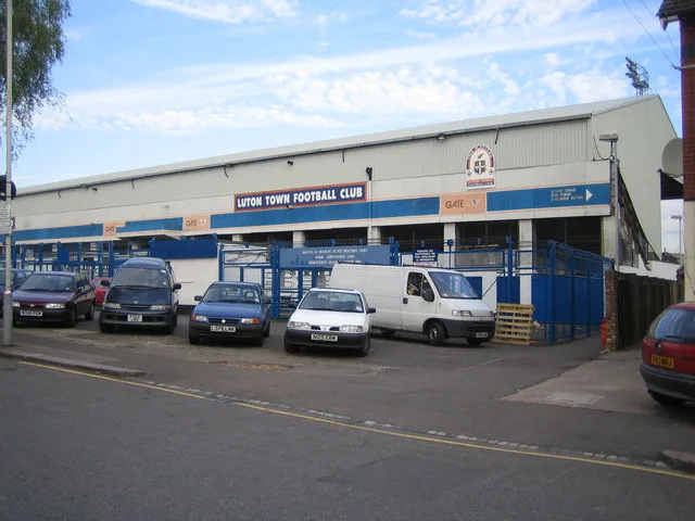
Kenilworth Road
Stadiums · 0.7 km
Jalalabad Jame Masjid
Historic churches · 0.8 km

Masjid Al-Hira (Sunni)
Historic churches · 0.8 km
Masjid Al-Ghurabaa
Historic churches · 0.9 km
Masjid-E-Ali (Shia)
Historic churches · 0.9 km

Baitul Abraar Jami Masjir
Historic churches · 0.9 km

Kokni Community Luton
Historic churches · 1.0 km
Odeon Luton
Theatres · 1.0 km

Jamia Al-Alkbaria
Historic churches · 1.0 km
Nearby
📷 5Historic churches · East of England
Madinah Masjid
Madinah Masjid — a church in england-london, United Kingdom.
📷 5Historic churches · East of England
Luton Central Mosque
Luton Central Mosque — a church in england-london, United Kingdom.
📷 5Historic churches · East of England
Masjid Al Huda
Masjid Al Huda — a church in england-london, United Kingdom.
📷 5Stadiums · East of England
Kenilworth Road
Kenilworth Road — football stadium in Luton, Bedfordshire, England.
📷 5Historic churches · East of England
Jalalabad Jame Masjid
Jalalabad Jame Masjid — a church in england-london, United Kingdom.
📷 5Historic churches · East of England
Masjid Al-Hira (Sunni)
Masjid Al-Hira (Sunni) — a church in england-london, United Kingdom.
Where to eat & stay near Rabia Girls' and Boys' School
Places to stay
 📷 7
📷 7Hotels · East of England
Spark by Hilton Luton
Spark by Hilton Luton — a hotel in england london. 4-star. Brand: Spark by Hilton.
 📷 7
📷 7Hotels · East of England
The Red Lion hotel
The Red Lion hotel — a hotel in england london.
 📷 5
📷 5Hostels · East of England
Stockwood Hotel
Stockwood Hotel — a hostel in england london.
 📷 5
📷 5Hotels · East of England
Hampton by Hilton London Luton Airport
Hampton by Hilton London Luton Airport — a hotel in england london. 3-star. Brand: Hampton.
 📷 3
📷 3Hotels · East of England
Hilton Garden Inn Luton North
Hilton Garden Inn Luton North — a hotel in england london. 4-star. Brand: Hilton Garden Inn.
 📷 5
📷 5Hotels · East of England
Offley Place Country House Hotel
Offley Place Country House Hotel — a hotel in england london.
Places to eat & drink
 📷 5
📷 5Historic pubs · East of England
The Fountain Public House
The Fountain Public House in England East, United Kingdom.
 📷 5
📷 5Restaurants · East of England
Old Moat House
Old Moat House — a restaurant in england london. Cuisine: pizza. Brand: Stonehouse Pizza & Carvery.
 📷 5
📷 5 📷 5
📷 5Historic pubs · East of England
Lilley Arms Public House
Lilley Arms Public House in England East, United Kingdom.
 📷 7
📷 7 📷 5
📷 5Historic pubs · East of England
The Spotted Dog Public House
The Spotted Dog Public House in England East, United Kingdom.
More natural landmarks in this region
 📷 5
📷 5Natural landmarks · East of England
Orton Mere
Orton Mere — lake in Peterborough, Cambridgeshire, England, UK.
 📷 5
📷 5Natural landmarks · East of England
Magog Down
Magog Down — a other in england-london, United Kingdom.
 📷 5
📷 5Natural landmarks · East of England
Abington Pottery
Abington Pottery — a other in england-london, United Kingdom.
 📷 5
📷 5Natural landmarks · East of England
Car Dyke
Car Dyke — a other in england-london, United Kingdom.
Frequently asked questions
- Where is Rabia Girls' and Boys' School?
- Rabia Girls' and Boys' School is in London, United Kingdom (postcode LU4 8HA), in the parish of Luton, unparished area.
- What is Rabia Girls' and Boys' School?
- Rabia Girls' and Boys' School — a school heritage in england-london, United Kingdom.
- How do I get to Rabia Girls' and Boys' School?
- The nearest railway station is Luton, about 1.9 km away. Drivers can use postcode LU4 8HA.
- When was Rabia Girls' and Boys' School built?
- Built or established in 1996.
- Is Rabia Girls' and Boys' School a protected site?
- Yes — Rabia Girls' and Boys' School is part of the Chilterns National Landscape (AONB).
- Is Rabia Girls' and Boys' School free to visit?
- Yes, Rabia Girls' and Boys' School is free to enter.
- How do I get to Rabia Girls' and Boys' School?
- The nearest railway station is Luton, about 1.9 km away. Drivers can navigate to postcode LU4 8HA.