Islands · Central Scotland
Inch Talla
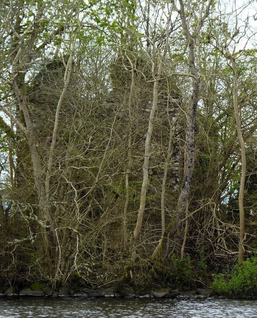
Inch Talla — island in the Lake of Menteith, Stirlingshire.

Wikimedia Commons contributors — see linked file page for photographer and licence licence
Plan your visit
- Typical visit
- 4 h–12 h
- Free entry
- Dog-friendly
About
Inch Talla is a island in the United Kingdom. Wikidata describes it as: "island in the Lake of Menteith, Stirlingshire". Coordinates: 56.1747°, -4.3019°.
Photo gallery
From the Wikipedia article
Inchtalla or Inch Talla is an island in the Loch or Lake of Menteith in central Scotland. Its name derives from the Gaelic words innis ("island") and "talla" ("hall"). The entire island is dominated by Talla Castle, which appears to have been built in the 18th century. It was erected on the site of an earlier building that dates from 1428. Isle of Monteith [Inchtalla]. Agreement, Countess of Airth and William, Earl of Monteith 'the haill rooms within the hall door with the second chamber nixt the hall called the schoolhouse and the north chamber nixt adjacent to the hall to be of equell use whenever occasions offers of any of the said countess hir relations or yet the said earl's (being men of quallitie) and the kitching and brewhous to be of common use for serving both parties, and the said Earl to have the littellvoult east the turnpyk on the South syd of the cloass'. (Scottish Record office, 1667)
Excerpt from Wikipedia under CC BY-SA 4.0. See the source article linked in Sources below.
- Coordinates
- 56.1747, -4.3019
- District
- Stirling
- Postcode
- FK8 3RD
- Parliamentary constituency
- Stirling and Strathallan
Sources
- wikidata: Q15228629 (CC0)
- wikipedia: Inchtalla (CC BY-SA 4.0)
- commons: Inch Talla, Lake of Menteith.jpg (CC BY-SA 4.0)
Other places nearby
Loading nearby places…
Nearby
 📷 3
📷 3Castles · Central Scotland
Talla Castle (ruins)
Talla Castle (ruins) — a castle in scotland-central, United Kingdom.
 📷 3
📷 3Castles · Central Scotland
Talla Castle
Talla Castle — castle in Stirling, Scotland, UK.
 📷 5
📷 5Abbeys & priories · Scottish Highlands
Inchmahome Priory
Inchmahome Priory in Scotland Islands, United Kingdom.
 📷 5
📷 5Islands · Central Scotland
Inchmahome
Inchmahome — island in Lake of Menteith, Stirling, Scotland, UK.
 📷 3
📷 3Archaeological sites · Central Scotland
Dog Isle, Crannog
Dog Isle, Crannog — a archaeological in scotland-central, United Kingdom.
 Flagship📷 3
Natural landmarks · Central Scotland
Lake of Menteith
Lake of Menteith — freshwater lake in Stirling, Scotland, UK, outflows east to Googie Water.
More places in this region
 Flagship📷 5
Islands · Central Scotland
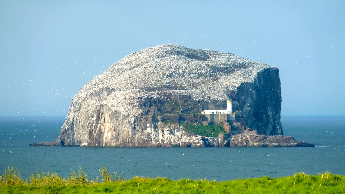
Bass Rock
Bass Rock — island in the east of Scotland.
 Flagship📷 3
Islands · Central Scotland
Fidra
Fidra — uninhabited island in the Firth of Forth, on the east coast of Scotland.
 Flagship📷 3
Islands · Central Scotland
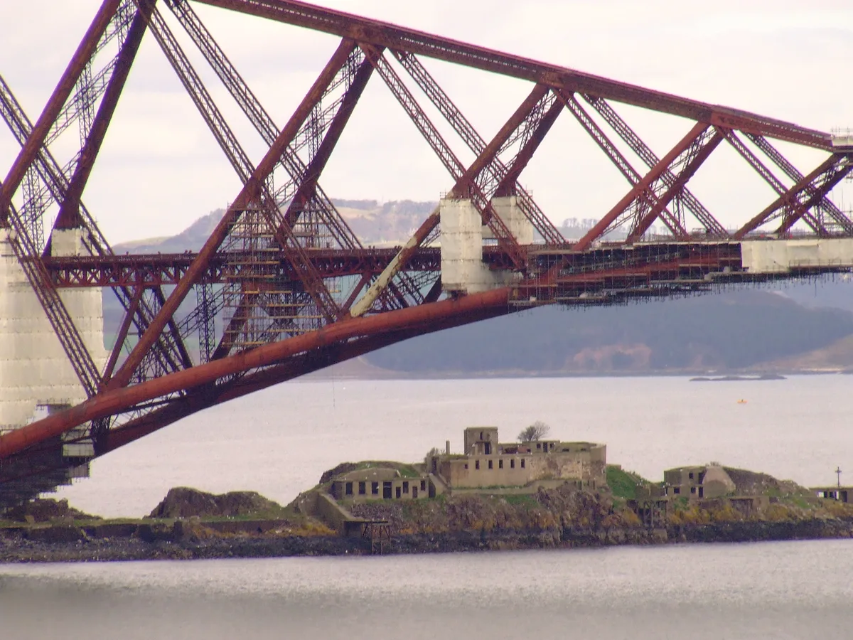
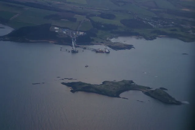
Inch Garvie
Inch Garvie — island in the Firth of Forth, Edinburgh, Scotland, UK.
 Flagship📷 3
Islands · Central Scotland
Inchcolm
Inchcolm — island in the Firth of Forth in Scotland.
Frequently asked questions
- Where is Inch Talla?
- Inch Talla is in central Scotland, United Kingdom (postcode FK8 3RD).
- What is Inch Talla?
- Inch Talla — island in the Lake of Menteith, Stirlingshire.
- How do I get to Inch Talla?
- Drivers can use postcode FK8 3RD.
- Is Inch Talla free to visit?
- Yes, Inch Talla is free to enter.
- How do I get to Inch Talla?
- Drivers can navigate to postcode FK8 3RD. It sits within the Stirling and Strathallan parliamentary constituency.