
Archaeological sites · Northern Ireland
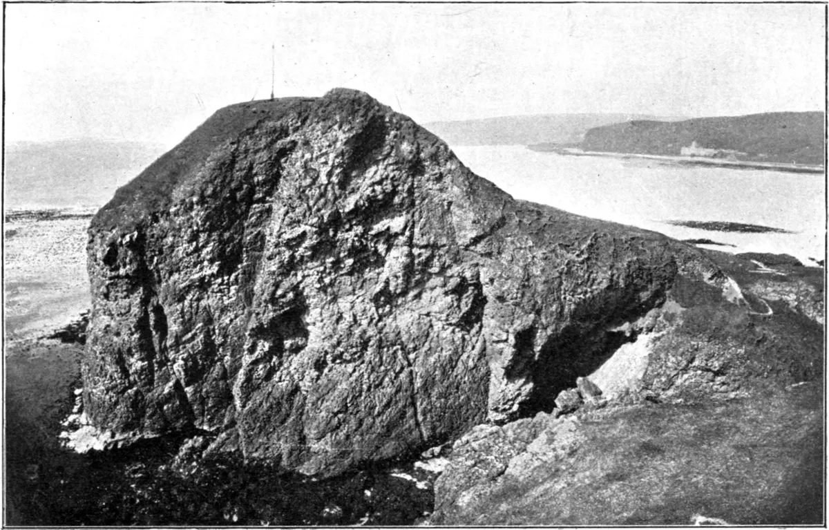
High Keil, dun site
High Keil, dun site — a archaeological in northern-ireland, United Kingdom.

James Emmans — CC BY-SA 2.0 via Wikimedia Commons licence

Plan your visit
- Typical visit
- 45 min–1.5 h
- Free entry
- Dog-friendly
About
High Keil, dun site is a archaeological located in northern-ireland, United Kingdom. Sourced from OpenStreetMap (ODbL licence); see local listings for visitor information, opening hours and admission details.
Photo gallery
Place summary
High Keil is an archaeological site located in Northern Ireland. It features the remains of a dun, a type of fortified settlement common in prehistoric Ireland. The site offers insights into early settlement patterns and defensive architecture in the region.
AI-generated from the structured facts on this page (operator, designation, listing, era). Not a substitute for visiting.
- Coordinates
- 55.3114, -5.6591
- District
- Argyll and Bute
- Postcode
- PA28 6RW
- Parliamentary constituency
- Argyll, Bute and South Lochaber
Sources
- osm: node/12908967005 (ODbL)
Other places nearby

High Keil
Villages · 0.2 km
Keil Port
Harbours & ports · 0.3 km

St. Columba's Church (ruins)
Historic houses · 0.6 km

St Columba's Chapel
Chapels · 0.6 km

Dunaverty Bay
Natural landmarks · 0.7 km
'St. Columba's Footprints'
Natural landmarks · 0.7 km

Dunaverty Memorial Burial Enclosure
Memorials & monuments · 0.8 km

Dunaverty Memorial Burial Enclosure
Archaeological sites · 0.8 km

Keil Caves
Natural landmarks · 0.8 km
Dunaverty Castle
Castles · 1.0 km

Dunaverty Castle
Vineyards · 1.1 km

Cnoc Mòr
Mountains & hills · 1.1 km
Nearby
📷 5📷 5📷 3Historic houses · Northern Ireland
St. Columba's Church (ruins)
St. Columba's Church (ruins) — a historic house in northern-ireland, United Kingdom.
📷 4Chapels · Northern Ireland
St Columba's Chapel
St Columba's Chapel — ruined medieval chapel near Southend, Argyll and Bute, Scotland, UK.
📷 5Natural landmarks · Northern Ireland
Dunaverty Bay
Dunaverty Bay — a natural feature in northern ireland.
📷 3Natural landmarks · Northern Ireland
'St. Columba's Footprints'
'St. Columba's Footprints' — a other in northern-ireland, United Kingdom.
Where to eat & stay near High Keil, dun site
Places to stay
 📷 5
📷 5 📷 5
📷 5Hotels · Scottish Lowlands
The Royal Hotel
The Royal Hotel — a hotel in scotland lowlands.
 📷 5
📷 5Caravan parks · Scottish Lowlands
Peninver Sands Holiday Park
Peninver Sands Holiday Park — a caravan park in scotland lowlands.
📷 5Caravan parks · Scottish Lowlands
Peninver Sands Holiday Park
Peninver Sands Holiday Park — a caravan park in scotland lowlands.
Places to eat & drink
 📷 5
📷 5Historic pubs · Scottish Lowlands
40 Main Street, Campbeltown
40 Main Street, Campbeltown in Northern Ireland, United Kingdom.
More archaeological sites in this region
 Flagship📷 5
Archaeological sites · Northern Ireland
Tollymore Forest Park
Tollymore Forest Park — park in the United Kingdom.
 📷 3
📷 3Archaeological sites · Northern Ireland
Annalong Forest
Annalong Forest — Forest in County Down, Northern Ireland.
 📷 3
📷 3Archaeological sites · Northern Ireland
Ballysallagh Forest
Ballysallagh Forest — forest in Northern Ireland.
 📷 3
📷 3Archaeological sites · Northern Ireland
Castleward Forest
Castleward Forest — castleward Forest: Northern Ireland.
Frequently asked questions
- Where is High Keil, dun site?
- High Keil, dun site is in Northern Ireland, United Kingdom (postcode PA28 6RW).
- What is High Keil, dun site?
- High Keil, dun site — a archaeological in northern-ireland, United Kingdom.
- How do I get to High Keil, dun site?
- Drivers can use postcode PA28 6RW.
- Is High Keil, dun site free to visit?
- Yes, High Keil, dun site is free to enter.
- How do I get to High Keil, dun site?
- Drivers can navigate to postcode PA28 6RW. It sits within the Argyll, Bute and South Lochaber parliamentary constituency.