
Campsites · South East England
Henfold Campsite
In or near Betchworth.
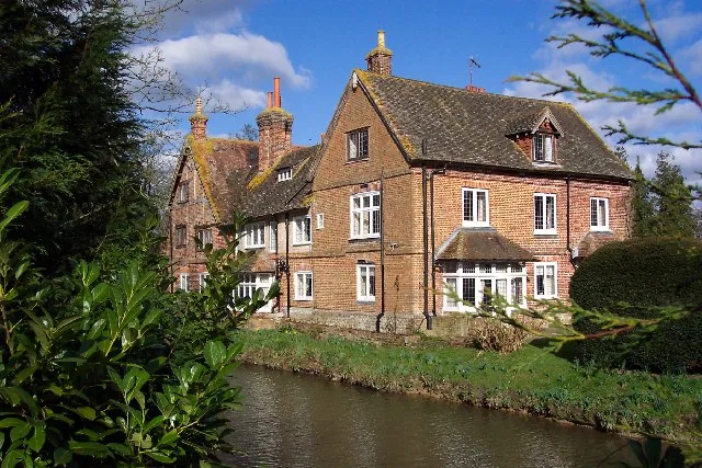
Henfold Campsite — a campsite in england south east.

David Howard — CC BY-SA 2.0 via Wikimedia Commons licence

Plan your visit
- Typical visit
- 1 h–2 h
- Nearest railway station
- Holmwood · 1.5 km
About
Henfold Campsite is a campsite located in england south east. Campsite listed with verified location and OSM metadata. Pitch availability, facilities (toilets, showers, electric hookup) and seasonal opening vary — confirm directly.
Photo gallery
Protected designations
- Area of Outstanding Natural Beauty: High Weald
- Area of Outstanding Natural Beauty: Surrey Hills
Designations sourced from Natural England open data under OGL v3.
Place summary
Henfold Campsite is located in South-East England. This campsite offers visitors a natural setting for outdoor stays, suitable for tents and caravans. Facilities typically include basic amenities for campers, allowing for a rustic experience. The surrounding landscape provides opportunities for walking and enjoying the outdoors.
AI-generated from the structured facts on this page (operator, designation, listing, era). Not a substitute for visiting.
- Coordinates
- 51.1826, -0.2991
- County
- Surrey
- District
- Mole Valley
- Parish
- Capel
- Postcode
- RH5 4RW
- Parliamentary constituency
- Dorking and Horley
- Nearest railway station
- Holmwood — 1.5 km
Sources
- osm: w444463697 (ODbL)
Other places nearby
Henfold Lakes Fishery and Caravan Park
Caravan parks · 0.2 km

Henfold House
Manor houses · 0.7 km

Holmwood
Villages · 1.6 km

Surrey Hills Park
Caravan parks · 2.0 km

Newdigate Brickworks
Forests & woodlands · 2.0 km

Holmwood War Memorial
Memorials & monuments · 2.0 km

The Dutch House
Historic houses · 2.2 km
Cudworth Manor
Stately homes · 3.0 km

Capel Military Show
Natural landmarks · 3.3 km

Oakleigh Grange
Manor houses · 3.3 km

Inholms Lane Clay Pit Nature Reserve
Forests & woodlands · 3.6 km

Anstiebury Camp: a large multivallate hillfort south-east of Crockers Farm
Vineyards · 3.6 km
Nearby
📷 5Caravan parks · South East England
Henfold Lakes Fishery and Caravan Park
Henfold Lakes Fishery and Caravan Park — a caravan park in england south east.
📷 5Manor houses · South East England
Henfold House
Henfold House — a manor in South East England, United Kingdom.
📷 5📷 5Caravan parks · South East England
Surrey Hills Park
Surrey Hills Park — a caravan park in england south east.
📷 5Forests & woodlands · South East England
Newdigate Brickworks
Newdigate Brickworks is a forest or woodland in the United Kingdom.
📷 5Memorials & monuments · South East England
Holmwood War Memorial
Holmwood War Memorial — Grade II listed building-listed memorial in england-south-east, United Kingdom.
Where to eat & stay near Henfold Campsite
Places to stay
📷 5Caravan parks · South East England
Henfold Lakes Fishery and Caravan Park
Henfold Lakes Fishery and Caravan Park — a caravan park in england south east.
📷 5Caravan parks · South East England
Surrey Hills Park
Surrey Hills Park — a caravan park in england south east.
 📷 5
 📷 5
 📷 5
 📷 5
Caravan parks · South East England
Conifer Park Caravan Site
Conifer Park Caravan Site — a caravan park in england london.
Places to eat & drink
 📷 7
Historic pubs · South East England
The Seven Stars Public House
The Seven Stars Public House in England South East, United Kingdom.
 📷 7
 📷 5
Historic pubs · South East England
The Old School Public House
The Old School Public House in England South East, United Kingdom.
 📷 5
Historic pubs · South East England
The Skimmington Castle Public House
The Skimmington Castle Public House in England South East, United Kingdom.
 📷 7
Historic pubs · South East England
Blue Anchor Public House
Blue Anchor Public House in England South East, United Kingdom.
 📷 7
Historic pubs · South East England
The Bull's Head Inn
The Bull's Head Inn in England South East, United Kingdom.
More places in this region
 📷 5
Campsites · South East England
Hammonds Glamping
Hammonds Glamping — a campsite in england london.
 📷 5
Campsites · South East England
Chantry Wood Campsite
Chantry Wood Campsite — a campsite in england london.
 📷 5
Campsites · South East England
Ranmore Common Campsite
Ranmore Common Campsite — a campsite in england london.
 📷 5
Frequently asked questions
- Where is Henfold Campsite?
- Henfold Campsite is in Surrey, South-East England, United Kingdom (postcode RH5 4RW), in the parish of Capel.
- What is Henfold Campsite?
- Henfold Campsite — a campsite in england south east.
- How do I get to Henfold Campsite?
- The nearest railway station is Holmwood, about 1.5 km away. The nearest town is Betchworth. Drivers can use postcode RH5 4RW.
- Is Henfold Campsite a protected site?
- Yes — Henfold Campsite is part of the High Weald National Landscape (AONB) and the Surrey Hills National Landscape (AONB).
- How do I get to Henfold Campsite?
- The nearest railway station is Holmwood, about 1.5 km away. Drivers can navigate to postcode RH5 4RW.