
Mountains & hills · South West England
Helman Tor
Also known as: Torr Helman
In or near Rescorla.
Helman Tor — Named summit at 209 m.

Wikimedia Commons contributors — see linked file page for photographer and licence licence

Plan your visit
- Typical visit
- 3 h–8 h
- Best time of year
- Late spring – early autumn (May–Oct)
- Nearest railway station
- Luxulyan · 3.8 km
- Free entry
- Dog-friendly
Getting there & planning your visit
To visit Helman Tor, the nearest railway station is Luxulyan, located 3.8 km away. The postcode for navigation is PL30 5DF, and entry to the site is free.
About
Helman Tor is a named summit in the United Kingdom. Also known as: Torr Helman. Wikidata describes it as: "Named summit at 209 m.". Coordinates: 50.4220°, -4.7294°.
Photo gallery
Official information
Helman Tor is a nature reserve managed by the Cornwall Wildlife Trust, known for its diverse habitats and wildlife. Visitors can explore the area and observe various species, including recently discovered wild beavers.
Protected designations
- Site of Special Scientific Interest: Mid Cornwall Moors SSSI
- Area of Outstanding Natural Beauty: Cornwall
Designations sourced from Natural England open data under OGL v3.
From the Wikipedia article
Helman Tor (Cornish: Torr Helman) is a granite hill in mid Cornwall, UK with several separated tors, and is designated as a (non-statutory) County Geology Site (with similar criteria to a County Wildlife Site). The hill also has a Scheduled Ancient Monument. Helman Tor is also the name of the largest nature reserve managed by the Cornwall Wildlife Trust which includes Breney Common (a Special Area of Conservation) and Red Moor. The Wildlife Trust aims to rewild the reserve, including potentially releasing beavers, as well as long-horn cattle and Cornish black pigs. Helman Tor, along with Breney Common, Red Moor and Belowda Beacon, is part of the Mid Cornwall Moors Site of Special Scientific Interest. It lies on the Saints' Way, a long-distance footpath completed in 1986. It is the northern end of a granite ridge. There are at least three rocking stones (logan stone) on the ridge. There is a prehistoric hill fort and a stone hut circle settlement on the site. There is evidence of walls constructed in Neolithic period, around 6,000 years ago, as well as some level platforms, thought to be house sites, one platform has a network of postholes. There is also remains of a field system. These are similar to those at Carn Brea and limited excavation was carried out by Roger Mercer. There is a second Logan stone in the highest pile beside the trig point (triangulation point). A third logan stone is further down the ridge to the south, outside the reserve.
Excerpt from Wikipedia under CC BY-SA 4.0. See the source article linked in Sources below.
- Coordinates
- 50.4220, -4.7294
- District
- Cornwall
- Parish
- Lanlivery
- Postcode
- PL30 5DF
- Parliamentary constituency
- South East Cornwall
- Nearest railway station
- Luxulyan — 3.8 km
- Official site
- www.cornwallwildlifetrust.org.uk
Sources
- osm: n477824254 (ODbL)
- wikipedia: Helman Tor (CC BY-SA 4.0)
- commons: Helman Tor.JPG (CC BY-SA 4.0)
Other places nearby
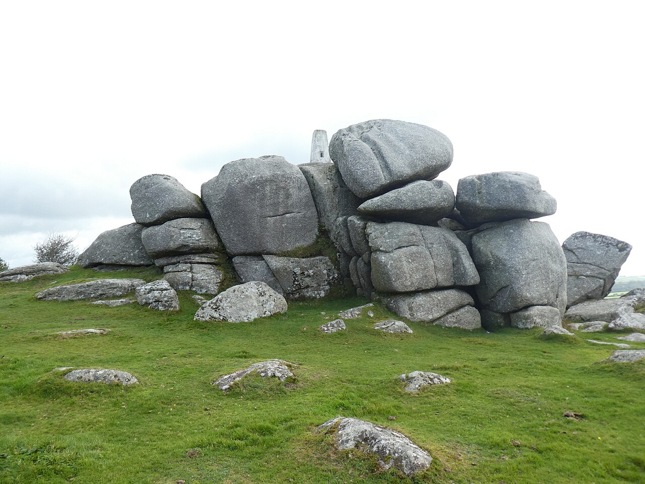
Earlier prehistoric hillfort, stone hut circle settlement and field system at Helman Tor
Vineyards · 0.1 km

Helman Tor
Forests & woodlands · 0.1 km

Breney Common
Forests & woodlands · 0.8 km

Red Moor
Forests & woodlands · 1.0 km
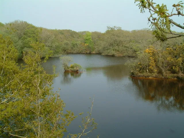
Red Moor nature reserve
Wildlife reserves · 1.1 km

Lowerton Moor
Forests & woodlands · 1.6 km

Penvivian Downs
Mountains & hills · 1.7 km

Ebenezer Chapel
Chapels · 2.3 km

Reperry Cross
Historic houses · 2.3 km

Mena Farm
Campsites · 2.4 km

Lanhydrock War Memorial Club
Memorials & monuments · 2.5 km

Lanlivery Hill
Mountains & hills · 2.7 km
Nearby
📷 5Vineyards · South West England
Earlier prehistoric hillfort, stone hut circle settlement and field system at Helman Tor
Earlier prehistoric hillfort, stone hut circle settlement and field system at Helman Tor — a UK vineyard in england south west, producing English or Welsh wine from cool-climate grape varieties.
📷 5Forests & woodlands · South West England
Helman Tor
Helman Tor is a forest or woodland in the United Kingdom.
📷 5Forests & woodlands · South West England
Breney Common
Breney Common is a forest or woodland in the United Kingdom.
📷 2Forests & woodlands · South West England
Red Moor
Red Moor is a forest or woodland in the United Kingdom.
📷 2Wildlife reserves · South West England
Red Moor nature reserve
Red Moor nature reserve — nature reserve near Lanlivery in mid Cornwall, England, UK.
📷 3Forests & woodlands · South West England
Lowerton Moor
Lowerton Moor is a forest or woodland in the United Kingdom.
Where to eat & stay near Helman Tor
Places to stay
📷 3Campsites · South West England
Mena Farm
Mena Farm — a campsite in england south west.
 📷 5
📷 5Campsites · South West England
Eden Valley Holiday Park
Eden Valley Holiday Park — a campsite in england south west.
 📷 2
📷 2Campsites · South West England
Croft Farm Campsite
Croft Farm Campsite — a campsite in england south west.
 📷 5
📷 5Campsites · South West England
Innis Inn Campsite
Innis Inn Campsite — a campsite in england south west.
 📷 5
📷 5B&Bs · South West England
The White Hart Inn
The White Hart Inn — a bed-and-breakfast in england south west.
📷 3Caravan parks · South West England
Resugga Green
Resugga Green — a caravan park in england south west.
Places to eat & drink
 📷 5
📷 5 📷 7
📷 7Historic pubs · South West England
Methodist Chapel
Methodist Chapel in England South West, United Kingdom.
 📷 7
📷 7Historic pubs · South West England
The Pack Horse Public House
The Pack Horse Public House in England South West, United Kingdom.
 📷 5
📷 5Restaurants · South West England
Pier House Hotel
Pier House Hotel — a restaurant in england south west.
 📷 7
📷 7Restaurants · South West England
The House on the Props
The House on the Props — a restaurant in england south west.
 📷 7
📷 7More mountains in this region
 📷 5
📷 5 📷 5
📷 5 📷 5
📷 5 📷 5
📷 5Frequently asked questions
- Where is Helman Tor?
- Helman Tor is in South-West England, United Kingdom (postcode PL30 5DF), in the parish of Lanlivery.
- What is Helman Tor?
- Helman Tor — Named summit at 209 m.
- How do I get to Helman Tor?
- The nearest railway station is Luxulyan, about 3.8 km away. Drivers can use postcode PL30 5DF.
- Is Helman Tor a protected site?
- Yes — Helman Tor is part of the Mid Cornwall Moors SSSI Site of Special Scientific Interest and the Cornwall National Landscape (AONB).
- Is Helman Tor free to visit?
- Yes, Helman Tor is free to enter.
- How do I get to Helman Tor?
- The nearest railway station is Luxulyan, about 3.8 km away. Drivers can navigate to postcode PL30 5DF.