
Villages · East Midlands
Heath
In or near Long Duckmanton.
Heath — a village in england east midlands.

JThomas — CC BY-SA 2.0 via Wikimedia Commons licence

Plan your visit
- Typical visit
- 1 h–2 h
- Nearest railway station
- Chesterfield · 7.2 km
About
A British village — settlements of this size traditionally cluster a green, parish church, pub and post office around historic land routes.
Photo gallery
Place summary
Heath is a village located in the East Midlands. This rural settlement features typical English countryside characteristics, including local architecture and community amenities. Visitors can expect a quiet atmosphere, with opportunities for walking and exploring the surrounding landscape.
AI-generated from the structured facts on this page (operator, designation, listing, era). Not a substitute for visiting.
- Coordinates
- 53.2000, -1.3333
- County
- Derbyshire
- District
- North East Derbyshire
- Parish
- Heath and Holmewood
- Postcode
- S44 5SE
- Parliamentary constituency
- Bolsover
- Nearest railway station
- Chesterfield — 7.2 km
Sources
- manual: geonames-2647221 (CC BY 4.0)
Other places nearby

Timberland Motorhomes
Caravan parks · 0.5 km

Heath Old Church
Historic houses · 0.6 km

Sutton Manor
Manor houses · 1.5 km

Doe Lea
Museums · 1.6 km
Dancing Flowers of Doe Lea
Public art & sculpture · 1.7 km

Sutton Scarsdale Hall
Historic houses · 1.7 km

Holmewood
Parks · 1.9 km

Ault Hucknall War Memorial
Memorials & monuments · 2.0 km
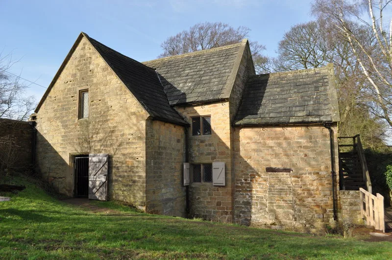
Stainsby Mill
Museums · 2.1 km

Stainsby Mill
Watermills · 2.1 km

Glapwell Collieries
Public art & sculpture · 2.1 km
Bramley Vale Drift Mine
Public art & sculpture · 2.1 km
Nearby
📷 5Caravan parks · East Midlands
Timberland Motorhomes
Timberland Motorhomes — a caravan park in england east midlands.
📷 3Historic houses · East Midlands
Heath Old Church
Heath Old Church — a historic house in england-east-midlands, United Kingdom.
📷 3Manor houses · East Midlands
Sutton Manor
Sutton Manor — Grade II listed building-listed manor in england-east-midlands, United Kingdom.
📷 5Museums · East Midlands
Doe Lea
Doe Lea is a small, linear village in the English county of Derbyshire. It is in the Bolsover district of the county and falls in the Ault Hucknall civil parish. The village runs along the old A617
📷 3Public art & sculpture · East Midlands
Dancing Flowers of Doe Lea
Dancing Flowers of Doe Lea — a public art in england-east-midlands, United Kingdom.
📷 3Historic houses · East Midlands
Sutton Scarsdale Hall
Sutton Scarsdale Hall — a other in england-east-midlands, United Kingdom.
Where to eat & stay near Heath
Places to stay
📷 5Caravan parks · East Midlands
Timberland Motorhomes
Timberland Motorhomes — a caravan park in england east midlands.
 📷 4
📷 4 📷 5
📷 5Campsites · East Midlands
Teversal Camping and Caravaning Club
Teversal Camping and Caravaning Club — a campsite in england east midlands.
 📷 5
📷 5Caravan parks · East Midlands
Caravan Club Site - Poolsbrook
Caravan Club Site - Poolsbrook — a caravan park in england east midlands.
 📷 7
📷 7 📷 5
📷 5Hotels · East Midlands
Ringwood Hall Hotel
Ringwood Hall Hotel — a hotel in england east midlands.
Places to eat & drink
 📷 5
📷 5Historic pubs · East Midlands
The Royal Oak Inn
The Royal Oak Inn in England East Midlands, United Kingdom.
 📷 7
📷 7Historic pubs · East Midlands
The Nags Head Public House
The Nags Head Public House in England East Midlands, United Kingdom.
 📷 5
📷 5Historic pubs · East Midlands
The Crispin Inn
The Crispin Inn in England East Midlands, United Kingdom.
 📷 5
📷 5Historic pubs · East Midlands
The Miners Arms Public House
The Miners Arms Public House in England East Midlands, United Kingdom.
 📷 5
📷 5 📷 5
📷 5Historic pubs · East Midlands
Portland Arms Public House
Portland Arms Public House in England East Midlands, United Kingdom.
More places in this region
 📷 5
📷 5 📷 5
📷 5 📷 5
📷 5 📷 5
📷 5Frequently asked questions
- Where is Heath?
- Heath is in Derbyshire, the East Midlands, United Kingdom (postcode S44 5SE), in the parish of Heath and Holmewood.
- What is Heath?
- Heath — a village in england east midlands.
- How do I get to Heath?
- The nearest railway station is Chesterfield, about 7.2 km away. Drivers can use postcode S44 5SE.
- How do I get to Heath?
- The nearest railway station is Chesterfield, about 7.2 km away. Drivers can navigate to postcode S44 5SE.