
Forests & woodlands · South East England
Hartslock
In or near Sulham.
Hartslock is a forest or woodland in the United Kingdom.

Wikimedia Commons licence
Plan your visit
- Typical visit
- 1 h–3 h
- Nearest railway station
- Howard's Halt · 1.3 km
- Free entry
- Family-friendly
- Dog-friendly
Getting there & planning your visit
Hartslock is located in South Oxfordshire, with the nearest railway station being Howard's Halt, approximately 1.3 km away. Entry to the forest is free, and it is accessible for visitors. The postcode for sat-nav is RG8 9LY.
About
Hartslock is a named forest, woodland or nature reserve in the United Kingdom. Coordinates: 51.5102°, -1.1098°. This entry is part of The Great Britain Guide, a free, ad-free, open-data tourist directory.
Photo gallery
Official information
Hartslock Nature Reserve is a wildlife site located along the Thames in Oxfordshire, known for its diverse orchid species. Visitors can explore the natural beauty of the reserve and observe various plant species throughout the seasons.
Protected designations
- Site of Special Scientific Interest: Hartslock SSSI
- Area of Outstanding Natural Beauty: Chilterns
- Area of Outstanding Natural Beauty: North Wessex Downs
Designations sourced from Natural England open data under OGL v3.
From the Wikipedia article
Hartslock, also known as Hartslock Woods, is a 41.8-hectare (103-acre) biological Site of Special Scientific Interest (SSSI) in a wooded area on the north bank of the River Thames to the south-east of Goring-on-Thames in the English county of Oxfordshire. An area of 29.4 hectares (73 acres) is a Special Area of Conservation and an area of 10 hectares (25 acres) is a nature reserve owned and managed by the Berkshire, Buckinghamshire and Oxfordshire Wildlife Trust (BBOWT). The site is well known for the variety of wild orchids that grow on its sloping grassland, and especially for the monkey orchid (Orchis simia) that grows in very few other places in England. The name Hartslock is believed to derive from the Hart family, who in the 15th century owned a 'lock', probably a wooden construction used to support nets and eel traps, across the river below the woods. This structure no longer exists, having been removed in stages during the 19th and early 20th centuries. In 1915, Hartslock Wood was one of the sites listed by Charles Rothschild, the founder of the Wildlife Trusts, as "worthy of preservation", although the exigencies of the First World War meant that no practical steps were taken to protect it then. In the 1950s and 60s, local residents reacted to encroaching agriculture by helping to monitor and protect the orchids, and in 1975/76 BBOWT bought part of the site and established it as a nature reserve. In 1986, the whole site was designated as an SSSI. The site has diverse semi-natural habitats, including species-rich chalk downland, ancient yew woodland, semi-natural broadleaved woodland, riverside fen and scrub. The wood has a variety of tree species including beech and yew, and there is a large colony of badgers. Besides the monkey orchid, several other orchid species, including lady (Orchis purpurea), bee (Ophrys apifera), pyramidal (Anacamptis pyramidalis), common spotted (Dactylorhiza fuchsii), common twayblade (Neottia ovata) and white helleborine…
Excerpt from Wikipedia under CC BY-SA 4.0. See the source article linked in Sources below.
- Coordinates
- 51.5102, -1.1098
- County
- Oxfordshire
- District
- South Oxfordshire
- Parish
- Goring-on-Thames
- Postcode
- RG8 9LY
- Parliamentary constituency
- Henley and Thame
- Nearest railway station
- Howard's Halt — 1.3 km
- Official site
- hartslock.org.uk
Sources
- osm: w103694400 (ODbL)
- wikipedia: Hartslock (CC BY-SA 4.0)
Other places nearby
Hartslock
Wildlife reserves · 0.1 km
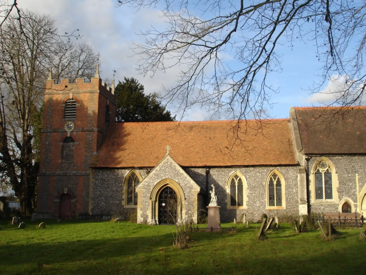
St Bartholomew's Church, Lower Basildon
Historic churches · 0.6 km

Jethro Tull
Memorials & monuments · 0.7 km

Gatehampton Manor
Manor houses · 1.1 km

The Old Tavern
Historic pubs · 1.1 km

Beale Park
Zoos & aquariums · 1.1 km

Gatehampton Railway Bridge
Historic bridges · 1.3 km

Valkyrie
Public art & sculpture · 1.3 km
Sculpture At The Childe-Beale Trust Su 7810 6175
Public art & sculpture · 1.3 km

Jennings Dog sculptures, Basildon Park
Public art & sculpture · 1.4 km

Basildon Park
Historic houses · 1.5 km

The Oratory Preparatory School
Natural landmarks · 2.2 km
Nearby
📷 5Wildlife reserves · South East England
Hartslock
Hartslock — wood and nature reserve by the Thames in south Oxfordshire, UK.
📷 5Historic churches · South East England
St Bartholomew's Church, Lower Basildon
St Bartholomew's Church, Lower Basildon — church in Lower Basildon, West Berkshire, England, UK.
📷 5Memorials & monuments · South East England
Jethro Tull
Jethro Tull — a memorial in england-south-east, United Kingdom.
📷 5Manor houses · South East England
Gatehampton Manor
Gatehampton Manor — Grade II listed building-listed manor in england-south-east, United Kingdom.
📷 7Historic pubs · South East England
The Old Tavern
The Old Tavern in England South East, United Kingdom.
📷 5Zoos & aquariums · South East England
Beale Park
Beale Park — Wildlife Park by the River Thames.
Where to eat & stay near Hartslock
Places to stay
 📷 5
📷 5 📷 5📷 5📷 5
Campsites · South East England
Braziers Park Campsite
Braziers Park Campsite — a campsite in england south east.
📷 5 📷 5
📷 5Campsites · South East England
Ridgeway View Campsite
Ridgeway View Campsite — a campsite in england south east.
Places to eat & drink
📷 7Historic pubs · South East England
The Old Tavern
The Old Tavern in England South East, United Kingdom.
 📷 5
📷 5Historic pubs · South East England
The Catherine Wheel Public House
The Catherine Wheel Public House in England South East, United Kingdom.
 📷 7
📷 7Historic pubs · South East England
The Bull Hotel
The Bull Hotel in England South East, United Kingdom.
 📷 5
📷 5 📷 5
📷 5Historic pubs · South East England
Cherry Tree Public House
Cherry Tree Public House in England South East, United Kingdom.
 📷 5
📷 5Historic pubs · South East England
The Crooked Billet Public House
The Crooked Billet Public House in England South East, United Kingdom.
More forests in this region
 📷 5
📷 5Forests & woodlands · South East England
Darland Banks
Darland Banks is a forest or woodland in the United Kingdom.
.jpg?width=1200) 📷 5
📷 5Forests & woodlands · South East England
Inholms Lane Clay Pit Nature Reserve
Inholms Lane Clay Pit Nature Reserve is a forest or woodland in the United Kingdom.
 📷 5
📷 5Forests & woodlands · South East England
Jeskyns Community Woodland
Jeskyns Community Woodland is a forest or woodland in the United Kingdom.
 📷 5
📷 5Forests & woodlands · South East England
Oxmore Copse
Oxmore Copse is a forest or woodland in the United Kingdom.
Frequently asked questions
- Where is Hartslock?
- Hartslock is in Oxfordshire, South-East England, United Kingdom (postcode RG8 9LY), in the parish of Goring-on-Thames.
- What is Hartslock?
- Hartslock is a forest or woodland in the United Kingdom.
- How do I get to Hartslock?
- The nearest railway station is Howard's Halt, about 1.3 km away. The nearest town is Sulham. Drivers can use postcode RG8 9LY.
- Is Hartslock a protected site?
- Yes — Hartslock is part of the Hartslock SSSI Site of Special Scientific Interest and the Chilterns National Landscape (AONB).
- Is Hartslock free to visit?
- Yes, Hartslock is free to enter.
- How do I get to Hartslock?
- The nearest railway station is Howard's Halt, about 1.3 km away. Drivers can navigate to postcode RG8 9LY.