
Mountains & hills · South West England
Hardown Hill
In or near Whitchurch Canonicorum.
Hardown Hill — Named summit at 202 m.

Wikimedia Commons contributors — see linked file page for photographer and licence licence

Plan your visit
- Typical visit
- 3 h–8 h
- Best time of year
- Late spring – early autumn (May–Oct)
- Free entry
- Dog-friendly
About
Hardown Hill is a named summit in the United Kingdom. Wikidata describes it as: "Named summit at 202 m.". Coordinates: 50.7453°, -2.8441°.
Photo gallery
Protected designations
- Site of Special Scientific Interest: Morcombelake SSSI
- Area of Outstanding Natural Beauty: Dorset
Designations sourced from Natural England open data under OGL v3.
From the Wikipedia article
Hardown Hill (207 metres, 679 feet high) is a hill between Ryall and Morcombelake in the county of Dorset, England. It rises west of the South Dorset Downs, close to the Dorset coast, and overlooks the Marshwood Vale to the north. Its prominence qualifies it as one of Dorset's four Marilyns and it is listed as one of the "top 12 Dorset views to take your breath away" by Dorset's official tourist website. The hill lies about 6 kilometres west of Bridport and about 500 metres north of the A 35 road. It is not nearly as well known as its southern extremity, Golden Cap, which is a spectacular bluff on the coast, 2 kilometres to the south. From the top of the hill, which is owned by the National Trust, there are impressive views that take in Thorncombe Beacon, Chardown Hill, Quarry Hill and Langdon Hill. There is a group of ten barrows, mostly covered in gorse and bracken, about 300 metres north of the summit above the hamlet of Ryall. These barrows are thought to be of disc and bowl form, likely dating to the Bronze Age. Wyatt Wingrave excavated fifteen artefacts dating to the Early Middle Ages in 1916, which he interpreted as the associated objects of an early Anglo-Saxon inhumation burial. No skeletal remains were found, and it is not clear which of the barrows was excavated. Vera Evison later reinterpreted the assemblage as a group of Anglo-Saxon burials that represented secondary interments in a Bronze Age barrow. A recent consideration of the context and a reclassification of the artefacts has cast doubts on the burial interpretation, and has instead interpreted the assemblage as a hoard.
Excerpt from Wikipedia under CC BY-SA 4.0. See the source article linked in Sources below.
- Coordinates
- 50.7453, -2.8441
- District
- Dorset
- Parish
- Whitchurch Canonicorum
- Postcode
- DT6 6DU
- Parliamentary constituency
- West Dorset
Sources
- osm: n1600651254 (ODbL)
- wikipedia: Hardown Hill (CC BY-SA 4.0)
- commons: Hardown Hill - geograph.org.uk - 1184418.jpg (CC BY-SA 4.0)
Other places nearby

Morcombelake
Villages · 0.3 km

Whitchurch Canonicorum
Towns & cities · 0.7 km

Chardown Hill
Mountains & hills · 1.0 km
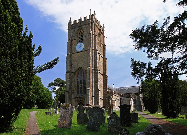
Church of St Candida and Holy Cross, Whitchurch Canonicorum
Historic churches · 1.4 km

Langdon Hill
Natural landmarks · 1.5 km

Whitchurch Canonicorum
Villages · 1.6 km

Chideock Manor
Manor houses · 1.7 km

Coppet Hill
Mountains & hills · 1.9 km
Coppet Hill
Mountains & hills · 1.9 km
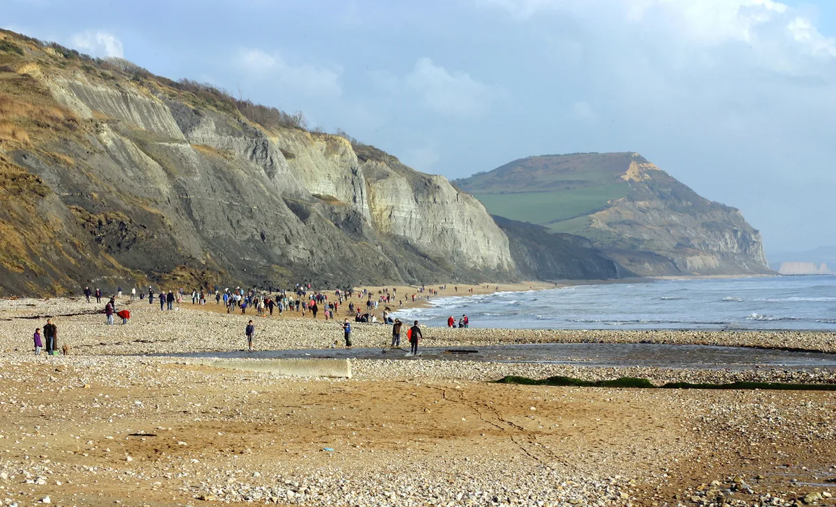
Golden Cap
Mountains & hills · 2.1 km

Chideock War Memorial
Memorials & monuments · 2.1 km

Chideock Parish Church (St Giles)
Historic churches · 2.2 km
Nearby
📷 5Flagship📷 10Towns & cities · South West England
Whitchurch Canonicorum
Whitchurch Canonicorum — village and civil parish in southwest Dorset, England.
📷 4Mountains & hills · South West England
Chardown Hill
Chardown Hill — a mountain in england-south-west, United Kingdom, 194 m.
📷 5Historic churches · South West England
Church of St Candida and Holy Cross, Whitchurch Canonicorum
Church of St Candida and Holy Cross, Whitchurch Canonicorum — Grade I listed church in Whitchurch Canonicorum, Dorset, England, UK.
📷 3Natural landmarks · South West England
Langdon Hill
Langdon Hill — a other in england-south-west, United Kingdom.
📷 5Villages · South West England
Whitchurch Canonicorum
Whitchurch Canonicorum — a village in england south west.
Where to eat & stay near Hardown Hill
Places to stay
 📷 5
📷 5Caravan parks · South West England
Dolphins River
Dolphins River — a caravan park in england south west.
 📷 5
📷 5Caravan parks · South West England
Golden Cap Holiday Park
Golden Cap Holiday Park — a caravan park in england south west.
 📷 5
📷 5Caravan parks · South West England
Newlands Holiday Camp
Newlands Holiday Camp — a caravan park in england south west.
 📷 5
📷 5Campsites · South West England
The Dorset Hideaway
The Dorset Hideaway — a campsite in england south west.
 📷 5
📷 5Campsites · South West England
Manor Farm Caravan and Camping Site
Manor Farm Caravan and Camping Site — a campsite in england south west.
 📷 5
📷 5Caravan parks · South West England
Manor Farm Holiday Centre
Manor Farm Holiday Centre — a caravan park in england south west.
Places to eat & drink
 📷 6
📷 6Historic pubs · South West England
Clock House Hotel
Clock House Hotel in England South West, United Kingdom.
 📷 7
📷 7Historic pubs · South West England
Charmouth House Hotel
Charmouth House Hotel in England South West, United Kingdom.
 📷 7
📷 7 📷 5
📷 5 📷 5
📷 5Historic pubs · South West England
10 North Street
10 North Street in England South West, United Kingdom.
 📷 7
📷 7Historic pubs · South West England
Greyhound Hotel
Greyhound Hotel in England South West, United Kingdom.
More mountains in this region
 📷 5
📷 5 📷 5
📷 5 📷 5
📷 5 📷 5
📷 5Frequently asked questions
- Where is Hardown Hill?
- Hardown Hill is in South-West England, United Kingdom (postcode DT6 6DU), in the parish of Whitchurch Canonicorum.
- What is Hardown Hill?
- Hardown Hill — Named summit at 202 m.
- How do I get to Hardown Hill?
- The nearest town is Whitchurch Canonicorum. Drivers can use postcode DT6 6DU.
- Is Hardown Hill a protected site?
- Yes — Hardown Hill is part of the Morcombelake SSSI Site of Special Scientific Interest and the Dorset National Landscape (AONB).
- Is Hardown Hill free to visit?
- Yes, Hardown Hill is free to enter.
- How do I get to Hardown Hill?
- Drivers can navigate to postcode DT6 6DU. It sits within the West Dorset parliamentary constituency.