Islands · South West England
Gweal
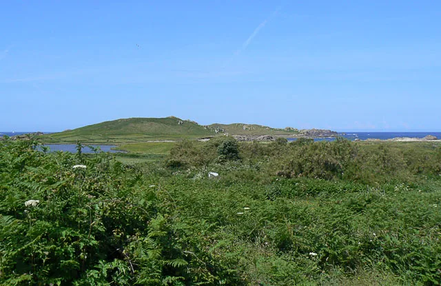
Gweal — island of the Isles of Scilly, Cornwall, England, UK.

Wikimedia Commons contributors — see linked file page for photographer and licence licence
Plan your visit
- Typical visit
- 4 h–12 h
- Free entry
- Dog-friendly
About
Gweal is a island in the United Kingdom. It covers approximately 6 km². Part of Isles of Scilly. Wikidata describes it as: "island of the Isles of Scilly, Cornwall, England, UK". Coordinates: 49.9539°, -6.3695°.
Photo gallery
Protected designations
- Site of Special Scientific Interest: Norrard Rocks SSSI
- Area of Outstanding Natural Beauty: Isles Of Scilly
- Ramsar wetland: Isles of Scilly
Designations sourced from Natural England open data under OGL v3.
From the Wikipedia article
Gweal ( GWEEL; Cornish: Gwydhyel, lit. 'place of trees') is one of the Isles of Scilly. It is the largest of the seven Norrard Rocks due west of Bryher. The name perhaps refers back to a time before most of the islands' area was inundated. On the top of Gweal Hill are the remanence of an entrance grave and two cairns. The water surrounding the island is about 52 feet deep.
Excerpt from Wikipedia under CC BY-SA 4.0. See the source article linked in Sources below.
- Coordinates
- 49.9539, -6.3695
- District
- Isles of Scilly
- Parish
- Bryher
- Postcode
- TR23 0PR
- Parliamentary constituency
- St Ives
Sources
- wikidata: Q1484057 (CC0)
- wikipedia: Gweal, Isles of Scilly (CC BY-SA 4.0)
- commons: Gweal - geograph.org.uk - 1959319.jpg (CC BY-SA 4.0)
Other places nearby
Loading nearby places…
Nearby
 📷 5
📷 5Beaches · South West England
Popplestones Beach
Popplestones Beach is a beach in the United Kingdom.
 Flagship📷 10
Islands · South West England
Bryher
Bryher — island of the Isles of Scilly, Cornwall, England.
 📷 5
📷 5Beaches · South West England
Great Par
Great Par is a beach in the United Kingdom.
 📷 8
📷 8Islands · South West England
Castle Bryher
Castle Bryher — island in Isles of Scilly, United Kingdom.
 📷 3
📷 3Beaches · South West England
Stoney Porth
Stoney Porth is a beach in the United Kingdom.
 📷 3
📷 3Museums · South West England
Bryhers Pop-up Museum
Bryhers Pop-up Museum — a museum in england-south-west, United Kingdom.
More places in this region
 Flagship📷 10
Islands · South West England
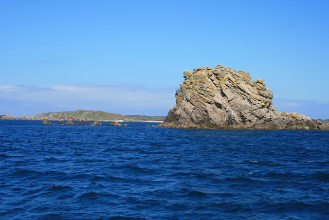
Annet
Annet — island in Isles of Scilly, United Kingdom.
 Flagship📷 10
Islands · South West England
Bishop Rock
Bishop Rock — islet in the Atlantic Ocean, at the Isles of Scilly, England.
Flagship📷 10Islands · South West England
Bryher
Bryher — island of the Isles of Scilly, Cornwall, England.
📷 8Islands · South West England
Castle Bryher
Castle Bryher — island in Isles of Scilly, United Kingdom.
Frequently asked questions
- Where is Gweal?
- Gweal is in South-West England, United Kingdom (postcode TR23 0PR), in the parish of Bryher.
- Is Gweal a protected site?
- Yes — Gweal is part of the Norrard Rocks SSSI Site of Special Scientific Interest and the Isles Of Scilly National Landscape (AONB).
- Is Gweal free to visit?
- Yes, Gweal is free to enter.
- How do I get to Gweal?
- Drivers can navigate to postcode TR23 0PR. It sits within the St Ives parliamentary constituency.