
Castles · Yorkshire & the Humber
Grewelthorpe
In or near Ripon.
Grewelthorpe is a village and civil parish in the county of North Yorkshire, England situated 3 miles (5 km) south of Masham and 6.2 miles (10 km) north of Ripon. It is located in the Nidderdale area

JThomas — CC BY-SA 2.0 via Wikimedia Commons licence

Plan your visit
- Typical visit
- 1.5 h–3 h
- Family-friendly
- Limited wheelchair access
About
Grewelthorpe is a village and civil parish in the county of North Yorkshire, England situated 3 miles (5 km) south of Masham and 6.2 miles (10 km) north of Ripon. It is located in the Nidderdale area of outstanding natural beauty. The name Grewelthorpe derives from the words Gruel and Thorpe, Gruel being a family name and thorpe meaning "outlying farmstead". Grewelthorpe was mentioned in the Domesday Book when it was known as Torp and was in the ownership of Gospatric. Until 1974 it was part of the West Riding of Yorkshire. From 1974 to 2023 it was part of the Borough of Harrogate, it is now administered by the unitary North Yorkshire Council. In 2009 Grewelthorpe has one active church, St James' Church, Grewelthorpe, and a pub, the Crown. It also has a duck pond, which is a distinctive feature of the village, it is populated by ducks which people come from surrounding villages to feed. The local primary school is known as Grewelthorpe Church of England Primary school and takes children from two years old to eleven years old. The current school building was opened in June 2003 and is located at cross hills in Grewelthorpe. However, Grewelthorpe has had a school since 1876. Unlike many Yorkshire villages Grewelthorpe does not currently have a cricket club. It last had one in the 1950s, but it folded as a result of the failure to find a suitable playing field.
Photo gallery
Protected designations
- Area of Outstanding Natural Beauty: Nidderdale
Designations sourced from Natural England open data under OGL v3.
From the Wikipedia article
Grewelthorpe is a village and civil parish in the county of North Yorkshire, England situated 3 miles (5 km) south of Masham and 6.2 miles (10 km) north of Ripon. It is located in the Nidderdale area of outstanding natural beauty. The name Grewelthorpe derives from the words Gruel and Thorpe, Gruel being a family name and thorpe meaning "outlying farmstead". Grewelthorpe was mentioned in the Domesday Book when it was known as Torp and was in the ownership of Gospatric. Until 1974 it was part of the West Riding of Yorkshire. From 1974 to 2023 it was part of the Borough of Harrogate, it is now administered by the unitary North Yorkshire Council. In 2009 Grewelthorpe has one active church, St James' Church, Grewelthorpe, and a pub, the Crown. It also has a duck pond, which is a distinctive feature of the village, it is populated by ducks which people come from surrounding villages to feed. The local primary school is known as Grewelthorpe Church of England Primary school and takes children from two years old to eleven years old. The current school building was opened in June 2003 and is located at cross hills in Grewelthorpe. However, Grewelthorpe has had a school since 1876. Unlike many Yorkshire villages Grewelthorpe does not currently have a cricket club. It last had one in the 1950s, but it folded as a result of the failure to find a suitable playing field.
Excerpt from Wikipedia under CC BY-SA 4.0. See the source article linked in Sources below.
- Coordinates
- 54.1814, -1.6486
- District
- North Yorkshire
- Parish
- Grewelthorpe
- Postcode
- HG4 3BY
- Parliamentary constituency
- Skipton and Ripon
Sources
- wikipedia: Grewelthorpe (CC BY-SA 4.0)
Other places nearby

Mowbray Castle
Follies · 0.9 km
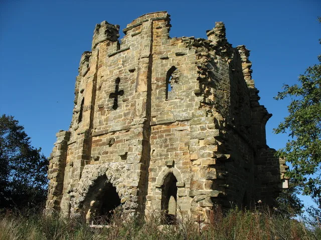
Mowbray Castle
Castles · 0.9 km

Hack Fall
Waterfalls · 1.0 km
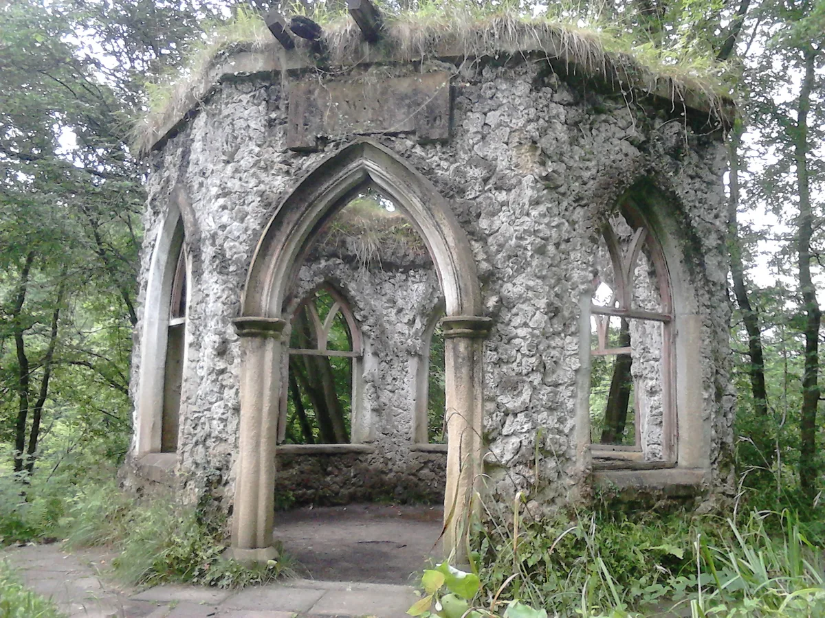
Hackfall
Gardens · 1.0 km

Hack Fall
Gorges · 1.0 km

Lover's Leap
Viewpoints · 1.1 km

Fisher's Hall
Historic houses · 1.1 km

Fisher's Hall
Archaeological sites · 1.1 km

Grotto
Follies · 1.1 km

Grewelthorpe Modern Stone Circle
Stone circles · 1.1 km

Rustic Temple
Follies · 1.1 km

Camp Hill
Archaeological sites · 1.2 km
Nearby
📷 3📷 3Castles · Yorkshire & the Humber
Mowbray Castle
Mowbray Castle — castle in Grewelthorpe, Harrogate, North Yorkshire, England, UK.
📷 5📷 5Gardens · Yorkshire & the Humber
Hackfall
Hackfall — historic woodland park near Grewelthorpe, Harrogate District, North Yorkshire, England, UK.
📷 5📷 4Viewpoints · Yorkshire & the Humber
Lover's Leap
Lover's Leap is a viewpoint in the United Kingdom.
Where to eat & stay near Grewelthorpe
Places to stay
 📷 5
📷 5Hotels · Yorkshire & the Humber
Swinton Park
Swinton Park — a hotel in england yorkshire.
 📷 7
📷 7Hotels · Yorkshire & the Humber
King's Head Hotel
King's Head Hotel — a hotel in england yorkshire.
 📷 7
📷 7Hotels · Yorkshire & the Humber
Bay Horse
Bay Horse — a hotel in england yorkshire.
 📷 2
📷 2 📷 5
📷 5Caravan parks · Yorkshire & the Humber
The Old Station Yard Caravan Site
The Old Station Yard Caravan Site — a caravan park in england yorkshire.
 📷 5
📷 5Campsites · Yorkshire & the Humber
Sleningford Watermill Caravan and Camping Park
Sleningford Watermill Caravan and Camping Park — a campsite in england yorkshire.
Places to eat & drink
 📷 7
📷 7Historic pubs · Yorkshire & the Humber
The Bruce Arms Inn
The Bruce Arms Inn in England Yorkshire, United Kingdom.
 📷 5
📷 5Historic pubs · Yorkshire & the Humber
The Freemasons Arms
The Freemasons Arms in England Yorkshire, United Kingdom.
 📷 7
📷 7Historic pubs · Yorkshire & the Humber
Lamb And Flag Public House
Lamb And Flag Public House in England Yorkshire, United Kingdom.
 📷 7
📷 7 📷 7
📷 7Historic pubs · Yorkshire & the Humber
Ye Hornblower Tavern
Ye Hornblower Tavern in England Yorkshire, United Kingdom.
 📷 5
📷 5Historic pubs · Yorkshire & the Humber
The Unicorn Hotel
The Unicorn Hotel in England Yorkshire, United Kingdom.
More castles in this region
 📷 5
📷 5Castles · Yorkshire & the Humber
Ashton-under-Lyne
Ashton-under-Lyne, also known simply as Ashton, is a market town in Tameside, Greater Manchester, United Kingdom. The population was 48,604 at the 2021 census. Historically a part of Lancashire, it is
 📷 5
📷 5Castles · Yorkshire & the Humber
Audenshaw
Audenshaw is a town in Tameside, Greater Manchester, England, 4.9 miles (7.9 km) east of Manchester. Historically part of Lancashire, in 2011 it had a population of 11,419. The name derives from Aldwi
 📷 5
📷 5Castles · Yorkshire & the Humber
Bramhall
Bramhall is a large village in the Metropolitan Borough of Stockport, Greater Manchester, England. It was formerly a civil parish in Cheshire. At the 2021 census, the built-up area, as defined by the
 📷 5
📷 5Castles · Yorkshire & the Humber
Bredbury
Bredbury is a town in the Metropolitan Borough of Stockport, Greater Manchester, England; it lies 8 miles (12.9 km) south-east of Manchester, 2 miles (3.2 km) east of Stockport and 3 miles (4.8 km) so
Frequently asked questions
- Where is Grewelthorpe?
- Grewelthorpe is in Yorkshire, United Kingdom (postcode HG4 3BY), in the parish of Grewelthorpe.
- What is Grewelthorpe?
- Grewelthorpe is a village and civil parish in the county of North Yorkshire, England situated 3 miles (5 km) south of Masham and 6.2 miles (10 km) north of Ripon. It is located in the Nidderdale area
- How do I get to Grewelthorpe?
- Drivers can use postcode HG4 3BY.
- Is Grewelthorpe a protected site?
- Yes — Grewelthorpe is part of the Nidderdale National Landscape (AONB).
- Does Grewelthorpe charge admission?
- Grewelthorpe typically charges admission. Check the official site for current ticket prices and opening hours.
- How do I get to Grewelthorpe?
- Drivers can navigate to postcode HG4 3BY. It sits within the Skipton and Ripon parliamentary constituency.