Mountains & hills · South West England
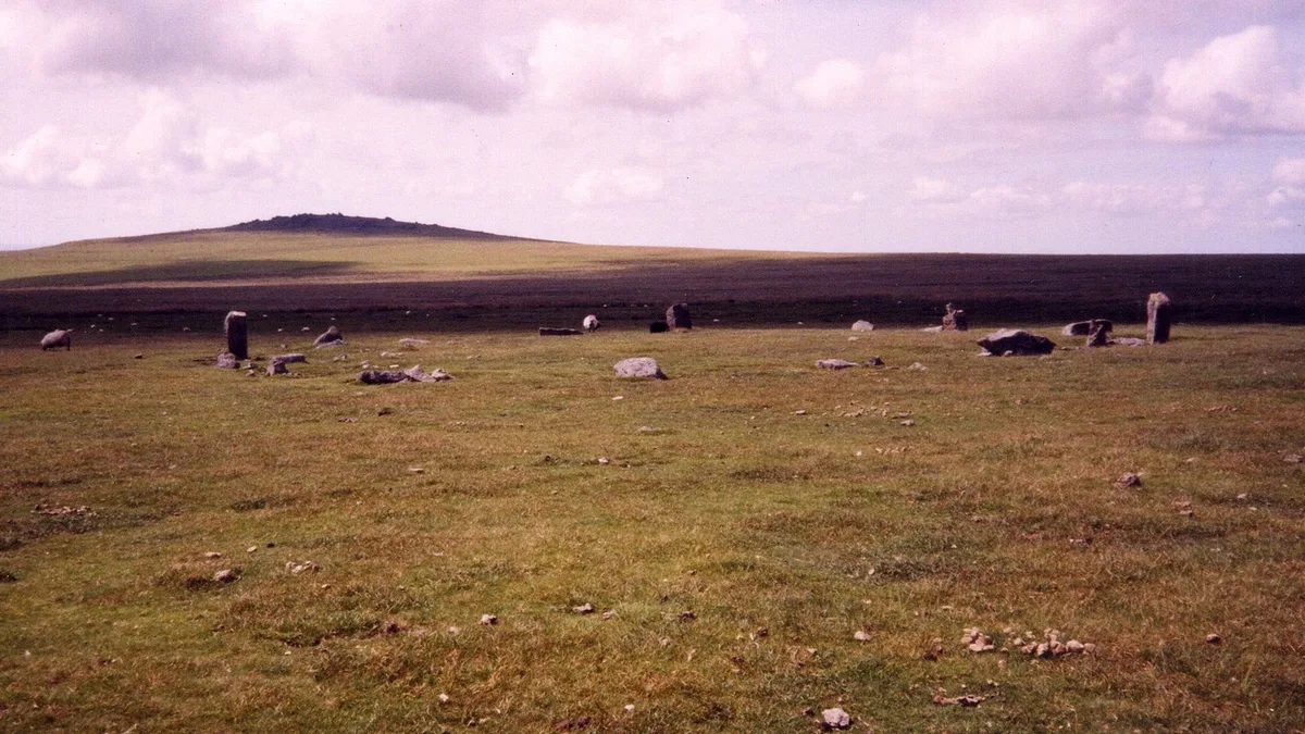
Great Mis Tor
In or near Merrivale.
Great Mis Tor — Named summit at 538 m.

Wikimedia Commons contributors — see linked file page for photographer and licence licence
Plan your visit
- Typical visit
- 3 h–8 h
- Best time of year
- Late spring – early autumn (May–Oct)
- Free entry
- Dog-friendly
About
Great Mis Tor is a named summit in the United Kingdom. Wikidata describes it as: "Named summit at 538 m.". Coordinates: 50.5741°, -4.0310°.
Photo gallery
360° viewimagery from 2021
Imagery © Mapillary contributors, CC BY-SA 4.0
From the Wikipedia article
Great Mis Tor is a hill with a rocky outcrop situated in Dartmoor. It has been called one of the grandest hills in Devon, and lies above the River Walkham, about 4 miles north-east of Princetown. There is a notable rock basin on the peak, called the Mis Tor Pan or The Devil's Frying Pan. The hill and surrounding area is on land owned by the Duchy of Cornwall, which is leased to the army. There have been cases of deaths and injury to the public caused by unexploded munitions in the area.
Excerpt from Wikipedia under CC BY-SA 4.0. See the source article linked in Sources below.
- Coordinates
- 50.5741, -4.0310
- Address
- Devon, England
Sources
- osm: n326006272 (ODbL)
- wikipedia: Great Mis Tor (CC BY-SA 4.0)
- commons: Great Mis Tor from Roos Tor.jpg (CC BY-SA 4.0)
Other places nearby
.jpg?width=1200)
A prehistoric and historic archaeological landscape within Merrivale Newtake
Archaeological sites · 1.1 km
Two concentric stone circles on Langstone Moor
Archaeological sites · 1.4 km

Langstone stone circle
Stone circles · 1.4 km

Black Dunghill
Mountains & hills · 1.9 km

Roos Tor
Mountains & hills · 2.0 km

Cocks Hill
Mountains & hills · 2.2 km

Langstone Man (Standing Stone)
Stone circles · 2.2 km

Merrivale
Towns & cities · 2.2 km

T-A Boundary Stone
Archaeological sites · 2.3 km

Merrivale Stone Row (East)
Stone circles · 2.3 km
Merrivale Stone Row (West)
Stone circles · 2.3 km

Three stone alignments, ten cairns, three stone hut circles and a length of the Great Western Reave on Longash Common
Archaeological sites · 2.3 km
Nearby
📷 5Archaeological sites · South West England
A prehistoric and historic archaeological landscape within Merrivale Newtake
A prehistoric and historic archaeological landscape within Merrivale Newtake — archaeological site in Dartmoor Forest, West Devon, England, UK.
📷 3Archaeological sites · South West England
Two concentric stone circles on Langstone Moor
Two concentric stone circles on Langstone Moor — archaeological site in Peter Tavy, West Devon, England, UK.
📷 3Stone circles · South West England
Langstone stone circle
Langstone stone circle — a stone circle in england-south-west, United Kingdom.
📷 5Mountains & hills · South West England
Black Dunghill
Black Dunghill — mountain in england south west. Elevation: 492 m.
📷 5Mountains & hills · South West England
Roos Tor
Roos Tor — mountain in england south west. Elevation: 454 m.
📷 5Mountains & hills · South West England
Cocks Hill
Cocks Hill — mountain in england south west. Elevation: 501 m.
Where to eat & stay near Great Mis Tor
Places to stay
 📷 5
📷 5Campsites · South West England
Beardown Farm
Beardown Farm — a campsite in england south west.
 📷 5
📷 5Campsites · South West England
Plume of Feathers Campsite
Plume of Feathers Campsite — a campsite in england south west.
 📷 5
📷 5Campsites · South West England
Tavistock, Camping & Caravan Club
Tavistock, Camping & Caravan Club — a campsite in england south west.
 📷 5
📷 5Campsites · South West England
Langstone Manor Park
Langstone Manor Park — a campsite in england south west.
 📷 5
📷 5B&Bs · South West England
Tor Royal B&B
Tor Royal B&B — a bed-and-breakfast in england south west.
 📷 5
📷 5Campsites · South West England
Harford Bridge Holiday Park
Harford Bridge Holiday Park — a campsite in england south west.
Places to eat & drink
 📷 6
📷 6Historic pubs · South West England
(White Hart Inn) Public House
(White Hart Inn) Public House in England South West, United Kingdom.
 📷 7
📷 7Historic pubs · South West England
Sir Francis Drake Public House
Sir Francis Drake Public House in England South West, United Kingdom.
 📷 7
📷 7Restaurants · South West England
The Cornish Arms
The Cornish Arms — a restaurant in england south west.
 📷 7
📷 7Historic pubs · South West England
Sportsmans Arms
Sportsmans Arms in England South West, United Kingdom.
 📷 7
📷 7 📷 7
📷 7Historic pubs · South West England
Warren House Inn
Warren House Inn in England South West, United Kingdom.
More mountains in this region
 📷 5
📷 5 📷 5
📷 5 📷 5
📷 5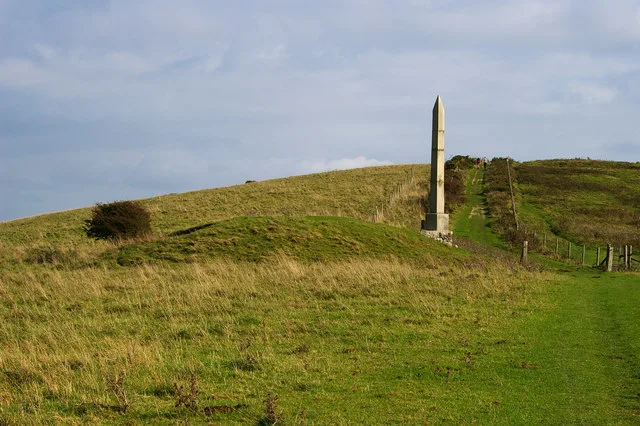 📷 5
📷 5Frequently asked questions
- Where is Great Mis Tor?
- Great Mis Tor is in South-West England, United Kingdom.
- What is Great Mis Tor?
- Great Mis Tor — Named summit at 538 m.
- How do I get to Great Mis Tor?
- Its coordinates are 50.5741°, -4.0310°.
- Is Great Mis Tor free to visit?
- Yes, Great Mis Tor is free to enter.