Natural landmarks · East of England
Gog Magog Hills
In or near Cherry Hinton.
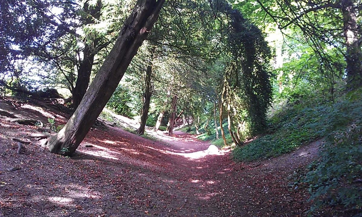
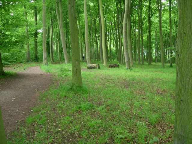
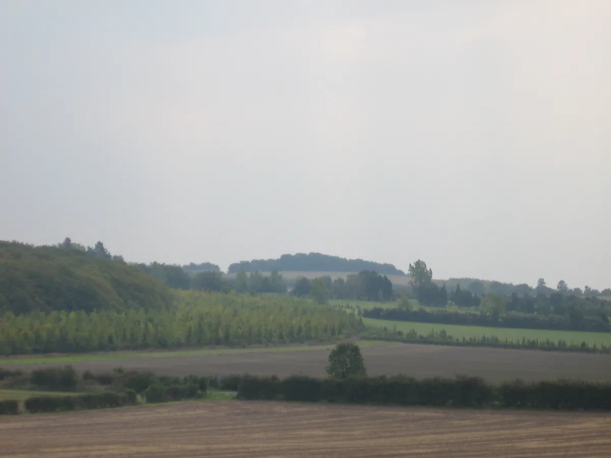
The Gog Magog Hills (known locally as the Gogs) are a range of low chalk hills extending for several miles to the southeast of Cambridge in England. The highest points are either side of the A1307 Bab

John Sutton — CC BY-SA 2.0 via Wikimedia Commons licence
Plan your visit
- Typical visit
- 1 h–2 h
- Nearest railway station
- Shelford · 3.3 km
- Dog-friendly
Getting there & planning your visit
To visit the Gog Magog Hills, the nearest railway station is Shelford, located 3.3 km away. The postcode for the area is CB22 3AE. Entry to the site is free.
About
The Gog Magog Hills (known locally as the Gogs) are a range of low chalk hills extending for several miles to the southeast of Cambridge in England. The highest points are either side of the A1307 Babraham Road, and are marked on the Ordnance Survey map as Little Trees Hill and Wandlebury Hill, at 74 m (243 ft), and Telegraph Clump, at 75 m (246 ft). The area as a whole is undefined, but is roughly the elevated area lying northwest of the 41 m (135 ft) col at Worsted Lodge. Unlike the nearby hills of the Newmarket Ridge, which have steep sides but flat tops, these hills have large drops between summits and as such have quite a distinctive appearance; Little Trees Hill looks particularly good from Huckeridge Hill near Sawston, and White Hill dominates the view from the National Cycle Route 11 section towards Great Shelford. The hills therefore have relatively high topographic prominence.
Photo gallery
Protected designations
- Site of Special Scientific Interest: Gog Magog Golf Course SSSI
Designations sourced from Natural England open data under OGL v3.
From the Wikipedia article
The Gog Magog Hills (known locally as the Gogs) are a range of low chalk hills extending for several miles to the southeast of Cambridge in England. The highest points are either side of the A1307 Babraham Road, and are marked on the Ordnance Survey map as Little Trees Hill and Wandlebury Hill, at 74 m (243 ft), and Telegraph Clump, at 75 m (246 ft). The area as a whole is undefined, but is roughly the elevated area lying northwest of the 41 m (135 ft) col at Worsted Lodge. Unlike the nearby hills of the Newmarket Ridge, which have steep sides but flat tops, these hills have large drops between summits and as such have quite a distinctive appearance; Little Trees Hill looks particularly good from Huckeridge Hill near Sawston, and White Hill dominates the view from the National Cycle Route 11 section towards Great Shelford. The hills therefore have relatively high topographic prominence.
Excerpt from Wikipedia under CC BY-SA 4.0. See the source article linked in Sources below.
Background
History
Gog, of the land of Magog, is mentioned in the Old Testament as an adversary of Israel. In British folklore, "Gogmagog" was reimagined as a savage giant who inhabited Britain at the time of Brutus's arrival. There was a hill figure of Gogmagog, of unknown date, at Wandlebury Ring, and it is this that gave their hills their name. Mention was made of it in the 17th and 18th centuries, but all trace of it was lost thereafter. The earliest mention of the name "Gog Magog" in connection with the hills occurs in a decree of 1574, forbidding Cambridge students from visiting the hills on pain of a fine. The 1990 book Where Troy Once Stood argued that the ancient city of Troy was in fact located in…
Sourced from Wikipedia under CC BY-SA 4.0.
- Coordinates
- 52.1655, 0.1802
- County
- Cambridgeshire
- District
- South Cambridgeshire
- Parish
- Stapleford
- Postcode
- CB22 3AE
- Parliamentary constituency
- South Cambridgeshire
- Nearest railway station
- Shelford — 3.3 km
Sources
- wikipedia: Gog Magog Hills (CC BY-SA 4.0)
Other places nearby

Gog Magog Hills
Mountains & hills · 0.5 km

Cambridge high point
Mountains & hills · 0.5 km

Great Shelford high point
Mountains & hills · 0.5 km

Wandlebury Ring (Iron Age Hill Fort)
Hill forts · 0.7 km
Wandlebury Hill Fort
Hill forts · 0.8 km

Wandlebury Hill
Wildlife reserves · 0.8 km

Ely View
Viewpoints · 0.8 km
Beechwoods nature reserve
Wildlife reserves · 0.9 km

Magog Down
Natural landmarks · 1.0 km

Wandlebury Country Park
Country parks · 1.1 km
Little Trees Hill
Mountains & hills · 1.2 km

Fox Hill
Mountains & hills · 1.5 km
Nearby
📷 5Mountains & hills · East of England
Gog Magog Hills
Gog Magog Hills — mountain in england london. Elevation: 75 m.
📷 5Mountains & hills · East of England
Cambridge high point
Cambridge high point — mountain in england london. Elevation: 69 m.
📷 5Mountains & hills · East of England
Great Shelford high point
Great Shelford high point — mountain in england london. Elevation: 57 m.
📷 5Hill forts · East of England
Wandlebury Ring (Iron Age Hill Fort)
Wandlebury Ring (Iron Age Hill Fort) — a hill fort in england-london, United Kingdom.
📷 5Hill forts · East of England
Wandlebury Hill Fort
Wandlebury Hill Fort — hillfort in Cambridgeshire, England, UK.
📷 4Wildlife reserves · East of England
Wandlebury Hill
Wandlebury Hill (grid reference TL493534) is a peak in the Gog Magog Hills, a ridge of low chalk hills extending for several miles to the southeast of Cambridge, England. The underlying rock is presen
Where to eat & stay near Gog Magog Hills
Places to stay
 📷 5
📷 5Caravan parks · East of England
Cambridge Cherry Hinton Caravan and Motorhome Club
Cambridge Cherry Hinton Caravan and Motorhome Club — a caravan park in england london.
 📷 5
📷 5Campsites · East of England
Bounds Campsite
Bounds Campsite — a campsite in england london.
 📷 5
📷 5Campsites · East of England
Camping & Caravanning Club - Cambridge Club Site
Camping & Caravanning Club - Cambridge Club Site — a campsite in england london.
 📷 5
📷 5 📷 7
📷 7Hotels · East of England
Travelodge Cambridge Central
Travelodge Cambridge Central — a hotel in england london. 2-star. Brand: Travelodge.
📷 5Places to eat & drink
 📷 7
📷 7Historic pubs · East of England
The Robin Hood
The Robin Hood in England East, United Kingdom.
 📷 7
📷 7Restaurants · East of England
sole & duck
sole & duck — a restaurant in england london.
 📷 5
📷 5 📷 7
📷 7 📷 5
📷 5Historic pubs · East of England
The Oak Public House
The Oak Public House in England East, United Kingdom.
 📷 7
📷 7Historic pubs · East of England
The Globe Public House
The Globe Public House in England East, United Kingdom.
More natural landmarks in this region
 📷 5
📷 5Natural landmarks · East of England
Orton Mere
Orton Mere — lake in Peterborough, Cambridgeshire, England, UK.
📷 5Natural landmarks · East of England
Magog Down
Magog Down — a other in england-london, United Kingdom.
 📷 5
📷 5Natural landmarks · East of England
Abington Pottery
Abington Pottery — a other in england-london, United Kingdom.
 📷 5
📷 5Natural landmarks · East of England
Car Dyke
Car Dyke — a other in england-london, United Kingdom.
Frequently asked questions
- Where is Gog Magog Hills?
- Gog Magog Hills is in Cambridgeshire, East of England, United Kingdom (postcode CB22 3AE), in the parish of Stapleford.
- What is Gog Magog Hills?
- The Gog Magog Hills (known locally as the Gogs) are a range of low chalk hills extending for several miles to the southeast of Cambridge in England. The highest points are either side of the A1307 Bab
- How do I get to Gog Magog Hills?
- The nearest railway station is Shelford, about 3.3 km away. Drivers can use postcode CB22 3AE.
- Is Gog Magog Hills a protected site?
- Yes — Gog Magog Hills is part of the Gog Magog Golf Course SSSI Site of Special Scientific Interest.
- How do I get to Gog Magog Hills?
- The nearest railway station is Shelford, about 3.3 km away. Drivers can navigate to postcode CB22 3AE.