
Mountains & hills · South West England
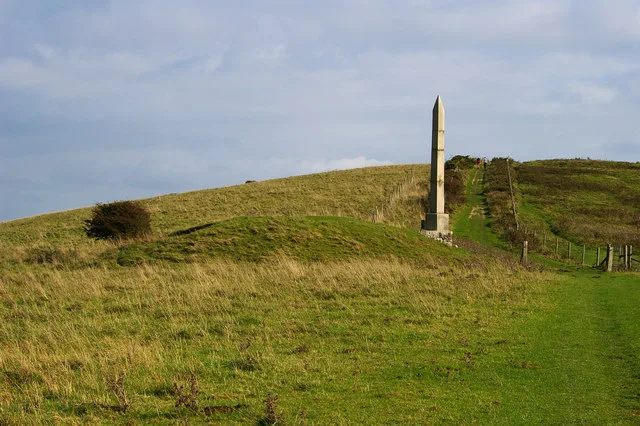
Godlingston Hill
In or near Harman's Cross.
Godlingston Hill — mountain in england south east. Elevation: 199 m.

Rude Health — CC BY-SA 2.0 via Wikimedia Commons licence

Plan your visit
- Typical visit
- 3 h–8 h
- Best time of year
- Late spring – early autumn (May–Oct)
- Nearest railway station
- Herston Halt · 2.0 km
- Dog-friendly
About
Godlingston Hill is a mountain located in england south east. Elevation: 199 m. A named British peak recorded in OpenStreetMap. Peaks are typically named on Ordnance Survey 1:50k mapping.
Photo gallery
Protected designations
- Site of Special Scientific Interest: Purbeck Ridge (East) SSSI
- Site of Special Scientific Interest: South Dorset Coast SSSI
- Area of Outstanding Natural Beauty: Dorset
Designations sourced from Natural England open data under OGL v3.
Place summary
Godlingston Hill is a mountain located in South-East England. It is known for its natural beauty and offers various outdoor activities. Visitors can expect a range of walking trails suitable for different skill levels, providing scenic views of the surrounding landscape. The area is popular among hikers and nature enthusiasts.
AI-generated from the structured facts on this page (operator, designation, listing, era). Not a substitute for visiting.
- Coordinates
- 50.6304, -1.9890
- District
- Dorset
- Parish
- Swanage
- Postcode
- BH19 3AA
- Parliamentary constituency
- South Dorset
- Nearest railway station
- Herston Halt — 2 km
Sources
- osm: n2776438760 (ODbL)
Other places nearby
Nine Barrow Down
Mountains & hills · 0.0 km

Godlingston Heath (C)
Archaeological sites · 0.8 km
Godlingston Heath (B)
Archaeological sites · 0.8 km
Godlingston Heath (A)
Archaeological sites · 0.8 km

Dean Hill
Mountains & hills · 0.9 km
Dean Hill
Mountains & hills · 0.9 km

Knitson Farm Tourers Site
Caravan parks · 1.0 km
Knitson Farm Tourers Site
Caravan parks · 1.1 km

Godlingston Manor
Manor houses · 1.1 km

Godlingstone Down (A)
Archaeological sites · 1.2 km
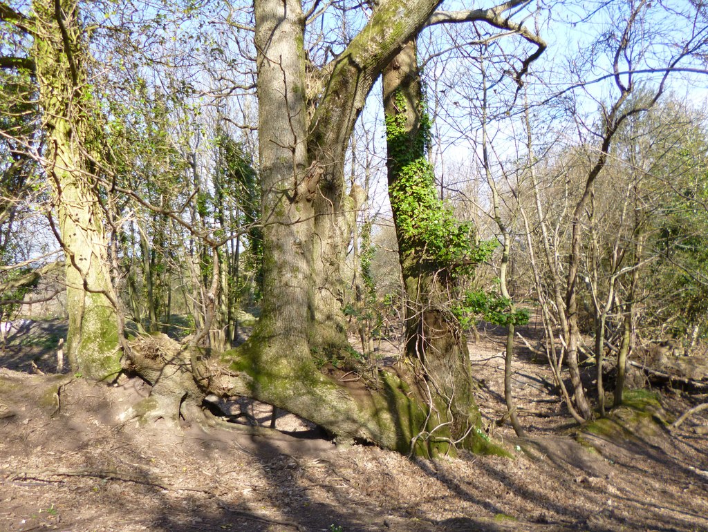
Godlingstone Down (A)
Archaeological sites · 1.2 km
Godlingstone Down (B)
Archaeological sites · 1.2 km
Nearby
📷 5Mountains & hills · South West England
Nine Barrow Down
Nine Barrow Down — a hill or mountain in england south east.
📷 5Archaeological sites · South West England
Godlingston Heath (C)
Godlingston Heath (C) — an archaeological site in South West England, United Kingdom.
📷 5Archaeological sites · South West England
Godlingston Heath (B)
Godlingston Heath (B) — an archaeological site in South West England, United Kingdom.
📷 5Archaeological sites · South West England
Godlingston Heath (A)
Godlingston Heath (A) — an archaeological site in South West England, United Kingdom.
📷 5Mountains & hills · South West England
Dean Hill
Dean Hill — mountain in england south east. Elevation: 120 m.
📷 5Mountains & hills · South West England
Dean Hill
Dean Hill — a hill or mountain in england south east.
Where to eat & stay near Godlingston Hill
Places to stay
📷 5Caravan parks · South West England
Knitson Farm Tourers Site
Knitson Farm Tourers Site — a caravan park in england south east.
📷 5Caravan parks · South West England
Knitson Farm Tourers Site
Knitson Farm Tourers Site — a caravan park in england south east.
 📷 5
Caravan parks · South West England
Ulwell Cottage Caravan Park
Ulwell Cottage Caravan Park — a caravan park in england south east.
 📷 5
Caravan parks · South West England
Herston Caravan and Camp Site
Herston Caravan and Camp Site — a caravan park in england south east.
 📷 5
Campsites · South West England
Studland Summer Camp (SSC)
Studland Summer Camp (SSC) — a campsite in england south east.
 📷 5
Caravan parks · South West England
Cauldron Barn Caravan Park
Cauldron Barn Caravan Park — a caravan park in england south east.
Places to eat & drink
 📷 5
Historic pubs · South West England
The Black Swan Inn
The Black Swan Inn in England South West, United Kingdom.
 📷 5
 📷 7
Historic pubs · South West England
Square and Compass
Square and Compass in England South West, United Kingdom.
 ★ Iconic📷 3
Historic pubs · South West England
The Square and Compass
Dorset's served-through-a-hatch family pub since 1907 — fossils, cider, pumpkin festival.
 📷 7
Historic pubs · South West England
The Scott Arms, Including Outbuilding On Left
The Scott Arms, Including Outbuilding On Left in England South West, United Kingdom.
 📷 5
Cafés · South West England
Café Villano
Café Villano — a café in england south east. Cuisine: coffee shop;sandwich;ice cream;regional.
More mountains in this region
 📷 5
 📷 5
 📷 5
 📷 5
Frequently asked questions
- Where is Godlingston Hill?
- Godlingston Hill is in South-West England, United Kingdom (postcode BH19 3AA), in the parish of Swanage.
- What is Godlingston Hill?
- Godlingston Hill — mountain in england south east. Elevation: 199 m.
- How do I get to Godlingston Hill?
- The nearest railway station is Herston Halt, about 2.0 km away. The nearest town is Harman's Cross. Drivers can use postcode BH19 3AA.
- Is Godlingston Hill a protected site?
- Yes — Godlingston Hill is part of the Purbeck Ridge (East) SSSI Site of Special Scientific Interest and the South Dorset Coast SSSI Site of Special Scientific Interest.
- How do I get to Godlingston Hill?
- The nearest railway station is Herston Halt, about 2.0 km away. Drivers can navigate to postcode BH19 3AA.