Caves · South Wales
Gloucester Hole
In or near Aust.
The Gloucester Hole is a roughly square opening in the limestone cliffs of the River Wye, directly opposite the town of Chepstow. The hole itself is on the Tutshill side of the river, in Gloucestershi

Graham Horn — CC BY-SA 2.0 via Wikimedia Commons licence
Plan your visit
- Typical visit
- 45 min–1.5 h
- Nearest railway station
- Chepstow · 0.7 km
- Free entry
- Dog-friendly
Getting there & planning your visit
To visit Gloucester Hole, the nearest railway station is Chepstow, which is 0.7 km away. Entry to the cave is free, and the postcode for sat-nav is NP16 7DL.
About
The Gloucester Hole is a roughly square opening in the limestone cliffs of the River Wye, directly opposite the town of Chepstow. The hole itself is on the Tutshill side of the river, in Gloucestershire, England; the river forms the boundary with Wales. The small square opening leads into a much larger chamber within the cliffs. The entrance is about 5 feet 6 inches (1.7 m) square, and runs in for about 12 feet (3.7 m). The cave was a natural opening in the limestone which was enlarged so that its greatest depth and greatest breadth are 27 feet (8.2 m), and its height at one point is 15 feet (4.6 m). There is speculation about its origin and about what it has been used for in the past. Suggestions include its use by the Shirenewton Quakers for storing tea, or for the storing of explosives by Brunel when the railway was built. A local antiquarian, J.G. Wood, wrote in 1901 that nearly 50 years earlier he had quizzed the oldest inhabitants and discovered that this natural cave had been enlarged and fitted with a crane at its mouth to unload large ships that could moor there in deep water, but could not easily dock at the shallower wharves on the Chepstow side of the river. The cargo was then reloaded onto trows and taken up river to Monmouth and Hereford. For many years mooring chains and rings in the cliff below survived to support this explanation. The cave can only be reached by boat at high tide. Next to the Hole is a Union Flag which was first painted in 1935 to mark the…
Photo gallery
Official information
Chepstow Museum showcases the history of Chepstow, highlighting its significance as a port and market center. Visitors can explore various displays related to local industries, art, and the town's pastimes, all housed in an 18th-century building near Chepstow Castle.
Protected designations
- Site of Special Scientific Interest: River Wye SSSI
- Site of Special Scientific Interest: Severn Estuary SSSI
- Area of Outstanding Natural Beauty: Wye Valley
- Ramsar wetland: Severn Estuary
Designations sourced from Natural England open data under OGL v3.
From the Wikipedia article
The Gloucester Hole is a roughly square opening in the limestone cliffs of the River Wye, directly opposite the town of Chepstow. The hole itself is on the Tutshill side of the river, in Gloucestershire, England; the river forms the boundary with Wales. The small square opening leads into a much larger chamber within the cliffs. The entrance is about 5 feet 6 inches (1.7 m) square, and runs in for about 12 feet (3.7 m). The cave was a natural opening in the limestone which was enlarged so that its greatest depth and greatest breadth are 27 feet (8.2 m), and its height at one point is 15 feet (4.6 m). There is speculation about its origin and about what it has been used for in the past. Suggestions include its use by the Shirenewton Quakers for storing tea, or for the storing of explosives by Brunel when the railway was built. A local antiquarian, J.G. Wood, wrote in 1901 that nearly 50 years earlier he had quizzed the oldest inhabitants and discovered that this natural cave had been enlarged and fitted with a crane at its mouth to unload large ships that could moor there in deep water, but could not easily dock at the shallower wharves on the Chepstow side of the river. The cargo was then reloaded onto trows and taken up river to Monmouth and Hereford. For many years mooring chains and rings in the cliff below survived to support this explanation. The cave can only be reached by boat at high tide. Next to the Hole is a Union Flag which was first painted in 1935 to mark the Silver Jubilee of King George V by some Chepstow salmon fishermen, and is regularly repainted. The highest tides reach nearly to the top of it. During flooding in January 2014, the water level rose above the flag for the first time in many years.
Excerpt from Wikipedia under CC BY-SA 4.0. See the source article linked in Sources below.
- Coordinates
- 51.6460, -2.6684
- County
- Gloucestershire
- District
- Forest of Dean
- Parish
- Tidenham
- Postcode
- NP16 7DL
- Parliamentary constituency
- Forest of Dean
- Phone
- 01291 625981
- Nearest railway station
- Chepstow — 0.7 km
- Official site
- www.monlife.co.uk
Sources
- wikipedia: Gloucester Hole (CC BY-SA 4.0)
Featured in this guide
Other places nearby

Chepstow Town Slipway
Marinas · 0.2 km

Old Wye Bridge
Historic bridges · 0.2 km

Chepstow Railway Bridge
Historic bridges · 0.3 km

Gwy House
Historic houses · 0.3 km

Chepstow Museum
Museums · 0.3 km

Woodfield Arms
B&Bs · 0.3 km

Castle Terrace, Chepstow
Gardens · 0.4 km
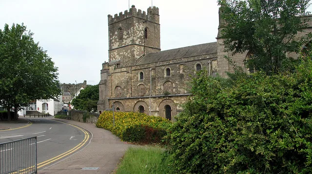
St Mary's Church
Historic churches · 0.5 km

Mint & Mustard
Restaurants · 0.5 km

Powis Almshouses
Gardens · 0.5 km
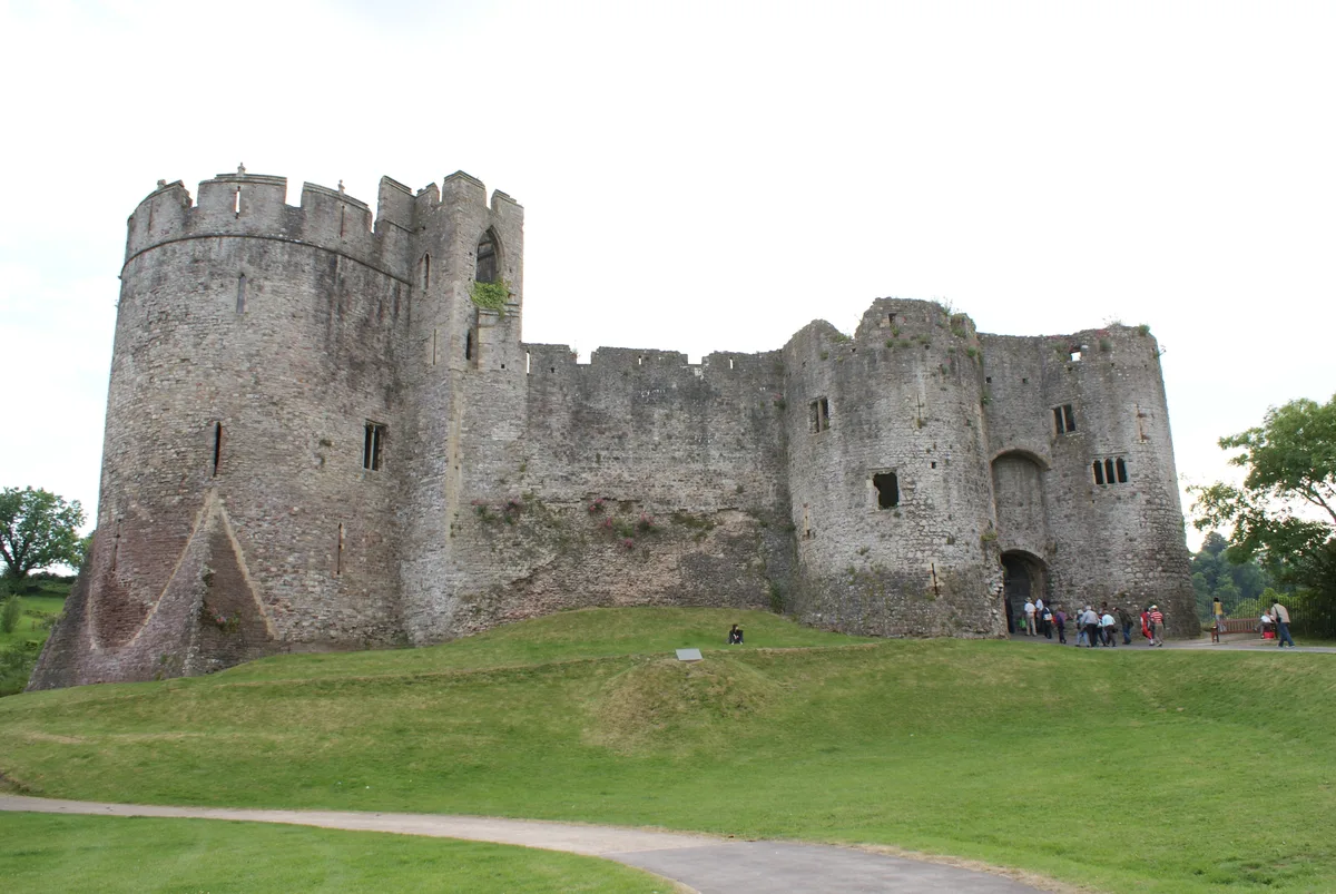
Chepstow Castle
Castles · 0.6 km

Beaufort Hotel
Historic houses · 0.6 km
Nearby
📷 5📷 5Historic bridges · South Wales
Old Wye Bridge
Old Wye Bridge — Grade I listed building-listed bridge in wales-south, United Kingdom.
📷 5Historic bridges · South Wales
Chepstow Railway Bridge
Chepstow Railway Bridge — a Grade II*-listed bridge in wales-south, United Kingdom.
📷 3Historic houses · South Wales
Gwy House
Gwy House — Grade II listed building in Monmouthshire.
📷 3Museums · South Wales
Chepstow Museum
Chepstow Museum — a museum in wales-south, United Kingdom.
📷 5Where to eat & stay near Gloucester Hole
Places to stay
📷 5 📷 5
📷 5Hotels · South Wales
St Pierre Country Club
St Pierre Country Club — a hotel in wales south.
 📷 7
📷 7 📷 5
📷 5 📷 5
📷 5Campsites · South Wales
Beeches Farm Campsite
Beeches Farm Campsite — a campsite in wales south.
 📷 7
📷 7B&Bs · South Wales
Tintern Old Rectory B&B
Tintern Old Rectory B&B — a bed-and-breakfast in wales south.
Places to eat & drink
📷 5Restaurants · South Wales
Mint & Mustard
Mint & Mustard — a restaurant in wales south.
 📷 7
📷 7 📷 6
📷 6 📷 7
📷 7Historic pubs · South West England
The Boar's Head
The Boar's Head in Wales South, United Kingdom.
 📷 5
📷 5Cafés · South West England
Swan House
Swan House — a café in england west midlands.
 📷 5
📷 5Restaurants · South West England
Roobroo
Roobroo — a restaurant in england west midlands.
More caves in this region
 📷 3
📷 3Caves · South Wales
Agen Allwedd (Ogof Gam)
Agen Allwedd (Ogof Gam) is a cave in the United Kingdom.
 📷 3
📷 3 📷 3
📷 3 📷 3
📷 3Frequently asked questions
- Where is Gloucester Hole?
- Gloucester Hole is in Gloucestershire, South Wales, United Kingdom (postcode NP16 7DL), in the parish of Tidenham.
- What is Gloucester Hole?
- The Gloucester Hole is a roughly square opening in the limestone cliffs of the River Wye, directly opposite the town of Chepstow. The hole itself is on the Tutshill side of the river, in Gloucestershi
- How do I get to Gloucester Hole?
- The nearest railway station is Chepstow, about 0.7 km away. Drivers can use postcode NP16 7DL.
- Is Gloucester Hole a protected site?
- Yes — Gloucester Hole is part of the River Wye SSSI Site of Special Scientific Interest and the Severn Estuary SSSI Site of Special Scientific Interest.
- Is Gloucester Hole free to visit?
- Yes, Gloucester Hole is free to enter.
- How do I get to Gloucester Hole?
- The nearest railway station is Chepstow, about 0.7 km away. Drivers can navigate to postcode NP16 7DL.