
Islands · Scottish Islands
Foula
Foula — island of the Shetland Islands, Scotland, UK.

Wikimedia Commons contributors — see linked file page for photographer and licence licence

Plan your visit
- Typical visit
- 4 h–12 h
- Free entry
- Dog-friendly
Getting there & planning your visit
Foula is located in the Shetland Islands, with the postcode ZE2 9PN. Entry to the island is free. Please note that there is no nearest railway station due to its remote location.
About
Foula is a island in the United Kingdom. It covers approximately 13 km². Recent population estimates put it at around 38 people. Part of Shetland Islands. Wikidata describes it as: "island of the Shetland Islands, Scotland, UK". Coordinates: 60.1333°, -2.0667°.
Photo gallery
Summary from the official site
Foula is a remote island in Shetland, known for its stunning natural beauty and rich wildlife. Visitors can explore its rugged landscapes, enjoy birdwatching, and experience the unique culture of the island's small community.
From the Wikipedia article
Foula ( FOO-lə), located in the Shetland archipelago of Scotland, is one of the United Kingdom's most remote permanently inhabited islands. The liner RMS Oceanic was wrecked on the Shaalds of Foula in 1914. Foula was the location for the film The Edge of the World (1937).
Excerpt from Wikipedia under CC BY-SA 4.0. See the source article linked in Sources below.
- Coordinates
- 60.1333, -2.0667
- District
- Shetland Islands
- Postcode
- ZE2 9PN
- Parliamentary constituency
- Orkney and Shetland
- Population
- 38
- Official site
- web.archive.org
Sources
- wikidata: Q932332 (CC0)
- wikipedia: Foula (CC BY-SA 4.0)
- commons: Ham Foula.jpg (CC BY-SA 4.0)
Other places nearby

Hamnafield
Mountains & hills · 0.6 km

Foula Post Office
Natural landmarks · 0.7 km

Ham
Villages · 0.9 km

Tounafield
Mountains & hills · 1.1 km
Ham Voe
Mountains & hills · 1.1 km

War Memorial, Durga Ness, Foula
Memorials & monuments · 1.2 km

Foula Airfield
Islands · 1.5 km

Da Noup
Mountains & hills · 1.6 km
The Noup
Mountains & hills · 1.6 km

Da Sneug
Mountains & hills · 1.8 km

Wick of Mucklabrek
Natural landmarks · 1.8 km

Hellabrick’s Wick
Natural landmarks · 1.9 km
Nearby
📷 5Mountains & hills · Scottish Islands
Hamnafield
Hamnafield — mountain in scotland islands. Elevation: 344 m.
📷 3Natural landmarks · Scottish Islands
Foula Post Office
Foula Post Office in Orkney + Shetland, United Kingdom.
📷 5📷 5Mountains & hills · Scottish Islands
Tounafield
Tounafield — mountain in scotland islands. Elevation: 344 m.
📷 3Mountains & hills · Scottish Islands
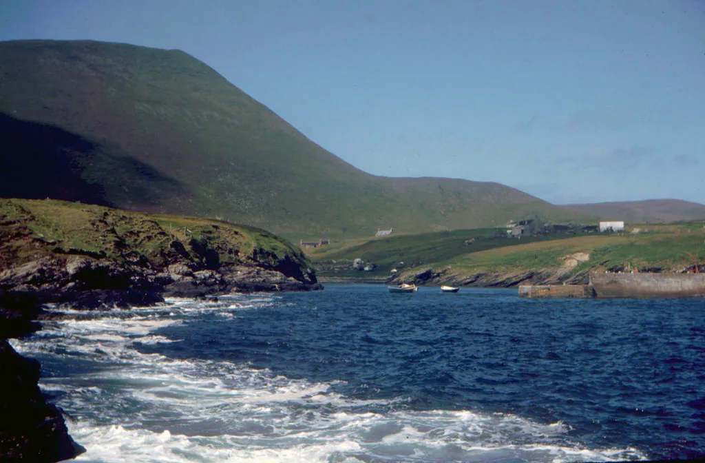
Ham Voe
Ham Voe — bay on Foula, Shetland Islands, Scotland, UK.
📷 5Memorials & monuments · Scottish Islands
War Memorial, Durga Ness, Foula
War Memorial, Durga Ness, Foula — category C listed building-listed memorial in scotland-islands, United Kingdom.
More places in this region
 📷 5
📷 5Islands · Scottish Islands
Bac Beag
Bac Beag — Scottish island, part of the Treshnish Isles in the Inner Hebrides.
 📷 5
📷 5Islands · Scottish Islands
Bac Mòr
Bac Mòr — island in Argyll and Bute, Scotland, UK, one of the Treshnish Isles.
 Flagship📷 3
Islands · Scottish Islands
Baleshare
Baleshare — flat tidal island in the Outer Hebrides, Scotland, UK.
 Flagship📷 5
Islands · Scottish Islands
Barra
Barra — island in Outer Hebrides, Scotland, UK.
Frequently asked questions
- Where is Foula?
- Foula is in the Scottish Islands, United Kingdom (postcode ZE2 9PN).
- What is Foula?
- Foula — island of the Shetland Islands, Scotland, UK.
- How do I get to Foula?
- Drivers can use postcode ZE2 9PN.
- Is Foula free to visit?
- Yes, Foula is free to enter.
- How do I get to Foula?
- Drivers can navigate to postcode ZE2 9PN. It sits within the Orkney and Shetland parliamentary constituency.