Mountains & hills · Scottish Islands
Tounafield
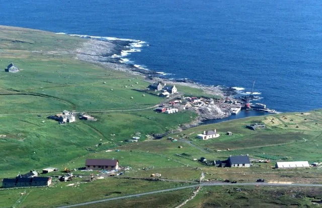
Tounafield — mountain in scotland islands. Elevation: 344 m.

Rude Health — CC BY-SA 2.0 via Wikimedia Commons licence
Plan your visit
- Typical visit
- 3 h–8 h
- Best time of year
- Late spring – early autumn (May–Oct)
About
Tounafield is a mountain located in scotland islands. Elevation: 344 m. A named British peak recorded in OpenStreetMap. Peaks are typically named on Ordnance Survey 1:50k mapping.
Photo gallery
Place summary
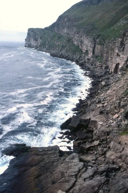
Tounafield is a mountain located in the Scottish Islands. It is characterised by its rugged terrain and scenic views typical of the region. As part of the diverse landscape of the islands, Tounafield offers opportunities for outdoor activities and exploration. Visitors can expect a remote setting that highlights the natural beauty of Scotland.
AI-generated from the structured facts on this page (operator, designation, listing, era). Not a substitute for visiting.
- Coordinates
- 60.1364, -2.0848
Sources
- osm: n2943400934 (ODbL)
Other places nearby
Loading nearby places…
Nearby
 📷 5
📷 5Mountains & hills · Scottish Islands
Hamnafield
Hamnafield — mountain in scotland islands. Elevation: 344 m.
 📷 5
📷 5Mountains & hills · Scottish Islands
Da Sneug
Da Sneug — mountain in scotland islands. Elevation: 418 m.
 📷 5
📷 5Natural landmarks · Scottish Islands
Wick of Mucklabrek
Wick of Mucklabrek — a natural feature in scotland islands.
 Flagship📷 3
Islands · Scottish Islands
Foula
Foula — island of the Shetland Islands, Scotland, UK.
 📷 3
📷 3Mountains & hills · Scottish Islands
Wick of Mucklaberg
Wick of Mucklaberg — bay on Foula, Shetland Islands, Scotland, UK.
 📷 5
📷 5Mountains & hills · Scottish Islands
Da Noup
Da Noup — a hill or mountain in scotland islands.
More mountains in this region
 📷 3
📷 3Mountains & hills · Scottish Islands
Aikerness Bay
Aikerness Bay — bay in Orkney Islands, Scotland, UK.
 📷 3
📷 3Mountains & hills · Scottish Islands
Aith Hope
Aith Hope — bay in Orkney Islands, Scotland, UK.

Mountains & hills · Scottish Islands
Aith Voe
Aith Voe — bay on West Mainland, Shetland Islands, Scotland, UK.
 📷 3
📷 3Mountains & hills · Scottish Islands
Aith Voe
Aith Voe — bay on South Mainland, Shetland Islands, Scotland, UK.
Frequently asked questions
- Where is Tounafield?
- Tounafield is in the Scottish Islands, United Kingdom.
- What is Tounafield?
- Tounafield — mountain in scotland islands. Elevation: 344 m.
- How do I get to Tounafield?
- Its coordinates are 60.1364°, -2.0848°.