Mountains & hills · South Wales
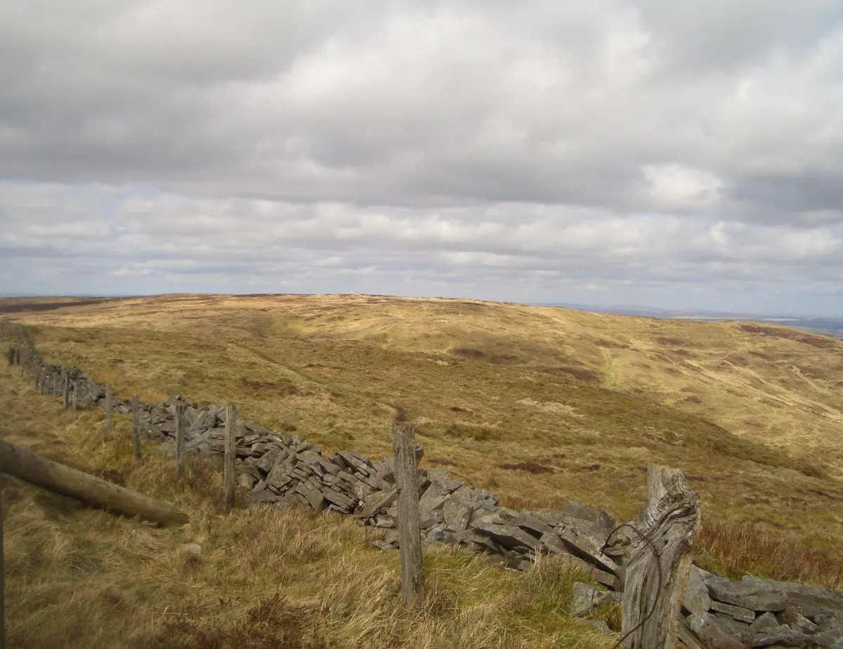
Fan Frynych
In or near Ystradfellte.
Fan Frynych — Named summit at 629 m.

Wikimedia Commons contributors — see linked file page for photographer and licence licence
Plan your visit
- Typical visit
- 3 h–8 h
- Best time of year
- Late spring – early autumn (May–Oct)
- Free entry
- Dog-friendly
About
Fan Frynych is a named summit in the United Kingdom. Wikidata describes it as: "Named summit at 629 m.". Coordinates: 51.8939°, -3.5158°.
Photo gallery
From the Wikipedia article
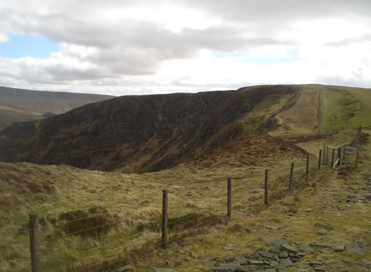
Fan Frynych is the northernmost peak of the Fforest Fawr massif in the Brecon Beacons National Park, South Wales. It is classed as a subsidiary summit of Fan Fawr and makes up half of the Craig Cerrig-gleisiad and Fan Frynych National Nature Reserve with its sister peak Craig Cerrig-gleisiad. The summit is marked by a trig point, where the northern face of Craig Cerrig-gleisiad can be viewed.
Excerpt from Wikipedia under CC BY-SA 4.0. See the source article linked in Sources below.
Background
Visiting
Being 'mountain' and/or 'moor', the entire mountain is mapped as open country and hence freely available to walkers under the access provisions of the CROW Act 2000. A network of paths and tracks cross its summit plateau and link with public rights of way to east, west and north. The 99 mile Beacons Way passes over Craig Cerrig-gleisiad immediately to its south, affording views over Fan Frynych's southern slopes and connecting with a path running the length of the east side of the plateau.
Sourced from Wikipedia under CC BY-SA 4.0.
- Coordinates
- 51.8939, -3.5158
- District
- Powys
- Parish
- Glyn Tarell
- Postcode
- LD3 8NP
- Parliamentary constituency
- Brecon, Radnor and Cwm Tawe
Sources
- osm: n6049092685 (ODbL)
- wikipedia: Fan Frynych (CC BY-SA 4.0)
- commons: Fanfrynych.JPG (CC BY-SA 4.0)
Other places nearby
Fan Frynych
Natural landmarks · 0.0 km

Craig Cerrig Gleisiad a Fan Frynych National Nature Reserve
Forests & woodlands · 0.2 km

Craig Cerrig-Gleisiad Deserted Rural Settlement
Vineyards · 0.8 km

Craig Cerrig-gleisiad
Mountains & hills · 1.0 km
Craig Cerrig-gleisiad
Natural landmarks · 1.0 km

Twyn Rhefr
Mountains & hills · 1.3 km

Twyn Dylluan-ddu
Mountains & hills · 1.3 km

YHA Llwyn-y-celyn (YHA Brecon Beacons)
Hostels · 1.6 km

Glyn Tarell
Historic churches · 2.2 km

Brecon Beacons Wild Camping
Campsites · 2.2 km

Y Gyrn longhuts
Vineyards · 2.5 km

Heol Senni
Historic churches · 3.1 km
Nearby
📷 3📷 3Forests & woodlands · South Wales
Craig Cerrig Gleisiad a Fan Frynych National Nature Reserve
Craig Cerrig Gleisiad a Fan Frynych National Nature Reserve is a forest or woodland in the United Kingdom.
📷 5Vineyards · South Wales
Craig Cerrig-Gleisiad Deserted Rural Settlement
Craig Cerrig-Gleisiad Deserted Rural Settlement — a UK vineyard in wales south, producing English or Welsh wine from cool-climate grape varieties.
📷 3Mountains & hills · South Wales
Craig Cerrig-gleisiad
Craig Cerrig-gleisiad — Named summit at 629 m.
📷 3Natural landmarks · South Wales
Craig Cerrig-gleisiad
Craig Cerrig-gleisiad — mountain (629m) in Powys.
📷 5Where to eat & stay near Fan Frynych
Places to stay
📷 5Hostels · South Wales
YHA Llwyn-y-celyn (YHA Brecon Beacons)
YHA Llwyn-y-celyn (YHA Brecon Beacons) — a hostel in wales south.
📷 5Campsites · South Wales
Brecon Beacons Wild Camping
Brecon Beacons Wild Camping — a campsite in wales south.
 📷 5
📷 5 📷 5
📷 5 📷 5
📷 5Caravan parks · Mid Wales
Aberbran Fawr Campsite
Aberbran Fawr Campsite — a caravan park in wales south.
 📷 5
📷 5Places to eat & drink
 📷 7
📷 7 📷 5
📷 5Historic pubs · South Wales
White Hart
White Hart — Historic pub — listed building or notable heritage status.
 📷 5
📷 5Restaurants · South Wales
Sultan of Wales
Sultan of Wales — a restaurant in wales south.
 📷 4
📷 4More mountains in this region
 Flagship📷 3
Mountains & hills · South Wales
Milford Haven Waterway
Milford Haven Waterway — ria, or flooded valley, in Pembrokeshire, south-west Wales, UK.
 📷 5
📷 5Mountains & hills · South Wales
Ogof Ffynnon Ddu
Ogof Ffynnon Ddu — cave in the Upper Swansea Valley in South Wales.
 📷 3
📷 3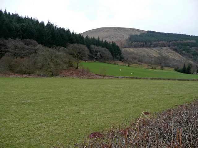 📷 3
📷 3Frequently asked questions
- Where is Fan Frynych?
- Fan Frynych is in South Wales, United Kingdom (postcode LD3 8NP), in the parish of Glyn Tarell.
- What is Fan Frynych?
- Fan Frynych — Named summit at 629 m.
- How do I get to Fan Frynych?
- Drivers can use postcode LD3 8NP.
- Is Fan Frynych free to visit?
- Yes, Fan Frynych is free to enter.
- How do I get to Fan Frynych?
- Drivers can navigate to postcode LD3 8NP. It sits within the Brecon, Radnor and Cwm Tawe parliamentary constituency.