
Hill forts · South East England
Durrington Walls
In or near Larkhill.
Durrington Walls — the site of a large Neolithic settlement, village; also it enclosed several hedges;.

Wikimedia Commons contributors — see linked file page for photographer and licence licence

Plan your visit
- Typical visit
- 1 h–2 h
- Free entry
- Dog-friendly
Getting there & planning your visit
Durrington Walls is located in Wiltshire, South East England, with the postcode SP4 8LY. Entry is free. There is no nearest railway station mentioned, so please plan your visit accordingly.
About
Durrington Walls is a hill fort in the United Kingdom. Part of Stonehenge, Avebury and Associated Sites. Wikidata describes it as: "the site of a large Neolithic settlement, village; also it enclosed several hedges;". Coordinates: 51.1925°, -1.7875°.
Photo gallery
Summary from the official site
Durrington Walls is a significant Neolithic henge located within the Stonehenge Landscape, believed to mark the village of the builders of Stonehenge. Visitors can explore the surrounding prehistoric monuments, including burial mounds and ancient earthworks, while enjoying the rich chalk grassland habitat.
Read more on the official property page.
Protected designations
- Site of Special Scientific Interest: River Avon System SSSI
- Site of Special Scientific Interest: Salisbury Plain SSSI
- Area of Outstanding Natural Beauty: Cranborne Chase & West Wiltshire Downs
Designations sourced from Natural England open data under OGL v3.
From the Wikipedia article
Durrington Walls is the site of a large Neolithic settlement and later henge enclosure located in the Stonehenge World Heritage Site in England. It lies 2 miles (3.2 km) north-east of Stonehenge in the parish of Durrington, just north of Amesbury in Wiltshire. The henge is the second-largest Late Neolithic palisaded enclosure known in the United Kingdom, after Hindwell in Wales. Between 2004 and 2006, excavations on the site by a team led by the University of Sheffield revealed seven houses. It has been suggested that the settlement may have originally had up to 1,000 houses and perhaps 4,000 people, if the entire enclosed area was used. The site was settled for about 500 years, starting sometime between c. 2800 and 2100 BC. The site may have been the largest settlement in northern Europe for a brief period. From 2010 to 2014, a combination of new technology and excavations revealed a 500-metre-diameter (1,600 ft) henge constructed largely of wooden posts. Evidence suggests that this complex was a complementary monument to Stonehenge. In 2020, a geophysical survey uncovered a number of pits, some natural sink holes and others apparently modified to hold massive timbers, interpreted as belonging to a 1.2-mile-wide (1.9 km) circle or circuit of 10-metre (33 ft) pits of Neolithic age. If this interpretation is correct, this would be Britain's largest prehistoric monument.
Excerpt from Wikipedia under CC BY-SA 4.0. See the source article linked in Sources below.
Background
History
Although there is evidence of some early Neolithic activity at the site, most of the structures seem to have been built in the late Neolithic/early Bronze Age. At some point c. 2600 BC, a large timber circle was constructed. It is now known as the Southern Circle. The circle was oriented southeast towards the sunrise on the midwinter solstice. Its four large concentric circles of postholes would have held extremely large standing timbers. A paved avenue was constructed on a slightly different alignment – towards the sunset on the summer solstice – and it led to the River Avon. This feature is similar to the Stonehenge Avenue. A large timber post lay on this orientation, about as far away…
Sourced from Wikipedia under CC BY-SA 4.0.
- Coordinates
- 51.1925, -1.7875
- District
- Wiltshire
- Parish
- Durrington
- Postcode
- SP4 8LY
- Parliamentary constituency
- East Wiltshire
- Opening
- Daily Dawn - Dusk
- Official site
- www.nationaltrust.org.uk
Sources
- wikidata: Q471738 (CC0)
- wikipedia: Durrington Walls (CC BY-SA 4.0)
- commons: Western wall of Durrington Walls.jpg (CC BY-SA 4.0)
Other places nearby
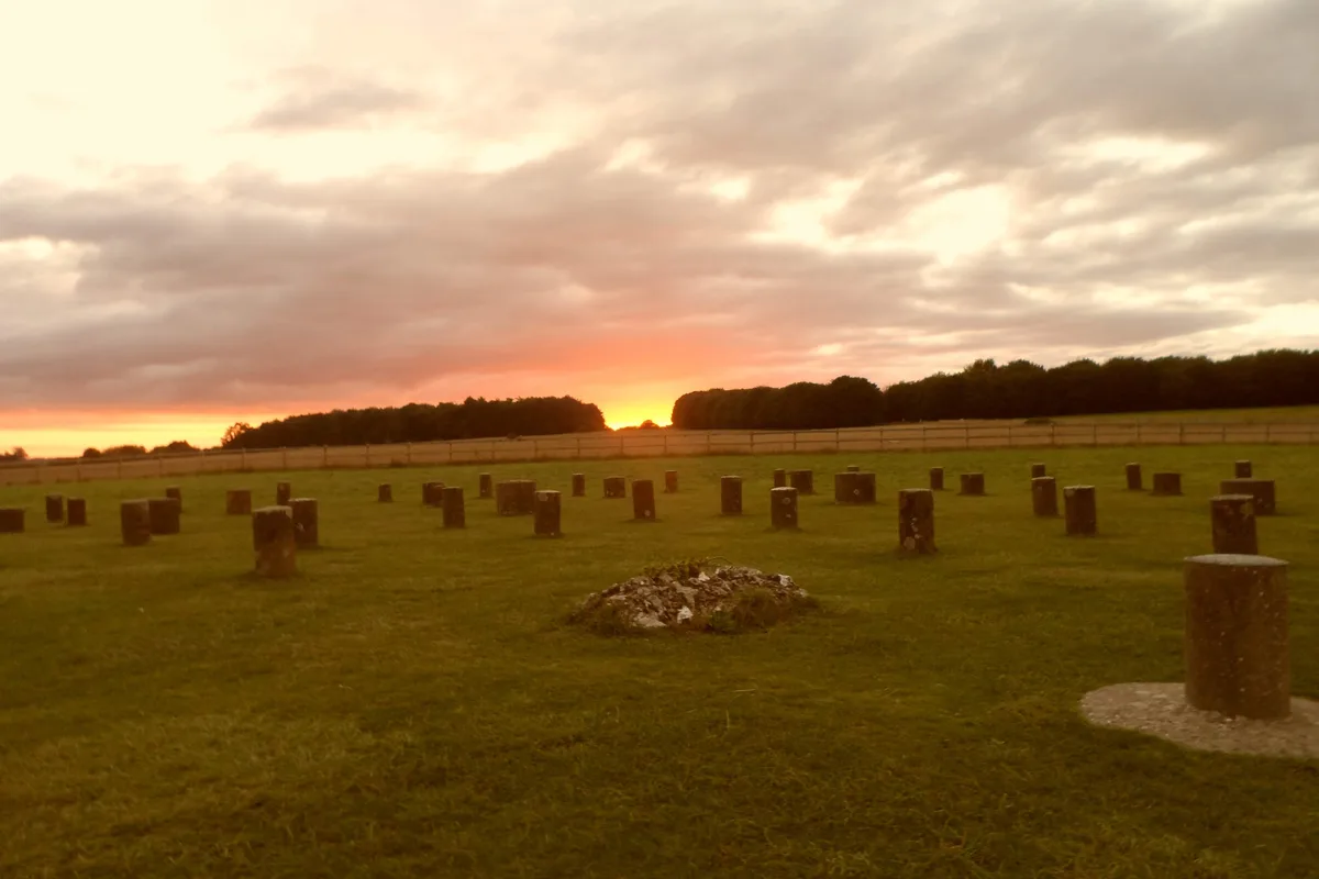
Henge monuments at Durrington Walls and Woodhenge, a round barrow cemetery, two additional round barrows and four settlements
Archaeological sites · 0.1 km
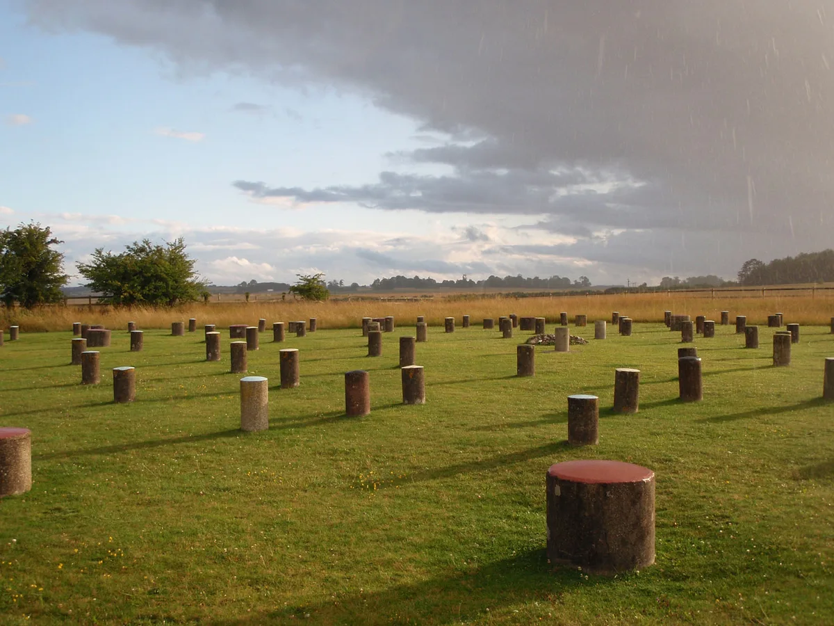
Woodhenge
Hill forts · 0.3 km

Cuckoo Stone
Archaeological sites · 0.5 km

Cuckoo Stone
Archaeological sites · 0.5 km

BCAC Hanger
Natural landmarks · 0.7 km

Neolithic Long Barrow
Burial mounds & barrows · 1.3 km

Afghan And Zulu War Memorial
Memorials & monuments · 1.3 km

Blick Mead
Archaeological sites · 1.7 km

Blick Mead
Archaeological sites · 1.7 km
Grey Bridge
Historic bridges · 1.8 km

Baluster Bridge And Gate Piers
Historic bridges · 1.8 km

Weir Bridge In Amesbury Abbey Park
Historic bridges · 1.9 km
Nearby
📷 5Archaeological sites · South East England
Henge monuments at Durrington Walls and Woodhenge, a round barrow cemetery, two additional round barrows and four settlements
Henge monuments at Durrington Walls and Woodhenge, a round barrow cemetery, two additional round barrows and four settlements — archaeological site in Durrington, Wiltshire, England, UK.
★ Iconic📷 5Hill forts · South East England
Woodhenge
Woodhenge — Neolithic henge and timber circle monument near Stonehenge.
📷 5Archaeological sites · South East England
Cuckoo Stone
Cuckoo Stone — a archaeological in england-south-east, United Kingdom.
📷 5Archaeological sites · South East England
Cuckoo Stone
Cuckoo Stone — archaeological in england south east.
📷 5Natural landmarks · South East England
BCAC Hanger
BCAC Hanger — a other in england-south-east, United Kingdom.
📷 5Burial mounds & barrows · South East England
Neolithic Long Barrow
Neolithic Long Barrow — a burial mound in england-south-east, United Kingdom.
Where to eat & stay near Durrington Walls
Places to stay
 📷 7
📷 7Hotels · South East England
Fairlawn House
Fairlawn House — a hotel in england south east.
 📷 5
📷 5Hostels · South East England
Cholderton Youth Hostel
Cholderton Youth Hostel — a hostel in england south east.
 📷 5
📷 5Campsites · South West England
Stonehenge Campsite & Glamping
Stonehenge Campsite & Glamping — a campsite in england south east.
 📷 5
📷 5Campsites · South West England
Stonehenge Touring Park
Stonehenge Touring Park — a campsite in england south east.
 📷 5
📷 5Caravan parks · South East England
Camping & Caravan Club Salisbury
Camping & Caravan Club Salisbury — a caravan park in england south east.
 📷 5
📷 5Places to eat & drink
 📷 5
📷 5 📷 5
📷 5Historic pubs · South West England
The Greyhound Tavern
The Greyhound Tavern in England South West, United Kingdom.
 📷 5
📷 5Historic pubs · South West England
Malet Arms
Malet Arms in England South West, United Kingdom.
 📷 7
📷 7Restaurants · South East England
The Old Castle
The Old Castle — a restaurant in england south east. Cuisine: american. Brand: Harvester.
 📷 5
📷 5Historic pubs · South West England
George and Dragon
George and Dragon in England South West, United Kingdom.
 📷 5
📷 5Historic pubs · South West England
The Royal George
The Royal George in England South West, United Kingdom.
More places in this region
 📷 5
📷 5Hill forts · South East England
Ankerwycke Priory
Ankerwycke Priory — Benedictine nunnery with associated moat and fishponds.
 📷 5
📷 5Hill forts · South East England
Shornemead Fort
Shornemead Fort — fort in Shorne, Kent, England, UK.
 📷 5
📷 5Hill forts · South East England
Smythe's Megalith
Smythe's Megalith — neolithic monument in Kent, England.
 📷 5
📷 5Hill forts · South East England
White Horse Stone
White Horse Stone — Two megaliths near Aylesford, Kent, England.
Frequently asked questions
- Where is Durrington Walls?
- Durrington Walls is in South-East England, United Kingdom (postcode SP4 8LY), in the parish of Durrington.
- What is Durrington Walls?
- Durrington Walls — the site of a large Neolithic settlement, village; also it enclosed several hedges;.
- How do I get to Durrington Walls?
- Drivers can use postcode SP4 8LY.
- Is Durrington Walls a protected site?
- Yes — Durrington Walls is part of the River Avon System SSSI Site of Special Scientific Interest and the Salisbury Plain SSSI Site of Special Scientific Interest.
- Is Durrington Walls free to visit?
- Yes, Durrington Walls is free to enter.
- How do I get to Durrington Walls?
- Drivers can navigate to postcode SP4 8LY. It sits within the East Wiltshire parliamentary constituency.