
Castles · South West England
Dunball
In or near Bawdrip.
Dunball is a small hamlet west of the village of Puriton and close to the town of Bridgwater, Somerset, England. Just north of Dunball is Down End which is the site of Down End Castle a motte-and-bail

Roger Cornfoot — CC BY-SA 2.0 via Wikimedia Commons licence

Plan your visit
- Typical visit
- 1.5 h–3 h
- Nearest railway station
- Bridgwater · 3.9 km
- Family-friendly
- Limited wheelchair access
Getting there & planning your visit
To visit Dunball, the nearest railway station is Bridgwater, located 3.9 km away. The postcode for sat-nav is TA6 4TN. Accessibility is limited for wheelchair users.
About
Dunball is a small hamlet west of the village of Puriton and close to the town of Bridgwater, Somerset, England. Just north of Dunball is Down End which is the site of Down End Castle a motte-and-bailey castle, which has been designated as a Scheduled Ancient Monument. Located on the A38, adjacent to Junction 23 of the M5 motorway, it hosts a wharf on the River Parrett, created in 1844 by Bridgwater coal merchants, which is the only part of the Port of Bridgwater still in commercial use today. Dunball also has a small industrial estate, built on the site of the Royal Ordnance Factory's hostel blocks; and a hotel. The wharf was formerly linked to the Bristol and Exeter Railway by a rail track which crossed the A38, on the right hand side of the hotel. The link was built in 1876 by coal merchants, and was originally operated as a horse-drawn tramway. It was removed during the Beeching Axe and Dunball also lost its railway station on 5 October 1964, which had opened in 1873. The wharf was used during World War II to bring Welsh coal to the nearby Royal Ordnance Factory, ROF Bridgwater. The wharf is now used for landing stone products, mainly marine sand and gravels dredged in the Bristol Channel. The King's Sedgemoor Drain drains into the River Parrett at Dunball, adjacent to the wharf, via a clyse. The clyse has been moved from its original location and it now obstructs the entrance to a small harbour adjacent to the wharf. During the Winter flooding of 2013–14 on the Somerse
Photo gallery
See it from the streetimagery from 2025
Imagery © Mapillary contributors, CC BY-SA 4.0
Protected designations
- Site of Special Scientific Interest: Bridgwater Bay SSSI
- National Nature Reserve: SOMERSET WETLANDS
- Ramsar wetland: Severn Estuary
Designations sourced from Natural England open data under OGL v3.
From the Wikipedia article
Dunball is a small hamlet west of the village of Puriton and close to the town of Bridgwater, Somerset, England. Just north of Dunball is Down End which is the site of Down End Castle a motte-and-bailey castle, which has been designated as a Scheduled Ancient Monument.
Located on the A38, adjacent to Junction 23 of the M5 motorway, it hosts a wharf on the River Parrett, created in 1844 by Bridgwater coal merchants, which is the only part of the Port of Bridgwater still in commercial use today. Dunball also has a small industrial estate, built on the site of the Royal Ordnance Factory's hostel blocks; and a hotel. The wharf was formerly linked to the Bristol and Exeter Railway by a rail track which crossed the A38, on the right hand side of the hotel. The link was built in 1876 by coal merchants, and was originally operated as a horse-drawn tramway. It was removed during the Beeching Axe and Dunball also lost its railway station on 5 October 1964, which had opened in 1873. The wharf was used during World War II to bring Welsh coal to the nearby Royal Ordnance Factory, ROF Bridgwater. The wharf is now used for landing stone products, mainly marine sand and gravels dredged in the Bristol Channel. The King's Sedgemoor Drain drains into the River Parrett at Dunball, adjacent to the wharf, via a clyse. The clyse has been moved from its original location and it now obstructs the entrance to a small harbour adjacent to the wharf. During the Winter flooding of 2013–14 on the Somerset Levels high volume pumps from the Netherlands were installed at Dunball. River silt was dredged from the river in this locality in order to make Bath bricks, an early type of cleaning agent with a mild scouring action.
Excerpt from Wikipedia under CC BY-SA 4.0. See the source article linked in Sources below.
- Coordinates
- 51.1628, -2.9878
- District
- Somerset
- Parish
- Puriton
- Postcode
- TA6 4TN
- Parliamentary constituency
- Bridgwater
- Nearest railway station
- Bridgwater — 3.9 km
Sources
- wikipedia: Dunball (CC BY-SA 4.0)
Other places nearby

River Cary
Castles · 0.2 km

Chisley Mount
Castles · 0.5 km

Caput Montis
Archaeological sites · 0.5 km
Down End Castle
Literary houses · 0.5 km

Down End Castle
Castles · 0.6 km
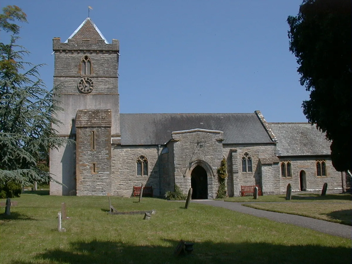
Church of St Michael and All Angels, Puriton
Historic churches · 1.3 km

Willow Man
Memorials & monuments · 1.4 km

Puriton
Castles · 1.5 km
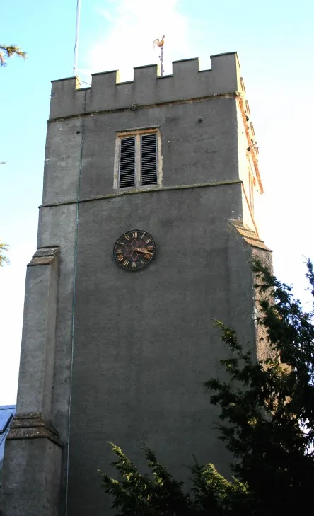
Church of St John the Baptist, Pawlett
Historic churches · 2.0 km

Pawlett
Villages · 2.2 km

Sydenham House
Historic houses · 2.5 km

ROC Post Puriton
Archaeological sites · 2.9 km
Nearby
📷 5Castles · South West England
River Cary
The River Cary is a river in Somerset, England. It is sourced from the Park Pond in Castle Cary and flows towards the southwest.
📷 5📷 3Archaeological sites · South West England
Caput Montis
Caput Montis — a archaeological in england-south-west, United Kingdom.
📷 5Literary houses · South West England
Down End Castle
Down End Castle — a literary house museum in england south west.
📷 5Castles · South West England
Down End Castle
Down End Castle, also known as Downend Castle, Chisley Mount or Chidley Mount, was a motte-and-bailey castle at Down End, north of Dunball in the parish of Puriton, Somerset, England. It has been des
📷 5Historic churches · South West England
Church of St Michael and All Angels, Puriton
Church of St Michael and All Angels, Puriton — church in Puriton, Somerset, England, UK.
Where to eat & stay near Dunball
Places to stay
 📷 5
📷 5Caravan parks · South West England
Fairways Holiday Park
Fairways Holiday Park — a caravan park in england south west.
 📷 7
📷 7Hotels · South West England
The Tudor Hotel & Restaurant
The Tudor Hotel & Restaurant — a hotel in england south west.
 📷 5
📷 5Caravan parks · South West England
Withy Water Caravan Park
Withy Water Caravan Park — a caravan park in england south west.
 📷 5
📷 5 📷 3
📷 3Caravan parks · South West England
Cripps Farm Holidays
Cripps Farm Holidays — a caravan park in england south west.
 📷 5
📷 5Caravan parks · South West England
Haven Burnham-on-Sea Holiday Village
Haven Burnham-on-Sea Holiday Village — a caravan park in england south west.
Places to eat & drink
 📷 6
📷 6Historic pubs · South West England
Cobblestones Public House
Cobblestones Public House in England South West, United Kingdom.
 📷 5
📷 5Restaurants · South West England
English Raj Tandoori Restaurant
English Raj Tandoori Restaurant — a restaurant in england south west. Cuisine: indian. 5-star.
 📷 7
📷 7Historic pubs · South West England
Quantock Gateway Hotel
Quantock Gateway Hotel in England South West, United Kingdom.
 📷 7
📷 7Historic pubs · South West England
King William Inn
King William Inn in England South West, United Kingdom.
 📷 5
📷 5 📷 7
📷 7Historic pubs · South West England
King Alfred Public House
King Alfred Public House in England South West, United Kingdom.
More castles in this region
 Flagship📷 10
Castles · South West England
Old Wardour Castle
Old Wardour Castle — Grade I listed castle in Wardour, Wiltshire, England, UK.
 📷 5
📷 5Castles · South West England
Ballands Castle
Ballands Castle — former castle in Somerset, England, UK.
 📷 5
📷 5Castles · South West England
Brownsea Castle
Brownsea Castle — grade II listed Device Fort in Purbeck, United Kingdom.
 📷 5
📷 5Castles · South West England
Castle Hill
Castle Hill — castle in Mere, Wiltshire.
Frequently asked questions
- Where is Dunball?
- Dunball is in South-West England, United Kingdom (postcode TA6 4TN), in the parish of Puriton.
- What is Dunball?
- Dunball is a small hamlet west of the village of Puriton and close to the town of Bridgwater, Somerset, England. Just north of Dunball is Down End which is the site of Down End Castle a motte-and-bail
- How do I get to Dunball?
- The nearest railway station is Bridgwater, about 3.9 km away. Drivers can use postcode TA6 4TN.
- Is Dunball a protected site?
- Yes — Dunball is part of the Bridgwater Bay SSSI Site of Special Scientific Interest and the SOMERSET WETLANDS National Nature Reserve.
- Does Dunball charge admission?
- Dunball typically charges admission. Check the official site for current ticket prices and opening hours.
- How do I get to Dunball?
- The nearest railway station is Bridgwater, about 3.9 km away. Drivers can navigate to postcode TA6 4TN.