
Museums · East Midlands
Dronfield
In or near Calow.
Dronfield is a town in North East Derbyshire, England, which includes Dronfield Woodhouse and Coal Aston. It lies in the valley of the River Drone between Chesterfield and Sheffield. The Peak District

Roger Templeman — CC BY-SA 2.0 via Wikimedia Commons licence

Plan your visit
- Typical visit
- 1.5 h–3 h
- Best time of year
- Year-round
- Nearest railway station
- Dronfield · 0.2 km
- Family-friendly
- Limited wheelchair access
Getting there & planning your visit
To visit Dronfield Museum, the nearest railway station is Dronfield, located just 0.2 km away. The postcode for sat-nav is S18 2FZ. Please note that wheelchair accessibility is limited.
About
Dronfield is a town in North East Derbyshire, England, which includes Dronfield Woodhouse and Coal Aston. It lies in the valley of the River Drone between Chesterfield and Sheffield. The Peak District National Park is three miles (4.8 km) to the west. The name comes from the Old English Dranfleld, probably meaning an open land infested with drone bees. The town existed before the 1086 Domesday Book, and has a 13th-century parish church. In 1662, Charles II granted the town a market, although this later ceased. The industrial history of the town includes coal mining, the wool trade, the production of soap and steel, and engineering. Today a range of manufacturing firms still operate in the town. The stadium to the north of the town is officially "The Home of Football", providing the playing surface for Sheffield F.C., the world's oldest football club. Dronfield's population increased in the post-war years from 6,500 in 1945 to 21,261 in the 2011 Census.
Photo gallery
From the Wikipedia article
Dronfield is a town in North East Derbyshire, England, which includes Dronfield Woodhouse and Coal Aston. It lies in the valley of the River Drone between Chesterfield and Sheffield. The Peak District National Park is three miles (4.8 km) to the west. The name comes from the Old English Dranfleld, probably meaning an open land infested with drone bees. The town existed before the 1086 Domesday Book, and has a 13th-century parish church. In 1662, Charles II granted the town a market, although this later ceased. The industrial history of the town includes coal mining, the wool trade, the production of soap and steel, and engineering. Today a range of manufacturing firms still operate in the town. The stadium to the north of the town is officially "The Home of Football", providing the playing surface for Sheffield F.C., the world's oldest football club. Dronfield's population increased in the post-war years from 6,500 in 1945 to 21,261 in the 2011 Census.
Excerpt from Wikipedia under CC BY-SA 4.0. See the source article linked in Sources below.
Background
History
Dronfield was in existence before the 1086 Domesday Book, though little is known about its early history. It suffered after the Norman Conquest when William the Conqueror sought to bring the North of England under control. Its name derives from the Old English drān and feld, meaning open land infested with drones (male bees). The Church of St John the Baptist was built by 1135 when Oscot was rector and the parish of Dronfield covered Little Barlow, Coal Aston, Povey, Holmesfield, Apperknowle, Dore and Totley. The Guild of the Blessed Virgin Mary was established in 1349 in the hall of the chantry priests. However, due to the Dissolution of the Monasteries and the subsequent suppression of…
Sourced from Wikipedia under CC BY-SA 4.0.
- Coordinates
- 53.3024, -1.4664
- County
- Derbyshire
- District
- North East Derbyshire
- Parish
- Dronfield
- Postcode
- S18 2FZ
- Parliamentary constituency
- North East Derbyshire
- Nearest railway station
- Dronfield — 0.2 km
Sources
- wikipedia: Dronfield (CC BY-SA 4.0)
Other places nearby

Lea Road Bridge (Tjc1 26)
Historic bridges · 0.3 km
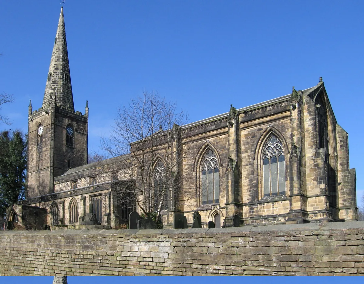
St John the Baptist's Church, Dronfield
Historic churches · 0.4 km

Peel Monument
Memorials & monuments · 0.6 km

Electra Palace Cinema
Theatres · 0.6 km
Dronfield War Memorial
Memorials & monuments · 0.6 km
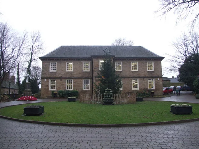
Dronfield Manor
Stately homes · 0.7 km

Metapic Wood
Forests & woodlands · 1.3 km

Unstone Manor House
Historic houses · 1.7 km

Unstone
Villages · 2.1 km

DoubleTree by Hilton Hotel Sheffield Park
Hotels · 2.4 km

Moortop
Mountains & hills · 3.0 km

Painted Fabrics
Memorials & monuments · 3.1 km
Nearby
📷 3Historic bridges · East Midlands
Lea Road Bridge (Tjc1 26)
Lea Road Bridge (Tjc1 26) — Grade II listed building-listed bridge in england-east-midlands, United Kingdom.
📷 3Historic churches · East Midlands
St John the Baptist's Church, Dronfield
St John the Baptist's Church, Dronfield — Grade I listed church in Derbyshire, England, UK.
📷 4Memorials & monuments · East Midlands
Peel Monument
Peel Monument — a memorial in East Midlands, United Kingdom.
📷 3Theatres · East Midlands
Electra Palace Cinema
Electra Palace Cinema in England East Midlands, United Kingdom.
📷 3Memorials & monuments · East Midlands
Dronfield War Memorial
Dronfield War Memorial — a memorial in East Midlands, United Kingdom.
📷 3Stately homes · East Midlands
Dronfield Manor
Dronfield Manor — Grade II listed building in Dronfield, Derbyshire, United Kingdom, used as a library.
Where to eat & stay near Dronfield
Places to stay
📷 5Hotels · East Midlands
DoubleTree by Hilton Hotel Sheffield Park
DoubleTree by Hilton Hotel Sheffield Park — a hotel in england east midlands. 4-star. Brand: DoubleTree.
 📷 5
📷 5 📷 5
📷 5Caravan parks · East Midlands
Birley Caravan Storage
Birley Caravan Storage — a caravan park in england east midlands.
 📷 5
📷 5Hotels · East Midlands
Hotel Mercure Sheffield Kenwood Hall & Spa
Hotel Mercure Sheffield Kenwood Hall & Spa — a hotel in england east midlands. 5-star. Brand: Accor.
 📷 5
📷 5Hostels · East Midlands
Westfield Barn (Whirlow Hall Farm Trust)
Westfield Barn (Whirlow Hall Farm Trust) — a hostel in england east midlands.
 📷 5
📷 5Hotels · East Midlands
Ringwood Hall Hotel
Ringwood Hall Hotel — a hotel in england east midlands.
Places to eat & drink
 📷 5
📷 5Historic pubs · Yorkshire & the Humber
Bagshawe Arms Public House
Bagshawe Arms Public House in England Yorkshire, United Kingdom.
 📷 3
📷 3Restaurants · East Midlands
The Old Vicarage, Derbyshire
The Old Vicarage is a restaurant located in Ridgeway, near Sheffield. The restaurant held one star in the Michelin Guide from 1998 to 2015. The head chef is TV chef Tessa Bramley.
 📷 7
📷 7Historic pubs · East Midlands
The Nags Head Public House
The Nags Head Public House in England East Midlands, United Kingdom.
 📷 5
📷 5Historic pubs · Yorkshire & the Humber
Union Hotel and adjoining boundary wall
Union Hotel and adjoining boundary wall in England Yorkshire, United Kingdom.
 📷 5
📷 5Historic pubs · Yorkshire & the Humber
Sheaf House Public House
Sheaf House Public House in England Yorkshire, United Kingdom.
 📷 7
📷 7Historic pubs · Yorkshire & the Humber
The Albion Public House
The Albion Public House in England Yorkshire, United Kingdom.
More museums in this region
 📷 5
📷 5Museums · East Midlands
Stamford Town Hall
Stamford Town Hall — building in Stamford, Lincolnshire, England, UK.
 📷 5
📷 5Museums · East Midlands
Thorney Museum
Thorney Museum — a museum in East Midlands, United Kingdom.
 📷 5
📷 5Museums · East Midlands
Octavia Hill Birthplace Museum
Octavia Hill Birthplace Museum — a museum in East Midlands, United Kingdom.
 📷 5
📷 5Museums · East Midlands
Museum of Technology
Museum of Technology — a museum in East Midlands, United Kingdom.
Frequently asked questions
- Where is Dronfield?
- Dronfield is in Derbyshire, the East Midlands, United Kingdom (postcode S18 2FZ), in the parish of Dronfield.
- What is Dronfield?
- Dronfield is a town in North East Derbyshire, England, which includes Dronfield Woodhouse and Coal Aston. It lies in the valley of the River Drone between Chesterfield and Sheffield. The Peak District
- How do I get to Dronfield?
- The nearest railway station is Dronfield, about 0.2 km away. The nearest town is Calow. Drivers can use postcode S18 2FZ.
- How do I get to Dronfield?
- The nearest railway station is Dronfield, about 0.2 km away. Drivers can navigate to postcode S18 2FZ.