
Historic bridges · East Midlands
Lea Road Bridge (Tjc1 26)
In or near Calow.
Lea Road Bridge (Tjc1 26) — Grade II listed building-listed bridge in england-east-midlands, United Kingdom.

Andrew Hill — CC BY-SA 2.0 via Wikimedia Commons licence

Plan your visit
- Typical visit
- 15 min–30 min
- Nearest railway station
- Dronfield · 0.1 km
- Free entry
- Dog-friendly
- Wheelchair accessible
Getting there & planning your visit
Lea Road Bridge is located in North East Derbyshire, with the nearest railway station being Dronfield, just 0.1 km away. Entry is free, and the site is wheelchair accessible. The postcode for sat-nav is S18 2DH.
About
Lea Road Bridge (Tjc1 26) is a Grade II listed building-listed bridge in england-east-midlands, United Kingdom, registered on the National Heritage List for England (NHLE entry 1417692). Listed status protects buildings and structures of special architectural or historic interest. See the linked Wikipedia article for further details.
Photo gallery
Heritage listing
Details A stone overbridge including an approach road and span over the River Drone, at the northern end of Dronfield Station, 1870 for the Midland Railway, built to the designs of J.S. Crossley. MATERIALS: snecked, quarry-faced Derbyshire gritstone walling, tooled ashlar dressings and red brick soffit linings. DESCRIPTION: the bridge is L-shape in plan, and consists of two segmental arches spanning the railway and cutting, a ramped approach road at right angles on the east side, and three further segmental arches, including one over the River Drone. The principal section consists of one span over the railway, and a smaller, approach arch spanning the west embankment. Both arches share the same detailing, typical of bridges on this section of the line, with V-jointed punch-dressed stepped voussoirs and drafted margins. The voussoirs return as elongated ashlar quoining to the brick soffit linings. The arches spring from pick-faced impost blocks and integral impost bands with tooled margins and chamfered upper arrises. A similar string course runs across the bridge face above the arches. This and the parapet are curved, following the road alignment. The parapet has steeply-curved, pick-dressed copings with drafted margins and hipped ends. All other stonework, including the abutments and spandrels, is snecked and quarry-faced. The bridge faces terminate at raking piers with shallow, hipped copings set beneath the parapet coping. Abutting these, with a straight joint on the west side, are walls of squared masonry flanking the approach road. On the east side, the bridge extends beyond the piers and then turns sharply to the north forming a ramped approach to Chesterfield Road. Within the curved section of the flanking wall is a segmental arch spanning the River Drone. The ap
From the Historic England List Entry under OGL v3.
Place summary
Lea Road Bridge is a Grade II listed bridge located in the East Midlands. It is notable for its architectural significance and historical value within the region.
AI-generated from the structured facts on this page (operator, designation, listing, era). Not a substitute for visiting.
- Coordinates
- 53.3020, -1.4706
- County
- Derbyshire
- District
- North East Derbyshire
- Parish
- Dronfield
- Postcode
- S18 2DH
- Parliamentary constituency
- North East Derbyshire
- Nearest railway station
- Dronfield — 0.1 km
Sources
- wikidata: Q26676615 (CC0)
Other places nearby
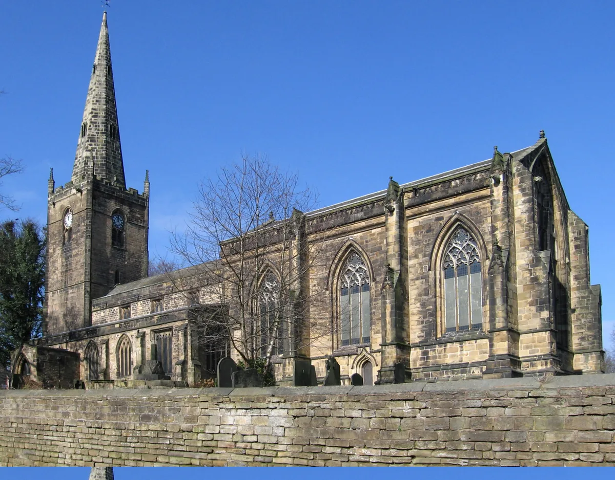
St John the Baptist's Church, Dronfield
Historic churches · 0.1 km

Dronfield
Museums · 0.3 km

Peel Monument
Memorials & monuments · 0.3 km
Dronfield War Memorial
Memorials & monuments · 0.4 km
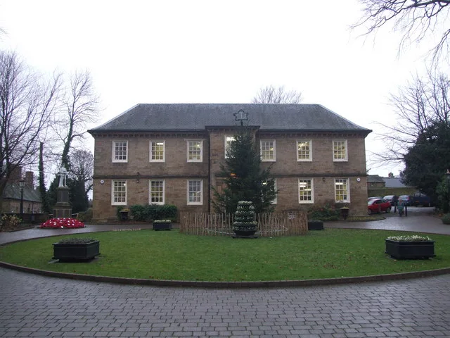
Dronfield Manor
Stately homes · 0.4 km

Electra Palace Cinema
Theatres · 0.8 km

Metapic Wood
Forests & woodlands · 1.6 km

Unstone Manor House
Historic houses · 1.9 km

Unstone
Villages · 2.3 km

DoubleTree by Hilton Hotel Sheffield Park
Hotels · 2.4 km

Painted Fabrics
Memorials & monuments · 3.1 km

Holmesfield
Castles · 3.2 km
Nearby
📷 3Historic churches · East Midlands
St John the Baptist's Church, Dronfield
St John the Baptist's Church, Dronfield — Grade I listed church in Derbyshire, England, UK.
📷 5Museums · East Midlands
Dronfield
Dronfield is a town in North East Derbyshire, England, which includes Dronfield Woodhouse and Coal Aston. It lies in the valley of the River Drone between Chesterfield and Sheffield. The Peak District
📷 4Memorials & monuments · East Midlands
Peel Monument
Peel Monument — a memorial in england-east-midlands, United Kingdom.
📷 3Memorials & monuments · East Midlands
Dronfield War Memorial
Dronfield War Memorial — a memorial in england-east-midlands, United Kingdom.
📷 3Stately homes · East Midlands
Dronfield Manor
Dronfield Manor — Grade II listed building in Dronfield, Derbyshire, United Kingdom, used as a library.
📷 3Theatres · East Midlands
Electra Palace Cinema
Electra Palace Cinema in England East Midlands, United Kingdom.
Where to eat & stay near Lea Road Bridge (Tjc1 26)
Places to stay
📷 5Hotels · East Midlands
DoubleTree by Hilton Hotel Sheffield Park
DoubleTree by Hilton Hotel Sheffield Park — a hotel in england east midlands. 4-star. Brand: DoubleTree.
 📷 5
📷 5 📷 5
📷 5Caravan parks · East Midlands
Birley Caravan Storage
Birley Caravan Storage — a caravan park in england east midlands.
 📷 5
📷 5Hostels · East Midlands
Westfield Barn (Whirlow Hall Farm Trust)
Westfield Barn (Whirlow Hall Farm Trust) — a hostel in england east midlands.
 📷 5
📷 5Hotels · East Midlands
Hotel Mercure Sheffield Kenwood Hall & Spa
Hotel Mercure Sheffield Kenwood Hall & Spa — a hotel in england east midlands. 5-star. Brand: Accor.
 📷 5
📷 5Places to eat & drink
 📷 5
📷 5Historic pubs · Yorkshire & the Humber
Bagshawe Arms Public House
Bagshawe Arms Public House in England Yorkshire, United Kingdom.
 📷 3
📷 3Restaurants · East Midlands
The Old Vicarage, Derbyshire
The Old Vicarage is a restaurant located in Ridgeway, near Sheffield. The restaurant held one star in the Michelin Guide from 1998 to 2015. The head chef is TV chef Tessa Bramley.
 📷 7
📷 7Historic pubs · East Midlands
The Nags Head Public House
The Nags Head Public House in England East Midlands, United Kingdom.
 📷 5
📷 5Historic pubs · Yorkshire & the Humber
Union Hotel and adjoining boundary wall
Union Hotel and adjoining boundary wall in England Yorkshire, United Kingdom.
 📷 5
📷 5Historic pubs · Yorkshire & the Humber
Sheaf House Public House
Sheaf House Public House in England Yorkshire, United Kingdom.
 📷 7
📷 7Historic pubs · Yorkshire & the Humber
The Albion Public House
The Albion Public House in England Yorkshire, United Kingdom.
More bridges in this region
 📷 5
📷 5Historic bridges · East Midlands
Mill Race Bridge To Market Deeping Mill
Mill Race Bridge To Market Deeping Mill — Grade II listed building-listed bridge in england-london, United Kingdom.
 📷 5
📷 5Historic bridges · East Midlands
Bridge Over West Glen River
Bridge Over West Glen River — Grade II listed building-listed bridge in england-london, United Kingdom.
 📷 5
📷 5Historic bridges · East Midlands
Bridge And Sluices
Bridge And Sluices — Grade II listed building-listed bridge in england-london, United Kingdom.
 📷 5
📷 5Historic bridges · East Midlands
Bridge Over River Gwash
Bridge Over River Gwash — Grade II listed building-listed bridge in england-london, United Kingdom.
Frequently asked questions
- Where is Lea Road Bridge (Tjc1 26)?
- Lea Road Bridge (Tjc1 26) is in Derbyshire, the East Midlands, United Kingdom (postcode S18 2DH), in the parish of Dronfield.
- What is Lea Road Bridge (Tjc1 26)?
- Lea Road Bridge (Tjc1 26) — Grade II listed building-listed bridge in england-east-midlands, United Kingdom.
- How do I get to Lea Road Bridge (Tjc1 26)?
- The nearest railway station is Dronfield, about 0.1 km away. Drivers can use postcode S18 2DH.
- Is Lea Road Bridge (Tjc1 26) a listed building?
- Lea Road Bridge (Tjc1 26) is officially recognised as Grade II listed building listed.
- Is Lea Road Bridge (Tjc1 26) free to visit?
- Yes, Lea Road Bridge (Tjc1 26) is free to enter.
- How do I get to Lea Road Bridge (Tjc1 26)?
- The nearest railway station is Dronfield, about 0.1 km away. Drivers can navigate to postcode S18 2DH.