
Canals · Scottish Highlands
Dingwall Canal
In or near Conon Bridge.
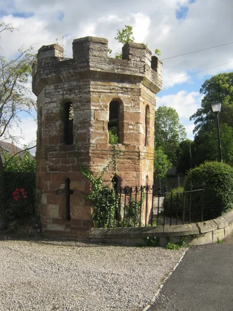
Dingwall Canal — canal in Highland, Scotland, UK.

Wikimedia Commons contributors — see linked file page for photographer and licence licence

Plan your visit
- Typical visit
- 1 h–2 h
- Nearest railway station
- Dingwall · 0.5 km
- Free entry
- Dog-friendly
About
Dingwall Canal is a canal in the United Kingdom. Wikidata describes it as: "canal in Highland, Scotland, UK". Coordinates: 57.5975°, -4.4157°.
Photo gallery
From the Wikipedia article
The Dingwall Canal was a short tidal canal running from the town of Dingwall to the Cromarty Firth in the county of Ross and Cromarty, Scotland. It was completed by 1819, to provide better access to the town, but was not a commercial success, and was abandoned in the 1880s after the arrival of the railways.
Excerpt from Wikipedia under CC BY-SA 4.0. See the source article linked in Sources below.
Background
History
In 1578, John Leslie the Bishop of Ross produced a map of Scotland, which was published in Rome. Dingwall was of sufficient importance to be included on the map, and when James VI awarded it a burgh charter in 1587, it mentioned cobles and small boats. However, there was a problem caused by the deposition of alluvium from the rivers Conon and Orrin, which made access more difficult, and by 1773 the burgh was in a depressed state. There is some indication that improvements were made to the river soon afterwards, on a plan dated 1777, but a major scheme was actioned in 1815. The River Peffery was made deeper and wider, to allow boats to reach the town. The project was designed by the canal…
Sourced from Wikipedia under CC BY-SA 4.0.
- Coordinates
- 57.5975, -4.4157
- District
- Highland
- Postcode
- IV15 9QZ
- Parliamentary constituency
- Caithness, Sutherland and Easter Ross
- Established
- 1816
- Nearest railway station
- Dingwall — 0.5 km
Sources
- wikidata: Q5278281 (CC0)
- wikipedia: Dingwall Canal (CC BY-SA 4.0)
- commons: DingwallCanal1.jpg (CC BY-SA 4.0)
Other places nearby

Dingwall Camping and Caravanning Club
Caravan parks · 0.2 km

Victoria Park
Stadiums · 0.3 km

Ross Memorial Hospital
Memorials & monuments · 0.4 km

Dingwall Castle Ruins
Castles · 0.4 km
Ferry Road drill hall, Dingwall
Historic houses · 0.4 km
Ross Lodge
Memorials & monuments · 0.4 km
Dingwall Castle
Castles · 0.4 km
David Ross Lodge Memorial Tablet
Memorials & monuments · 0.4 km

Dingwall Sheriff Court
Other places · 0.4 km
Monument to Roderick Maclennan
Memorials & monuments · 0.4 km
Monument to Roderick Maclennan, Dingwall Castle, Castle Street, Dingwall
Memorials & monuments · 0.4 km
Dingwall Castle Folly
Castles · 0.5 km
Nearby
📷 5Caravan parks · Scottish Highlands
Dingwall Camping and Caravanning Club
Dingwall Camping and Caravanning Club — a caravan park in scotland highlands.
📷 5Stadiums · Scottish Highlands
Victoria Park
Victoria Park — football stadium in Dingwall, Scotland.
📷 4Memorials & monuments · Scottish Highlands
Ross Memorial Hospital
Ross Memorial Hospital in Scotland Islands, United Kingdom.
📷 3Castles · Scottish Highlands
Dingwall Castle Ruins
Dingwall Castle Ruins — a castle in Scottish Highlands, United Kingdom.
📷 3Historic houses · Scottish Highlands
Ferry Road drill hall, Dingwall
Ferry Road drill hall, Dingwall in Scotland Islands, United Kingdom.
📷 3Memorials & monuments · Scottish Highlands
Ross Lodge
Ross Lodge — a memorial in Scottish Highlands, United Kingdom.
Where to eat & stay near Dingwall Canal
Places to stay
📷 5Caravan parks · Scottish Highlands
Dingwall Camping and Caravanning Club
Dingwall Camping and Caravanning Club — a caravan park in scotland highlands.
 📷 7
📷 7Hotels · Scottish Highlands
Conon Bridge Hotel
Conon Bridge Hotel — a hotel in scotland highlands.
 📷 5
📷 5B&Bs · Scottish Highlands
Holly Lodge
Holly Lodge — a bed-and-breakfast in scotland highlands.
 📷 5
📷 5Campsites · Scottish Highlands
Black Rock Holiday Park
Black Rock Holiday Park — a campsite in scotland highlands.
 📷 5
📷 5 📷 5
📷 5Campsites · Scottish Highlands
Riverside Campsite
Riverside Campsite — a campsite in scotland highlands.
Places to eat & drink
📷 5Historic pubs · Scottish Highlands
Holly Lodge Hotel, Strathpeffer
Holly Lodge Hotel, Strathpeffer in Scotland Highlands, United Kingdom.
 📷 7
📷 7Historic pubs · Scottish Highlands
93-97 Academy Street, Inverness
93-97 Academy Street, Inverness in Scotland Highlands, United Kingdom.
 📷 5
📷 5Historic pubs · Scottish Highlands
67 Church Street, Inverness
67 Church Street, Inverness in Scotland Highlands, United Kingdom.
 📷 5
📷 5Historic pubs · Scottish Highlands
15-21 Queensgate, Inverness
15-21 Queensgate, Inverness in Scotland Highlands, United Kingdom.
 📷 7
📷 7Historic pubs · Scottish Highlands
Imperial Bar, 1-9 Academy Street, Inverness
Imperial Bar, 1-9 Academy Street, Inverness in Scotland Highlands, United Kingdom.
 📷 7
📷 7Historic pubs · Scottish Highlands
Commercial Bar, 84 High Street, Invergordon
Commercial Bar, 84 High Street, Invergordon in Scotland Highlands, United Kingdom.
More places in this region
 📷 3
📷 3Canals · Scottish Highlands
Aberdeenshire Canal
Aberdeenshire Canal — canal in Aberdeenshire, Scotland, UK.
 📷 3
📷 3Canals · Scottish Highlands
Aberdeenshire Canal, remains of, NW of Brae of Kintore
Aberdeenshire Canal, remains of, NW of Brae of Kintore — architectural structure in Aberdeenshire, Scotland, UK.
 📷 5
📷 5Canals · Scottish Highlands
Caledonian Canal
Caledonian Canal — canal in Scotland, UK.
 📷 4
📷 4Canals · Scottish Highlands
Glen Loy Aqueduct
Glen Loy Aqueduct in Scotland Islands, United Kingdom.
Frequently asked questions
- Where is Dingwall Canal?
- Dingwall Canal is in the Scottish Highlands, United Kingdom (postcode IV15 9QZ).
- What is Dingwall Canal?
- Dingwall Canal — canal in Highland, Scotland, UK.
- How do I get to Dingwall Canal?
- The nearest railway station is Dingwall, about 0.5 km away. The nearest town is Conon Bridge. Drivers can use postcode IV15 9QZ.
- When was Dingwall Canal built?
- Built or established in 1816.
- Is Dingwall Canal free to visit?
- Yes, Dingwall Canal is free to enter.
- How do I get to Dingwall Canal?
- The nearest railway station is Dingwall, about 0.5 km away. Drivers can navigate to postcode IV15 9QZ.