
Canals · Scottish Highlands
Aberdeenshire Canal
In or near Daviot.
Aberdeenshire Canal — canal in Aberdeenshire, Scotland, UK.

Wikimedia Commons contributors — see linked file page for photographer and licence licence

Plan your visit
- Typical visit
- 1 h–2 h
- Nearest railway station
- Inverurie · 2.0 km
- Free entry
- Dog-friendly
Getting there & planning your visit
To visit Aberdeenshire Canal, the nearest railway station is Inverurie, located 2 km away. The postcode for navigation is AB51 3XH, and entry to the canal is free.
About
Aberdeenshire Canal is a canal in the United Kingdom. Wikidata describes it as: "canal in Aberdeenshire, Scotland, UK". Coordinates: 57.2683°, -2.3697°.
Photo gallery
From the Wikipedia article
The Aberdeenshire Canal was a waterway in Aberdeenshire, Scotland, designed by John Rennie, which ran from the port of Aberdeen to Port Elphinstone, Inverurie. It was originally planned to reach Monymusk, but had been truncated by the time an act of Parliament was obtained in 1796. Construction was hampered by a lack of finance, and some local opposition, but it opened in 1805. Some of the workmanship was sub-standard, and several of the locks failed soon afterwards, but they were reconstructed, and reopened in late 1806. It was used for the carriage of a wide variety of cargo, and passenger services were also introduced. These proved popular, and two boats a day made the journey during the summer months, with one in the winter. They gradually faced competition from the adjacent turnpike road, which was quicker but more expensive. A connecting lock was built in 1834, to enable boats to enter Aberdeen harbour, which eased the problem of transhipping goods to larger vessels. The canal normally closed between December and March each year, due to icing. It was never a financial success, and the shareholders did not receive any dividends during its life. Negotiations began in 1845 with the Great North of Scotland Railway, who eventually bought it. Contractors working for the railway company drained much of the canal before any money had changed hands, and the breach had to be repaired. The canal was finally closed in early 1854, so that the railway could lay tracks along its course. The line from Kittybrewster to Huntly was completed by September 1854. As the railway runs straighter than the canal, in some places, clear evidence can be seen for the canal. A scenic walk has been created at Port Elphinstone, part of which follows a channel labelled Old Canal on Ordnance Survey maps, this part thought to be a later lade that served a mill.
Excerpt from Wikipedia under CC BY-SA 4.0. See the source article linked in Sources below.
Background
History
The canal was originally conceived as part of a bigger scheme to link Aberdeen to Monymusk, via Inverurie, with a branch from Inverurie along the course of the Ury Glen to Insch. Captain George Taylor conducted a survey, which confirmed that the plan was feasible, in 1793, but by the time a subscription list was started, the plans had been truncated, with just the section from Aberdeen to Inverurie remaining. Advertisements appeared in the local press, listing the benefits of the enterprise, which included increasing the value of certain stone quarries and land. By 1795, some £11,000 had been pledged, and a general meeting was held, at which the subscribers decided that work would commence…
Description
| designation2 = Scheduled Monument | designation2_offname = Aberdeenshire Canal, remains of, S of Dalwearie | designation2_type = Industrial: inland water | designation2_date = 10 March 1998 | designation2_number = | designation3 = Scheduled Monument | designation3_offname = Aberdeenshire Canal, remains of, Beidleston to Woodland's Wood | designation3_type = Industrial: inland water | designation3_date = 20 December 1999 | designation3_number = | designation4 = Scheduled Monument | designation4_offname = Aberdeenshire Canal, remains of, N and E of Tillybrig Cottage, Dyce | designation4_type = Industrial: inland water | designation4_date = 7 January 1998 | designation4_number = |…
Visiting
| repeal_date = | repealing_legislation = | related_legislation = | status = Current | original_text = https://www.legislation.gov.uk/ukla/Geo3/49/3/contents/enacted | collapsed = yes }} The canal eventually opened in early June 1805. The committee of management met at Inverurie, where they were congratulated on completing the task by the provost, magistrates, minister and others. They set off in the barge The Countess of Kintore, suitably decorated for the occasion, and travelled to Kintore, where they were met by the magistrates and other inhabitants. Several groups of ladies joined them as they approached Aberdeen, and travelled through the locks. Crowds gathered on the banks, and…
Sourced from Wikipedia under CC BY-SA 4.0.
- Coordinates
- 57.2683, -2.3697
- District
- Aberdeenshire
- Postcode
- AB51 3XH
- Parliamentary constituency
- Gordon and Buchan
- Established
- 1854
- Nearest railway station
- Inverurie — 2 km
Sources
- wikidata: Q4667031 (CC0)
- wikipedia: Aberdeenshire Canal (CC BY-SA 4.0)
- commons: Aberdeenshire Canal at Port Elphinstone.jpg (CC BY-SA 4.0)
Other places nearby

Broomend of Crichie Stone Circle / Henge
Stone circles · 0.2 km

Broomend of Crichie Stone Circle / Henge
Archaeological sites · 0.2 km

Port Elphinstone
Villages · 0.4 km

Sluice Bridges, Port Elphinstone, Inverurie, Aberdeenshire Canal
Historic bridges · 0.6 km

Battle of Inverurie (1745) Memorial
Memorials & monuments · 0.8 km

Urie Bridge, Keithhall Road, Inverurie
Historic bridges · 0.9 km

The Bass and Little Bass
Castles · 0.9 km

The Bass and Little Bass, motte-and-bailey castle
Literary houses · 0.9 km
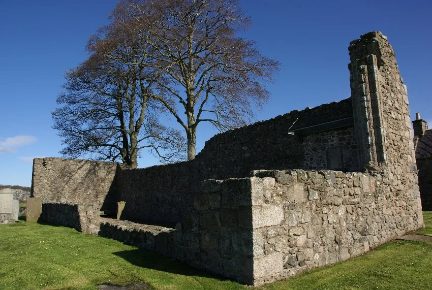
Kinkell, St Michael's Church And Burial-ground
Historic churches · 1.1 km

St Mary's Episcopal Church, High Street, Inverurie
Historic churches · 1.1 km

Shaw Hill
Mountains & hills · 1.2 km
Bruce's Camp
Vineyards · 1.2 km
Nearby
📷 3Stone circles · Scottish Highlands
Broomend of Crichie Stone Circle / Henge
Broomend of Crichie Stone Circle / Henge — a stone circle in Scottish Highlands, United Kingdom.
📷 5Archaeological sites · Scottish Highlands
Broomend of Crichie Stone Circle / Henge
Broomend of Crichie Stone Circle / Henge — archaeological in scotland highlands.
📷 5📷 5Historic bridges · Scottish Highlands
Sluice Bridges, Port Elphinstone, Inverurie, Aberdeenshire Canal
Sluice Bridges, Port Elphinstone, Inverurie, Aberdeenshire Canal — category C listed building-listed bridge in scotland-highlands, United Kingdom.
📷 3Memorials & monuments · Scottish Highlands
Battle of Inverurie (1745) Memorial
Battle of Inverurie (1745) Memorial — a memorial in Scottish Highlands, United Kingdom.
📷 5Historic bridges · Scottish Highlands
Urie Bridge, Keithhall Road, Inverurie
Urie Bridge, Keithhall Road, Inverurie — category B listed building-listed bridge in scotland-highlands, United Kingdom.
Where to eat & stay near Aberdeenshire Canal
Places to stay
 📷 7
📷 7Hotels · Scottish Highlands
Hampton by Hilton Aberdeen Airport
Hampton by Hilton Aberdeen Airport — a hotel in scotland highlands. 3.5-star. Brand: Hampton.
 📷 5
📷 5Hotels · Scottish Highlands
Hilton Aberdeen TECA
Hilton Aberdeen TECA — a hotel in scotland highlands.
 📷 7
📷 7Hotels · Scottish Highlands
Village Hotel Club
Village Hotel Club — a hotel in scotland highlands.
 📷 5
📷 5 📷 7
📷 7Hotels · Scottish Highlands
Sure Hotel by Best Western Aberdeen
Sure Hotel by Best Western Aberdeen — a hotel in scotland highlands.
 📷 4
📷 4Campsites · Scottish Highlands
Ythan Valley Campsite
Ythan Valley Campsite — a campsite in scotland highlands.
Places to eat & drink
 📷 7
📷 7Historic pubs · Scottish Highlands
Grant Arms Hotel, The Square, Monymusk
Grant Arms Hotel, The Square, Monymusk in Scotland Highlands, United Kingdom.
 📷 5
📷 5Historic pubs · Scottish Highlands
97 High Street, Old Aberdeen, Aberdeen
97 High Street, Old Aberdeen, Aberdeen in Scotland Highlands, United Kingdom.
 📷 5
📷 5Historic pubs · Scottish Highlands
Public House, Alford Place, Aberdeen
Public House, Alford Place, Aberdeen in Scotland Highlands, United Kingdom.
 📷 7
📷 7 📷 5
📷 5Historic pubs · Scottish Highlands
3 Golden Square, Aberdeen
3 Golden Square, Aberdeen in Scotland Highlands, United Kingdom.
 📷 5
📷 5Historic pubs · Scottish Highlands
10 Bon-accord Square, Aberdeen
10 Bon-accord Square, Aberdeen in Scotland Highlands, United Kingdom.
More places in this region
 📷 3
📷 3Canals · Scottish Highlands
Aberdeenshire Canal, remains of, NW of Brae of Kintore
Aberdeenshire Canal, remains of, NW of Brae of Kintore — architectural structure in Aberdeenshire, Scotland, UK.
 📷 5
📷 5Canals · Scottish Highlands
Caledonian Canal
Caledonian Canal — canal in Scotland, UK.
 📷 3
📷 3 📷 4
📷 4Canals · Scottish Highlands
Glen Loy Aqueduct
Glen Loy Aqueduct in Scotland Islands, United Kingdom.
Frequently asked questions
- Where is Aberdeenshire Canal?
- Aberdeenshire Canal is in the Scottish Highlands, United Kingdom (postcode AB51 3XH).
- What is Aberdeenshire Canal?
- Aberdeenshire Canal — canal in Aberdeenshire, Scotland, UK.
- How do I get to Aberdeenshire Canal?
- The nearest railway station is Inverurie, about 2.0 km away. The nearest town is Daviot. Drivers can use postcode AB51 3XH.
- When was Aberdeenshire Canal built?
- Built or established in 1854.
- Is Aberdeenshire Canal free to visit?
- Yes, Aberdeenshire Canal is free to enter.
- How do I get to Aberdeenshire Canal?
- The nearest railway station is Inverurie, about 2.0 km away. Drivers can navigate to postcode AB51 3XH.