
Historic churches · North West England
Cumbria
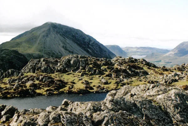
In or near Buttermere.
Cumbria ( KUM-bree-ə) is a ceremonial county in North West England. It borders the Scottish council areas of Dumfries and Galloway and Scottish Borders to the north; the English ceremonial counties of

Dave Dunford — CC BY-SA 2.0 via Wikimedia Commons licence

Plan your visit
- Typical visit
- 30 min–1 h
- Free entry
About
Cumbria ( KUM-bree-ə) is a ceremonial county in North West England. It borders the Scottish council areas of Dumfries and Galloway and Scottish Borders to the north; the English ceremonial counties of Northumberland and County Durham to the east, North Yorkshire to the south-east, and Lancashire to the south; and the Irish Sea to the west. Its largest settlement is the city of Carlisle. Cumbria is predominantly rural, with an area of 6,769 km2 (2,614 sq mi) and an estimated population of 510,680 in 2024. Carlisle is in the north of the county; the towns of Workington and Whitehaven lie on the west coast, Barrow-in-Furness on the south coast, and Penrith and Kendal in the east. For local government purposes the county comprises two unitary authority areas, Westmorland and Furness and Cumberland, the councils of which collaborate through the Cumbria Combined Authority. Cumbria was created in 1974 from the historic counties of Cumberland and Westmorland, the Furness area of Lancashire, and a small part of Yorkshire. The interior of Cumbria contains several upland areas. Together they fringe the Vale of Eden, the wide valley of the River Eden, which runs south-east to north-west across the county and broadens into the Solway Plain near Carlisle. To the north-east are part of the Border Moors, and to the east part of the North Pennines; the latter have been designated a national landscape. South of the vale are the Orton Fells, Howgill Fells, and part of the Yorkshire Dales, which
Photo gallery
Official information
The Office of the Lord-Lieutenant of Cumbria represents the King in the county, promoting civic and cultural initiatives. The newly appointed Lord-Lieutenant, Mr. Alexander Scott, will work with various organizations to support the community and enhance the region's heritage.
Protected designations
- Site of Special Scientific Interest: River Derwent and Tributaries SSSI
- Site of Special Scientific Interest: Pillar and Ennerdale Fells SSSI
- National Nature Reserve: WILD ENNERDALE
Designations sourced from Natural England open data under OGL v3.
From the Wikipedia article
Cumbria ( KUM-bree-ə) is a ceremonial county in North West England. It borders the Scottish council areas of Dumfries and Galloway and Scottish Borders to the north; the English ceremonial counties of Northumberland and County Durham to the east, North Yorkshire to the south-east, and Lancashire to the south; and the Irish Sea to the west. Its largest settlement is the city of Carlisle. Cumbria is predominantly rural, with an area of 6,769 km2 (2,614 sq mi) and an estimated population of 510,680 in 2024. Carlisle is in the north of the county; the towns of Workington and Whitehaven lie on the west coast, Barrow-in-Furness on the south coast, and Penrith and Kendal in the east. For local government purposes the county comprises two unitary authority areas, Westmorland and Furness and Cumberland, the councils of which collaborate through the Cumbria Combined Authority. Cumbria was created in 1974 from the historic counties of Cumberland and Westmorland, the Furness area of Lancashire, and a small part of Yorkshire. The interior of Cumbria contains several upland areas. Together they fringe the Vale of Eden, the wide valley of the River Eden, which runs south-east to north-west across the county and broadens into the Solway Plain near Carlisle. To the north-east are part of the Border Moors, and to the east part of the North Pennines; the latter have been designated a national landscape. South of the vale are the Orton Fells, Howgill Fells, and part of the Yorkshire Dales, which are all within the Yorkshire Dales national park. The south-west contains the Lake District, a large upland area which has been designated a national park and UNESCO World Heritage Site. It includes England's highest mountain, Scafell Pike; its longest and largest lake, Windermere; and its deepest lake, Wast Water. The county has a long coast to the west which is bordered by a plain for most of its length. The north-west coast is part of the Solway Firth, a national landscape, and the south coa
Excerpt from Wikipedia under CC BY-SA 4.0. See the source article linked in Sources below.
Background
History
dates from the late Neolithic age and was constructed by some of the earliest inhabitants of Cumbria]] During the Neolithic period what is now Cumbria area contained an important centre of stone axe production (the so-called Langdale axe factory), products of which have been found across Great Britain. During this period, stone circles and henges were built across the county, and today, Cumbria has one of the largest number of preserved field monuments in England'. While not part of the region conquered in the Romans' initial conquest of Britain in AD 43, most of modern-day Cumbria was later conquered in response to a revolt deposing the Roman-aligned ruler of the Brigantes in AD 69. The…
Visiting
]] ]] The largest and most widespread industry is tourism, with the county attracting over 47 million visitors annually. The Lake District National Park alone receives some 15.8 million visitors every year. Despite this, fewer than 50,000 people reside permanently within the Lake District: mostly in Ambleside, Bowness-on-Windermere, Coniston, Gosforth, Grasmere, Keswick, and Windermere. {| |valign="top"| {| class="wikitable col4right" ! Rank !! Attraction !! Location !! Visitors |- | 1 || Windermere Lake Cruises || Bowness-on-Windermere || 1,313,807 |- | 2 || Rheged || Penrith || 439,568 |- | 3 || Ullswater Steamers || Glenridding || 348,000 |- | 4 || Whinlatter Forest Park and Visitor…
Sourced from Wikipedia under CC BY-SA 4.0.
- Coordinates
- 54.5000, -3.2500
- Official site
- web.archive.org
Sources
- wikipedia: Cumbria (CC BY-SA 4.0)
Other places nearby

YHA Black Sail
Hostels · 0.3 km

Looking Stead
Mountains & hills · 0.7 km

Innominate Peak
Mountains & hills · 0.8 km
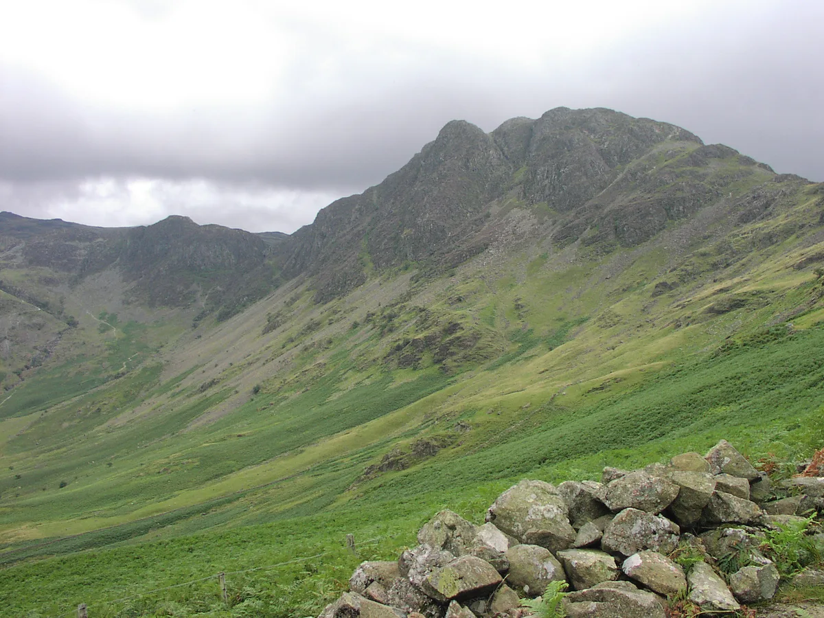
Hay Stacks
Mountains & hills · 0.8 km

Haystacks (Buttermere)
Mountains & hills · 0.8 km
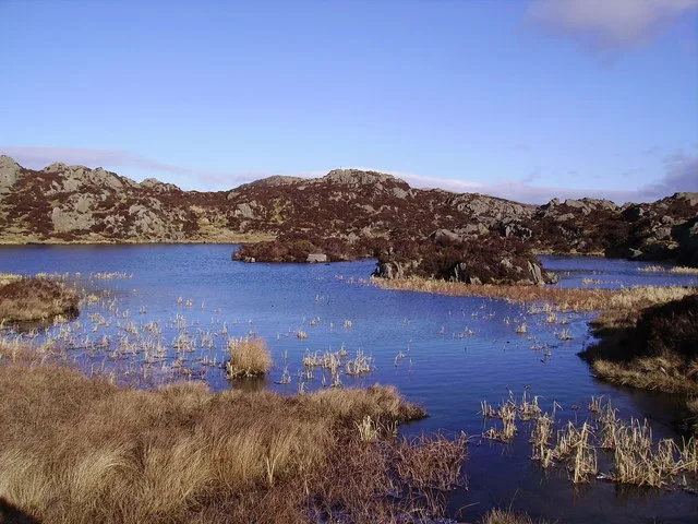
Innominate Tarn
Natural landmarks · 0.9 km

Haystacks SE Top
Mountains & hills · 0.9 km
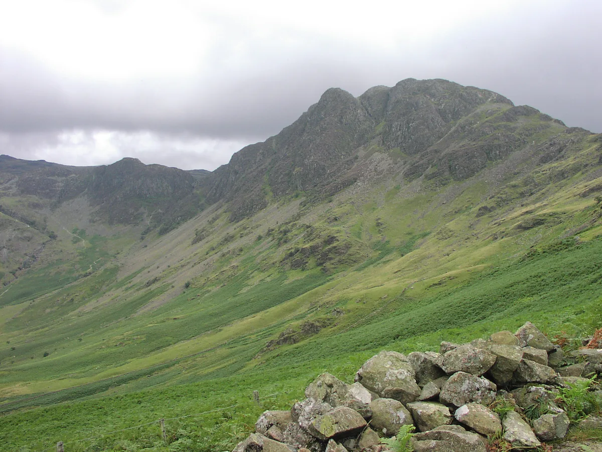
Haystacks
Natural landmarks · 0.9 km
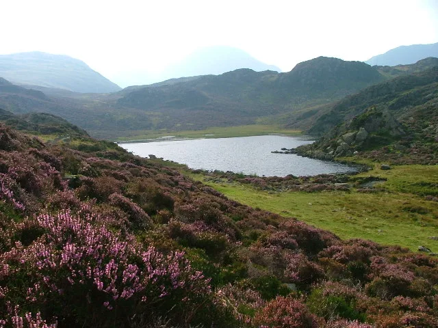
Blackbeck Tarn
Natural landmarks · 1.1 km

Seavy Knott
Mountains & hills · 1.2 km
Seat
Mountains & hills · 1.2 km

Green Crag
Mountains & hills · 1.3 km
Nearby
📷 5Hostels · North West England
YHA Black Sail
YHA Black Sail — a hostel in england north east.
📷 5Mountains & hills · North West England
Looking Stead
Looking Stead — mountain in england north west. Elevation: 627.7 m.
📷 5Mountains & hills · North West England
Innominate Peak
Innominate Peak — mountain in england north east. Elevation: 545 m.
📷 3📷 5Mountains & hills · North West England
Haystacks (Buttermere)
Haystacks (Buttermere) — a hill or mountain in england north east.
📷 3Natural landmarks · North West England
Innominate Tarn
Innominate Tarn — lake in the United Kingdom.
Where to eat & stay near Cumbria
Places to stay
📷 5Hostels · North West England
YHA Black Sail
YHA Black Sail — a hostel in england north east.
 📷 5
📷 5Hostels · North West England
Honister Pass YHA
Honister Pass YHA — a hostel in england north east.
 📷 5
📷 5Campsites · North West England
Dalegarth Guest House Camp Site
Dalegarth Guest House Camp Site — a campsite in england north east.
 📷 5
📷 5Campsites · North West England
Wasdale Head Campsite
Wasdale Head Campsite — a campsite in england north west.
 📷 5
📷 5Campsites · North West England
Seathwaite Farm Campsite
Seathwaite Farm Campsite — a campsite in england north west.
 📷 5
📷 5Campsites · North West England
Wasdale Campsite
Wasdale Campsite — a campsite in england north west.
Places to eat & drink
 📷 7
📷 7Cafés · North West England
Grange Bridge Cottage
Grange Bridge Cottage — a café in england north east.
 📷 5
📷 5 📷 7
📷 7Historic pubs · North West England
The Travellers Rest
The Travellers Rest in England North West, United Kingdom.
 📷 7
📷 7Historic pubs · North West England
The Pheasant Inn
The Pheasant Inn in Scotland Lowlands, United Kingdom.
 📷 5
📷 5Historic pubs · North West England
Golden Rule Hotel
Golden Rule Hotel in England North West, United Kingdom.
 📷 7
📷 7Historic pubs · North West England
Church House Public House
Church House Public House in England North West, United Kingdom.
More places in this region
 📷 3
📷 3Historic churches · North West England
All Saints Chapel, Somerford
All Saints Chapel, Somerford — church in Cheshire East, Cheshire, England, UK.
 📷 3
📷 3Historic churches · North West England
All Saints Church, Church Lawton
All Saints Church, Church Lawton — Grade II* listed church in Church Lawton, Cheshire East, Cheshire, England, UK.
 📷 3
📷 3Historic churches · North West England
All Saints Church, Scholar Green
All Saints Church, Scholar Green — church in Cheshire East, Cheshire, England, UK.
 📷 3
📷 3Historic churches · North West England
All Saints Church, Siddington
All Saints Church, Siddington — church in Cheshire East, Cheshire, England, UK.
Frequently asked questions
- Where is Cumbria?
- Cumbria is in North-East England, United Kingdom.
- What is Cumbria?
- Cumbria ( KUM-bree-ə) is a ceremonial county in North West England. It borders the Scottish council areas of Dumfries and Galloway and Scottish Borders to the north; the English ceremonial counties of
- How do I get to Cumbria?
- Its coordinates are 54.5000°, -3.2500°.
- Is Cumbria a protected site?
- Yes — Cumbria is part of the River Derwent and Tributaries SSSI Site of Special Scientific Interest and the Pillar and Ennerdale Fells SSSI Site of Special Scientific Interest.
- Is Cumbria free to visit?
- Yes, Cumbria is free to enter.