
Wildlife reserves · London
Cuddington Meadows
In or near Netherne-on-the-Hill.
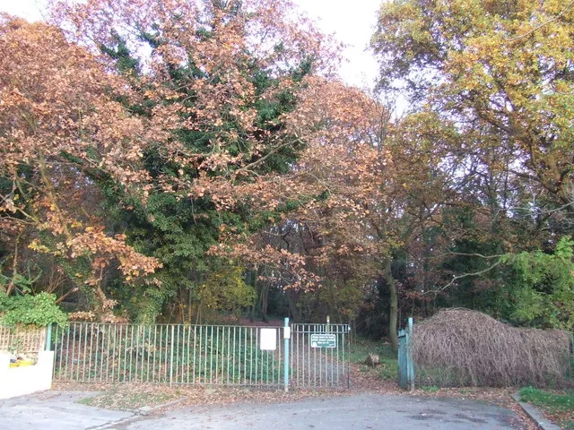
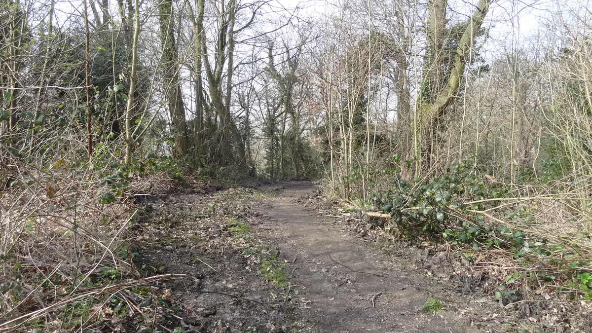
Cuddington Meadows — nature reserve in London.

Wikimedia Commons licence
Plan your visit
- Typical visit
- 2 h–4 h
- Best time of year
- Autumn & winter (migration & wildfowl)
- Nearest railway station
- Banstead · 0.6 km
- Free entry
- Dog-friendly
Getting there & planning your visit
Cuddington Meadows is located in Sutton, London, with the nearest railway station being Banstead, which is 0.6 km away. Entry to the wildlife reserve is free.
About
Cuddington Meadows is a wildlife reserve in the United Kingdom. Wikidata describes it as: "nature reserve in London". Coordinates: 51.3348°, -0.2135°.
Photo gallery
Protected designations
- Site of Special Scientific Interest: Banstead Downs SSSI
Designations sourced from Natural England open data under OGL v3.
From the Wikipedia article
Cuddington Meadows is a 1.4-hectare (3.5-acre) Local Nature Reserve and Site of Borough Importance for Nature Conservation, Grade I, in Belmont in the London Borough of Sutton. It is owned by Sutton Council and managed by the council together with Sutton Nature Conservation Volunteers. The site was shown as two enclosures on the open Banstead Downs on an early nineteenth-century map, and it was later part of Walnut Tree Farm, which became Cuddington Hospital in 1897. The hospital closed in 1984, and in the late 1990s the land was transferred to Sutton Council to be managed for nature conservation. It is mainly chalk grassland with some scrub. Its most important feature is a variety of unusual flowering plants, including greater knapweed, lady's bedstraw and field scabious. Sixteen species of butterflies have been recorded, such as the rare small blue and green hairstreak. There is access from Cuddington Park Close.
Excerpt from Wikipedia under CC BY-SA 4.0. See the source article linked in Sources below.
- Coordinates
- 51.3348, -0.2135
- District
- Sutton
- Parish
- Sutton, unparished area
- Postcode
- SM7 1RF
- Parliamentary constituency
- Sutton and Cheam
- Nearest railway station
- Banstead — 0.6 km
Sources
- wikidata: Q16890783 (CC0)
- wikipedia: Cuddington Meadows (CC BY-SA 4.0)
Other places nearby

Banstead Downs
Forests & woodlands · 0.8 km

Cheam War Memorial
Memorials & monuments · 1.1 km

Belmont War Memorial
Memorials & monuments · 1.3 km

Banstead Preparatory School
Natural landmarks · 1.4 km

Cheam
Chapels · 1.5 km

Priory Preparatory School
Abbeys & priories · 1.5 km
Banstead
Museums · 1.6 km

Belmont Pastures
Wildlife reserves · 1.6 km

The Pastures
Forests & woodlands · 1.7 km

War Memorial, Church of All Saints, Banstead
Memorials & monuments · 1.7 km

Banstead War Memorial
Memorials & monuments · 1.7 km

Shanklin Village
Chapels · 1.9 km
Nearby
📷 5Forests & woodlands · London
Banstead Downs
Banstead Downs is a forest or woodland in the United Kingdom.
📷 5Memorials & monuments · London
Cheam War Memorial
Cheam War Memorial — Grade II listed building-listed memorial in england-london, United Kingdom.
📷 5Memorials & monuments · London
Belmont War Memorial
Belmont War Memorial is a memorial in the United Kingdom.
📷 5Natural landmarks · London
Banstead Preparatory School
Banstead Preparatory School — a school heritage in england-london, United Kingdom.
📷 5Chapels · London
Cheam
Cheam — a methodist chapel in england-london, United Kingdom.
📷 5Abbeys & priories · London
Priory Preparatory School
Priory Preparatory School — a school heritage in england-london, United Kingdom.
Where to eat & stay near Cuddington Meadows
Places to stay
 📷 5
📷 5Hotels · London
ibis London Sutton Point
ibis London Sutton Point — a hotel in england london.
 📷 5
📷 5Campsites · London
Banstead & District Scout Campsite
Banstead & District Scout Campsite — a campsite in england london.
 📷 7
📷 7Hotels · London
London Croydon Aerodrome Hotel, BW Signature Collection
London Croydon Aerodrome Hotel, BW Signature Collection — a hotel in england london. 4-star. Brand: Best Western.
 📷 5
📷 5 📷 5
📷 5Campsites · London
1st Malden Scout Group Grounds
1st Malden Scout Group Grounds — a campsite in england london.
 📷 5
📷 5Campsites · London
Girl Guides Marion Hill House Group Grounds
Girl Guides Marion Hill House Group Grounds — a campsite in england london.
Places to eat & drink
 📷 5
📷 5Historic pubs · London
26 And 28, High Street
26 And 28, High Street in England London, United Kingdom.
 📷 5
📷 5Historic pubs · London
The Old Kings Head Public House
The Old Kings Head Public House in England London, United Kingdom.
 📷 5
📷 5Historic pubs · London
The Wellington Public House
The Wellington Public House in England London, United Kingdom.
 📷 5📷 5
Historic pubs · London
Marquis Of Granby Public House
Marquis Of Granby Public House in England London, United Kingdom.
 📷 5
📷 5Historic pubs · London
The Cricketers Public House
The Cricketers Public House in England London, United Kingdom.
More places in this region
 Flagship📷 10
Wildlife reserves · London
Bedfords Park
Bedfords Park — Havering London Borough green landscape, also an Essex Wildlife Trust Nature reserve.
 Flagship📷 10
 Flagship📷 10
Wildlife reserves · London
Bramley Bank
Bramley Bank — Nature reserve in Upper Shirley.
 Flagship📷 10
Wildlife reserves · London
Chafford Gorges Nature Park
Chafford Gorges Nature Park — Essex Wildlife Trust Nature reserve.
Frequently asked questions
- Where is Cuddington Meadows?
- Cuddington Meadows is in London, United Kingdom (postcode SM7 1RF), in the parish of Sutton, unparished area.
- What is Cuddington Meadows?
- Cuddington Meadows — nature reserve in London.
- How do I get to Cuddington Meadows?
- The nearest railway station is Banstead, about 0.6 km away. The nearest town is Netherne-on-the-Hill. Drivers can use postcode SM7 1RF.
- Is Cuddington Meadows a protected site?
- Yes — Cuddington Meadows is part of the Banstead Downs SSSI Site of Special Scientific Interest.
- Is Cuddington Meadows free to visit?
- Yes, Cuddington Meadows is free to enter.
- How do I get to Cuddington Meadows?
- The nearest railway station is Banstead, about 0.6 km away. Drivers can navigate to postcode SM7 1RF.
- Are dogs allowed at Cuddington Meadows?
- Most wildlife reserves allow dogs on lead only, with restrictions during ground-nesting bird season (March-July). Check signage at the reserve.