
Archaeological sites · South East England
Cowleaze Wood
In or near Ibstone.
Cowleaze Wood — woodland in the Chiltern Hills of South East England.

Wikimedia Commons contributors — see linked file page for photographer and licence licence

Plan your visit
- Typical visit
- 45 min–1.5 h
- Nearest railway station
- Chinnor · 5.5 km
- Free entry
- Dog-friendly
Getting there & planning your visit
Cowleaze Wood is located in South Oxfordshire, with the nearest railway station being Chinnor, which is 5.5 km away. Entry is free, and the postcode for sat-nav is HP14 3YL.
About
Cowleaze Wood is an archaeological site in the United Kingdom. Wikidata describes it as: "woodland in the Chiltern Hills of South East England". Coordinates: 51.6550°, -0.9450°.
Photo gallery
Protected designations
- Site of Special Scientific Interest: Aston Rowant SSSI
- Site of Special Scientific Interest: Wormsley Chalk Banks SSSI
- National Nature Reserve: ASTON ROWANT
- Area of Outstanding Natural Beauty: Chilterns
Designations sourced from Natural England open data under OGL v3.
From the Wikipedia article
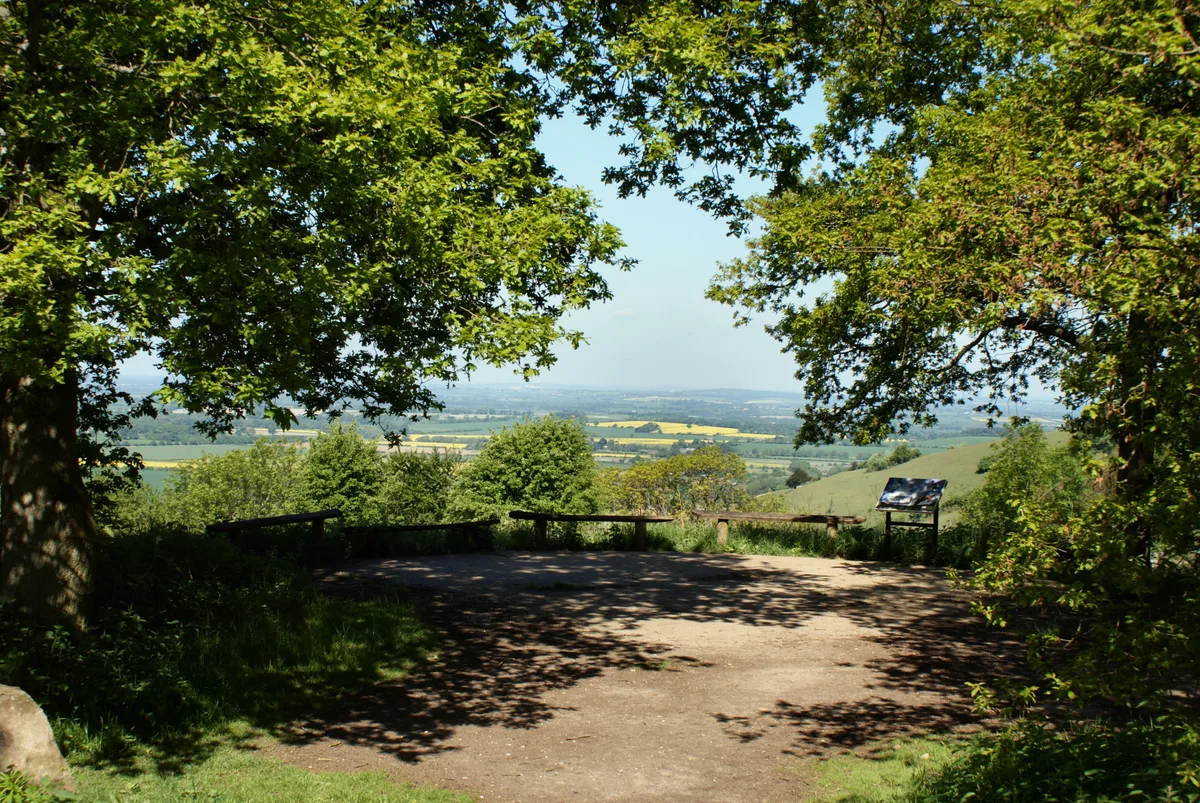
Cowleaze Wood is a 70-acre (28 ha) woodland in the Chiltern Hills, a chalk ridge in South East England. The wood is in the civil parish of Lewknor, in Oxfordshire, about 1+1⁄4 miles (2 km) southeast of the village. It is next to the county boundary with Buckinghamshire, and adjoins Lydall's Wood on the Buckinghamshire side of the boundary. The Forestry Commission owns Coweleaze Wood, and planted it between 1957 and 1966. It is particularly known for its bluebells, and walkers are also attracted to the wood by sightings of red kites. There is a large car park adjoining the wood, and a picnic area with sculptured benches designed by furniture designer Fred Baier.
Excerpt from Wikipedia under CC BY-SA 4.0. See the source article linked in Sources below.
- Coordinates
- 51.6550, -0.9450
- County
- Oxfordshire
- District
- South Oxfordshire
- Parish
- Lewknor
- Postcode
- HP14 3YL
- Parliamentary constituency
- Henley and Thame
- Nearest railway station
- Chinnor — 5.5 km
Sources
- wikidata: Q5179739 (CC0)
- wikipedia: Cowleaze Wood (CC BY-SA 4.0)
- commons: Ride, in Cowleaze Wood - geograph.org.uk - 1439839.jpg (CC BY-SA 4.0)
Other places nearby

LW579 51 Squadron memorial
Memorials & monuments · 0.2 km

Bald Hill
Mountains & hills · 0.3 km

Stokenchurch Gap
Natural landmarks · 0.9 km

Bald Hill
Mountains & hills · 0.9 km

Aston Rowant Nature Reserve
Forests & woodlands · 0.9 km

Beacon Hill
Mountains & hills · 1.2 km
Aston Rowant NNR
Wildlife reserves · 1.2 km

Garsington Opera
Theatres · 1.5 km

Garsington Opera
Open-air theatres · 1.5 km

The Knapp
Mountains & hills · 2.0 km

Lewknor
Villages · 2.4 km

Church of St Margaret, Lewknor
Historic churches · 2.5 km
Nearby
📷 3Memorials & monuments · South East England
LW579 51 Squadron memorial
LW579 51 Squadron memorial — a memorial in South East England, United Kingdom.
📷 5Mountains & hills · South East England
Bald Hill
Bald Hill — a hill or mountain in england west midlands.
📷 5Natural landmarks · South East England
Stokenchurch Gap
Stokenchurch Gap — natural landmark in england west midlands.
📷 5Mountains & hills · South East England
Bald Hill
Bald Hill — mountain in england west midlands. Elevation: 257 m.
📷 5Forests & woodlands · South East England
Aston Rowant Nature Reserve
Aston Rowant Nature Reserve is a forest or woodland in the United Kingdom.
📷 5Mountains & hills · South East England
Beacon Hill
Beacon Hill — mountain in england west midlands. Elevation: 253 m.
Where to eat & stay near Cowleaze Wood
Places to stay
 📷 5
📷 5Campsites · South East England
Cholsey Grange CARAVAN Certificated Location
Cholsey Grange CARAVAN Certificated Location — a campsite in england west midlands.
 📷 5
📷 5Campsites · South East England
White Mark Farm Camp Site
White Mark Farm Camp Site — a campsite in england west midlands.
 📷 5
📷 5 📷 5
📷 5Caravan parks · South East England
Little Acre CL
Little Acre CL — a caravan park in england west midlands.
 📷 5
📷 5Campsites · South East England
Chiltern Retreat, Woodland Camping
Chiltern Retreat, Woodland Camping — a campsite in england west midlands.
 📷 5
📷 5Campsites · South East England
Chiltern Retreat, Park Field Camping
Chiltern Retreat, Park Field Camping — a campsite in england south east.
Places to eat & drink
📷 5Historic pubs · South East England
Ye Olde Leathern Bottle Public House
Ye Olde Leathern Bottle Public House in England South East, United Kingdom.
 📷 7
📷 7Historic pubs · South East England
Fox And Hounds Inn Public House
Fox And Hounds Inn Public House in England South East, United Kingdom.
 📷 5
📷 5Historic pubs · South East England
Fox And Hounds Hotel And Public House
Fox And Hounds Hotel And Public House in England South East, United Kingdom.
 📷 5
📷 5Historic pubs · South East England
Sir Charles Napier Inn
Sir Charles Napier Inn in England South East, United Kingdom.
 📷 5
📷 5Historic pubs · South East England
England's Rose
England's Rose in England South East, United Kingdom.
 📷 5
📷 5Historic pubs · South East England
The Bull And Butcher
The Bull And Butcher in England South East, United Kingdom.
More archaeological sites in this region
 📷 5
📷 5Archaeological sites · South East England
Chatham Dockyard, site of South Mast Pond
Chatham Dockyard, site of South Mast Pond — archaeological site in Medway, Kent, England, UK.
 📷 5
📷 5Archaeological sites · South East England
Open areas within Roman, Saxon and medieval town
Open areas within Roman, Saxon and medieval town — archaeological site in Medway, Kent, England, UK.
 📷 5
📷 5Archaeological sites · South East England
Oxmoor Copse
Oxmoor Copse — woodland in Surrey, England.
 📷 5
📷 5Frequently asked questions
- Where is Cowleaze Wood?
- Cowleaze Wood is in Oxfordshire, South-East England, United Kingdom (postcode HP14 3YL), in the parish of Lewknor.
- What is Cowleaze Wood?
- Cowleaze Wood — woodland in the Chiltern Hills of South East England.
- How do I get to Cowleaze Wood?
- The nearest railway station is Chinnor, about 5.5 km away. The nearest town is Ibstone. Drivers can use postcode HP14 3YL.
- Who owns Cowleaze Wood?
- Cowleaze Wood is owned by Forestry Commission.
- Is Cowleaze Wood a protected site?
- Yes — Cowleaze Wood is part of the Aston Rowant SSSI Site of Special Scientific Interest and the Wormsley Chalk Banks SSSI Site of Special Scientific Interest.
- Is Cowleaze Wood free to visit?
- Yes, Cowleaze Wood is free to enter.
- How do I get to Cowleaze Wood?
- The nearest railway station is Chinnor, about 5.5 km away. Drivers can navigate to postcode HP14 3YL.