Mountains & hills · West Midlands
The Knapp
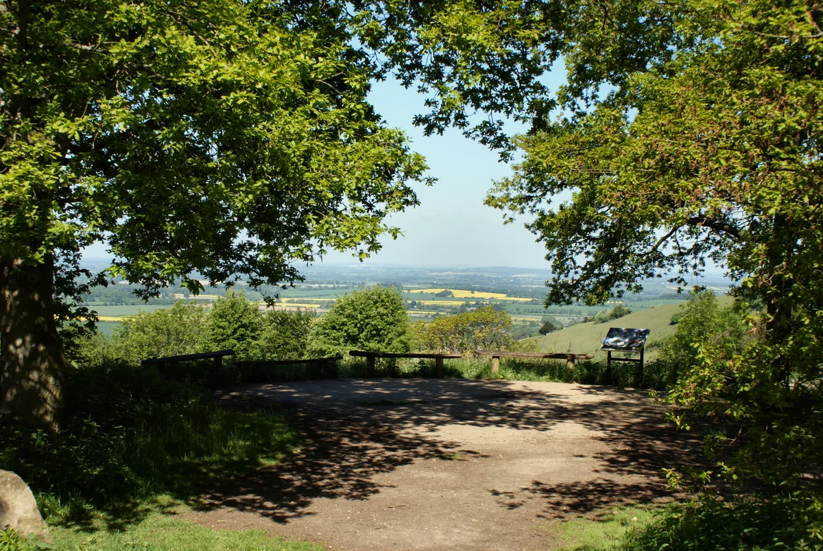
The Knapp — mountain in england west midlands. Elevation: 155 m.

David Howard — CC BY-SA 2.0 via Wikimedia Commons licence
Plan your visit
- Typical visit
- 3 h–8 h
- Best time of year
- Late spring – early autumn (May–Oct)
About
The Knapp is a mountain located in england west midlands. Elevation: 155 m. A named British peak recorded in OpenStreetMap. Peaks are typically named on Ordnance Survey 1:50k mapping.
Photo gallery
Place summary
The Knapp is a mountain located in the West Midlands. It offers a range of outdoor activities for visitors, including walking and exploring the natural landscape. The area is known for its scenic views and diverse wildlife, making it suitable for both casual walkers and more experienced hikers. The Knapp provides a tranquil setting for those looking to enjoy the outdoors.
AI-generated from the structured facts on this page (operator, designation, listing, era). Not a substitute for visiting.
- Coordinates
- 51.6683, -0.9656
Sources
- osm: n3111699071 (ODbL)
Other places nearby
Loading nearby places…
Nearby
 📷 5
📷 5Villages · West Midlands
Lewknor
Lewknor — a village in england west midlands.
 📷 3
📷 3Historic churches · West Midlands
Church of St Margaret, Lewknor
Church of St Margaret, Lewknor — Grade I listed building-listed church in england-west-midlands, United Kingdom.
 📷 5
📷 5Wildlife reserves · West Midlands
Aston Rowant NNR
Aston Rowant NNR — area in the Chiltern Hills, England.
 📷 5
📷 5Forests & woodlands · West Midlands
Aston Rowant Nature Reserve
Aston Rowant Nature Reserve is a forest or woodland in the United Kingdom.
 📷 5
📷 5Natural landmarks · West Midlands
Stokenchurch Gap
Stokenchurch Gap — natural landmark in england west midlands.
 📷 5
📷 5Mountains & hills · West Midlands
Bald Hill
Bald Hill — a hill or mountain in england west midlands.
Where to eat & stay near The Knapp
Places to stay
 📷 5
📷 5Campsites · West Midlands
White Mark Farm Camp Site
White Mark Farm Camp Site — a campsite in england west midlands.
 📷 5
📷 5Campsites · West Midlands
Cholsey Grange CARAVAN Certificated Location
Cholsey Grange CARAVAN Certificated Location — a campsite in england west midlands.
 📷 5
📷 5Caravan parks · West Midlands
Little Acre CL
Little Acre CL — a caravan park in england west midlands.
 📷 5
📷 5Campsites · West Midlands
Home Farm
Home Farm — a campsite in england west midlands.
 📷 5
📷 5Hotels · West Midlands
Oxfordshire Golf Club
Oxfordshire Golf Club — a hotel in england west midlands.
 📷 5
📷 5Hotels · West Midlands
The Spread Eagle
The Spread Eagle — a hotel in england west midlands.
Places to eat & drink
 📷 5
📷 5Restaurants · West Midlands
The Swan
The Swan — a restaurant in england west midlands.
 📷 5
📷 5Restaurants · West Midlands
Radhuni
Radhuni — a restaurant in england west midlands.
 📷 5
📷 5Restaurants · West Midlands
The Angel Restaurant
The Angel Restaurant — a restaurant in england west midlands.
 📷 3
📷 3Historic pubs · West Midlands
The Coach & Horses
The Coach & Horses — Historic pub — listed building or notable heritage status.
 📷 5
📷 5Restaurants · West Midlands
Coco Tamarind
Coco Tamarind — a restaurant in england west midlands.
 📷 3
📷 3Historic pubs · West Midlands
Town Arms
Town Arms — Historic pub — listed building or notable heritage status.
More mountains in this region
 📷 5
📷 5Mountains & hills · West Midlands
Arbury Hill
Arbury Hill — Named summit at 224.3 m.
Mountains & hills · West Midlands
Barr Beacon
Barr Beacon — Named summit at 227 m.
 📷 3
📷 3Mountains & hills · West Midlands
Barrow Hill
Barrow Hill — Named summit at 179 m.
Mountains & hills · West Midlands
Beacon Hill
Beacon Hill — Named summit at 237 m.
Frequently asked questions
- Where is The Knapp?
- The Knapp is in the West Midlands, United Kingdom.
- What is The Knapp?
- The Knapp — mountain in england west midlands. Elevation: 155 m.
- How do I get to The Knapp?
- Its coordinates are 51.6683°, -0.9656°.