
Mountains & hills · South East England
Colwell Bay
In or near Brook.
Colwell Bay — Isle of Wight, England.

Wikimedia Commons contributors — see linked file page for photographer and licence licence

Plan your visit
- Typical visit
- 3 h–8 h
- Best time of year
- Late spring – early autumn (May–Oct)
- Nearest railway station
- Lymington Pier · 8.2 km
- Free entry
- Dog-friendly
Getting there & planning your visit
Colwell Bay is located in the Isle of Wight, with the nearest railway station being Lymington Pier, approximately 8.2 km away. Entry to the bay is free. The postcode for Colwell Bay is PO39 0BE.
About
Colwell Bay is a named summit in the United Kingdom. Heritage designation: Site of Special Scientific Interest. Part of English Channel. Wikidata describes it as: "Isle of Wight, England". Coordinates: 50.6845°, -1.5442°.
Photo gallery
See it from the streetimagery from 2019
Imagery © Mapillary contributors, CC BY-SA 4.0
Protected designations
- Area of Outstanding Natural Beauty: Isle Of Wight
Designations sourced from Natural England open data under OGL v3.
From the Wikipedia article
Colwell Bay (grid reference SZ323873) is a bay in the west of the Isle of Wight. It is located between the towns of Totland and Yarmouth. The bay's northernmost point is Cliff's End (Fort Albert) the closest point of the Island to the British mainland, with Hurst Castle situated at the end of a long peninsula just under a mile (1500 metres) to the northwest. The bay's southern boundary is marked by Warden Point. Colwell Bay has a popular beach, with two miles of sand and shingle, and facilities including cafes, shops and equipment hire outlets. An area of 33.5 acres (13.56 ha) has been notified as a geological Site of Special Scientific Interest, notification originally taking place in 1959. The site is significant for its Eocene geology and maritime vegetated soft cliff habitat. It is the location of three chines: Colwell Chine, Brambles Chine and Linstone Chine. Colwell Bay is on the A3054 road and near the western end of the A3055 road. Public transport to the area is provided by Southern Vectis route 7 and the Needles Tour.
Excerpt from Wikipedia under CC BY-SA 4.0. See the source article linked in Sources below.
- Coordinates
- 50.6845, -1.5442
- District
- Isle of Wight
- Parish
- Totland
- Postcode
- PO39 0BE
- Parliamentary constituency
- Isle of Wight West
- Nearest railway station
- Lymington Pier — 8.2 km
Sources
- wikidata: Q5150322 (CC0)
- wikipedia: Colwell Bay (CC BY-SA 4.0)
- commons: Colwell Bay.jpg (CC BY-SA 4.0)
Other places nearby

Fort Ruins
Forts · 0.3 km

Fort Ruins
Forts · 0.4 km
Fort Ruins
Forts · 0.4 km
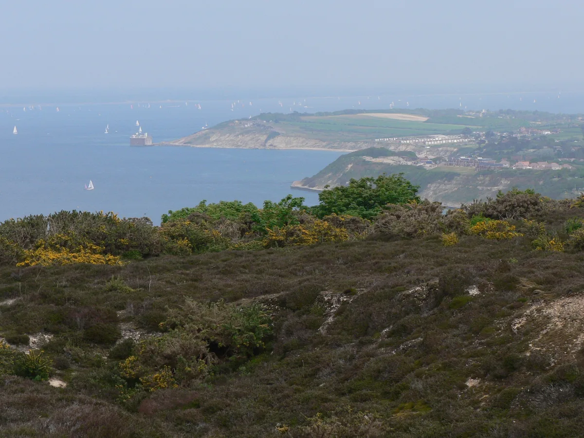
Totland Bay
Mountains & hills · 0.7 km

YHA Totland Bay
Hostels · 0.8 km

Totland Bay War Memorial
Memorials & monuments · 0.9 km
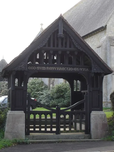
Christ Church, Totland
Historic churches · 0.9 km

West Wight Heritage Centre
Museums · 1.1 km

Lacey's Farm Quarry
Quarries · 1.1 km
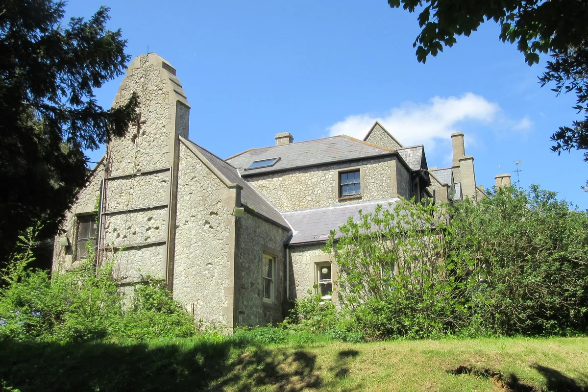
Weston Manor
Stately homes · 1.2 km

Stoats Farm
Caravan parks · 1.2 km

Heathfield Farm Camp Site
Campsites · 1.2 km
Nearby
📷 5📷 5📷 5📷 5📷 5📷 5Memorials & monuments · South East England
Totland Bay War Memorial
Totland Bay War Memorial — Grade II listed building-listed memorial in england-south-east, United Kingdom.
Where to eat & stay near Colwell Bay
Places to stay
📷 5📷 5📷 5Campsites · South East England
Heathfield Farm Camp Site
Heathfield Farm Camp Site — a campsite in england south east.
 📷 5
📷 5Hotels · South East England
Farringford House
Farringford House — a hotel in england south east.
 📷 7
📷 7 📷 7
📷 7Hotels · South East England
The George Hotel
The George Hotel — a hotel in england south east.
Places to eat & drink
 📷 7
📷 7 📷 5
📷 5Historic pubs · South East England
The Beach House
The Beach House in England South East, United Kingdom.
 📷 7
📷 7 📷 7
📷 7 📷 7
📷 7Historic pubs · South East England
Walhampton Arms, formerly farm building range at Home Farm
Walhampton Arms, formerly farm building range at Home Farm in England South East, United Kingdom.
 📷 7
📷 7Historic pubs · South East England
The Hobler Public House
The Hobler Public House in England South East, United Kingdom.
More mountains in this region
 📷 5
📷 5 📷 5
📷 5Mountains & hills · South East England
Reigate Caves
Reigate Caves is a mountain or hill in the United Kingdom.
 📷 5
📷 5Mountains & hills · South East England
North Downs
North Downs — a hill or mountain in england london.
 📷 5
📷 5Mountains & hills · South East England
Blue Bell Hill
Blue Bell Hill — a hill or mountain in england london.
Frequently asked questions
- Where is Colwell Bay?
- Colwell Bay is in South-East England, United Kingdom (postcode PO39 0BE), in the parish of Totland.
- What is Colwell Bay?
- Colwell Bay — Isle of Wight, England.
- How do I get to Colwell Bay?
- The nearest railway station is Lymington Pier, about 8.2 km away. Drivers can use postcode PO39 0BE.
- Is Colwell Bay a listed building?
- Colwell Bay is officially recognised as Site of Special Scientific Interest listed.
- Is Colwell Bay a protected site?
- Yes — Colwell Bay is part of the Isle Of Wight National Landscape (AONB).
- Is Colwell Bay free to visit?
- Yes, Colwell Bay is free to enter.
- How do I get to Colwell Bay?
- Drivers can navigate to postcode PO39 0BE. It sits within the Isle of Wight West parliamentary constituency.