
Forests & woodlands · East of England
Cley Marshes
In or near Blakeney.
Cley Marshes is a forest or woodland in the United Kingdom.

Wikimedia Commons contributors — see linked file page for photographer and licence licence

Plan your visit
- Typical visit
- 1 h–3 h
- Nearest railway station
- Kelling Heath Park · 6.1 km
- Free entry
- Family-friendly
- Dog-friendly
Getting there & planning your visit
Cley Marshes is located in North Norfolk, postcode NR25 7SA. The nearest railway station is Kelling Heath Park, which is 6.1 km away. Entry to Cley Marshes is free.
About
Cley Marshes is a named forest, woodland or nature reserve in the United Kingdom. Records date its origin to 1926. Coordinates: 52.9599°, 1.0588°.
Photo gallery
Official information
Cley Marshes is a nature reserve known for its wide open marshes and diverse birdlife. Visitors can enjoy scenic views, explore the habitats, and participate in guided walks to learn more about the local wildlife.
Protected designations
- Site of Special Scientific Interest: North Norfolk Coast SSSI
- Area of Outstanding Natural Beauty: Norfolk Coast
- Ramsar wetland: North Norfolk Coast
Designations sourced from Natural England open data under OGL v3.
From the Wikipedia article
Cley Marshes is a 176-hectare (430-acre) nature reserve on the North Sea coast of England just outside the village of Cley next the Sea, Norfolk. A reserve since 1926, it is the oldest of the reserves belonging to the Norfolk Wildlife Trust (NWT), which is itself the oldest county Wildlife Trust in the United Kingdom. Cley Marshes protects an area of reed beds, freshwater marsh, pools and wet meadows and is part of the North Norfolk Coast Site of Special Scientific Interest (SSSI), Special Area of Conservation (SAC), Special Protection Area (SPA), and Ramsar Site due to the large numbers of birds it attracts. The reserve is important for some scarce breeding species, such as pied avocets on the islands, and western marsh harriers, Eurasian bitterns and bearded reedlings in the reeds, and is also a major migration stopoff and wintering site. There are also several nationally or locally scarce invertebrates and plants specialised for this coastal habitat. It has five bird hides and an environmentally friendly visitor centre and further expansion is planned through the acquisition of neighbouring land and improvements to visitor facilities. The site has a long history of human occupation, from prehistoric farming to its use as a prisoner of war camp in the Second World War. The reserve attracts large numbers of visitors, contributing significantly to the economy of Cley village. Despite centuries of embankment to reclaim land and protect the village, the marshes have been flooded many times, and the southward march of the coastal shingle bank and encroachment by the sea make it inevitable that the reserve will eventually be lost. New wetlands are being created further inland to compensate for the loss of coastal habitats.
Excerpt from Wikipedia under CC BY-SA 4.0. See the source article linked in Sources below.
Background
Visiting
The reserve is to the north of the A149 coast road just east of the village of Cley next the Sea, 6 km (3.7 mi) north of Holt. The visitor centre and car park are to the south of the road, opposite the reserve. The reserve can be reached by public transport using the bus service that stops outside the visitor centre. The reserve is viewable from the visitor centre, footpaths next to the A149 and down the East Bank, the beach and the road running from the beach back to the main road. It can be accessed by footpaths at three points, each leading to one or more bird hides. Beach Road and the beach itself form part of the Peddars Way long distance footpath. The present visitor centre, which…
Sourced from Wikipedia under CC BY-SA 4.0.
- Coordinates
- 52.9599, 1.0588
- County
- Norfolk
- District
- North Norfolk
- Parish
- Cley Next The Sea
- Postcode
- NR25 7SA
- Parliamentary constituency
- North Norfolk
- Established
- 1926
- Nearest railway station
- Kelling Heath Park — 6.1 km
- Official site
- www.norfolkwildlifetrust.org.uk
Sources
- osm: w160670925 (ODbL)
- wikipedia: Cley Marshes (CC BY-SA 4.0)
- commons: Cley Marshes Nature Reserve - geograph.org.uk - 1405631.jpg (CC BY-SA 4.0)
Other places nearby
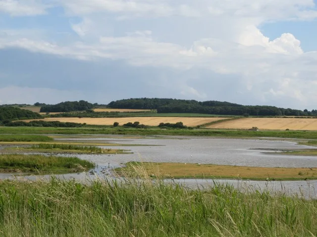
Cley Marshes
Wildlife reserves · 0.2 km

Vera
Museums · 0.8 km

Cley Windmill
Windmills · 1.2 km

Blakeney Chapel
Chapels · 1.3 km

Whaleborne House
Historic houses · 1.3 km

Rectory Hill
Campsites · 1.5 km

Cley next the Sea
Villages · 1.6 km
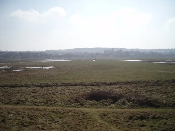
Salthouse Marshes
Wildlife reserves · 1.6 km
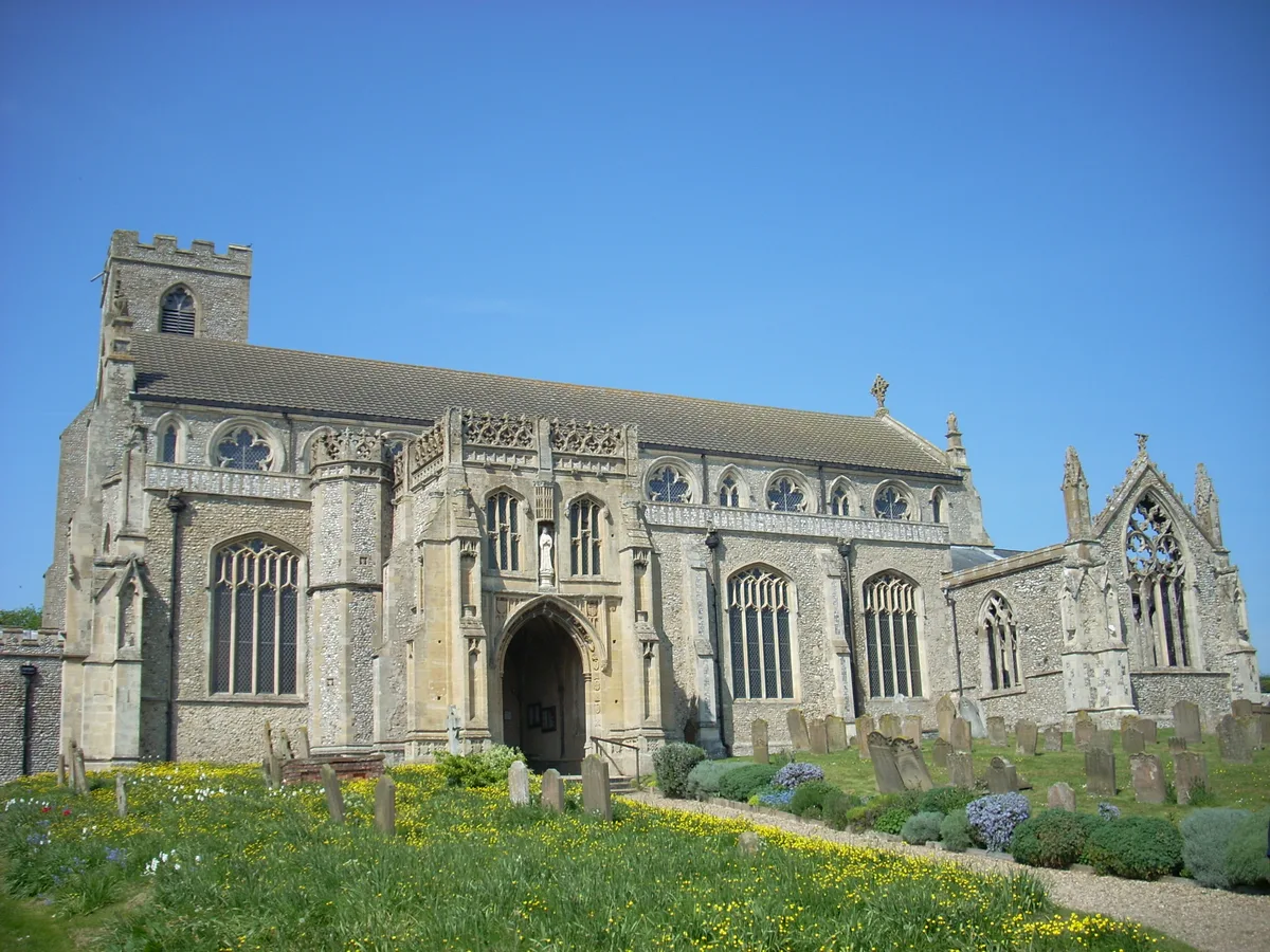
St Margaret's, Cley
Historic churches · 1.7 km

The Sheiling
Caravan parks · 1.8 km

Salthouse
Villages · 2.1 km

Wiveton War Memorial
Memorials & monuments · 2.2 km
Nearby
Flagship📷 5Wildlife reserves · East of England
Cley Marshes
Cley Marshes — nature reserve on the North Sea coast of England.
📷 5📷 3📷 3Chapels · East of England
Blakeney Chapel
Blakeney Chapel — Ruined building on the North Norfolk coast of England.
📷 3Historic houses · East of England
Whaleborne House
Whaleborne House — house in Cley Next the Sea, North Norfolk, England, UK.
📷 5Where to eat & stay near Cley Marshes
Places to stay
📷 5📷 5 📷 5
📷 5Caravan parks · East of England
Friary Farm Caravan Park
Friary Farm Caravan Park — a caravan park in england east midlands.
 📷 5
📷 5 📷 5
📷 5 📷 5
📷 5Places to eat & drink
 📷 5
📷 5Historic pubs · East of England
White Horse Public House
White Horse Public House in England East, United Kingdom.
 📷 5
📷 5 📷 5
📷 5Historic pubs · East of England
The Bluebell
The Bluebell in England East, United Kingdom.
 📷 5
📷 5 📷 5
📷 5Historic pubs · East of England
Oxford Stores Public House
Oxford Stores Public House in England East, United Kingdom.
 📷 5
📷 5Historic pubs · East of England
The White Horse Public House
The White Horse Public House in England East, United Kingdom.
Other forests from this era
 📷 5
📷 5 📷 5
📷 5Forests & woodlands · London
The London Wetland Centre
The London Wetland Centre is a forest or woodland in the United Kingdom.
_by_Peter_Laszlo_Peri.jpg?width=1200) 📷 5
📷 5Forests & woodlands · London
The Preacher
The Preacher — Public artwork (statue) by Peter Lazslo Peri.
.jpg?width=1200) 📷 5
📷 5Forests & woodlands · South East England
Bisham Woods
Bisham Woods is a forest or woodland in the United Kingdom.
More forests in this region
 📷 5
📷 5Forests & woodlands · East of England
Adams Road Bird Sanctuary
Adams Road Bird Sanctuary is a forest or woodland in the United Kingdom.
 📷 5
📷 5Forests & woodlands · East of England
Arthur's Meadow NR
Arthur's Meadow NR is a forest or woodland in the United Kingdom.
 📷 5
📷 5Forests & woodlands · East of England
Ashwell Quarry & Quarry Springs
Ashwell Quarry & Quarry Springs is a forest or woodland in the United Kingdom.
 📷 5
📷 5Forests & woodlands · East of England
Ashwell Springs
Ashwell Springs is a forest or woodland in the United Kingdom.
Frequently asked questions
- Where is Cley Marshes?
- Cley Marshes is in Norfolk, East of England, United Kingdom (postcode NR25 7SA), in the parish of Cley Next The Sea.
- What is Cley Marshes?
- Cley Marshes is a forest or woodland in the United Kingdom.
- How do I get to Cley Marshes?
- The nearest railway station is Kelling Heath Park, about 6.1 km away. The nearest town is Blakeney. Drivers can use postcode NR25 7SA.
- When was Cley Marshes built?
- Built or established in 1926.
- Is Cley Marshes a protected site?
- Yes — Cley Marshes is part of the North Norfolk Coast SSSI Site of Special Scientific Interest and the Norfolk Coast National Landscape (AONB).
- Is Cley Marshes free to visit?
- Yes, Cley Marshes is free to enter.
- How do I get to Cley Marshes?
- The nearest railway station is Kelling Heath Park, about 6.1 km away. Drivers can navigate to postcode NR25 7SA.