
Historic churches · East Midlands
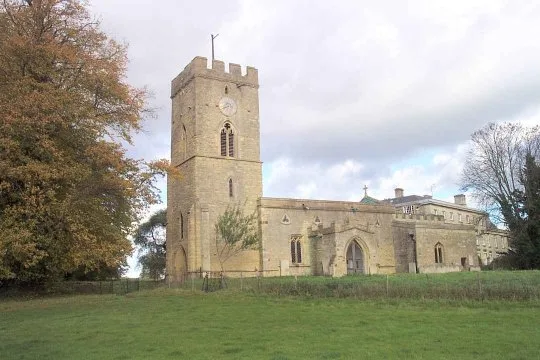
Church of St James
In or near Woodford.
Church of St James — church in Grafton Underwood, Northamptonshire, England, UK.

Wikimedia Commons contributors — see linked file page for photographer and licence licence

Plan your visit
- Typical visit
- 30 min–1 h
- Nearest railway station
- Wicksteed Park · 5.2 km
- Free entry
About
Church of St James is a historic church in the United Kingdom. Heritage designation: Grade I listed building. Affiliated with Anglicanism. Wikidata describes it as: "church in Grafton Underwood, Northamptonshire, England, UK". Coordinates: 52.4123°, -0.6459°.
Photo gallery
Protected designations
- Site of Special Scientific Interest: Upper Nene Valley Gravel Pits SSSI
Designations sourced from Natural England open data under OGL v3.
Place summary
The Church of St James is a Grade I listed building located in the West Midlands. It is part of the Upper Nene Valley Gravel Pits Site of Special Scientific Interest (SSSI).
AI-generated from the structured facts on this page (operator, designation, listing, era). Not a substitute for visiting.
- Coordinates
- 52.4123, -0.6459
- District
- North Northamptonshire
- Parish
- Grafton Underwood
- Postcode
- NN14 3AA
- Parliamentary constituency
- Kettering
- Nearest railway station
- Wicksteed Park — 5.2 km
Sources
- wikidata: Q17526940 (CC0)
- commons: St.James, Grafton Underwood, Northants - geograph.org.uk - 2165451.jpg (CC BY-SA 4.0)
Other places nearby

Bridge Circa 20 Metres West Of Number 40
Historic bridges · 0.1 km

Bridge Circa 20 Metres South West Of Number 33
Historic bridges · 0.2 km
Bridge Circa 10 Metres South East Of Grafton Park Farm Barn Range
Historic bridges · 0.2 km

Grafton Underwood
Villages · 0.2 km
Bridge Circa 10 Metres South East Of The Duke's Arms Farmhouse
Historic bridges · 0.3 km

Boughton House
Historic houses · 2.6 km

Church of St Edmund, Warkton
Historic churches · 2.9 km
St Andrew's Church, Cranford
Historic churches · 3.0 km

Stone Bridge Over River Ise
Historic bridges · 3.1 km

War Memorial Approximately 6 Metres South of Church of St John the Baptist
Memorials & monuments · 3.2 km

Twywell Hills and Dales
Forests & woodlands · 3.4 km
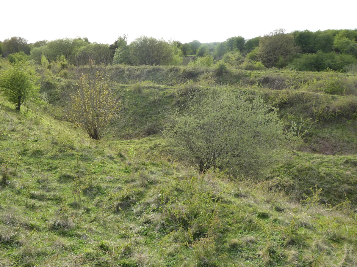
Twywell Hills and Dales
Wildlife reserves · 3.4 km
Nearby
📷 3Historic bridges · East Midlands
Bridge Circa 20 Metres West Of Number 40
Bridge Circa 20 Metres West Of Number 40 — Grade II listed building-listed bridge in england-west-midlands, United Kingdom.
📷 3Historic bridges · East Midlands
Bridge Circa 20 Metres South West Of Number 33
Bridge Circa 20 Metres South West Of Number 33 — Grade II listed building-listed bridge in england-west-midlands, United Kingdom.
📷 3Historic bridges · East Midlands
Bridge Circa 10 Metres South East Of Grafton Park Farm Barn Range
Bridge Circa 10 Metres South East Of Grafton Park Farm Barn Range — Grade II listed building-listed bridge in england-west-midlands, United Kingdom.
📷 5📷 3Historic bridges · East Midlands
Bridge Circa 10 Metres South East Of The Duke's Arms Farmhouse
Bridge Circa 10 Metres South East Of The Duke's Arms Farmhouse — Grade II listed building-listed bridge in england-west-midlands, United Kingdom.
📷 4Historic houses · East Midlands
Boughton House
Boughton House is a country house in the parish of Weekley in Northamptonshire, England, located about 3 miles (4.8 km) north-east of Kettering. It is situated within an estate of 11,000 acres (4,451.
Where to eat & stay near Church of St James
Places to stay
 📷 5
📷 5Campsites · East Midlands
Wicksteed Park Camping
Wicksteed Park Camping — a campsite in england west midlands.
 📷 5
📷 5 📷 5
📷 5Campsites · East of England
Wadenhoe Scout Campsite
Wadenhoe Scout Campsite — a campsite in england west midlands.
 📷 5
📷 5Hotels · East Midlands
The Saxon Crown
The Saxon Crown — a hotel in england west midlands.
 📷 5
📷 5Campsites · East Midlands
Brightside Caravan Park
Brightside Caravan Park — a campsite in england west midlands.
 📷 7
📷 7Hotels · East Midlands
Hampton by Hilton Corby/Kettering
Hampton by Hilton Corby/Kettering — a hotel in england west midlands. 4-star. Brand: Hampton.
Places to eat & drink
 📷 5
📷 5Historic pubs · East Midlands
The Snooty Fox
The Snooty Fox in England East, United Kingdom.
 📷 5
📷 5Historic pubs · East Midlands
Hare And Hounds Public House
Hare And Hounds Public House in England East, United Kingdom.
 📷 5
📷 5Historic pubs · East of England
Kings Arms Public House And Attached Outbuildings To Rear
Kings Arms Public House And Attached Outbuildings To Rear in England East, United Kingdom.
 📷 5
📷 5Historic pubs · East Midlands
The Spread Eagle Public House
The Spread Eagle Public House in England East Midlands, United Kingdom.
 📷 5
📷 5Historic pubs · East Midlands
67 and 69 High Street
67 and 69 High Street in England East, United Kingdom.
 📷 5
📷 5Historic pubs · East Midlands
Thornhill Arms Public House
Thornhill Arms Public House in England East Midlands, United Kingdom.
More places in this region
 📷 5
📷 5Historic churches · East Midlands
All Saints' Church, Stamford
All Saints' Church, Stamford — church in Stamford, Lincolnshire, England, UK.
 📷 5
📷 5Historic churches · East Midlands
Church of All Saints
Church of All Saints — church in Little Casterton, Rutland, United Kingdom.
 📷 5
📷 5Historic churches · East Midlands
Church of All Saints
Church of All Saints — church in Fenland, UK.
 📷 5
📷 5Historic churches · East Midlands
Church of St Leonard
Church of St Leonard — church in Fenland, UK.
Frequently asked questions
- Where is Church of St James?
- Church of St James is in the East Midlands, United Kingdom (postcode NN14 3AA), in the parish of Grafton Underwood.
- What is Church of St James?
- Church of St James — church in Grafton Underwood, Northamptonshire, England, UK.
- How do I get to Church of St James?
- The nearest railway station is Wicksteed Park, about 5.2 km away. The nearest town is Woodford. Drivers can use postcode NN14 3AA.
- Is Church of St James a listed building?
- Church of St James is officially recognised as Grade I listed building listed.
- Is Church of St James a protected site?
- Yes — Church of St James is part of the Upper Nene Valley Gravel Pits SSSI Site of Special Scientific Interest.
- Is Church of St James free to visit?
- Yes, Church of St James is free to enter.
- How do I get to Church of St James?
- The nearest railway station is Wicksteed Park, about 5.2 km away. Drivers can navigate to postcode NN14 3AA.