
Historic churches · East Midlands
St Andrew's Church, Cranford
In or near Woodford.
St Andrew's Church, Cranford — church in Northamptonshire, UK.

Wikimedia Commons contributors — see linked file page for photographer and licence licence

Plan your visit
- Typical visit
- 30 min–1 h
- Nearest railway station
- Wicksteed Park · 4.3 km
- Free entry
Getting there & planning your visit
To visit St Andrew's Church in Cranford, you can take a train to Wicksteed Park, which is approximately 4.3 km away. The postcode for the church is NN14 4AL. Entry to the church is free.
About
St Andrew's Church, Cranford is a historic church in the United Kingdom. Records date its origin to 1101. Built in the Norman architecture style. Constructed primarily of lead. Heritage designation: Grade II* listed building. Wikidata describes it as: "church in Northamptonshire, UK". Coordinates: 52.3857°, -0.6440°.
Photo gallery
Heritage listing
St Andrew's Church is a redundant Anglican church in Cranford St Andrew, Northamptonshire, England. It is recorded in the National Heritage List for England as a designated Grade II* listed building, and is under the care of the Churches Conservation Trust. The church stands in the park of Cranford Hall, to the southwest of the house.
From the Historic England List Entry under OGL v3.
Official information
St Andrew's Church in Cranford is a historic church that offers visitors a glimpse into its architectural and cultural significance. It serves as a place of worship and community gathering, showcasing traditional church features and local heritage.
Protected designations
- Site of Special Scientific Interest: Upper Nene Valley Gravel Pits SSSI
Designations sourced from Natural England open data under OGL v3.
From the Wikipedia article
St Andrew's Church is a redundant Anglican church in Cranford St Andrew, Northamptonshire, England. It is recorded in the National Heritage List for England as a designated Grade II* listed building, and is under the care of the Churches Conservation Trust. The church stands in the park of Cranford Hall, to the southwest of the house.
Excerpt from Wikipedia under CC BY-SA 4.0. See the source article linked in Sources below.
Background
History
St Andrew's dates from the later part of the 12th century, the nave arcade surviving from that time. The tower was added during the following century, at which time the church was largely rebuilt, and a north chapel was added. Further building took place in the 14th century when the clerestory and porch were added, and new windows were inserted. The south chapel was added in the following century. In 1674 the south chapel was refaced with ashlar. The church was vested in the Churches Conservation Trust on 1 December 1996.
Architecture
The arcade between the nave and the north aisle is Norman in style and consists of three bays. The arches are round-headed and are carried on cylindrical piers with plain capitals. There is a ring of four bells. Two of these were cast in 1624 by William Haulsey, the third was cast in 1683 by Tobias III Norris, and the fourth dates from 1718 and was cast by Thomas I Eayre. In the 1930s, when the church was still in use, its plate was described as including a cup from about 1570, a paten of 1813, and flagon of 1835.
Sourced from Wikipedia under CC BY-SA 4.0.
- Coordinates
- 52.3857, -0.6440
- District
- North Northamptonshire
- Parish
- Cranford
- Postcode
- NN14 4AL
- Parliamentary constituency
- Kettering
- Established
- 1101
- Nearest railway station
- Wicksteed Park — 4.3 km
- Official site
- www.visitchurches.org.uk
Sources
- wikidata: Q7592338 (CC0)
- wikipedia: St Andrew's Church, Cranford (CC BY-SA 4.0)
- commons: Cranford St. Andrew Church - geograph.org.uk - 119333.jpg (CC BY-SA 4.0)
Other places nearby
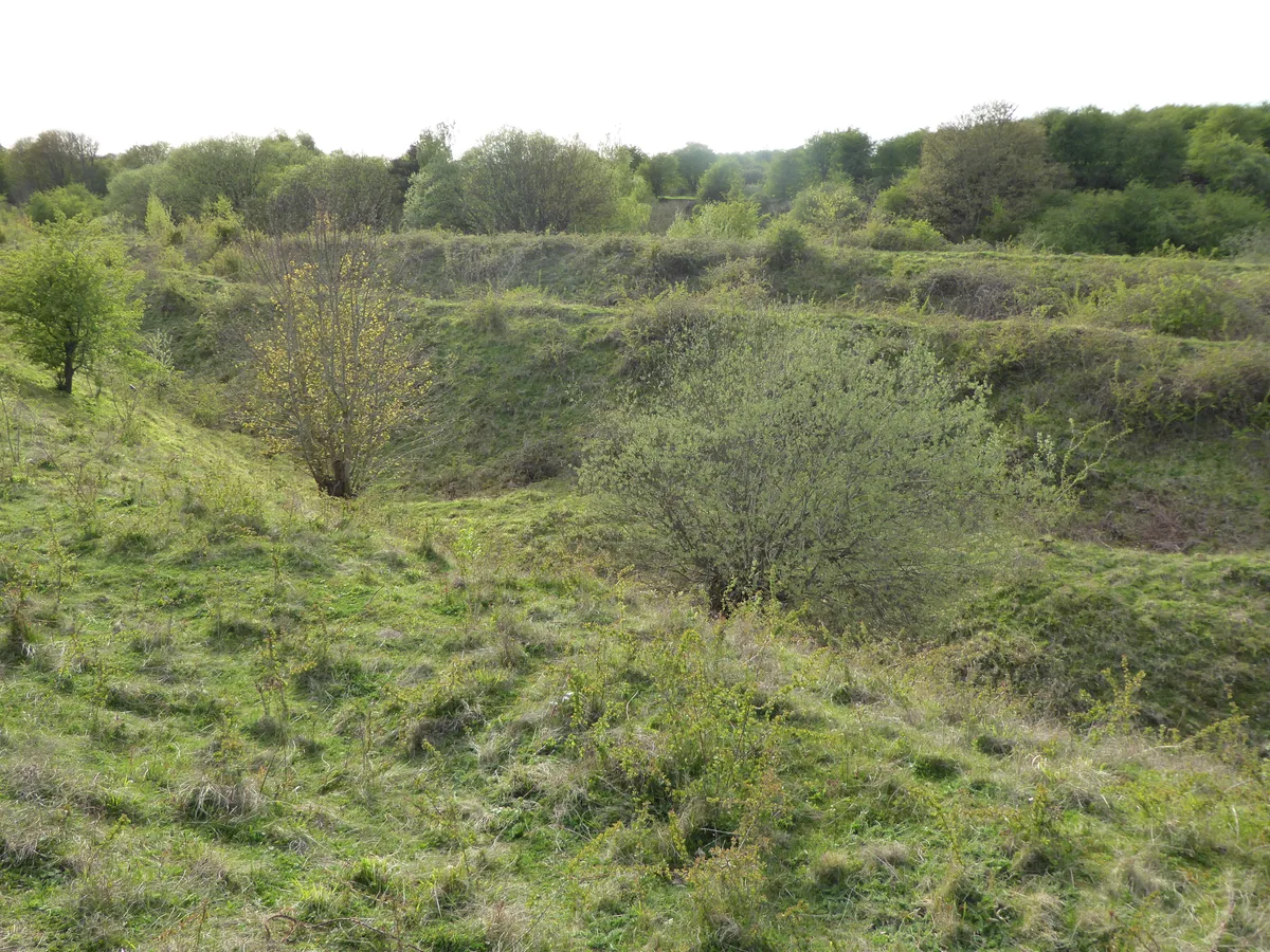
Twywell Hills and Dales
Wildlife reserves · 1.4 km

Twywell Hills and Dales
Forests & woodlands · 2.0 km

Cranford
Villages · 2.2 km

Twywell
Villages · 2.9 km

Bridge Circa 20 Metres West Of Number 40
Historic bridges · 2.9 km

Church of St James
Historic churches · 3.0 km

Bridge Circa 20 Metres South West Of Number 33
Historic bridges · 3.0 km

Blofield Monument, Approximately 6 Metres North Of North Aisle Of Church Of St Mary
Memorials & monuments · 3.0 km

Church of St Mary the Virgin
Historic churches · 3.1 km

Grafton Underwood
Villages · 3.1 km
Bridge Circa 10 Metres South East Of Grafton Park Farm Barn Range
Historic bridges · 3.1 km
Bridge Circa 10 Metres South East Of The Duke's Arms Farmhouse
Historic bridges · 3.2 km
Nearby
📷 5Wildlife reserves · East Midlands
Twywell Hills and Dales
Twywell Hills and Dales — nature reserve in the United Kingdom.
📷 5Forests & woodlands · East Midlands
Twywell Hills and Dales
Twywell Hills and Dales is a forest or woodland in the United Kingdom.
📷 5📷 5📷 3Historic bridges · East Midlands
Bridge Circa 20 Metres West Of Number 40
Bridge Circa 20 Metres West Of Number 40 — Grade II listed building-listed bridge in england-west-midlands, United Kingdom.
📷 3Historic churches · East Midlands
Church of St James
Church of St James — church in Grafton Underwood, Northamptonshire, England, UK.
Where to eat & stay near St Andrew's Church, Cranford
Places to stay
 📷 5
📷 5Campsites · East Midlands
Wicksteed Park Camping
Wicksteed Park Camping — a campsite in england west midlands.
 📷 5
📷 5 📷 5
📷 5 📷 7
📷 7Hotels · East Midlands
The Hind Hotel
The Hind Hotel — a hotel in england west midlands.
 📷 5
📷 5 📷 5
📷 5Campsites · East of England
Wadenhoe Scout Campsite
Wadenhoe Scout Campsite — a campsite in england west midlands.
Places to eat & drink
 📷 5
📷 5Historic pubs · East Midlands
Hare And Hounds Public House
Hare And Hounds Public House in England East, United Kingdom.
 📷 5
📷 5Historic pubs · East Midlands
67 and 69 High Street
67 and 69 High Street in England East, United Kingdom.
 📷 5
📷 5Historic pubs · East Midlands
The Bell Inn Public House
The Bell Inn Public House in England East, United Kingdom.
📷 5Historic pubs · East Midlands
Mulso Arms Public House And Barns Attached To North West And South West
Mulso Arms Public House And Barns Attached To North West And South West in England East, United Kingdom.
 📷 5
📷 5Historic pubs · East Midlands
The Snooty Fox
The Snooty Fox in England East, United Kingdom.
 📷 5
📷 5Historic pubs · East of England
Kings Arms Public House And Attached Outbuildings To Rear
Kings Arms Public House And Attached Outbuildings To Rear in England East, United Kingdom.
Other places from this era
 📷 5
📷 5Historic churches · London
All Hallows Staining
All Hallows Staining — church in City of London, UK.
 📷 5
📷 5Historic churches · London
All Hallows' Church, Tottenham
All Hallows' Church, Tottenham — church in Tottenham, London.
 📷 5
📷 5Historic churches · London
All Saints Church, Kingston upon Thames
All Saints Church, Kingston upon Thames — church in Kingston upon Thames, London.
 📷 5
📷 5Historic churches · London
All Saints' Church, Edmonton
All Saints' Church, Edmonton — church in Edmonton, London.
More places in this region
 📷 5
📷 5Historic churches · East Midlands
All Saints' Church, Stamford
All Saints' Church, Stamford — church in Stamford, Lincolnshire, England, UK.
 📷 5
📷 5Historic churches · East Midlands
Church of All Saints
Church of All Saints — church in Little Casterton, Rutland, United Kingdom.
 📷 5
📷 5Historic churches · East Midlands
Church of All Saints
Church of All Saints — church in Fenland, UK.
 📷 5
📷 5Historic churches · East Midlands
Church of St Leonard
Church of St Leonard — church in Fenland, UK.
Frequently asked questions
- Where is St Andrew's Church, Cranford?
- St Andrew's Church, Cranford is in the East Midlands, United Kingdom (postcode NN14 4AL), in the parish of Cranford.
- What is St Andrew's Church, Cranford?
- St Andrew's Church, Cranford — church in Northamptonshire, UK.
- How do I get to St Andrew's Church, Cranford?
- The nearest railway station is Wicksteed Park, about 4.3 km away. The nearest town is Woodford. Drivers can use postcode NN14 4AL.
- When was St Andrew's Church, Cranford built?
- Built or established in 1101.
- Is St Andrew's Church, Cranford a listed building?
- St Andrew's Church, Cranford is officially recognised as Grade II* listed building listed.
- Is St Andrew's Church, Cranford a protected site?
- Yes — St Andrew's Church, Cranford is part of the Upper Nene Valley Gravel Pits SSSI Site of Special Scientific Interest.
- Is St Andrew's Church, Cranford free to visit?
- Yes, St Andrew's Church, Cranford is free to enter.
- How do I get to St Andrew's Church, Cranford?
- The nearest railway station is Wicksteed Park, about 4.3 km away. Drivers can navigate to postcode NN14 4AL.