Historic bridges · East Midlands
Bridge Circa 10 Metres South East Of Grafton Park Farm Barn Range
In or near Woodford.
Bridge Circa 10 Metres South East Of Grafton Park Farm Barn Range — Grade II listed building-listed bridge in england-west-midlands, United Kingdom.

John Sutton — CC BY-SA 2.0 via Wikimedia Commons licence
Plan your visit
- Typical visit
- 15 min–30 min
- Nearest railway station
- Wicksteed Park · 5.4 km
- Free entry
- Dog-friendly
Getting there & planning your visit
To visit the Bridge Circa 10 Metres South East Of Grafton Park Farm Barn Range, the nearest railway station is Wicksteed Park, located 5.4 km away. Entry to the site is free.
About
Bridge Circa 10 Metres South East Of Grafton Park Farm Barn Range is a Grade II listed building-listed bridge in england-west-midlands, United Kingdom, registered on the National Heritage List for England (NHLE entry 1052059). Listed status protects buildings and structures of special architectural or historic interest. See the linked Wikipedia article for further details.
Photo gallery
Heritage listing
Details GRAFTON UNDERWOOD SP9280 GRAFTON UNDERWOOD 1337-0/16/326 Bridge c.10m SE of Grafton Park Farm barn range GV II Bridge. C18/C19. Limestone rubble. Small semi-circular arch with keystone to north and south. Blue brick capping and C20 railings. Listing NGR: SP9236780368 Legacy The contents of this record have been generated from a legacy data system. Legacy System number: 231101 Legacy System: LBS
From the Historic England List Entry under OGL v3.
Protected designations
- Site of Special Scientific Interest: Upper Nene Valley Gravel Pits SSSI
Designations sourced from Natural England open data under OGL v3.
Place summary
Bridge Circa 10 Metres South East Of Grafton Park Farm Barn Range is a Grade II listed bridge located in the West Midlands, within the parish of Grafton Underwood. This structure is notable for its historical significance and architectural merit.
AI-generated from the structured facts on this page (operator, designation, listing, era). Not a substitute for visiting.
- Coordinates
- 52.4135, -0.6434
- District
- North Northamptonshire
- Parish
- Grafton Underwood
- Postcode
- NN14 3AA
- Parliamentary constituency
- Kettering
- Nearest railway station
- Wicksteed Park — 5.4 km
Sources
- wikidata: Q26303869 (CC0)
Other places nearby

Grafton Underwood
Villages · 0.0 km
Bridge Circa 20 Metres South West Of Number 33
Historic bridges · 0.1 km
Bridge Circa 10 Metres South East Of The Duke's Arms Farmhouse
Historic bridges · 0.1 km

Bridge Circa 20 Metres West Of Number 40
Historic bridges · 0.2 km

Church of St James
Historic churches · 0.2 km

Boughton House
Historic houses · 2.6 km

War Memorial Approximately 6 Metres South of Church of St John the Baptist
Memorials & monuments · 3.1 km
St Andrew's Church, Cranford
Historic churches · 3.1 km

Church of St Edmund, Warkton
Historic churches · 3.1 km

Stone Bridge Over River Ise
Historic bridges · 3.2 km

Twywell
Villages · 3.4 km

Twywell Hills and Dales
Forests & woodlands · 3.4 km
Nearby
📷 5📷 3Historic bridges · East Midlands
Bridge Circa 20 Metres South West Of Number 33
Bridge Circa 20 Metres South West Of Number 33 — Grade II listed building-listed bridge in england-west-midlands, United Kingdom.
📷 3Historic bridges · East Midlands
Bridge Circa 10 Metres South East Of The Duke's Arms Farmhouse
Bridge Circa 10 Metres South East Of The Duke's Arms Farmhouse — Grade II listed building-listed bridge in england-west-midlands, United Kingdom.
📷 3Historic bridges · East Midlands
Bridge Circa 20 Metres West Of Number 40
Bridge Circa 20 Metres West Of Number 40 — Grade II listed building-listed bridge in england-west-midlands, United Kingdom.
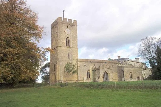
📷 3Historic churches · East Midlands
Church of St James
Church of St James — church in Grafton Underwood, Northamptonshire, England, UK.
📷 4Historic houses · East Midlands
Boughton House
Boughton House is a country house in the parish of Weekley in Northamptonshire, England, located about 3 miles (4.8 km) north-east of Kettering. It is situated within an estate of 11,000 acres (4,451.
Where to eat & stay near Bridge Circa 10 Metres South East Of Grafton Park Farm Barn Range
Places to stay
 📷 5
📷 5Campsites · East Midlands
Wicksteed Park Camping
Wicksteed Park Camping — a campsite in england west midlands.
 📷 5
📷 5 📷 5
📷 5Campsites · East of England
Wadenhoe Scout Campsite
Wadenhoe Scout Campsite — a campsite in england west midlands.
 📷 5
📷 5Hotels · East Midlands
The Saxon Crown
The Saxon Crown — a hotel in england west midlands.
 📷 5
📷 5Campsites · East Midlands
Brightside Caravan Park
Brightside Caravan Park — a campsite in england west midlands.
 📷 7
📷 7Hotels · East Midlands
Hampton by Hilton Corby/Kettering
Hampton by Hilton Corby/Kettering — a hotel in england west midlands. 4-star. Brand: Hampton.
Places to eat & drink
 📷 5
📷 5 📷 5
📷 5Historic pubs · East Midlands
Hare And Hounds Public House
Hare And Hounds Public House in England East, United Kingdom.
 📷 5
📷 5Historic pubs · East of England
Kings Arms Public House And Attached Outbuildings To Rear
Kings Arms Public House And Attached Outbuildings To Rear in England East, United Kingdom.
 📷 5
📷 5Historic pubs · East Midlands
The Spread Eagle Public House
The Spread Eagle Public House in England East Midlands, United Kingdom.
 📷 5
📷 5Historic pubs · East Midlands
67 and 69 High Street
67 and 69 High Street in England East, United Kingdom.
 📷 5
📷 5Historic pubs · East Midlands
Thornhill Arms Public House
Thornhill Arms Public House in England East Midlands, United Kingdom.
More bridges in this region
 📷 5
📷 5Historic bridges · East Midlands
Mill Race Bridge To Market Deeping Mill
Mill Race Bridge To Market Deeping Mill — Grade II listed building-listed bridge in england-london, United Kingdom.
 📷 5
📷 5Historic bridges · East Midlands
Bridge Over West Glen River
Bridge Over West Glen River — Grade II listed building-listed bridge in england-london, United Kingdom.
 📷 5
📷 5Historic bridges · East Midlands
Bridge And Sluices
Bridge And Sluices — Grade II listed building-listed bridge in england-london, United Kingdom.
 📷 5
📷 5Historic bridges · East Midlands
Bridge Over River Gwash
Bridge Over River Gwash — Grade II listed building-listed bridge in england-london, United Kingdom.
Frequently asked questions
- Where is Bridge Circa 10 Metres South East Of Grafton Park Farm Barn Range?
- Bridge Circa 10 Metres South East Of Grafton Park Farm Barn Range is in the West Midlands, United Kingdom (postcode NN14 3AA), in the parish of Grafton Underwood.
- What is Bridge Circa 10 Metres South East Of Grafton Park Farm Barn Range?
- Bridge Circa 10 Metres South East Of Grafton Park Farm Barn Range — Grade II listed building-listed bridge in england-west-midlands, United Kingdom.
- How do I get to Bridge Circa 10 Metres South East Of Grafton Park Farm Barn Range?
- The nearest railway station is Wicksteed Park, about 5.4 km away. Drivers can use postcode NN14 3AA.
- Is Bridge Circa 10 Metres South East Of Grafton Park Farm Barn Range a listed building?
- Bridge Circa 10 Metres South East Of Grafton Park Farm Barn Range is officially recognised as Grade II listed building listed.
- Is Bridge Circa 10 Metres South East Of Grafton Park Farm Barn Range a protected site?
- Yes — Bridge Circa 10 Metres South East Of Grafton Park Farm Barn Range is part of the Upper Nene Valley Gravel Pits SSSI Site of Special Scientific Interest.
- Is Bridge Circa 10 Metres South East Of Grafton Park Farm Barn Range free to visit?
- Yes, Bridge Circa 10 Metres South East Of Grafton Park Farm Barn Range is free to enter.
- How do I get to Bridge Circa 10 Metres South East Of Grafton Park Farm Barn Range?
- The nearest railway station is Wicksteed Park, about 5.4 km away. Drivers can navigate to postcode NN14 3AA.