
Windmills · South East England
Chislet Windmill
In or near Boyden Gate.
Chislet Windmill — a Grade II*-listed windmill in england-south-east, United Kingdom.

Jo and Steve Turner — CC BY-SA 2.0 via Wikimedia Commons licence

Plan your visit
- Typical visit
- 30 min–1 h
- Nearest railway station
- Herne Bay · 5.3 km
- Free entry
- Family-friendly
- Dog-friendly
Getting there & planning your visit
To visit Chislet Windmill, the nearest railway station is Herne Bay, located 5.3 km away. The postcode for sat-nav is CT6 6EZ, and entry to the windmill is free.
About
Chislet Windmill is a Grade II*-listed building in england-south-east, United Kingdom. Grade II* status is conferred by Historic England (or Cadw, Historic Environment Scotland or NIEA equivalents) on buildings of exceptional national interest. See the linked Wikipedia article for full historical and architectural details.
Photo gallery
See it from the streetimagery from 2021
Imagery © Mapillary contributors, CC BY-SA 4.0
Protected designations
- Site of Special Scientific Interest: Thanet Coast SSSI
- Area of Outstanding Natural Beauty: Kent Downs
- Ramsar wetland: Thanet Coast & Sandwich Bay
Designations sourced from Natural England open data under OGL v3.
From the Wikipedia article
Chislet windmill was a Grade II listed smock mill in Chislet, Kent, England. It was built in 1744 and burnt down on 15 October 2005.
Excerpt from Wikipedia under CC BY-SA 4.0. See the source article linked in Sources below.
Background
History
The earliest record of a mill at Chislet is from 1666. Chislet windmill was built in 1744. It was marked on Murdoch Mackenzie's map of 1774 and the 1819-43 Ordnance Survey map and subsequent maps. The mill was working until 1916, when the cap and sails blew off in a gale, it is said that the fantail was tied up by the tenant of the Mill House and thus was unable to turn the mill into wind, thus leading to the mill being tailwinded.
Description
Chislet windmill was a three-storey black smock mill on a low brick base, with four spring sails. The mill was winded by a fantail. The mill drove three pairs of millstones. The Wallower, Upright Shaft, Great Spur Wheel and two of the three Stone Nuts were wood, the third Stone Nut was iron.
Sourced from Wikipedia under CC BY-SA 4.0.
- Coordinates
- 51.3666, 1.1939
- County
- Kent
- District
- Canterbury
- Parish
- Canterbury, unparished area
- Postcode
- CT6 6EZ
- Parliamentary constituency
- Herne Bay and Sandwich
- Established
- 1744
- Nearest railway station
- Herne Bay — 5.3 km
Sources
- wikidata: Q5102126 (CC0)
- wikipedia: Chislet Windmill (CC BY-SA 4.0)
Other places nearby

Reculver Civic War Memorial
Memorials & monuments · 1.2 km

Reculver Visitor Centre
Natural landmarks · 1.3 km

Reculver
Other places · 1.4 km
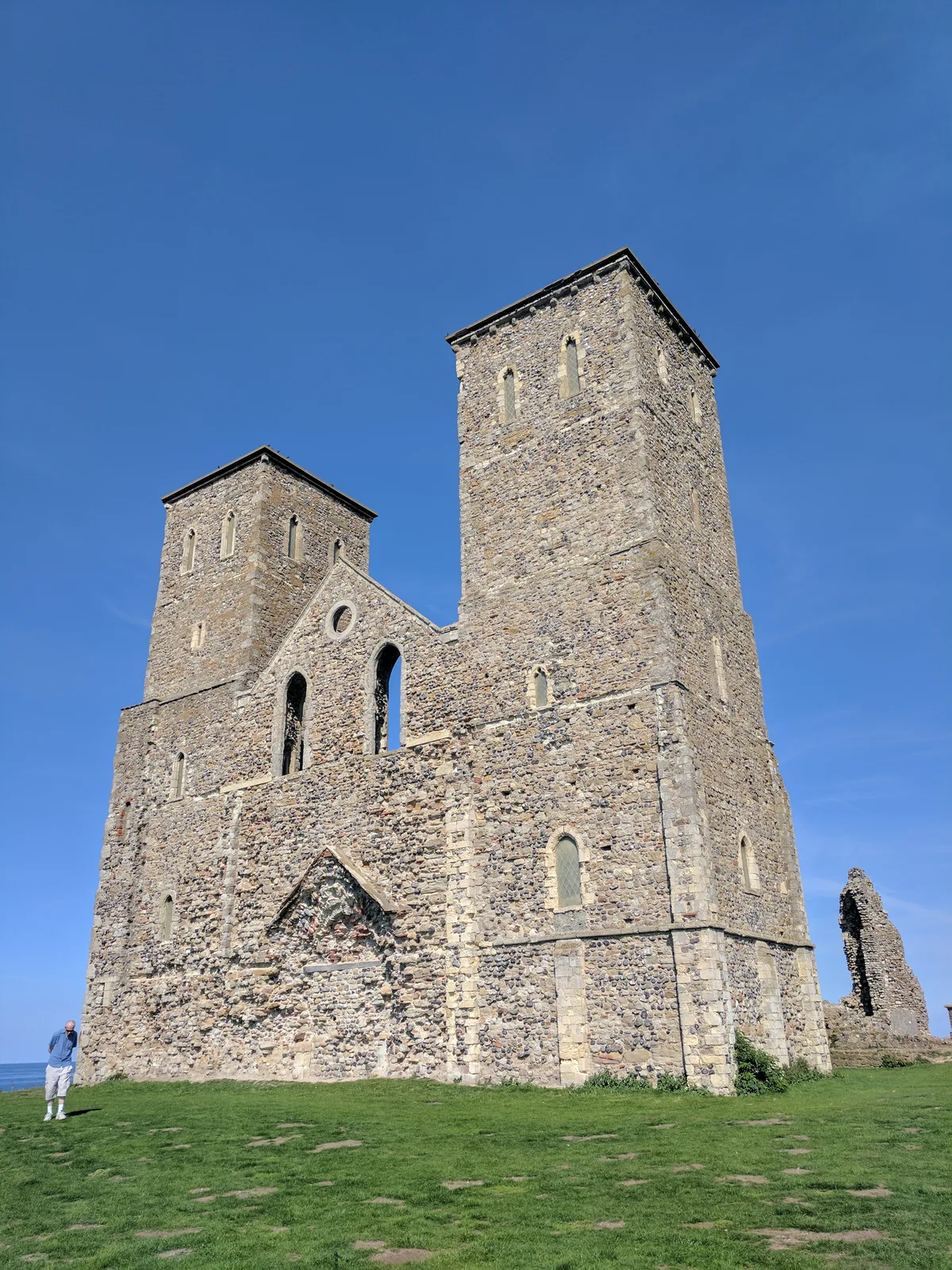
Reculver Saxon Shore fort, Anglo-Saxon monastery and associated remains
Archaeological sites · 1.4 km

Reculver Roman Fort
Archaeological sites · 1.4 km

Reculver Roman Fort
Archaeological sites · 1.4 km
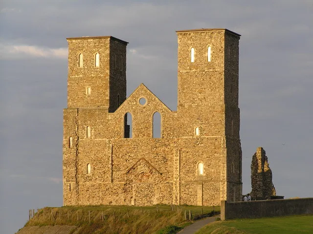
St Mary's Church, Reculver
Historic churches · 1.5 km

Reculver Towers
Historic houses · 1.5 km

Bishopstone Manor
Manor houses · 1.6 km

Bishopstone Glen
Viewpoints · 1.9 km

Highstead Farm
Campsites · 2.0 km

Boyden Gate
Towns & cities · 2.4 km
Nearby
📷 5Memorials & monuments · South East England
Reculver Civic War Memorial
Reculver Civic War Memorial — a memorial in england-south-east, United Kingdom.
📷 5Natural landmarks · South East England
Reculver Visitor Centre
Reculver Visitor Centre — a natural landmark in england-south-east, United Kingdom.
📷 5📷 5Archaeological sites · South East England
Reculver Saxon Shore fort, Anglo-Saxon monastery and associated remains
Reculver Saxon Shore fort, Anglo-Saxon monastery and associated remains — archaeological site in Canterbury, Kent, England, UK.
📷 5Archaeological sites · South East England
Reculver Roman Fort
Reculver Roman Fort — a archaeological in england-south-east, United Kingdom.
📷 5Archaeological sites · South East England
Reculver Roman Fort
Reculver Roman Fort — archaeological in england south east.
Where to eat & stay near Chislet Windmill
Places to stay
📷 5 📷 5
📷 5Caravan parks · South East England
South View Caravan Park
South View Caravan Park — a caravan park in england south east.
 📷 5
📷 5 📷 5
📷 5Campsites · South East England
St Nicholas Camping Site
St Nicholas Camping Site — a campsite in england south east.
 📷 5
📷 5Campsites · South East England
Nethergong Camping
Nethergong Camping — a campsite in england south east.
📷 5Places to eat & drink
 📷 5
📷 5 📷 5
📷 5 📷 5
📷 5Historic pubs · South East England
The Powell Arms Public House
The Powell Arms Public House in England South East, United Kingdom.
 📷 7
📷 7Cafés · South East England
Chapters
Chapters — a café in england south east.
 📷 6
📷 6 📷 5
📷 5More windmills in this region
 📷 5
📷 5Windmills · South East England
Buckland Windmill
Buckland Windmill is a windmill in the United Kingdom.
 📷 5
📷 5Windmills · South East England
Meopham Windmill
Meopham Windmill is a windmill in the United Kingdom.
 📷 5
📷 5Windmills · South East England
Mugswell Windmill
Mugswell Windmill is a windmill in the United Kingdom.
 📷 5
📷 5Windmills · South East England
Reigate Mill Church
Reigate Mill Church is a windmill in the United Kingdom.
Frequently asked questions
- Where is Chislet Windmill?
- Chislet Windmill is in Kent, South-East England, United Kingdom (postcode CT6 6EZ), in the parish of Canterbury, unparished area.
- What is Chislet Windmill?
- Chislet Windmill — a Grade II*-listed windmill in england-south-east, United Kingdom.
- How do I get to Chislet Windmill?
- The nearest railway station is Herne Bay, about 5.3 km away. Drivers can use postcode CT6 6EZ.
- When was Chislet Windmill built?
- Built or established in 1744.
- Who owns Chislet Windmill?
- Chislet Windmill is owned by |built = 1744.
- Is Chislet Windmill a listed building?
- Chislet Windmill is officially recognised as Grade II* listed.
- Is Chislet Windmill a protected site?
- Yes — Chislet Windmill is part of the Thanet Coast SSSI Site of Special Scientific Interest and the Kent Downs National Landscape (AONB).
- Is Chislet Windmill free to visit?
- Yes, Chislet Windmill is free to enter.