
Archaeological sites · South East England
Reculver Roman Fort
In or near Boyden Gate.
Reculver Roman Fort — archaeological in england south east.

Chris Whippet — CC BY-SA 2.0 via Wikimedia Commons licence

Plan your visit
- Typical visit
- 45 min–1.5 h
- Nearest railway station
- Herne Bay · 5.9 km
About
Reculver Roman Fort is a archaeological located in england south east. A British archaeological site recorded in OpenStreetMap with at least one heritage quality signal (Wikidata link, Wikipedia article or designated operator).
Photo gallery
360° viewimagery from 2021
Imagery © Mapillary contributors, CC BY-SA 4.0
Protected designations
- Site of Special Scientific Interest: Thanet Coast SSSI
- Area of Outstanding Natural Beauty: Kent Downs
- Ramsar wetland: Thanet Coast & Sandwich Bay
Designations sourced from Natural England open data under OGL v3.
Place summary
Reculver Roman Fort is an archaeological site located in South-East England. It features the remains of a Roman fort that was part of the coastal defence system during the Roman occupation. The site offers insights into military architecture and Roman life in Britain. Visitors can explore the ruins and the surrounding landscape, which includes views of the coastline.
AI-generated from the structured facts on this page (operator, designation, listing, era). Not a substitute for visiting.
- Coordinates
- 51.3791, 1.1996
- County
- Kent
- District
- Canterbury
- Parish
- Canterbury, unparished area
- Postcode
- CT6 6SU
- Parliamentary constituency
- Herne Bay and Sandwich
- Nearest railway station
- Herne Bay — 5.9 km
Sources
- osm: w1078045534 (ODbL)
- wikidata: Q1735409 (CC0)
Other places nearby

Reculver Roman Fort
Archaeological sites · 0.0 km
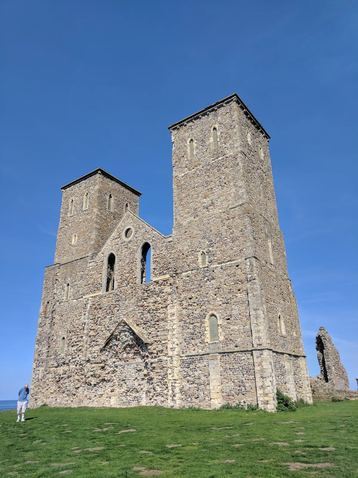
Reculver Saxon Shore fort, Anglo-Saxon monastery and associated remains
Archaeological sites · 0.0 km

Reculver Towers
Historic houses · 0.1 km
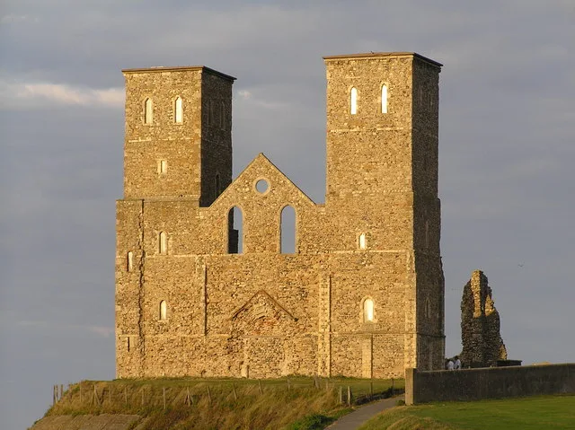
St Mary's Church, Reculver
Historic churches · 0.1 km

Reculver
Other places · 0.1 km

Reculver Visitor Centre
Natural landmarks · 0.2 km

Chislet Windmill
Windmills · 1.4 km

Bishopstone Manor
Manor houses · 1.9 km

Reculver Civic War Memorial
Memorials & monuments · 2.0 km

Bishopstone Glen
Viewpoints · 2.2 km

Beltinge Bay
Natural landmarks · 3.3 km

Highstead Farm
Campsites · 3.4 km
Nearby
📷 5Archaeological sites · South East England
Reculver Roman Fort
Reculver Roman Fort — a archaeological in england-south-east, United Kingdom.
📷 5Archaeological sites · South East England
Reculver Saxon Shore fort, Anglo-Saxon monastery and associated remains
Reculver Saxon Shore fort, Anglo-Saxon monastery and associated remains — archaeological site in Canterbury, Kent, England, UK.
📷 5Historic houses · South East England
Reculver Towers
Reculver Towers — a historic house in england-south-east, United Kingdom.
📷 5Historic churches · South East England
St Mary's Church, Reculver
St Mary's Church, Reculver — church in Reculver, England.
📷 5📷 5Natural landmarks · South East England
Reculver Visitor Centre
Reculver Visitor Centre — a natural landmark in england-south-east, United Kingdom.
Where to eat & stay near Reculver Roman Fort
Places to stay
📷 5 📷 5
📷 5Campsites · South East England
St Nicholas Camping Site
St Nicholas Camping Site — a campsite in england south east.
 📷 5
📷 5 📷 5
📷 5Caravan parks · South East England
South View Caravan Park
South View Caravan Park — a caravan park in england south east.
 📷 5
📷 5Campsites · South East England
Nethergong Camping
Nethergong Camping — a campsite in england south east.
📷 5Places to eat & drink
 📷 5
📷 5 📷 5
📷 5 📷 5
📷 5Historic pubs · South East England
The Powell Arms Public House
The Powell Arms Public House in England South East, United Kingdom.
 📷 7
📷 7Cafés · South East England
Chapters
Chapters — a café in england south east.
 📷 6
📷 6 📷 5
📷 5More archaeological sites in this region
 📷 5
📷 5Archaeological sites · South East England
Chatham Dockyard, site of South Mast Pond
Chatham Dockyard, site of South Mast Pond — archaeological site in Medway, Kent, England, UK.
 📷 5
📷 5Archaeological sites · South East England
Open areas within Roman, Saxon and medieval town
Open areas within Roman, Saxon and medieval town — archaeological site in Medway, Kent, England, UK.
 📷 5
📷 5Archaeological sites · South East England
Oxmoor Copse
Oxmoor Copse — woodland in Surrey, England.
 📷 5
📷 5Frequently asked questions
- Where is Reculver Roman Fort?
- Reculver Roman Fort is in Kent, South-East England, United Kingdom (postcode CT6 6SU), in the parish of Canterbury, unparished area.
- What is Reculver Roman Fort?
- Reculver Roman Fort — archaeological in england south east.
- How do I get to Reculver Roman Fort?
- The nearest railway station is Herne Bay, about 5.9 km away. Drivers can use postcode CT6 6SU.
- Is Reculver Roman Fort a protected site?
- Yes — Reculver Roman Fort is part of the Thanet Coast SSSI Site of Special Scientific Interest and the Kent Downs National Landscape (AONB).
- How do I get to Reculver Roman Fort?
- The nearest railway station is Herne Bay, about 5.9 km away. Drivers can navigate to postcode CT6 6SU.