
Mountains & hills · South West England
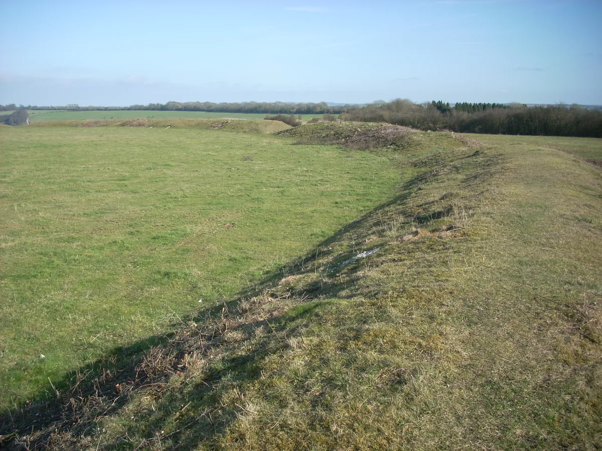
Chiselbury Camp
In or near Baverstock.
Chiselbury Camp — a hill or mountain in england south east.

Colin Park — CC BY-SA 2.0 via Wikimedia Commons licence

Plan your visit
- Typical visit
- 3 h–8 h
- Best time of year
- Late spring – early autumn (May–Oct)
- Nearest railway station
- Tisbury · 7.3 km
- Dog-friendly
About
A British hill or mountain, named on Ordnance Survey maps and walked by hill-baggers. Chiselbury Camp is a named hill or mountain in england south east, recorded in the GeoNames UK gazetteer. British landmarks of this type are typically marked on Ordnance Survey maps and recorded in the national gazetteer for cartographic and navigational reference. Coordinates and feature classification are sourced from the GeoNames open dataset.
Photo gallery
Protected designations
- Site of Special Scientific Interest: River Avon System SSSI
- Area of Outstanding Natural Beauty: Cranborne Chase & West Wiltshire Downs
Designations sourced from Natural England open data under OGL v3.
Place summary
Chiselbury Camp is a mountain located in South-East England. It is notable for its archaeological significance as an ancient hillfort. Visitors to the area can expect rugged terrain and scenic views typical of the region's landscape. The site is of interest to those exploring historical earthworks and natural features.
AI-generated from the structured facts on this page (operator, designation, listing, era). Not a substitute for visiting.
- Coordinates
- 51.0522, -1.9757
- District
- Wiltshire
- Parish
- Fovant
- Postcode
- SP3 5JE
- Parliamentary constituency
- Salisbury
- Nearest railway station
- Tisbury — 7.3 km
Sources
- manual: geonames-11548890 (CC BY 4.0)
Other places nearby
Chiselbury
Hill forts · 0.0 km

Chiselbury Hill
Mountains & hills · 0.1 km

6th (City of London) Battalion, the London Regiment (Rifles) (Fovant Badge)
Public art & sculpture · 0.2 km

Australian Commonwealth Military Forces (Fovant Badge)
Public art & sculpture · 0.3 km
Royal Corps of Signals (Fovant Badge)
Public art & sculpture · 0.3 km
The Wiltshire Regiment (Fovant Badge)
Public art & sculpture · 0.3 km
London Rifle Brigade (Fovant Badge)
Public art & sculpture · 0.3 km
Post Office Rifles (Fovant Badge)
Public art & sculpture · 0.4 km
Devonshire Regiment (Fovant Badge)
Public art & sculpture · 0.4 km

Compton Down
Mountains & hills · 0.7 km

Fovant
Villages · 1.2 km

Congregational Chapel
Chapels · 1.6 km
Nearby
📷 5Hill forts · South West England
Chiselbury
Chiselbury — site of an Iron Age univallate hillfort located in Wiltshire, England, UK.
📷 5Mountains & hills · South West England
Chiselbury Hill
Chiselbury Hill — mountain in england south east. Elevation: 202 m.
📷 5Public art & sculpture · South West England
6th (City of London) Battalion, the London Regiment (Rifles) (Fovant Badge)
6th (City of London) Battalion, the London Regiment (Rifles) (Fovant Badge) — a public art in england-south-east, United Kingdom.
📷 5Public art & sculpture · South West England
Australian Commonwealth Military Forces (Fovant Badge)
Australian Commonwealth Military Forces (Fovant Badge) — a public art in england-south-east, United Kingdom.
📷 5Public art & sculpture · South West England
Royal Corps of Signals (Fovant Badge)
Royal Corps of Signals (Fovant Badge) — a public art in england-south-east, United Kingdom.
📷 5Public art & sculpture · South West England
The Wiltshire Regiment (Fovant Badge)
The Wiltshire Regiment (Fovant Badge) — a public art in england-south-east, United Kingdom.
Where to eat & stay near Chiselbury Camp
Places to stay
 📷 5
📷 5Campsites · South West England
Marshwood Farm Camping
Marshwood Farm Camping — a campsite in england south east.
 📷 5
📷 5B&Bs · South West England
The Royal Oak
The Royal Oak — a bed-and-breakfast in england south east.
 📷 5
📷 5B&Bs · South West England
Burcombe Manor Bed and Breakfast
Burcombe Manor Bed and Breakfast — a bed-and-breakfast in england south east.
 📷 5
📷 5Caravan parks · South West England
Coombe Caravan Park
Coombe Caravan Park — a caravan park in england south east.
 📷 7
📷 7Hotels · South West England
The Pembroke Arms
The Pembroke Arms — a hotel in england south east.
 📷 5
📷 5Caravan parks · South East England
Cherwell Leys Farm
Cherwell Leys Farm — a caravan park in england south east.
Places to eat & drink
 📷 5
📷 5 📷 5
📷 5Historic pubs · South West England
Three Crowns Public House
Three Crowns Public House in England South West, United Kingdom.
 📷 5
📷 5Historic pubs · South West England
The Rose and Crown Inn
The Rose and Crown Inn in England South West, United Kingdom.
 📷 7
📷 7 📷 5
📷 5Historic pubs · South West England
The Haunch Of Venison
The Haunch Of Venison in England South West, United Kingdom.
 📷 7
📷 7Historic pubs · South West England
The Benett Arms
The Benett Arms in England South West, United Kingdom.
More mountains in this region
 📷 5
📷 5 📷 5
📷 5 📷 5
📷 5 📷 5
📷 5Frequently asked questions
- Where is Chiselbury Camp?
- Chiselbury Camp is in South-East England, United Kingdom (postcode SP3 5JE), in the parish of Fovant.
- What is Chiselbury Camp?
- Chiselbury Camp — a hill or mountain in england south east.
- How do I get to Chiselbury Camp?
- The nearest railway station is Tisbury, about 7.3 km away. Drivers can use postcode SP3 5JE.
- Is Chiselbury Camp a protected site?
- Yes — Chiselbury Camp is part of the River Avon System SSSI Site of Special Scientific Interest and the Cranborne Chase & West Wiltshire Downs National Landscape (AONB).
- How do I get to Chiselbury Camp?
- The nearest railway station is Tisbury, about 7.3 km away. Drivers can navigate to postcode SP3 5JE.