Natural landmarks · South West England
Cheesewring
In or near Upton Cross.
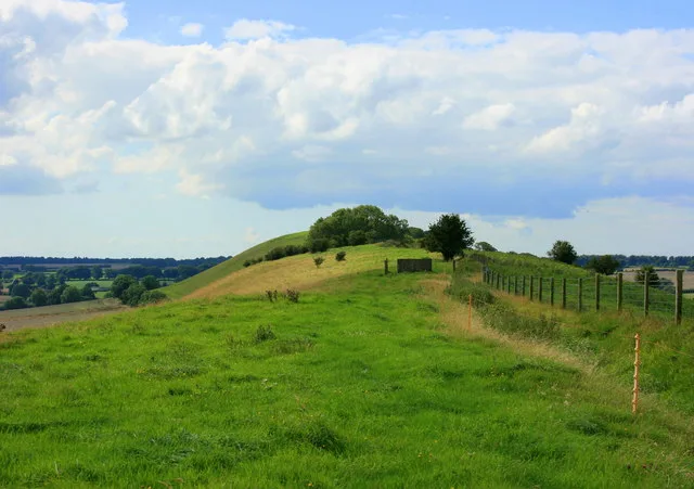
The Cheesewring (Cornish: Keuswask) is a granite tor in Cornwall, England, situated on the eastern flank of Bodmin Moor on Stowe's Hill in the parish of Linkinhorne approximately one mile northwest of

Gareth James — CC BY-SA 2.0 via Wikimedia Commons licence
Plan your visit
- Typical visit
- 1 h–2 h
- Nearest railway station
- Liskeard · 8.8 km
- Free entry
- Family-friendly
- Dog-friendly
Getting there & planning your visit
Cheesewring is located in Cornwall, with the nearest railway station being Liskeard, which is 8.8 km away. The postcode for Cheesewring is PL14 5LJ, and entry is free.
About
The Cheesewring (Cornish: Keuswask) is a granite tor in Cornwall, England, situated on the eastern flank of Bodmin Moor on Stowe's Hill in the parish of Linkinhorne approximately one mile northwest of the village of Minions and four miles (6 km) north of Liskeard. It is a natural geological formation, a rock outcrop of granite slabs formed by weathering. The name derives from the resemblance of the piled slabs to a stack of "cheeses" in a traditional cider press. Wilkie Collins described the Cheesewring in 1861 in his book Rambles Beyond Railways: If a man dreams of a great pile of stones in a nightmare, he would dream of such a pile as the Cheesewring. All the heaviest and largest of the seven thick slabs of which it is composed are at the top; all the lightest and smallest at the bottom. It rises perpendicularly to a height of thirty-two feet, without lateral support of any kind. The fifth and sixth rocks are of immense size and thickness, and overhang fearfully all round the four lower rocks which support them. All are perfectly irregular; the projections of one do not fit into the interstices of another; they are heaped up loosely in their extraordinary top-heavy form on slanting ground, half way down a steep hill. Located adjacent to the Cheesewring Quarry (which supplied the granite cladding for the structure of Tower Bridge, London) and surrounded by other granite formations, this landmark was threatened with destruction in the late nineteenth century by the proximity…
Photo gallery
Protected designations
- Area of Outstanding Natural Beauty: Cornwall
Designations sourced from Natural England open data under OGL v3.
From the Wikipedia article
The Cheesewring (Cornish: Keuswask) is a granite tor in Cornwall, England, situated on the eastern flank of Bodmin Moor on Stowe's Hill in the parish of Linkinhorne approximately one mile northwest of the village of Minions and four miles (6 km) north of Liskeard. It is a natural geological formation, a rock outcrop of granite slabs formed by weathering. The name derives from the resemblance of the piled slabs to a stack of "cheeses" in a traditional cider press. Wilkie Collins described the Cheesewring in 1861 in his book Rambles Beyond Railways: If a man dreams of a great pile of stones in a nightmare, he would dream of such a pile as the Cheesewring. All the heaviest and largest of the seven thick slabs of which it is composed are at the top; all the lightest and smallest at the bottom. It rises perpendicularly to a height of thirty-two feet, without lateral support of any kind. The fifth and sixth rocks are of immense size and thickness, and overhang fearfully all round the four lower rocks which support them. All are perfectly irregular; the projections of one do not fit into the interstices of another; they are heaped up loosely in their extraordinary top-heavy form on slanting ground, half way down a steep hill. Located adjacent to the Cheesewring Quarry (which supplied the granite cladding for the structure of Tower Bridge, London) and surrounded by other granite formations, this landmark was threatened with destruction in the late nineteenth century by the proximity of blasting operations, but was saved as a result of local activism.
Excerpt from Wikipedia under CC BY-SA 4.0. See the source article linked in Sources below.
- Coordinates
- 50.5254, -4.4593
- District
- Cornwall
- Parish
- Linkinhorne
- Postcode
- PL14 5LJ
- Parliamentary constituency
- South East Cornwall
- Nearest railway station
- Liskeard — 8.8 km
Sources
- wikipedia: Cheesewring (CC BY-SA 4.0)
Featured in this guide
Other places nearby
Stowe's Hill
Mountains & hills · 0.1 km

Rock stack
Viewpoints · 0.1 km

Daniel Gumb's Cave
Caves · 0.1 km

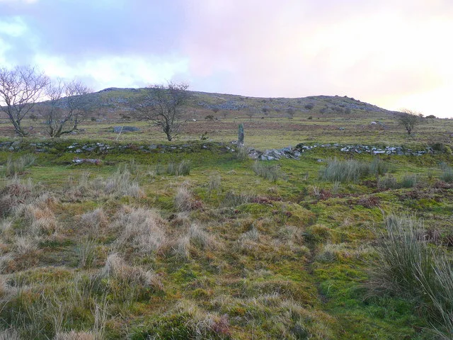
Earlier Prehistoric hillfort, two cairns, medieval pound and adjacent Prehistoric field systems, hut circles and transhumance hu
Vineyards · 0.3 km

Cheesewring Farm Campsite
Campsites · 0.4 km
Cheesewring Farm Caravan site
Caravan parks · 0.4 km
Rillaton Barrow
Hill forts · 0.5 km

Rillaton Cist
Archaeological sites · 0.5 km

WB1
Memorials & monuments · 0.6 km

Mine Ruins
Historic houses · 0.9 km

Prince of Wales Shaft (Phoenix Mine)
Historic houses · 0.9 km

The Hurlers: North circle
Archaeological sites · 0.9 km
Nearby
📷 3📷 3📷 3Caves · South West England
Daniel Gumb's Cave
Daniel Gumb's Cave — a cave in england-south-west, United Kingdom.
📷 5Vineyards · South West England
Earlier Prehistoric hillfort, two cairns, medieval pound and adjacent Prehistoric field systems, hut circles and transhumance hu
Earlier Prehistoric hillfort, two cairns, medieval pound and adjacent Prehistoric field systems, hut circles and transhumance hu — a UK vineyard in england south west, producing English or Welsh wine from cool-climate grape varieties.
📷 5Campsites · South West England
Cheesewring Farm Campsite
Cheesewring Farm Campsite — a campsite in england south west.
📷 5Caravan parks · South West England
Cheesewring Farm Caravan site
Cheesewring Farm Caravan site — a caravan park in england south west.
Where to eat & stay near Cheesewring
Places to stay
📷 5Campsites · South West England
Cheesewring Farm Campsite
Cheesewring Farm Campsite — a campsite in england south west.
📷 5Caravan parks · South West England
Cheesewring Farm Caravan site
Cheesewring Farm Caravan site — a caravan park in england south west.
 📷 5
📷 5Campsites · South West England
Siblyback Lake Campsite
Siblyback Lake Campsite — a campsite in england south west.
 📷 5
📷 5Campsites · South West England
Colliford Tavern Camp Site
Colliford Tavern Camp Site — a campsite in england south west.
 📷 5
📷 5Caravan parks · South West England
Pine Green Caravan & Camping Park
Pine Green Caravan & Camping Park — a caravan park in england south west.
 📷 5
📷 5Places to eat & drink
 📷 7
📷 7Restaurants · South West England
Himalayan Spice
Himalayan Spice — a restaurant in england south west.
 📷 7
📷 7Historic pubs · South West England
The Barley Sheaf Public House
The Barley Sheaf Public House in England South West, United Kingdom.
 📷 7
📷 7Historic pubs · South West England
The Albion Public House
The Albion Public House in England South West, United Kingdom.
 📷 7
📷 7Historic pubs · South West England
Tavernan Carow Public House
Tavernan Carow Public House in England South West, United Kingdom.
 📷 5
📷 5Historic pubs · South West England
Bakers Arms Public House
Bakers Arms Public House in England South West, United Kingdom.
 📷 7
📷 7Historic pubs · South West England
The Bell Inn And Attached Wall And Coach House
The Bell Inn And Attached Wall And Coach House in England South West, United Kingdom.
More natural landmarks in this region
 📷 5
📷 5Natural landmarks · South West England
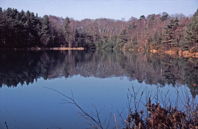
Blue Pool
Blue Pool — lake in Dorset, England, UK.
 📷 5
📷 5Natural landmarks · South West England
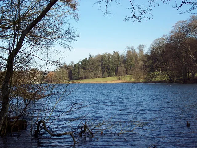
Fonthill Lake
Fonthill Lake — lake in Wiltshire, England, UK.
 📷 5
📷 5 📷 5
📷 5Natural landmarks · South West England
Orchardleigh Lake
Orchardleigh Lake — lake in the United Kingdom.
Frequently asked questions
- Where is Cheesewring?
- Cheesewring is in South-West England, United Kingdom (postcode PL14 5LJ), in the parish of Linkinhorne.
- What is Cheesewring?
- The Cheesewring (Cornish: Keuswask) is a granite tor in Cornwall, England, situated on the eastern flank of Bodmin Moor on Stowe's Hill in the parish of Linkinhorne approximately one mile northwest of
- How do I get to Cheesewring?
- The nearest railway station is Liskeard, about 8.8 km away. Drivers can use postcode PL14 5LJ.
- Is Cheesewring a protected site?
- Yes — Cheesewring is part of the Cornwall National Landscape (AONB).
- Is Cheesewring free to visit?
- Yes, Cheesewring is free to enter.
- How do I get to Cheesewring?
- Drivers can navigate to postcode PL14 5LJ. It sits within the South East Cornwall parliamentary constituency.