
Castles · West Midlands
Castlebourne folly
In or near Bell End.
Castlebourne folly — building in Worcestershire.

Peter Whatley — CC BY-SA 2.0 via Wikimedia Commons licence

Plan your visit
- Typical visit
- 1.5 h–3 h
- Nearest railway station
- Hagley · 5.6 km
- Family-friendly
- Limited wheelchair access
Getting there & planning your visit
To visit Castlebourne folly, the nearest railway station is Hagley, located 5.6 km away. The postcode for sat-nav is DY9 9XX. Accessibility is limited for wheelchair users.
About
Castlebourne folly is a castle in the United Kingdom — fortified architecture from the medieval, Tudor, or Victorian-revival period. Wikidata describes it as: "building in Worcestershire". Coordinates: 52.3896°, -2.0838°.
Photo gallery
From the Wikipedia article
The Castlebourne folly in the parish of Belbroughton, Worcestershire, England, was built as a sham castle towards the end of the eighteenth century and is similar in age and design to Clent Castle another folly about 2.2 miles (3.5 km) away in an adjacent parish of Clent. In the middle nineteenth century a house, Castlebourne (originally Castle Bourne) was built in a Gothic castle style close to the folly and connected by a wall about 20 yards (18 m) long and 5 yards (4.6 m) high with an archway. The folly, wall and house are designated as a Grade II listed building by English Heritage. The folly, and the later house, were built on a mound. The folly has a square three-bay plan. The two outer bays are formed by large circular two story corner towers. On the south side, the two towers have pointed windows (some blind), while on the first floor they have quatrefoil windows and relief mouldings above in form of Maltese crosses. The central bay has a blocked pointed doorway with hood mould and returns. The floor above the doorway has a blind pointed first floor window. The roof is of slate behind embattled parapets. The wall connecting the folly to the house faces south-west and has an embattled parapet above a moulded cornice. It can be spotted in Winter months, if you look up the hill from the dual carriageway below where the original driveway posts are discretely laid a few metres from the road you can get a good glimpse of the castle normally out of view in summertime.
Excerpt from Wikipedia under CC BY-SA 4.0. See the source article linked in Sources below.
- Coordinates
- 52.3896, -2.0838
- County
- Worcestershire
- District
- Bromsgrove
- Parish
- Belbroughton
- Postcode
- DY9 9XX
- Parliamentary constituency
- Bromsgrove
- Nearest railway station
- Hagley — 5.6 km
Sources
- wikidata: Q5050467 (CC0)
- wikipedia: Castlebourne folly (CC BY-SA 4.0)
Other places nearby

Bell End
Towns & cities · 0.5 km

Arenig Glacial Boulder
Memorials & monuments · 1.1 km

Cader Idris Glacial Erratic Boulder
Memorials & monuments · 1.5 km

Moat Bridge And Walls About 16 Yards South-West Of Moor Hall
Historic bridges · 1.8 km

Romsley Hill
Mountains & hills · 2.3 km

Churchyard Cross About 25 Yards South Of Thee Church Of The Holy Trinity
Memorials & monuments · 2.5 km

The Queens
Restaurants · 2.6 km

St Christopher
Public art & sculpture · 2.6 km

Clent Hills Camping and Caravanning Club Site
Campsites · 2.6 km
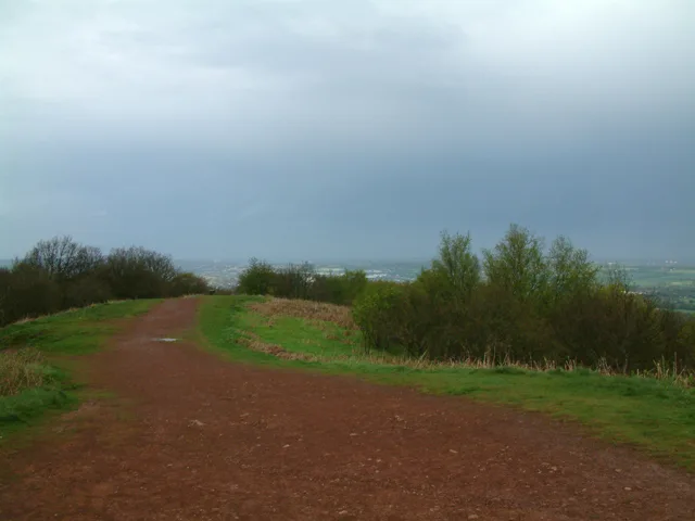
Walton Hill
Mountains & hills · 2.9 km

Clent War Memorial
Memorials & monuments · 2.9 km

Chapman's Hill
Mountains & hills · 3.0 km
Nearby
📷 3📷 3Memorials & monuments · West Midlands
Arenig Glacial Boulder
Arenig Glacial Boulder — a memorial in West Midlands, United Kingdom.
📷 3Memorials & monuments · West Midlands
Cader Idris Glacial Erratic Boulder
Cader Idris Glacial Erratic Boulder — a memorial in West Midlands, United Kingdom.
📷 3Historic bridges · West Midlands
Moat Bridge And Walls About 16 Yards South-West Of Moor Hall
Moat Bridge And Walls About 16 Yards South-West Of Moor Hall — Grade II listed building-listed bridge in england-west-midlands, United Kingdom.
📷 5Mountains & hills · West Midlands
Romsley Hill
Romsley Hill — a hill or mountain in england west midlands.
📷 3Memorials & monuments · West Midlands
Churchyard Cross About 25 Yards South Of Thee Church Of The Holy Trinity
Churchyard Cross About 25 Yards South Of Thee Church Of The Holy Trinity — Grade II listed building-listed memorial in england-west-midlands, United Kingdom.
Where to eat & stay near Castlebourne folly
Places to stay
📷 4Campsites · West Midlands
Clent Hills Camping and Caravanning Club Site
Clent Hills Camping and Caravanning Club Site — a campsite in england west midlands.
 📷 5
📷 5Campsites · West Midlands
Blackwell Adventure Outdoor Activity Centre
Blackwell Adventure Outdoor Activity Centre — a campsite in england west midlands.
📷 5Campsites · West Midlands
Roberts Podded Village
Roberts Podded Village — a campsite in england west midlands.
📷 5Hostels · West Midlands
Stable Block at Blackwell Court
Stable Block at Blackwell Court — a hostel in england west midlands.
📷 5Hostels · West Midlands
Blackwell Court Manor House
Blackwell Court Manor House — a hostel in england west midlands.
 📷 5
📷 5Hotels · West Midlands
ibis budget Bromsgrove 2 stars
ibis budget Bromsgrove 2 stars — a hotel in england west midlands. 2-star. Brand: Ibis Budget.
Places to eat & drink
📷 5 📷 3
📷 3Historic pubs · West Midlands
The Crabmill
The Crabmill — Historic pub — listed building or notable heritage status.
 📷 3
📷 3Historic pubs · West Midlands
The Swan
The Swan — Historic pub — listed building or notable heritage status.
 📷 3
📷 3Historic pubs · West Midlands
The Talbot
The Talbot — Historic pub — listed building or notable heritage status.
 📷 7
📷 7Historic pubs · West Midlands
Golden Lion Public House
Golden Lion Public House in England West Midlands, United Kingdom.
 📷 5
📷 5Historic pubs · West Midlands
Black Cross Public House
Black Cross Public House in England West Midlands, United Kingdom.
More castles in this region
 📷 3
📷 3 📷 3
📷 3Castles · West Midlands
Hoar Cross Hall
Hoar Cross Hall — a castle in West Midlands, United Kingdom.
 📷 3
📷 3Castles · West Midlands
Chartley Castle, Chartley Old Hall and associated water control systems including garden remains
Chartley Castle, Chartley Old Hall and associated water control systems including garden remains — scheduled monument-listed castle in england-east-midlands, United Kingdom.
 📷 5
📷 5Frequently asked questions
- Where is Castlebourne folly?
- Castlebourne folly is in Worcestershire, the West Midlands, United Kingdom (postcode DY9 9XX), in the parish of Belbroughton.
- What is Castlebourne folly?
- Castlebourne folly — building in Worcestershire.
- How do I get to Castlebourne folly?
- The nearest railway station is Hagley, about 5.6 km away. The nearest town is Bell End. Drivers can use postcode DY9 9XX.
- Does Castlebourne folly charge admission?
- Castlebourne folly typically charges admission. Check the official site for current ticket prices and opening hours.
- How do I get to Castlebourne folly?
- The nearest railway station is Hagley, about 5.6 km away. Drivers can navigate to postcode DY9 9XX.