Beaches · Mid Wales
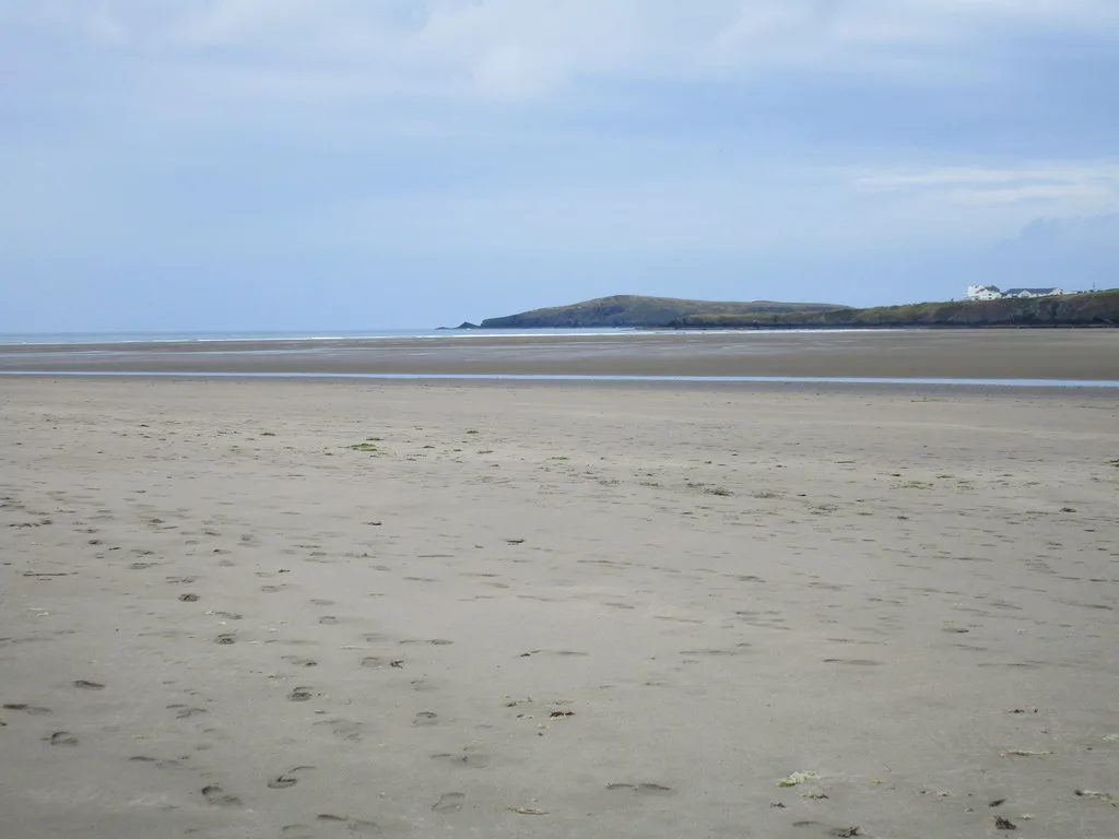
Gwbert
In or near Aberporth.
Gwbert in Wales Mid, United Kingdom.

Chris Gunns — CC BY-SA 2.0 via Wikimedia Commons licence
Plan your visit
- Typical visit
- 1 h–3 h
- Best time of year
- Summer (Jun–Aug)
- Free entry
- Family-friendly
- Dog-friendly
About
Gwbert is a place of interest in Wales Mid, United Kingdom — drawn from open-data sources for visitor reference. See the linked Wikipedia article for the full description.
Photo gallery
From the Wikipedia article
Gwbert (Welsh pronunciation: [ˈɡubɛrt]), also known as Gwbert-on-Sea, is a cliff-top coastal village in Y Ferwig community, Ceredigion, Wales. It lies at the most southerly coastal point of Ceredigion, on the eastern shore of the Teifi estuary, from where there are views westwards over Cardigan Bay, and south-westwards to Poppit Sands and the headland of Cemaes Head, in neighbouring Pembrokeshire. It is reached by the B4548 road from the town of Cardigan (Welsh: Aberteifi), 2.8 miles (4.5 km) away.
Excerpt from Wikipedia under CC BY-SA 4.0. See the source article linked in Sources below.
Background
History
Gwbert as seen today essentially dates back only as far as the early 20th century, the most prominent buildings being the extensive Cliff Hotel and the smaller Gwbert Hotel. The settlement has an interesting history as a failed would-be resort, but despite its lack of facilities it is a popular holiday venue, being within easy reach of the Ceredigion and Pembrokeshire coastlines, both rich in scenery and wildlife. The Ceredigion Coast Path, a 60 mi long-distance footpath, and part of the Wales Coast Path, passes through Gwbert, making a marked detour inland north of the Cliff Hotel to avoid a dangerous cliff path.
Description
Central to the Gwbert development plan was the extension to the old Gwbert Inn, opened in July 1890 by Mrs Evelyn Morgan-Richardson, wife of the developer. The status of the inn was raised to that of a hotel, at this time being known as the Gwbert Hotel. A promotional book, published by the Great Western Railway in 1907, declared "The Gwbert Hotel, the only one, is situate in its own grounds of 101 acres on the lofty cliffs by the mouth of the river Teifi, facing the Atlantic. An ideal spot for those who seek complete rest, bracing air, and country life with all its glorious advantages." However, in May 1906 the hotel was totally destroyed by fire. Early publicity postcards from the hotel…
Sourced from Wikipedia under CC BY-SA 4.0.
- Coordinates
- 52.1100, -4.6840
- District
- Ceredigion
- Parish
- Y Ferwig
- Postcode
- SA43 1PP
- Parliamentary constituency
- Ceredigion Preseli
Sources
Other places nearby

Patch Caravan Park
Caravan parks · 0.5 km

Patch Beach
Beaches · 0.6 km

Patch Pontoon
Piers · 0.7 km

Gwbert
Villages · 0.7 km
Gwbert Hotel
Hotels · 0.7 km

Craig Y Gwbert
Archaeological sites · 1.2 km

Graig y Gwbert
Vineyards · 1.2 km
Poppit Sands
Beaches · 1.2 km

Cardigan Lifeboat Station
Beaches · 1.2 km

Cardigan
Natural landmarks · 1.3 km

Towyn Warren
Mountains & hills · 1.5 km

Cardigan Island Coastal Farm Park
Parks · 1.5 km
Nearby
📷 5Caravan parks · Mid Wales
Patch Caravan Park
Patch Caravan Park — a caravan park in wales mid.
📷 3Beaches · Mid Wales
Patch Beach
Patch Beach is a beach in the United Kingdom.
📷 3Piers · Mid Wales
Patch Pontoon
Patch Pontoon is a pier in the United Kingdom.
📷 5📷 5📷 3Archaeological sites · Mid Wales
Craig Y Gwbert
Craig Y Gwbert — a archaeological in wales-mid, United Kingdom.
Where to eat & stay near Gwbert
Places to stay
📷 5Caravan parks · Mid Wales
Patch Caravan Park
Patch Caravan Park — a caravan park in wales mid.
📷 5 📷 5
📷 5Caravan parks · Mid Wales
Cardigan Bay Holiday Park
Cardigan Bay Holiday Park — a caravan park in wales mid.
 📷 5
📷 5 📷 5
📷 5Campsites · Mid Wales
Alltycoed Campsite
Alltycoed Campsite — a campsite in wales mid.
 📷 5
📷 5B&Bs · Mid Wales
Teifi Netpool Inn
Teifi Netpool Inn — a bed-and-breakfast in wales mid.
Places to eat & drink
 📷 3
📷 3Historic pubs · Mid Wales
Bar 45
Bar 45 — Historic pub — listed building or notable heritage status.
 📷 5
📷 5Historic pubs · Mid Wales
The Grosvenor
The Grosvenor — Historic pub — listed building or notable heritage status.
 📷 5
📷 5Restaurants · Mid Wales
Fusion Bar and Restaurant
Fusion Bar and Restaurant — a restaurant in wales mid.
 📷 4
📷 4Historic pubs · Mid Wales
Cardiff Arms
Cardiff Arms — Historic pub — listed building or notable heritage status.
 📷 3
📷 3Historic pubs · Mid Wales
The Pendre Inn
The Pendre Inn — Historic pub — listed building or notable heritage status.
 📷 5
📷 5More beaches in this region
 📷 3
📷 3.jpg?width=1200) 📷 3
📷 3 📷 3
📷 3 📷 3
📷 3Frequently asked questions
- Where is Gwbert?
- Gwbert is in Mid Wales, United Kingdom (postcode SA43 1PP), in the parish of Y Ferwig.
- What is Gwbert?
- Gwbert in Wales Mid, United Kingdom.
- How do I get to Gwbert?
- Drivers can use postcode SA43 1PP.
- Is Gwbert free to visit?
- Yes, Gwbert is free to enter.
- How do I get to Gwbert?
- Drivers can navigate to postcode SA43 1PP. It sits within the Ceredigion Preseli parliamentary constituency.