
Canals · Yorkshire & the Humber
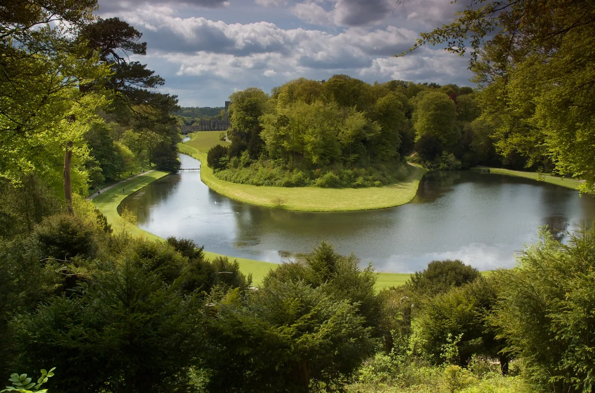
Canal Approximately 500 Metres Long, With The Drum Falls And Weir Inlet
In or near Ripon.
Canal Approximately 500 Metres Long, With The Drum Falls And Weir Inlet — Grade I listed building in Lindrick with Studley Royal and Fountains, Harrogate, North Yorkshire, England, UK.

Wikimedia Commons contributors — see linked file page for photographer and licence licence

Plan your visit
- Typical visit
- 1 h–2 h
- Free entry
- Dog-friendly
About
Canal Approximately 500 Metres Long, With The Drum Falls And Weir Inlet is a canal in the United Kingdom. Heritage designation: Grade I listed building. Wikidata describes it as: "Grade I listed building in Lindrick with Studley Royal and Fountains, Harrogate, North Yorkshire, England, UK". Coordinates: 54.1155°, -1.5733°.
Photo gallery
Protected designations
- Area of Outstanding Natural Beauty: Nidderdale
Designations sourced from Natural England open data under OGL v3.
Place summary
The Canal Approximately 500 Metres Long, With The Drum Falls And Weir Inlet is located in the Nidderdale Area of Outstanding Natural Beauty in Yorkshire. This Grade I listed building features distinct water management elements, including a weir inlet and falls, which reflect its historical significance in the region.
AI-generated from the structured facts on this page (operator, designation, listing, era). Not a substitute for visiting.
- Coordinates
- 54.1155, -1.5733
- District
- North Yorkshire
- Parish
- Lindrick with Studley Royal and Fountains
- Postcode
- HG4 3DY
- Parliamentary constituency
- Skipton and Ripon
Sources
- wikidata: Q17538211 (CC0)
- commons: Weir in Studley Royal Gardens - geograph.org.uk - 331317.jpg (CC BY-SA 4.0)
Other places nearby

The Wrestlers
Public art & sculpture · 0.0 km

Studley Royal Park
Abbeys & priories · 0.1 km
Studley Royal Park including the Ruins of Fountains Abbey
UNESCO World Heritage · 0.1 km

Octagon Tower
Follies · 0.1 km
_(geograph_7029265).jpg?width=1200)
Neptune
Public art & sculpture · 0.1 km

Temple of Piety
Follies · 0.2 km
_(geograph_7029264).jpg?width=1200)
Temple of Fame
Follies · 0.3 km
_(geograph_7029260).jpg?width=1200)
Quebec Monument
Memorials & monuments · 0.3 km

Hercules wrestling Anteus
Public art & sculpture · 0.3 km

Rustic Bridge At South End Of The Canal, With Culvert And Arch To Reservoir
Historic bridges · 0.4 km

Tent Hill
Viewpoints · 0.4 km

Rustic Bridge Over River Skell Approximately 150 Metres East Of Outlet From Lake
Historic bridges · 0.5 km
Nearby
📷 3Public art & sculpture · Yorkshire & the Humber
The Wrestlers
The Wrestlers — Public artwork (statue).
📷 5Abbeys & priories · Yorkshire & the Humber
Studley Royal Park
Studley Royal Park is an estate in North Yorkshire, England. The site has an area of 800 acres (323 ha) and includes an 18th-century landscaped garden; the ruins of Fountains Abbey; Fountains Hall, a
📷 3UNESCO World Heritage · Yorkshire & the Humber
Studley Royal Park including the Ruins of Fountains Abbey
Studley Royal Park including the Ruins of Fountains Abbey — group of structures in North Yorkshire, England, UK.
★ Iconic📷 3📷 3📷 3Where to eat & stay near Canal Approximately 500 Metres Long, With The Drum Falls And Weir Inlet
Places to stay
 📷 5
📷 5Caravan parks · Yorkshire & the Humber
River Laver Holiday Park Ltd.
River Laver Holiday Park Ltd. — a caravan park in england yorkshire.
 📷 5
📷 5Campsites · Yorkshire & the Humber
Clotherholme Farm Campsite
Clotherholme Farm Campsite — a campsite in england yorkshire.
 📷 5
📷 5Campsites · Yorkshire & the Humber
Copper Beech Glade
Copper Beech Glade — a campsite in england yorkshire.
 📷 7
📷 7Hotels · Yorkshire & the Humber
The Old Deanery
The Old Deanery — a hotel in england yorkshire.
 📷 5
📷 5Caravan parks · Yorkshire & the Humber
Ripon - Lockside Caravan Site
Ripon - Lockside Caravan Site — a caravan park in england yorkshire.
 📷 5
📷 5Campsites · Yorkshire & the Humber
Woodhouse Farm
Woodhouse Farm — a campsite in england yorkshire.
Places to eat & drink
 📷 7
📷 7Historic pubs · Yorkshire & the Humber
Lamb And Flag Public House
Lamb And Flag Public House in England Yorkshire, United Kingdom.
 📷 5
📷 5Cafés · Yorkshire & the Humber
Lula's Café
Lula's Café — a café in england yorkshire.
 📷 5
📷 5Historic pubs · Yorkshire & the Humber
The Unicorn Hotel
The Unicorn Hotel in England Yorkshire, United Kingdom.
 📷 7
📷 7 📷 7
📷 7Historic pubs · Yorkshire & the Humber
Ye Hornblower Tavern
Ye Hornblower Tavern in England Yorkshire, United Kingdom.
 📷 7
📷 7Historic pubs · Yorkshire & the Humber
The Fleece Public House
The Fleece Public House in England Yorkshire, United Kingdom.
More places in this region
 📷 3
📷 3 📷 5
📷 5Canals · Yorkshire & the Humber
Hollinwood Branch Canal
Hollinwood Branch Canal is a canal in the United Kingdom.
 📷 3
📷 3Canals · Yorkshire & the Humber
Macclesfield Canal
Macclesfield Canal — canal in north west England.
 📷 5
📷 5Canals · Yorkshire & the Humber
Peak Forest Canal
Peak Forest Canal — canal in Derbyshire/Cheshire/Greater Manchester, England, UK.
Frequently asked questions
- Where is Canal Approximately 500 Metres Long, With The Drum Falls And Weir Inlet?
- Canal Approximately 500 Metres Long, With The Drum Falls And Weir Inlet is in Yorkshire, United Kingdom (postcode HG4 3DY), in the parish of Lindrick with Studley Royal and Fountains.
- What is Canal Approximately 500 Metres Long, With The Drum Falls And Weir Inlet?
- Canal Approximately 500 Metres Long, With The Drum Falls And Weir Inlet — Grade I listed building in Lindrick with Studley Royal and Fountains, Harrogate, North Yorkshire, England, UK.
- How do I get to Canal Approximately 500 Metres Long, With The Drum Falls And Weir Inlet?
- The nearest town is Ripon. Drivers can use postcode HG4 3DY.
- Is Canal Approximately 500 Metres Long, With The Drum Falls And Weir Inlet a listed building?
- Canal Approximately 500 Metres Long, With The Drum Falls And Weir Inlet is officially recognised as Grade I listed building listed.
- Is Canal Approximately 500 Metres Long, With The Drum Falls And Weir Inlet a protected site?
- Yes — Canal Approximately 500 Metres Long, With The Drum Falls And Weir Inlet is part of the Nidderdale National Landscape (AONB).
- Is Canal Approximately 500 Metres Long, With The Drum Falls And Weir Inlet free to visit?
- Yes, Canal Approximately 500 Metres Long, With The Drum Falls And Weir Inlet is free to enter.
- How do I get to Canal Approximately 500 Metres Long, With The Drum Falls And Weir Inlet?
- Drivers can navigate to postcode HG4 3DY. It sits within the Skipton and Ripon parliamentary constituency.