Mountains & hills · Scottish Lowlands
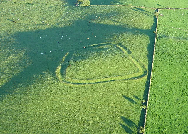
Caermote Hill
Caermote Hill — a hill or mountain in scotland lowlands.

David Purchase — CC BY-SA 2.0 via Wikimedia Commons licence
Plan your visit
- Typical visit
- 3 h–8 h
- Best time of year
- Late spring – early autumn (May–Oct)
About
A British hill or mountain, named on Ordnance Survey maps and walked by hill-baggers. Caermote Hill is a named hill or mountain in scotland lowlands, recorded in the GeoNames UK gazetteer. British landmarks of this type are typically marked on Ordnance Survey maps and recorded in the national gazetteer for cartographic and navigational reference. Coordinates and feature classification are sourced from the GeoNames open dataset.
Photo gallery
Place summary
Caermote Hill is a mountain located in the Scottish Lowlands. It is characterised by its distinct elevation and rugged terrain, offering views of the surrounding landscape. The area is suitable for outdoor activities such as hiking and provides a natural setting for those interested in exploring the region's geography.
AI-generated from the structured facts on this page (operator, designation, listing, era). Not a substitute for visiting.
- Coordinates
- 54.7230, -3.2498
Sources
- manual: geonames-12613939 (CC BY 4.0)
Other places nearby
Loading nearby places…
Nearby
 📷 3
📷 3Mountains & hills · Scottish Lowlands
Caer Mote
Caer Mote — Named summit at 289 m.
 📷 5
📷 5Mountains & hills · Scottish Lowlands
Caer Mot
Caer Mot — mountain in scotland lowlands. Elevation: 285 m.
 📷 3
📷 3Archaeological sites · Scottish Lowlands
Caer Mote Enclosure
Caer Mote Enclosure — a archaeological in scotland-lowlands, United Kingdom.
 📷 3
📷 3Archaeological sites · Scottish Lowlands
Caermote Fort
Caermote Fort — a archaeological in scotland-lowlands, United Kingdom.
 📷 5
📷 5Mountains & hills · Scottish Lowlands
Setrah Hill
Setrah Hill — mountain in scotland lowlands. Elevation: 202 m.
 📷 4
📷 4Caravan parks · Scottish Lowlands
Skiddaw View Holiday Park
Skiddaw View Holiday Park — a caravan park in scotland lowlands.
Where to eat & stay near Caermote Hill
Places to stay
📷 4Caravan parks · Scottish Lowlands
Skiddaw View Holiday Park
Skiddaw View Holiday Park — a caravan park in scotland lowlands.

Caravan parks · Scottish Lowlands
Keswick Lodge Retreat
Keswick Lodge Retreat — a caravan park in scotland lowlands.
 📷 5
📷 5Campsites · Scottish Lowlands
Linskeldfield Farm Camping
Linskeldfield Farm Camping — a campsite in scotland lowlands.

Caravan parks · Scottish Lowlands
Threapland Park
Threapland Park — a caravan park in scotland lowlands.
 📷 5
📷 5Caravan parks · Scottish Lowlands
Coal Beck Caravan Park
Coal Beck Caravan Park — a caravan park in scotland lowlands.
 📷 3
📷 3Caravan parks · Scottish Lowlands
Larches Caravan Park
Larches Caravan Park — a caravan park in scotland lowlands.
Places to eat & drink
 📷 5
📷 5Historic pubs · Scottish Lowlands
The Pheasant Inn
The Pheasant Inn in Scotland Lowlands, United Kingdom.
 📷 5
📷 5Historic pubs · Scottish Lowlands
Kings Arms Walter Willsons
Kings Arms Walter Willsons in Scotland Lowlands, United Kingdom.
 📷 4
📷 4Historic pubs · Scottish Lowlands
Oddfellows Arms
Oddfellows Arms — Historic pub — listed building or notable heritage status.
 📷 5
📷 5Cafés · Scottish Lowlands
YHA Cafe
YHA Cafe — a café in scotland lowlands.
 📷 5
📷 5Cafés · North East England
Grange Bridge Cottage
Grange Bridge Cottage — a café in england north east.
 📷 5
📷 5Cafés · Scottish Lowlands
Crumbs
Crumbs — a café in scotland lowlands.
More mountains in this region
 📷 3
📷 3Mountains & hills · Scottish Lowlands
Andrewhinney Hill
Andrewhinney Hill — Named summit at 677 m.
 📷 3
📷 3Mountains & hills · Scottish Lowlands
Arbory Hill
Arbory Hill — Named summit at 429 m.
 📷 3
📷 3Mountains & hills · Scottish Lowlands
Auchenton Hill ( East Mount Lowther)
Auchenton Hill ( East Mount Lowther) — Named summit at 631 m.
 📷 3
📷 3Mountains & hills · Scottish Lowlands
Bakestall
Bakestall — Named summit at 673.5 m.
Frequently asked questions
- Where is Caermote Hill?
- Caermote Hill is in the Scottish Lowlands, United Kingdom.
- What is Caermote Hill?
- Caermote Hill — a hill or mountain in scotland lowlands.
- How do I get to Caermote Hill?
- Its coordinates are 54.7230°, -3.2498°.