
Museums · North West England
Brougham, Cumbria
In or near Eamont Bridge.
Brougham is a small village (or more properly a collection of hamlets) and civil parish on the outskirts of Penrith in the Westmorland and Furness unitary authority area in Cumbria, England. Accordi

Andrew Smith — CC BY-SA 2.0 via Wikimedia Commons licence

Plan your visit
- Typical visit
- 1.5 h–3 h
- Best time of year
- Year-round
- Nearest railway station
- Penrith (North Lakes) · 2.9 km
- Family-friendly
- Limited wheelchair access
Getting there & planning your visit
To visit Brougham in Cumbria, the nearest railway station is Penrith (North Lakes), which is 2.9 km away. The postcode for sat-nav is CA10 2DE. Accessibility is limited for wheelchair users.
About
Brougham is a small village (or more properly a collection of hamlets) and civil parish on the outskirts of Penrith in the Westmorland and Furness unitary authority area in Cumbria, England. According to the 2001 census the parish had a population of 279, falling marginally to 277 at the 2011 Census. Within the parish are the remains of Brocavum Roman fort. The ruins of the medieval Brougham Castle, once home to Lady Anne Clifford, are next to the fort. The mainly 19th century Brougham Hall, the former seat of the Lords Brougham and Vaux is nearby. The 17th-century Countess Pillar, set up by Lady Anne, is beside the A66 near the castle. The parish has two Anglican churches: The historic Ninekirks, dedicated to St Ninian, is situated by the banks of the River Eamont and was extensively rebuilt by Lady Anne Clifford. It was previously a Norman foundation, probably on the site of an earlier Anglo-Saxon church. There is reputed to have been an even more ancient monastery nearby, founded by St Ninian (see also History of Cumbria). St Wilfred's or Brougham Chapel is next to the hall, overlooking the River Lowther. Brougham "village" itself is no more than a scattering of farms and modern housing near the hall and is, along with neighbouring Eamont Bridge, often classed as an outlying suburb of Penrith. There are some more cottages next to the castle, which is partially built on the site of the Roman fort. Within the parish is Whinfell Forest the site of a Red squirrel reserve
Photo gallery
Protected designations
- Site of Special Scientific Interest: River Eden and Tributaries SSSI
Designations sourced from Natural England open data under OGL v3.
From the Wikipedia article
Brougham is a small village (or more properly a collection of hamlets) and civil parish on the outskirts of Penrith in the Westmorland and Furness unitary authority area in Cumbria, England. According to the 2001 census the parish had a population of 279, falling marginally to 277 at the 2011 Census. Within the parish are the remains of Brocavum Roman fort. The ruins of the medieval Brougham Castle, once home to Lady Anne Clifford, are next to the fort. The mainly 19th century Brougham Hall, the former seat of the Lords Brougham and Vaux is nearby. The 17th-century Countess Pillar, set up by Lady Anne, is beside the A66 near the castle.
The parish has two Anglican churches:
The historic Ninekirks, dedicated to St Ninian, is situated by the banks of the River Eamont and was extensively rebuilt by Lady Anne Clifford. It was previously a Norman foundation, probably on the site of an earlier Anglo-Saxon church. There is reputed to have been an even more ancient monastery nearby, founded by St Ninian (see also History of Cumbria). St Wilfred's or Brougham Chapel is next to the hall, overlooking the River Lowther. Brougham "village" itself is no more than a scattering of farms and modern housing near the hall and is, along with neighbouring Eamont Bridge, often classed as an outlying suburb of Penrith. There are some more cottages next to the castle, which is partially built on the site of the Roman fort. Within the parish is Whinfell Forest the site of a Red squirrel reserve, a Center Parcs holiday village, and the site of RAF Hornby Hall World War II aerodrome.
Excerpt from Wikipedia under CC BY-SA 4.0. See the source article linked in Sources below.
- Coordinates
- 54.6445, -2.7248
- District
- Westmorland and Furness
- Parish
- Brougham
- Postcode
- CA10 2DE
- Parliamentary constituency
- Westmorland and Lonsdale
- Nearest railway station
- Penrith (North Lakes) — 2.9 km
Sources
- wikipedia: Brougham, Cumbria (CC BY-SA 4.0)
Other places nearby

Lord Chancellor's Den
Historic houses · 0.6 km
Brougham Hall
Castles · 0.7 km

Brougham Hall
Castles · 0.7 km

Bridge Over Road Between Brougham Hall And Chapel Of St Wilfred
Historic bridges · 0.7 km
.jpg?width=1200)
Chapel Of St Wilfred Of Brougham Chapel
Chapels · 0.7 km
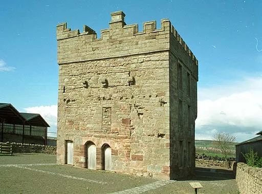
Clifton Hall
Stately homes · 0.9 km

Clifton Motte
Literary houses · 0.9 km

Lowther Holiday Park
Campsites · 0.9 km

Boer War Memorial, Eamont Bridge
Memorials & monuments · 1.1 km
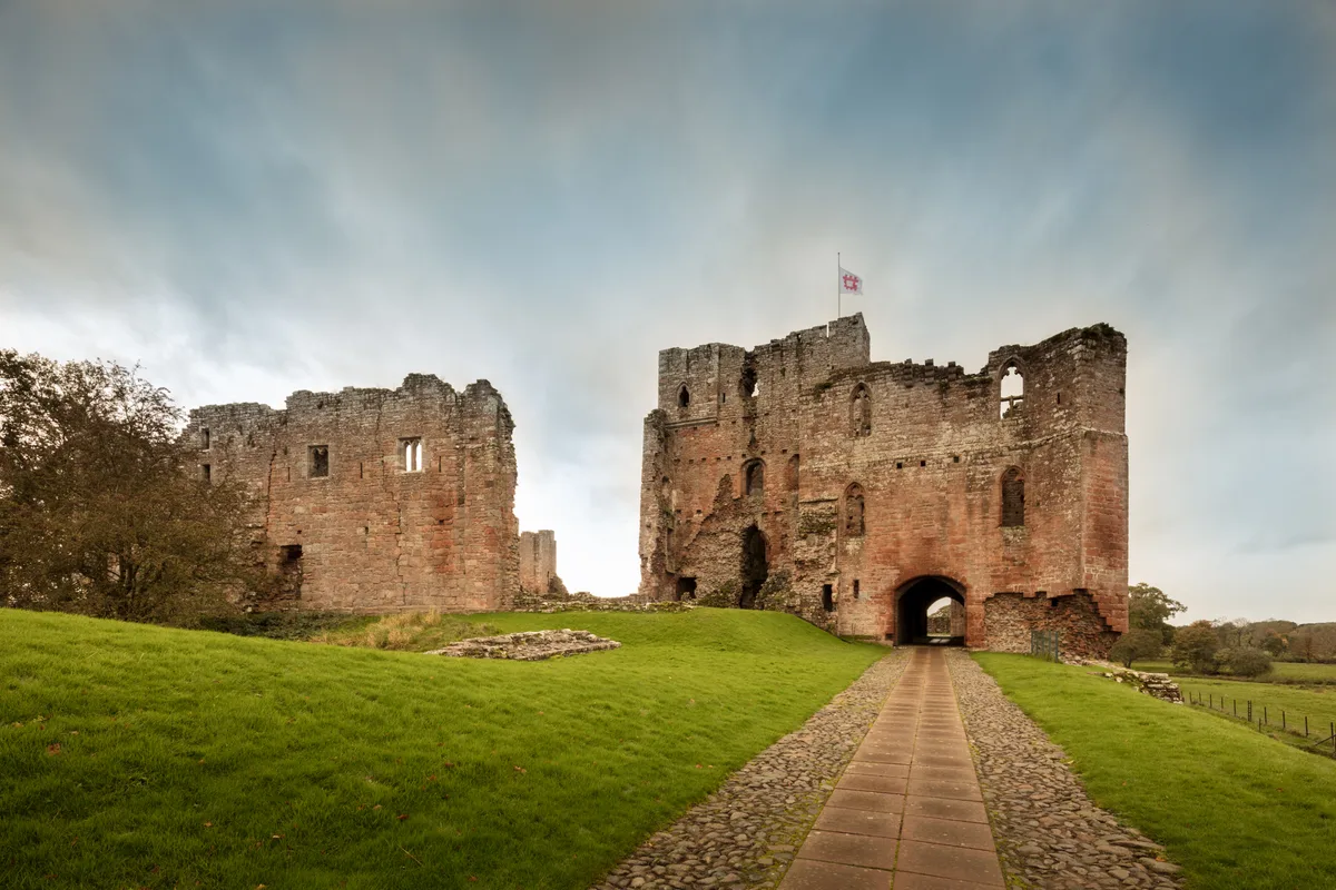
Brougham Castle
Castles · 1.1 km

Brocavum Roman Fort
Archaeological sites · 1.1 km

Brocavum Roman Fort
Archaeological sites · 1.1 km
Nearby
📷 3Historic houses · North West England
Lord Chancellor's Den
Lord Chancellor's Den — a historic house in scotland-lowlands, United Kingdom.
📷 3Castles · North West England
Brougham Hall
Brougham Hall — a castle in scotland-lowlands, United Kingdom.
📷 5📷 3Historic bridges · North West England
Bridge Over Road Between Brougham Hall And Chapel Of St Wilfred
Bridge Over Road Between Brougham Hall And Chapel Of St Wilfred — Grade II listed building-listed bridge in scotland-lowlands, United Kingdom.
📷 3Chapels · North West England
Chapel Of St Wilfred Of Brougham Chapel
Chapel Of St Wilfred Of Brougham Chapel — chapel in Brougham, Cumbria, England, UK.
📷 5Stately homes · North West England
Clifton Hall
Clifton Hall — manor house in Cumbria,England.
Where to eat & stay near Brougham, Cumbria
Places to stay
📷 5Campsites · North West England
Lowther Holiday Park
Lowther Holiday Park — a campsite in scotland lowlands.
 📷 5
📷 5Caravan parks · North West England
Crossfells Campsite
Crossfells Campsite — a caravan park in scotland lowlands.
 📷 4
📷 4Caravan parks · North West England
Lowther Holiday Park
Lowther Holiday Park — a caravan park in scotland lowlands.
 📷 5
📷 5Caravan parks · North West England
Southwaite Green Mill
Southwaite Green Mill — a caravan park in scotland lowlands.
 📷 5
📷 5Hostels · North West England
Abbotsbank Supported Housing
Abbotsbank Supported Housing — a hostel in scotland lowlands.
 📷 5
📷 5Hostels · North West England
Fellfoot Youth Hostel
Fellfoot Youth Hostel — a hostel in scotland lowlands.
Places to eat & drink
 📷 7
📷 7Historic pubs · North West England
Two Lions public house and integral stables
Two Lions public house and integral stables in Scotland Lowlands, United Kingdom.
 📷 6
📷 6Historic pubs · North West England
Gloucester Arms
Gloucester Arms in Scotland Lowlands, United Kingdom.
 📷 7
📷 7Cafés · North West England
Narrowbar Cafe
Narrowbar Cafe — a café in scotland lowlands.
 📷 3
📷 3 📷 5
📷 5Historic pubs · North West England
Horse And Farrier Inn And Stables
Horse And Farrier Inn And Stables in Scotland Lowlands, United Kingdom.
 📷 5
📷 5Historic pubs · North East England
1, Scattergate
1, Scattergate in England North East, United Kingdom.
More museums in this region
 📷 3
📷 3Museums · North West England
Cube Gallery
Cube Gallery — former architecture museum in Manchester, England.
 📷 3
📷 3Museums · North West England
Cuckooland Museum
Cuckooland Museum — horological museum in England, UK.
 📷 4
📷 4Museums · North West England
Elizabeth Gaskell's House
Elizabeth Gaskell's House — museum in Manchester.
 📷 3
📷 3Museums · North West England
Englesea Brook Chapel and Museum of Primitive Methodism
Englesea Brook Chapel and Museum of Primitive Methodism — Primitive Methodist chapel and museum, United Kingdom.
Frequently asked questions
- Where is Brougham, Cumbria?
- Brougham, Cumbria is in the Scottish Lowlands, United Kingdom (postcode CA10 2DE), in the parish of Brougham.
- What is Brougham, Cumbria?
- Brougham is a small village (or more properly a collection of hamlets) and civil parish on the outskirts of Penrith in the Westmorland and Furness unitary authority area in Cumbria, England. Accordi
- How do I get to Brougham, Cumbria?
- The nearest railway station is Penrith (North Lakes), about 2.9 km away. Drivers can use postcode CA10 2DE.
- Is Brougham, Cumbria a protected site?
- Yes — Brougham, Cumbria is part of the River Eden and Tributaries SSSI Site of Special Scientific Interest.
- How do I get to Brougham, Cumbria?
- The nearest railway station is Penrith (North Lakes), about 2.9 km away. Drivers can navigate to postcode CA10 2DE.