
Historic bridges · South Wales
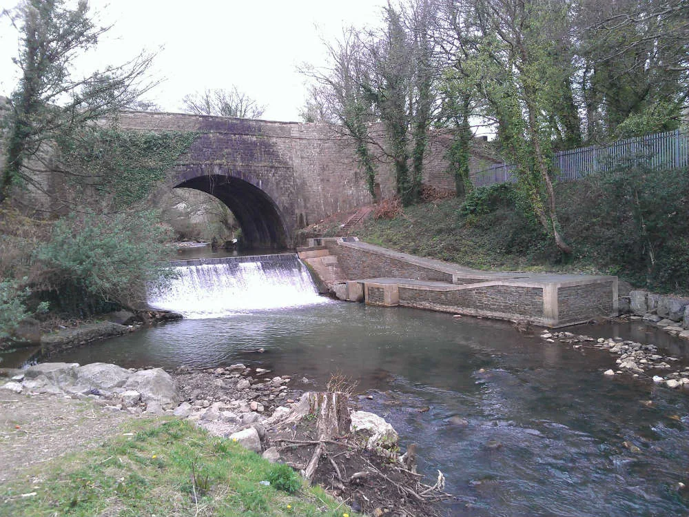
Bridge 52 at Pontymoile Basin, Monmouthshire and Brecon Canal
In or near Caerleon.
Bridge 52 at Pontymoile Basin, Monmouthshire and Brecon Canal — Grade II listed building-listed bridge in wales-south, United Kingdom.

Jaggery — CC BY-SA 2.0 via Wikimedia Commons licence

Plan your visit
- Typical visit
- 15 min–30 min
- Nearest railway station
- Pontypool and New Inn · 0.9 km
- Free entry
- Dog-friendly
Getting there & planning your visit
To visit Bridge 52 at Pontymoile Basin, the nearest railway station is Pontypool and New Inn, located 0.9 km away. The postcode for the area is NP4 0RF. Entry to the bridge is free.
About
Bridge 52 at Pontymoile Basin, Monmouthshire and Brecon Canal is a Grade II listed building-listed bridge in wales-south, United Kingdom, registered on the Cadw register of listed buildings (Wales) (entry 3136). Listed status protects buildings and structures of special architectural or historic interest. See the linked Wikipedia article for further details.
Photo gallery
See it from the streetimagery from 2025
Imagery © Mapillary contributors, CC BY-SA 4.0
Heritage listing
Reason for designation: Included for its special interest as one of the unaltered surviving early C19 Brecknock and Abergavenny canal bridges. History: The Brecknock and Abergavenny Canal was promoted in 1792 to connect the upper Usk valley to the Monmouthshire Canal at Pontymoile and from there to the sea at Newport. Construction began in 1797, with Thomas Dadford Jnr. as engineer, and the first section, from Gilwern to Llangynidr was completed in that year with the stretch as far as Brecon following in 1800. Work then stopped for a time with the result that the section to the Blaenavon Road east of Govilon was not completed until 1805, now with Thomas Cartwright as engineer. Further funds had to be raised and the last section from west of Llanfoist to Pontymoile was completed betwen 1809 and 1812, with William Crosley as engineer. Linked to the tramroads the canal was an important artery for trade in iron, lime and coal. In 1865 the Monmouthshire and the Brecknock and Abergavenny Canal Companies merged becoming the Monmouthshire and Brecon Canal Company. Later still in 1880 the canal was bought out by the Great Western Railway and gradually the canal was run down until it was abandoned finally in 1962. Restoration work was begun in 1964, and the canal is once again open between Pontymoile and Brecon with the title Monmouthshire and Brecon Canal. Exterior: Junction bridge at the junction of the Brecknock and Abergavenny Canal and the now closed Monmouthshire Canal. Semi-elliptical arch with voussoirs; faced and coursed stone; parapet with slab coping; curving abutments partly with plain pilasters. Towpath to Brecknock and Abergavenny Canal runs beneath bridge arch on south-east side. A diamond shaped 6-ton weight limit sign survives from the GWR period of ownership. Lo
From Cadw under OGL v3.
Protected designations
- Site of Special Scientific Interest: River Wye SSSI
- Site of Special Scientific Interest: Severn Estuary SSSI
Designations sourced from Natural England open data under OGL v3.
Place summary
Bridge 52 at Pontymoile Basin is a Grade II listed bridge located on the Monmouthshire and Brecon Canal in South Wales. Situated in the parish of Pontymoile, this structure is notable for its historical significance within the region's canal network.
AI-generated from the structured facts on this page (operator, designation, listing, era). Not a substitute for visiting.
- Coordinates
- 51.6957, -3.0258
- District
- Torfaen
- Parish
- Pontymoile
- Postcode
- NP4 0RF
- Parliamentary constituency
- Torfaen
- Nearest railway station
- Pontypool and New Inn — 0.9 km
Sources
- wikidata: Q29483052 (CC0)
Other places nearby
Pontymoile Basin
Canals · 0.0 km
Aqueduct over Afon Lwyd, Monmouthshire and Brecon Canal
Aqueducts · 0.2 km

Canal Bridge at Coed-y-Gric
Historic bridges · 0.3 km

Best Western
Hotels · 0.5 km

West Monmouth School
Natural landmarks · 0.8 km

Pontypool Park
Parks · 0.9 km

Shell Grotto, Pontypool
Follies · 0.9 km

Shell Grotto
Archaeological sites · 0.9 km

Hanbury Arms Haunted Hotel & Museum
Museums · 1.0 km

Mount Pleasant United Reformed Church
Historic churches · 1.0 km

Gorsedd Stones
Heritage railway stations · 1.1 km

Pontypool War Memorial Gates
Memorials & monuments · 1.1 km
Nearby
📷 4Canals · South Wales
Pontymoile Basin
Pontymoile Basin (Welsh: Basn Pont-y-moel) is a mooring point and canal junction on the Monmouthshire & Brecon Canal.
📷 3Aqueducts · South Wales
Aqueduct over Afon Lwyd, Monmouthshire and Brecon Canal
Aqueduct over Afon Lwyd, Monmouthshire and Brecon Canal — Grade II listed building in Torfaen County Borough. It is about 450m south-east of Pontymoile roundabout approached by the canal towpath from Pontymoile basin. Spans the border between New Inn and Pontymoile communities.
📷 5Historic bridges · South Wales
Canal Bridge at Coed-y-Gric
Canal Bridge at Coed-y-Gric — Grade II listed building-listed bridge in wales-south, United Kingdom.
📷 5📷 5Natural landmarks · South Wales
West Monmouth School
West Monmouth School — a school heritage in wales-south, United Kingdom.
📷 4Parks · South Wales
Pontypool Park
Pontypool Park — former grounds of Pontypool House.
Where to eat & stay near Bridge 52 at Pontymoile Basin, Monmouthshire and Brecon Canal
Places to stay
📷 5 📷 5
📷 5 📷 5
📷 5Campsites · South Wales
Pont Kemys Caravan & Camping Park
Pont Kemys Caravan & Camping Park — a campsite in wales south.
 📷 7
📷 7 📷 5
📷 5 📷 7
📷 7Hotels · South Wales
Three Salmons Hotel
Three Salmons Hotel — a hotel in wales south.
Places to eat & drink
 📷 5
📷 5Restaurants · South Wales
Little Crown
Little Crown — a restaurant in wales south.
 📷 7
📷 7 📷 7
📷 7 📷 3
📷 3 📷 5
📷 5Historic pubs · South Wales
The White Hart, Llangybi, Monmouthshire
The White Hart, Llangybi, Monmouthshire in Wales South, United Kingdom.
 📷 7
📷 7Restaurants · South Wales
The Priory Hotel & Restaurant
The Priory Hotel & Restaurant — a restaurant in wales south. Cuisine: international. 3-star.
More bridges in this region
.jpg?width=1200) 📷 3
📷 3Historic bridges · South Wales
Afon Taff Viaduct
Afon Taff Viaduct is a historic bridge in the United Kingdom.
 📷 3
📷 3Historic bridges · South Wales
Avonmouth Bridge
Avonmouth Bridge is a historic bridge in the United Kingdom.
 📷 5
📷 5Historic bridges · South Wales
Biblins Bridge
Biblins Bridge is a historic bridge in the United Kingdom.
 📷 3
📷 3Historic bridges · South Wales
Blackweir Bridge
Blackweir Bridge is a historic bridge in the United Kingdom.
Frequently asked questions
- Where is Bridge 52 at Pontymoile Basin, Monmouthshire and Brecon Canal?
- Bridge 52 at Pontymoile Basin, Monmouthshire and Brecon Canal is in South Wales, United Kingdom (postcode NP4 0RF), in the parish of Pontymoile.
- What is Bridge 52 at Pontymoile Basin, Monmouthshire and Brecon Canal?
- Bridge 52 at Pontymoile Basin, Monmouthshire and Brecon Canal — Grade II listed building-listed bridge in wales-south, United Kingdom.
- How do I get to Bridge 52 at Pontymoile Basin, Monmouthshire and Brecon Canal?
- The nearest railway station is Pontypool and New Inn, about 0.9 km away. The nearest town is Caerleon. Drivers can use postcode NP4 0RF.
- Is Bridge 52 at Pontymoile Basin, Monmouthshire and Brecon Canal a listed building?
- Bridge 52 at Pontymoile Basin, Monmouthshire and Brecon Canal is officially recognised as Grade II listed building listed.
- Is Bridge 52 at Pontymoile Basin, Monmouthshire and Brecon Canal a protected site?
- Yes — Bridge 52 at Pontymoile Basin, Monmouthshire and Brecon Canal is part of the River Wye SSSI Site of Special Scientific Interest and the Severn Estuary SSSI Site of Special Scientific Interest.
- Is Bridge 52 at Pontymoile Basin, Monmouthshire and Brecon Canal free to visit?
- Yes, Bridge 52 at Pontymoile Basin, Monmouthshire and Brecon Canal is free to enter.
- How do I get to Bridge 52 at Pontymoile Basin, Monmouthshire and Brecon Canal?
- The nearest railway station is Pontypool and New Inn, about 0.9 km away. Drivers can navigate to postcode NP4 0RF.