
Vineyards · Scottish Lowlands
Branthat Plantation, enclosed settlement 320m SE of Gill
In or near Dalton.
Branthat Plantation, enclosed settlement 320m SE of Gill — a UK vineyard in scotland lowlands, producing English or Welsh wine from cool-climate grape varieties.

Nigel Thompson — CC BY-SA 2.0 via Wikimedia Commons licence

Plan your visit
- Typical visit
- 1 h–2 h
- Best time of year
- Late summer & autumn (Aug–Oct)
- Nearest railway station
- Annan · 7.3 km
About
Branthat Plantation, enclosed settlement 320m SE of Gill is one of Britain's growing number of vineyards, located in scotland lowlands. UK viticulture has expanded significantly since the 1980s, with English sparkling wines now winning international awards. Most British vineyards offer tours and tastings of their estate-grown wines. architectural structure in Dumfries and Galloway, Scotland, UK
Photo gallery
Protected designations
- Ramsar wetland: Upper Solway Flats & Marshes
Designations sourced from Natural England open data under OGL v3.
Place summary
Branthat Plantation is a vineyard located 320 metres southeast of Gill in the Scottish Lowlands. This enclosed settlement is characterised by its agricultural focus, primarily on grape cultivation. Visitors can expect a rural setting conducive to wine production, with the landscape reflecting the region's natural beauty. The vineyard offers insight into local viticulture practices and may include opportunities for tastings or tours.
AI-generated from the structured facts on this page (operator, designation, listing, era). Not a substitute for visiting.
- Coordinates
- 54.9968, -3.3746
- District
- Dumfries and Galloway
- Postcode
- DG12 5PZ
- Parliamentary constituency
- Dumfriesshire, Clydesdale and Tweeddale
- Nearest railway station
- Annan — 7.3 km
Sources
- wikidata: Q56667574 (CC0)
Other places nearby

Douglas Monument
Memorials & monuments · 1.8 km
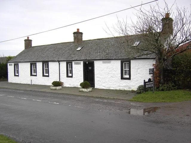
Ruthwell Museum
Museums · 2.0 km
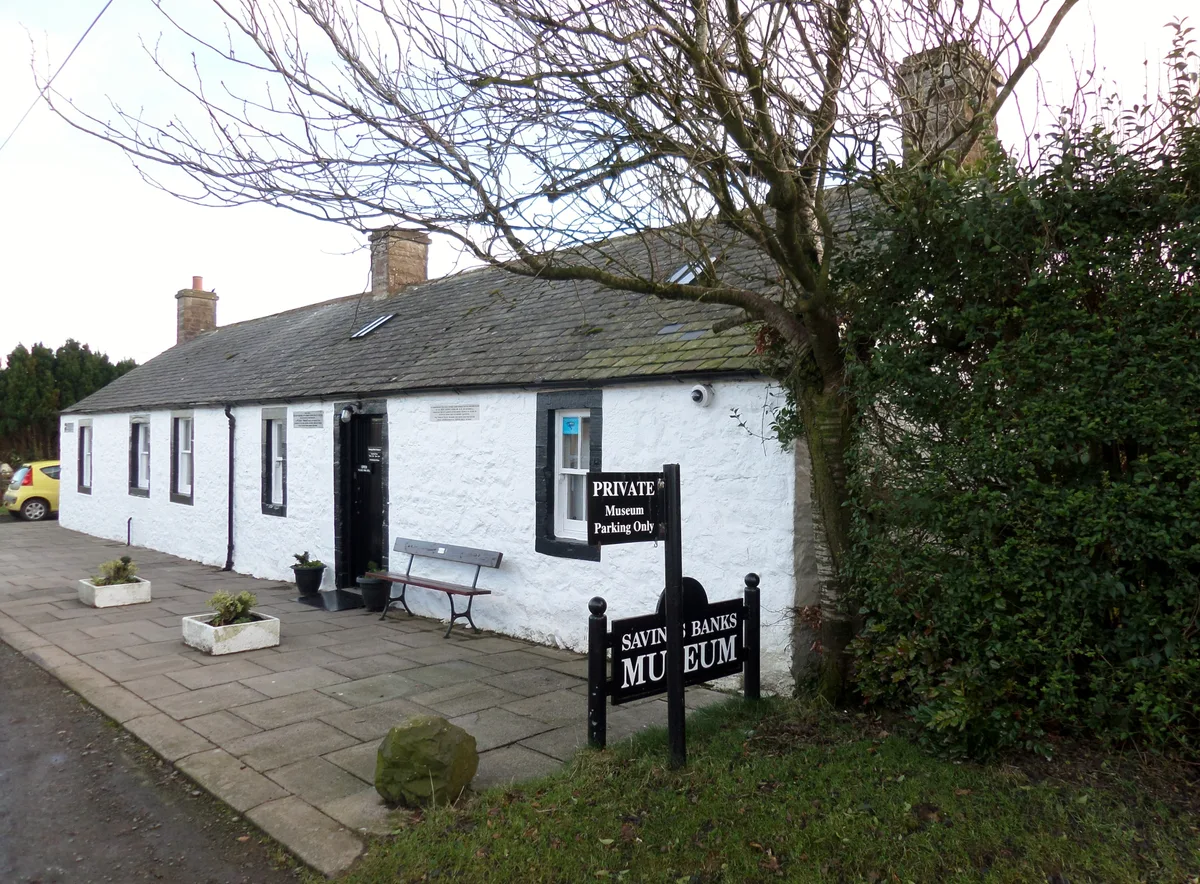
Savings Banks Museum
Museums · 2.0 km

Kinmount House
Historic houses · 2.1 km

Ruthwell Church
Historic churches · 2.1 km

Cummertrees Mill
Watermills · 2.1 km

Ruthwell
Villages · 2.2 km

Cummertrees
Villages · 2.2 km

Cummertrees Parish Church
Historic churches · 2.3 km

Queensberry Bay Holiday Park
Caravan parks · 2.7 km

The Farmers Inn
Historic pubs · 3.0 km
War Memorial
Memorials & monuments · 3.1 km
Nearby
📷 3Memorials & monuments · North West England
Douglas Monument
Douglas Monument — a memorial in scotland-lowlands, United Kingdom.
📷 3Museums · Scottish Lowlands
Ruthwell Museum
Ruthwell Museum — museum in Dumfries and Galloway, Scotland, UK.
📷 3Museums · Scottish Lowlands
Savings Banks Museum
Savings Banks Museum is a museum in the United Kingdom.
📷 3Historic houses · North West England
Kinmount House
Kinmount House — house in Dumfries and Galloway, Scotland, UK.
📷 5Historic churches · Scottish Lowlands
Ruthwell Church
Ruthwell Church — category B listed building-listed church in scotland-lowlands, United Kingdom.
📷 5Watermills · North West England
Cummertrees Mill
Cummertrees Mill — category B listed building-listed watermill in scotland-lowlands, United Kingdom.
Where to eat & stay near Branthat Plantation, enclosed settlement 320m SE of Gill
Places to stay
📷 5Caravan parks · North West England
Queensberry Bay Holiday Park
Queensberry Bay Holiday Park — a caravan park in scotland lowlands.
 📷 3
📷 3Hotels · Scottish Lowlands
Comlongon Castle (Hotel)
Comlongon Castle (Hotel) — a hotel in scotland lowlands.
 📷 5
📷 5Caravan parks · North West England
Broom Fisheries campsite
Broom Fisheries campsite — a caravan park in scotland lowlands.
 📷 5
📷 5Caravan parks · Scottish Lowlands
Hoddom Castle Caravan Park & Campsite
Hoddom Castle Caravan Park & Campsite — a caravan park in scotland lowlands.
 📷 5
📷 5Caravan parks · North West England
Galabank Camping and Caravan Park
Galabank Camping and Caravan Park — a caravan park in scotland lowlands.
Places to eat & drink
📷 7Historic pubs · Scottish Lowlands
The Farmers Inn
The Farmers Inn in Scotland Lowlands, United Kingdom.
 📷 7
📷 7Historic pubs · North West England
Queensberry Arms Hotel
Queensberry Arms Hotel in Scotland Lowlands, United Kingdom.
 📷 5
📷 5Historic pubs · Scottish Lowlands
Bruce Arms Public House, 3 Castle Street, Lochmaben
Bruce Arms Public House, 3 Castle Street, Lochmaben in Scotland Lowlands, United Kingdom.
 📷 5
📷 5Historic pubs · Scottish Lowlands
Queen O' The South Public House, 8-10 Nith Place, Dumfries
Queen O' The South Public House, 8-10 Nith Place, Dumfries in Scotland Lowlands, United Kingdom.
 📷 5
📷 5Historic pubs · Scottish Lowlands
73-77 English Street, Dumfries
73-77 English Street, Dumfries in Scotland Lowlands, United Kingdom.
 📷 5
📷 5Historic pubs · Scottish Lowlands
The Globe Inn, 56 High Street, Dumfries
The Globe Inn, 56 High Street, Dumfries in Scotland Lowlands, United Kingdom.
More places in this region
 📷 4
📷 4 📷 5
📷 5Vineyards · Scottish Lowlands
Wardlaw Hill
Wardlaw Hill — a UK vineyard in scotland highlands, producing English or Welsh wine from cool-climate grape varieties.
📷 5Vineyards · Scottish Lowlands
Harpercroft
Harpercroft — a UK vineyard in scotland highlands, producing English or Welsh wine from cool-climate grape varieties.
 📷 5
📷 5Vineyards · Scottish Lowlands
Great Cumbrae, The Lorn
Great Cumbrae, The Lorn — a UK vineyard in scotland highlands, producing English or Welsh wine from cool-climate grape varieties.
Frequently asked questions
- Where is Branthat Plantation, enclosed settlement 320m SE of Gill?
- Branthat Plantation, enclosed settlement 320m SE of Gill is in the Scottish Lowlands, United Kingdom (postcode DG12 5PZ).
- What is Branthat Plantation, enclosed settlement 320m SE of Gill?
- Branthat Plantation, enclosed settlement 320m SE of Gill — a UK vineyard in scotland lowlands, producing English or Welsh wine from cool-climate grape varieties.
- How do I get to Branthat Plantation, enclosed settlement 320m SE of Gill?
- The nearest railway station is Annan, about 7.3 km away. The nearest town is Dalton. Drivers can use postcode DG12 5PZ.
- Is Branthat Plantation, enclosed settlement 320m SE of Gill a protected site?
- Yes — Branthat Plantation, enclosed settlement 320m SE of Gill is part of the Upper Solway Flats & Marshes Ramsar wetland.
- How do I get to Branthat Plantation, enclosed settlement 320m SE of Gill?
- The nearest railway station is Annan, about 7.3 km away. Drivers can navigate to postcode DG12 5PZ.